
Boston: questions along the Freedom Trail
Explore Boston through five Freedom Trail chapters about public ground, government, trade and a North End household.
Begin the visual journeyPlan a real visit to Boston Freedom TrailExplore 9 reviewed views along the routeGuided visual journey
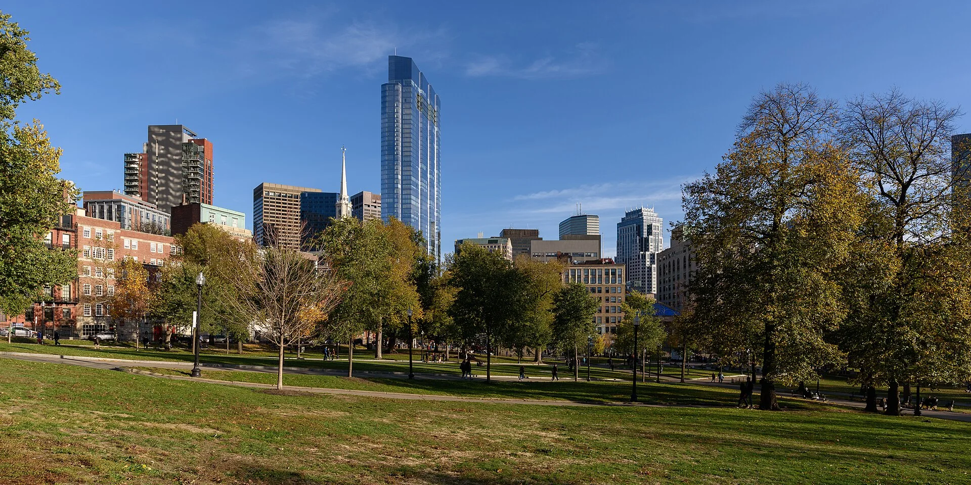
Boston Common lawn with the downtown skyline · King of Hearts · CC BY-SA 4.0 · Resized and converted to WebP
Reading mode
Place stories to read at your own pace
Compare independent photographs from different dates and viewpoints.
Chapter 1
Begin with Boston Common
Begin with open ground rather than a founding hero. Boston Common gives the city room to gather, but public space has never meant a single purpose or an equal entitlement. Compare the breadth of the park with the smaller features in the photographs. Ask where an ordinary pause becomes a public statement, and how the city beyond the trees changes the sense of enclosure. The National Park Service dates the town’s purchase of this ground to 1634. Its account also describes military training, grazing and public punishment: leisure is only one layer of the landscape.
A tranquil photograph cannot reconstruct those competing uses. Read its open space as something maintained and governed, rather than land simply waiting to become a park. The City’s archaeology account explains that grazing rights belonged to white male property owners. That limitation matters when a route is named for freedom. Who could use common resources, and who was excluded from the community making the rules?
Our next chapter changes scale from ground to government. The shift to the State House is an editorial transition between independent local scenes, not a recorded crossing. Granary Burying Ground is an optional discovery for comparing another way public land holds memory. Images record particular moments; arrange actual paths, crossings and present access separately.
Read further: Boston Common: grass and the meaning of shared groundReal-travel note
Independent local scenes with editorial transitions; check actual connections and present access separately.
Compare independent photographs from different dates and viewpoints.
Chapter 2
Read the Massachusetts State House
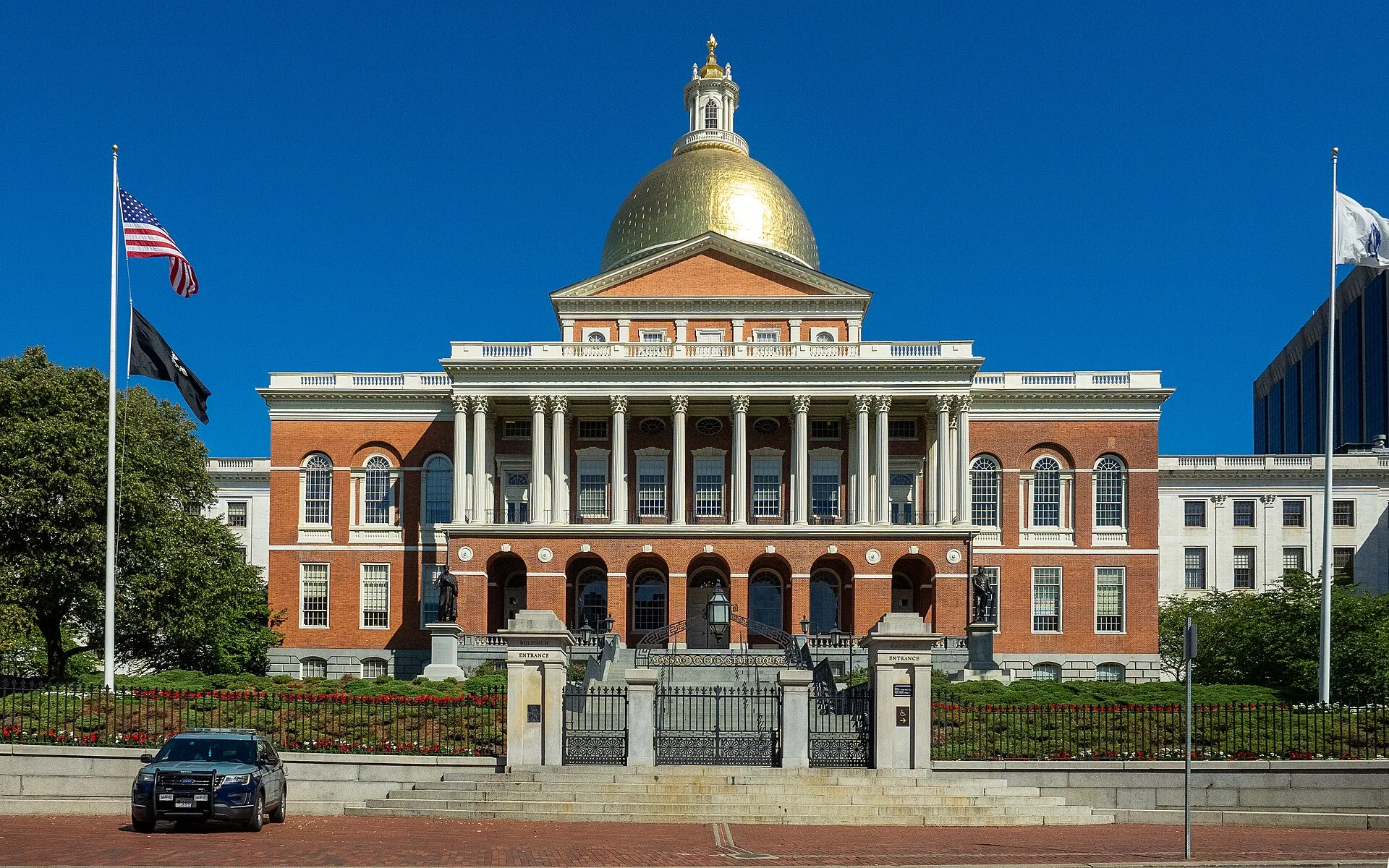
Look first at the State House as a composition: a dome above a civic frontage, a building made legible from the city below. Compare the overall silhouette with the closer views, keeping the building separate from the Old State House that appears later. Massachusetts’ official history identifies Charles Bulfinch as the architect and dates completion to 1798. It also explains that the dome passed through wood-shingle and copper coverings before its gold finish. A familiar emblem can be the result of change rather than an untouched original.
The building asks a second question about visibility. A landmark makes government visible, but its façade cannot tell us who had political rights or whose concerns reached the chambers. The language of a republic and the distribution of power need to be considered together. Resist turning a shining roof into a simple conclusion about liberty. Instead, compare the scale of the institution with the individual viewpoint from which it is photographed.
This chapter concerns exterior observation. It does not establish admission to working government rooms, security procedures or a current accessible approach. Check the legislature’s visiting information for an actual visit. The next chapter jumps editorially to the older governmental building downtown; it does not trace a continuous path. King’s Chapel offers a separate comparison of architecture and institutional authority.
Real-travel note
Independent local scenes with editorial transitions; check actual connections and present access separately.
Compare independent photographs from different dates and viewpoints.
Chapter 3
Power at the Old State House
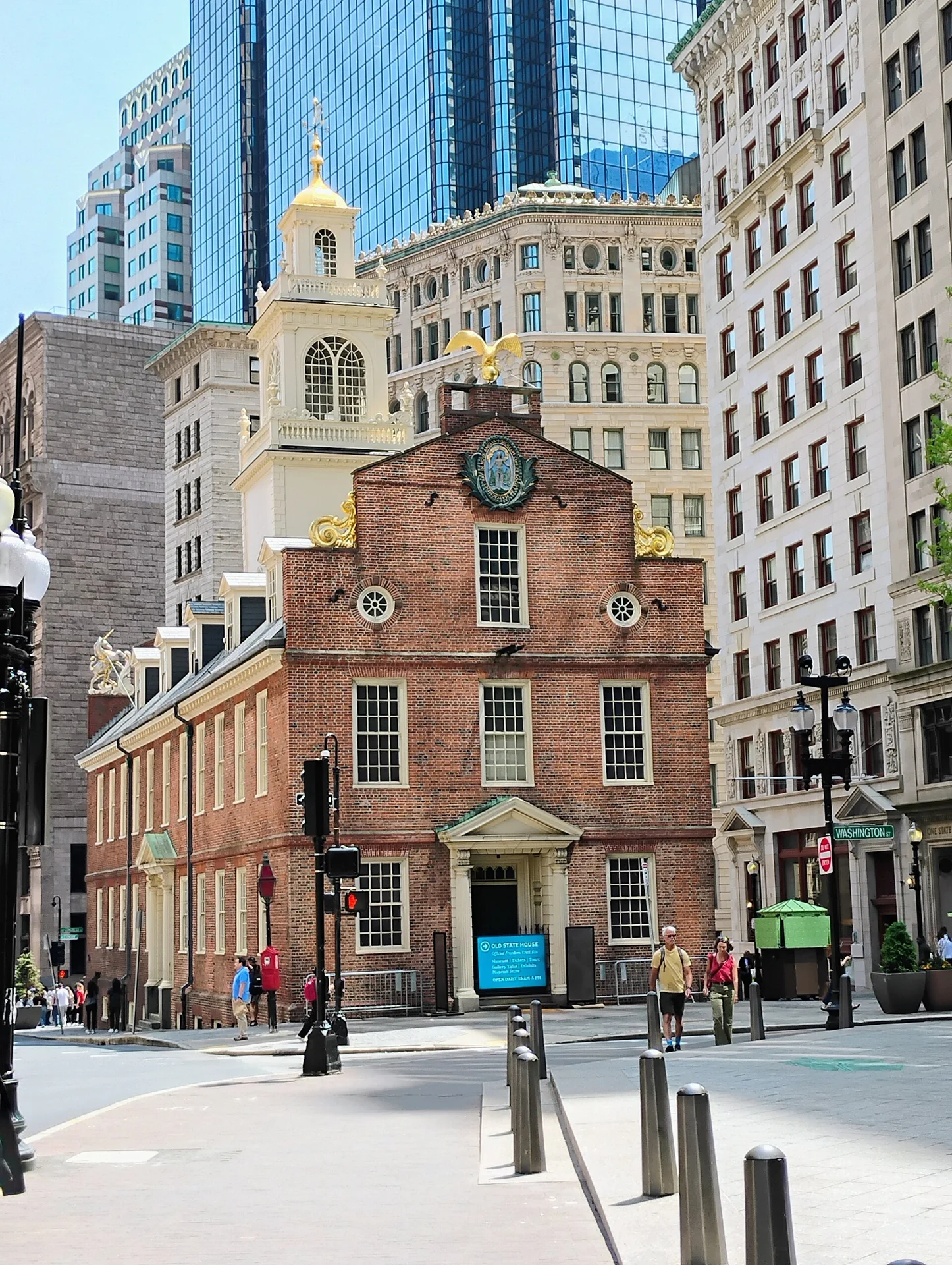
At the Old State House, compare the building’s compact outline with the surrounding city before concentrating on its architectural details. The contrast makes political history feel physically small without making it unimportant. The National Park Service dates the building to 1713 and describes its combined roles as a governmental seat and merchants’ exchange. Commerce and public authority were housed together, not in separate historical worlds.
The same source records the Declaration of Independence being read from the balcony on July 18, 1776. Consider the difference between a proclamation and the people able to claim its promises. This chapter does not ask the façade to resolve that tension. It asks how a balcony, a street and a later museum can each frame a public event differently. Looking at a site of revolutionary memory should leave room for questions about exclusion and the uneven expansion of rights.
The photographs offer independent comparisons of scale and surface. They do not reconstruct an eighteenth-century crowd or establish current access to the interior. Old South Meeting House is an optional discovery that broadens the question of public assembly. Our transition to Faneuil Hall is editorial, with actual crossings and connections left to separate planning. Keep the old and new State Houses distinct: similar names link institutions, not a single building moving through time.
Real-travel note
Independent local scenes with editorial transitions; check actual connections and present access separately.
Compare independent photographs from different dates and viewpoints.
Chapter 4
Question Faneuil Hall’s public memory
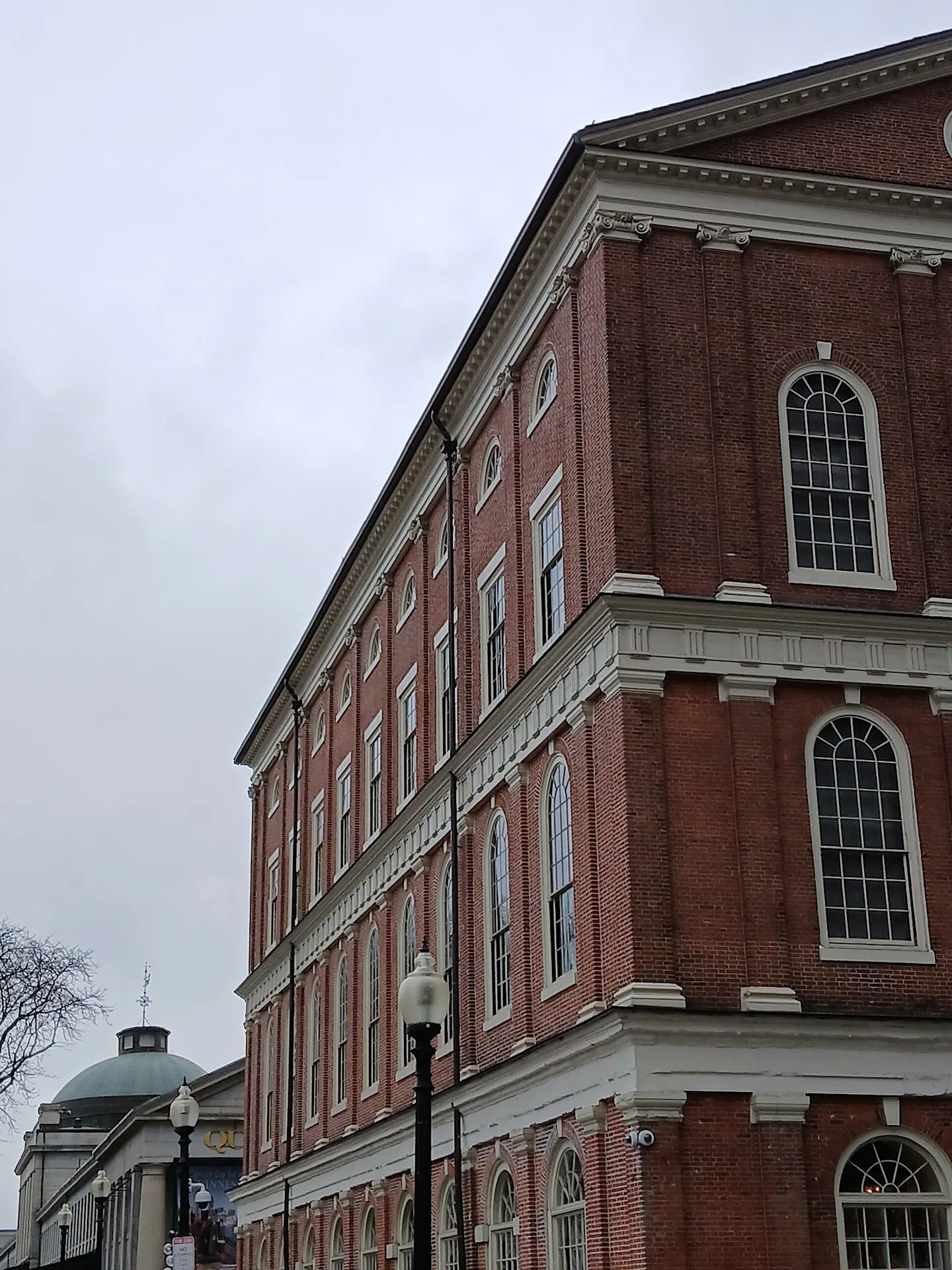
Faneuil Hall brings a difficult contradiction into view. Look at the building as both a civic landmark and a place shaped by trade. Boston’s archaeology service dates its original market and meeting space to 1742 and its expansion to the present form to 1806. Its location also records a changed shoreline: the service describes a former cove and dock subsequently filled for market use. The city’s physical ground is as constructed as its commemorative image.
The hall’s benefactor, Peter Faneuil, derived wealth from the trafficking of enslaved people. Later antislavery meetings do not cancel that origin. Nor should the origin erase the work of people who used public assembly to contest slavery. Hold these histories together rather than letting a celebratory nickname do the interpreting. The National Park Service explicitly distinguishes Faneuil’s involvement in slavery from the mistaken claim that enslaved people were sold in this hall. Precision makes the moral questions stronger.
Compare the exterior with the entrance detail and the separate interior photograph of the meeting hall. That interior is supplementary historical imagery, not evidence that an outdoor visit includes entry. The next chapter shifts to a North End household, an editorial change rather than a verified walk through the intervening streets. Present admission, events and interior access require separate checks. This is a place to ask whose names public buildings retain, and how interpretation changes the meaning of an inherited landmark.
Real-travel note
Independent local scenes with editorial transitions; check actual connections and present access separately.
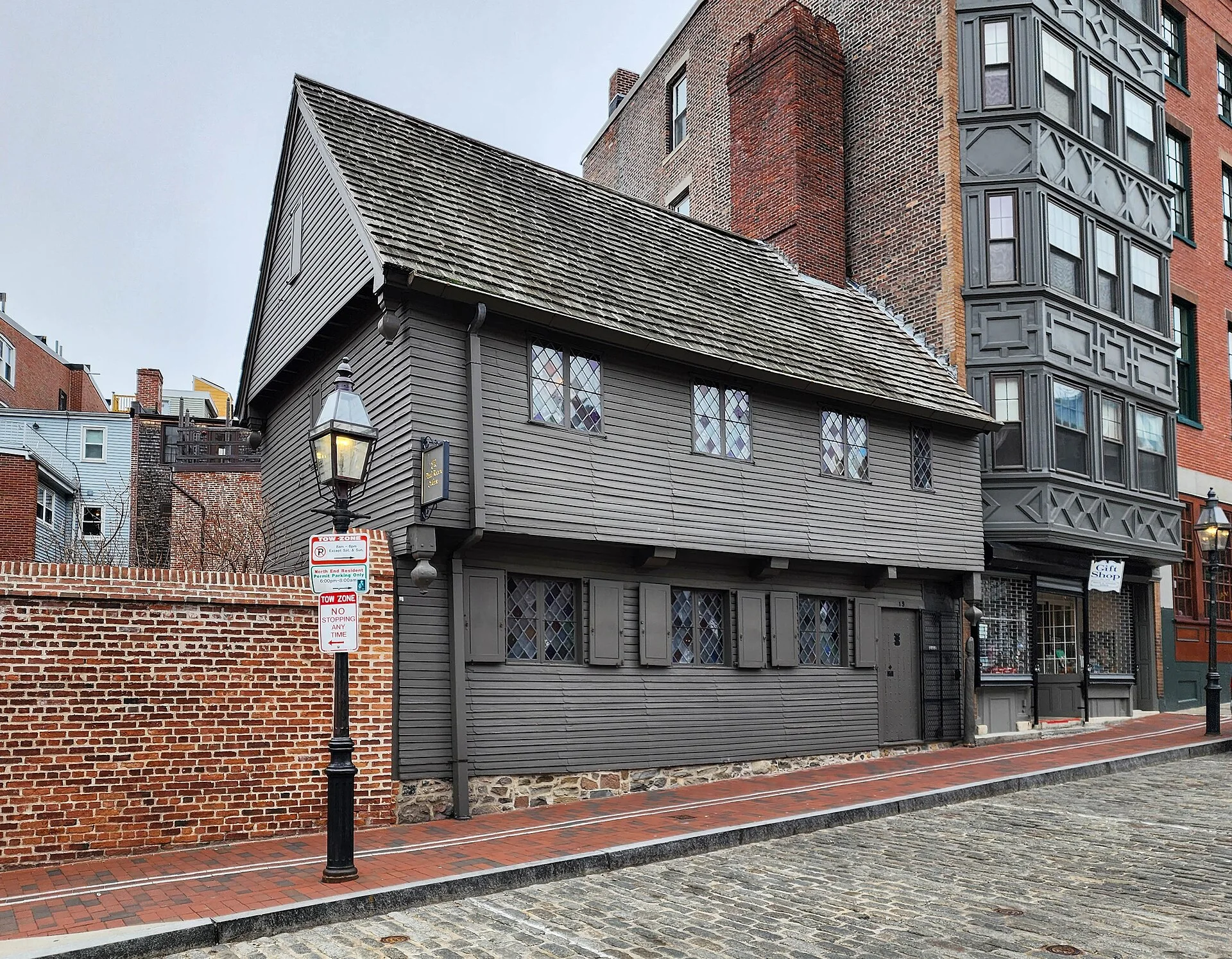
Compare independent photographs from different dates and viewpoints.
Chapter 5
A household beyond the midnight ride
Finish at the scale of a house. The Paul Revere House stands for more than a famous departure: its material history stretches across different owners, residents and later decisions about preservation. The Paul Revere Memorial Association dates the building to about 1680 and identifies merchant Robert Howard as its first owner. Compare the overall house with its smaller features and its relation to North Square. Domestic scale brings the people behind a national story closer, while leaving many lives outside the frame.
The City’s archaeology account identifies an enslaved man named Samuel living on Howard’s property. It also records other people Howard enslaved, while carefully distinguishing uncertain residence from documented presence. That caution is a useful way to look: a photographed house cannot tell us every occupant’s experience, and the name attached to a museum is not a complete list of the people whose labor made a household possible.
The Association describes the restoration that preceded the museum’s opening in 1908. The exterior therefore also belongs to a history of choosing how the past should appear. This chapter does not promise interior admission or reconstruct the midnight ride. Old North Church is a separate discovery for examining how a signal became public memory. The journey ends with questions about evidence, household power and commemoration, rather than a claim to have followed an uninterrupted historic walk.
Read further: Paul Revere House: more than one householdReal-travel note
Independent local scenes with editorial transitions; check actual connections and present access separately.
9 reviewed experiences
Explore along the route
Step into the places along this journey. Choose a view independently of the story chapters. Free previews do not count toward chapter progress. Return to the journey above to continue through its stops.
Begin with Boston Common Short observation sequence
2013-07 · 5 connected local positions and return. Boston Common paths, lawns and trees; this is a short park segment.
Reviewed 2026-10-30 · Nearby viewpoint
Explore at your own pace; these views do not count toward chapter completion. Check each point's coverage note before navigating provider imagery. Availability may change.
Sources
- Boston Common — National Park Service
- Boston Common archaeology — City of Boston
- The Massachusetts State House — Commonwealth of Massachusetts
- Visit the State House — Massachusetts Legislature
- Old State House — National Park Service
- Boston Slavery Exhibit — City of Boston
- Frequently Asked Questions: Faneuil Hall and slavery — National Park Service
- Paul Revere House — Paul Revere Memorial Association
- Paul Revere House archaeological sites — City of Boston
- Granary Burying Ground — City of Boston
- King’s Chapel — National Park Service
- Old South Meeting House — National Park Service
- History of Old North Church — Old North Church
- Boston Common November 2016 001.jpg — King of Hearts
- Boston Common November 2016 004.jpg — King of Hearts
- Boston Common May 2018 002.jpg — King of Hearts
- Boston -Massachusetts State House (48718911666).jpg — Ajay Suresh from New York, NY, USA
- The Massachusetts State House, Boston (493530) (11061457814).jpg — Robert Linsdell from St. Andrews, Canada
- Massachusetts State House from Boston Common, Boston, Massachusetts.jpg — Christian David
- The Old State House- Boston Mass.jpg — The Other 95%
- 2024 Old State House Lion - Boston.jpg — Farragutful
- Boston Old State House NE StateCongressSt 9445 20190429.jpg — Karlunun
- Faneuil Hall Mar 2025 10.jpg — Epicgenius
- Faneuil Hall Mar 2025 28.jpg — Epicgenius
- Faneuil Hall Mar 2025 24.jpg — Epicgenius
- Paul Revere House, Boston, 2023-02-21.jpg — Crisco 1492
- Paul Revere house.jpg — victorgrigas
- 2017 Paul Revere House from east.jpg — Beyond My Ken
- Boston Granary Burying Ground 16.jpg — Miguel Hermoso Cuesta
- Kings chapel boston 2009h.JPG — User:Chensiyuan
- Old South Meeting House, Boston, MA, 2023-02-21 01.jpg — Crisco 1492
- Old North Church exterior.jpg — LEvalyn


Your journey, remembered.
Explored 0 of 5 stops. Explore every stop to unlock your keepsake.
5 stops to your keepsakeExplore every stop to share or download your keepsake.
Plan separate site visits
Allow half a day as an outdoor planning estimate; actual connections and interiors are additional.
Official sources checked:
Arrange actual connections
Five chapters use editorial transitions between independent local scenes. They do not record a continuous Freedom Trail walk. Check streets, crossings, construction and individual access needs separately; no continuous or step-free route is established.
Check interiors and religious sites
Exterior images do not establish current opening or admission. Check government security, museum tickets and church visiting or worship arrangements with each institution.