
Zhangjiajie: the stream gives the pillars their scale
Yuanjiajie spreads the sandstone peaks across a view. Golden Whip Stream puts trees, water and people back within reach. Height changes meaning between the two.
ZhangjiajieObservation essay
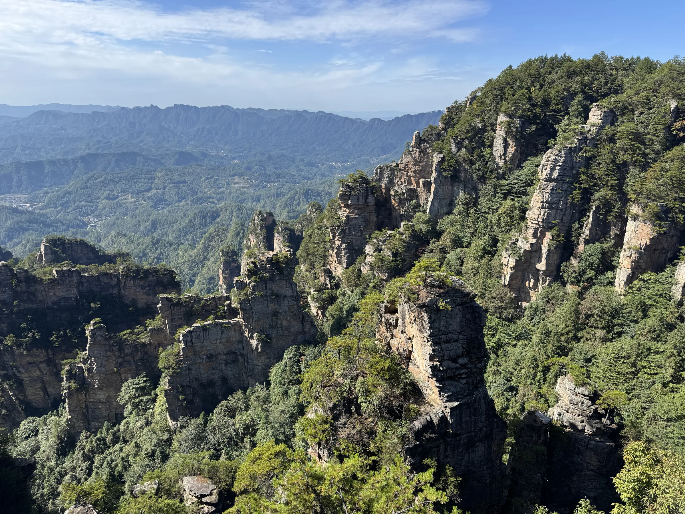
The high view arranges peaks in a row
In the Yuanjiajie photograph, pillars form an uneven edge on the right, with trees climbing their surfaces. Successive distant ridges become paler. The eye starts comparing outlines: a sharper summit, a wider gap, a column standing apart from its neighbour.
Recognising these differences is easier than estimating their size. Without a familiar building for reference, the peaks can resemble a model and then suddenly look enormous. Trees offer a clue, but their crowns shrink to texture in the distance. Another viewpoint helps give that height a more tangible measure.
Beside the stream, things return to reach
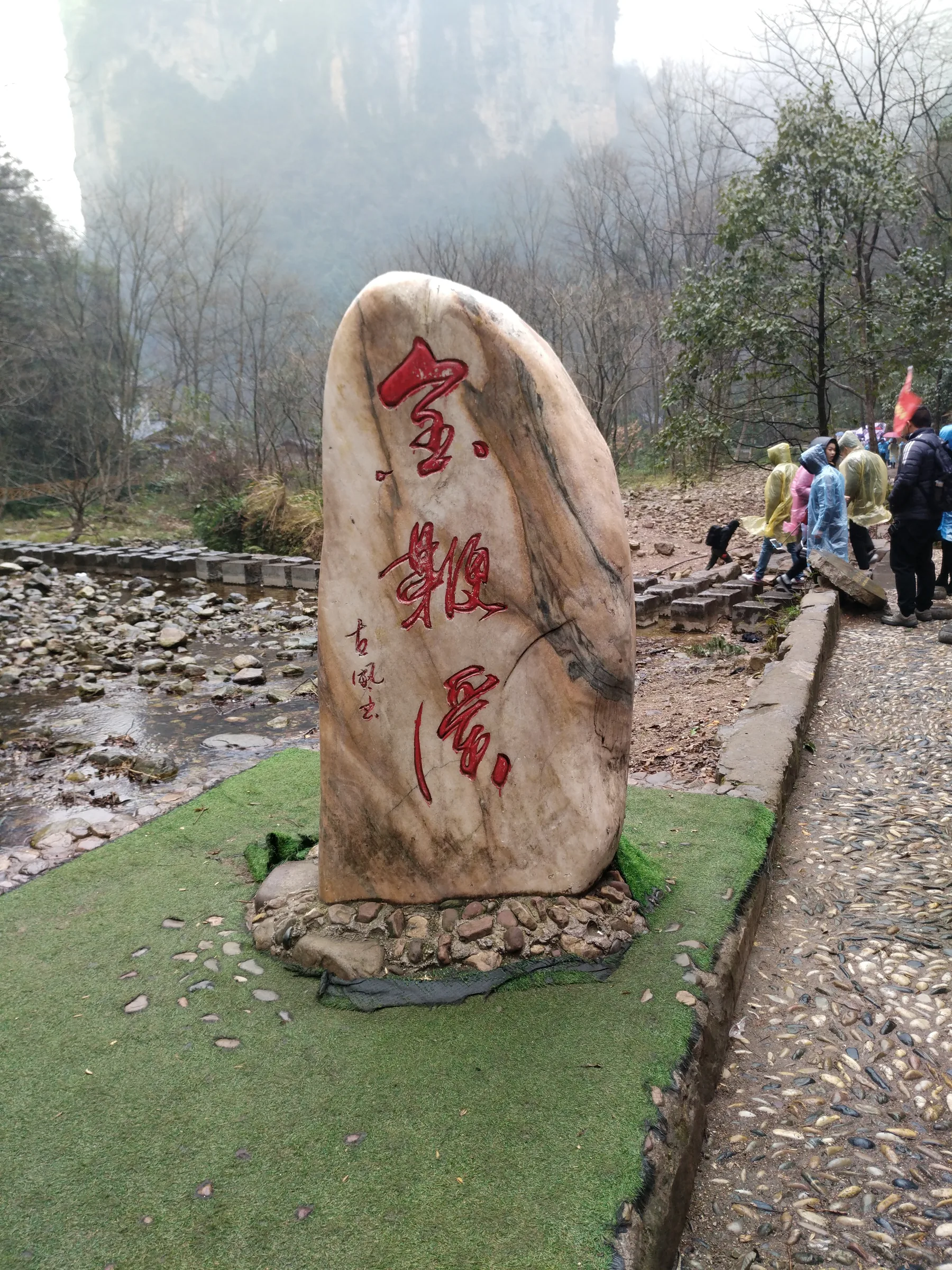
The stream photograph supplies a foreground inscription stone, an edged path and people in rainwear. Water occupies part of the lower left; a cliff fades behind the trees. The mountain is less completely presented, yet a person, a rock and a stretch of path give useful comparisons of size.
Hunan’s forestry account places Golden Whip Stream in a gorge between the peaks. At this lower level, the mountains help determine how far a view can extend on either side. The path follows the valley, while attention moves repeatedly between high rock and things beside one’s feet.
Quartz sandstone before a resemblance
UNESCO’s Wulingyuan description identifies quartz sandstone pillars and includes streams, gorges and forest in the landscape’s value. The language supplies a starting point that does not depend on recognising an animal or person in a silhouette. The peaks share a material context and belong within connected terrain.
Look separately at horizontal markings on the rock and vertical gaps dividing the masses. A photograph cannot establish the formation of every fracture. It can reveal these different directions before a memorable name takes over. There is plenty to examine in a surface without deciding what it resembles.
Trees do more than cover stone
In the Yuanjiajie image, green crowns and growth in crevices alternate with pale exposed walls. In the Tianzi Mountain photograph, dense vegetation fills the lower ground while several columns retain distinct outlines. Greenery sometimes conceals an edge and sometimes makes it clearer.
Looking only at the most isolated pillar can leave the space between peaks unnoticed. Shift attention into a gap and a slope begins to descend into the trees. Landform and vegetation appear together in the heritage description for good reason: what looks like background is part of how the whole landscape becomes visible.
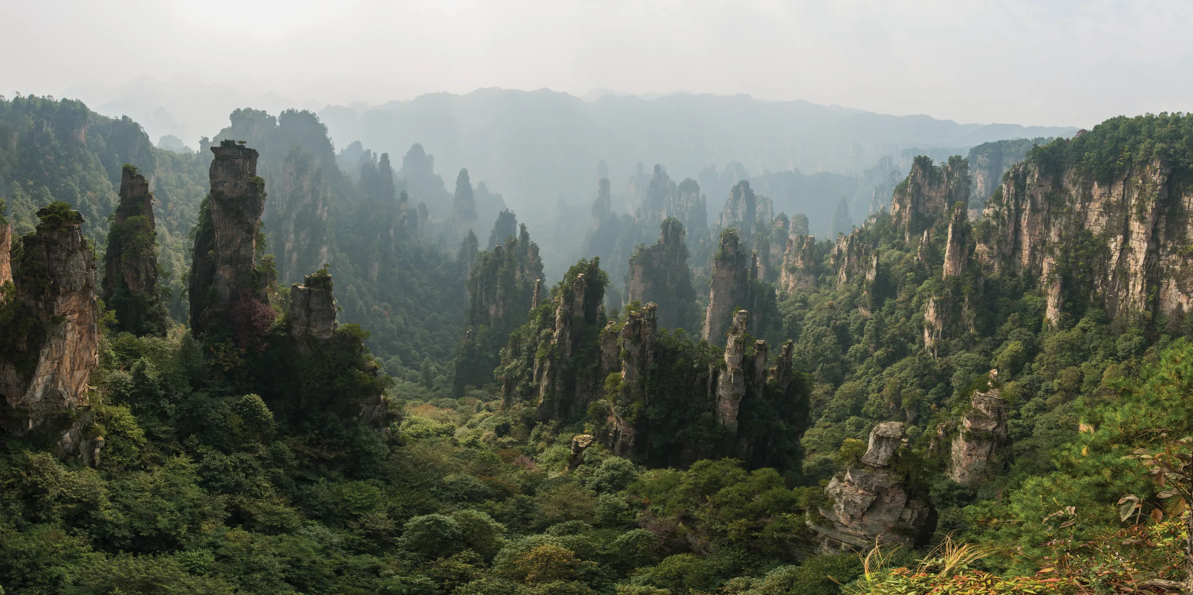
Mist changes the way distance reads
The nearer walls in the Tianzi Mountain photograph retain detail, while distant ridges become faint lines. Mist removes some information and strengthens other outlines. Attention can move from a textured surface to successive bands of grey-green, reading depth through their changing clarity.
A clear photograph and a misty one therefore offer different kinds of information. One helps distinguish surfaces; the other can separate overlapping ranges. There is no need to choose a preferred condition in advance. What is actually visible may deserve more time than the image remembered before arrival.
Keep both heights in the same account
Return to the stream photograph after the wide pillar views. The relationship between walkers and path becomes more noticeable. An elevated view explains how the peaks extend; the valley supplies a familiar bodily scale. Each position helps interpret the other.
They are not viewpoints a few steps apart. Golden Whip Stream, Yuanjiajie and Tianzi Mountain involve separate scenic areas and choices about ascent and transport, which need current planning. Carry a smaller question between them: does the eye first notice the stone, or the opening that separates it from the next peak?
References
These sources inform the essay’s historical and local context. Its observations and interpretations are original to WalkThere.
UNESCO World Heritage Centre
Wulingyuan Scenic and Historic Interest AreaDescribes quartz sandstone pillars, gorges, streams and vegetation as a landscape.
Hunan Forestry Department
Zhangjiajie National Forest ParkOfficial local context for Golden Whip Stream’s gorge, peaks and forest.
More journey background
Related journey sources
- Hunan Tianzi Mountain Nature Reserve — Hunan Forestry Department
- Zhangjiajie route — Hunan Department of Culture and Tourism
- Yuanjiajie, Bailong Elevator and Mihuntai — Hunan Department of Culture and Tourism
- Wulingyuan scenic area transport guide — Hunan Department of Culture and Tourism
- Wulingyuan one-ticket system background — People’s Government of Hunan Province
- Zhangjiajie National Forest Park — Wikidata
- Bailong Elevator — Wikidata
- Tianzi Mountain — Wikidata