
Amsterdam’s canal ring: water first, city afterwards
Look beneath the reflections to the planning, unequal geography and continuing maintenance that make a canal city possible.
Amsterdam Canal RingObservation essay
There is an engineering drawing beneath the reflection
A photograph of Amsterdam often begins with houses: gables shoulder to shoulder, their colours repeated in the water. Temporarily remove those houses from the picture. Canals, quays and bridges remain—the conditions that made the neighbourhood possible. UNESCO describes a planned new port city rather than streets simply gathering beside a natural river.
Drainage and the filling of land worked together in the expansion. Water needed a place within the plan, while the ground between waterways had to support building. A waterside address was therefore part of the city’s construction, not an ordinary street later rewarded with a view.
The arcs took time to build
Amsterdam’s City Archives uses 1613 as a starting point for a major phase of expansion, followed by a later extension towards the Amstel after 1656. Parallel curves look effortless on a map. In construction they required separate campaigns of excavation, clearance and investment.
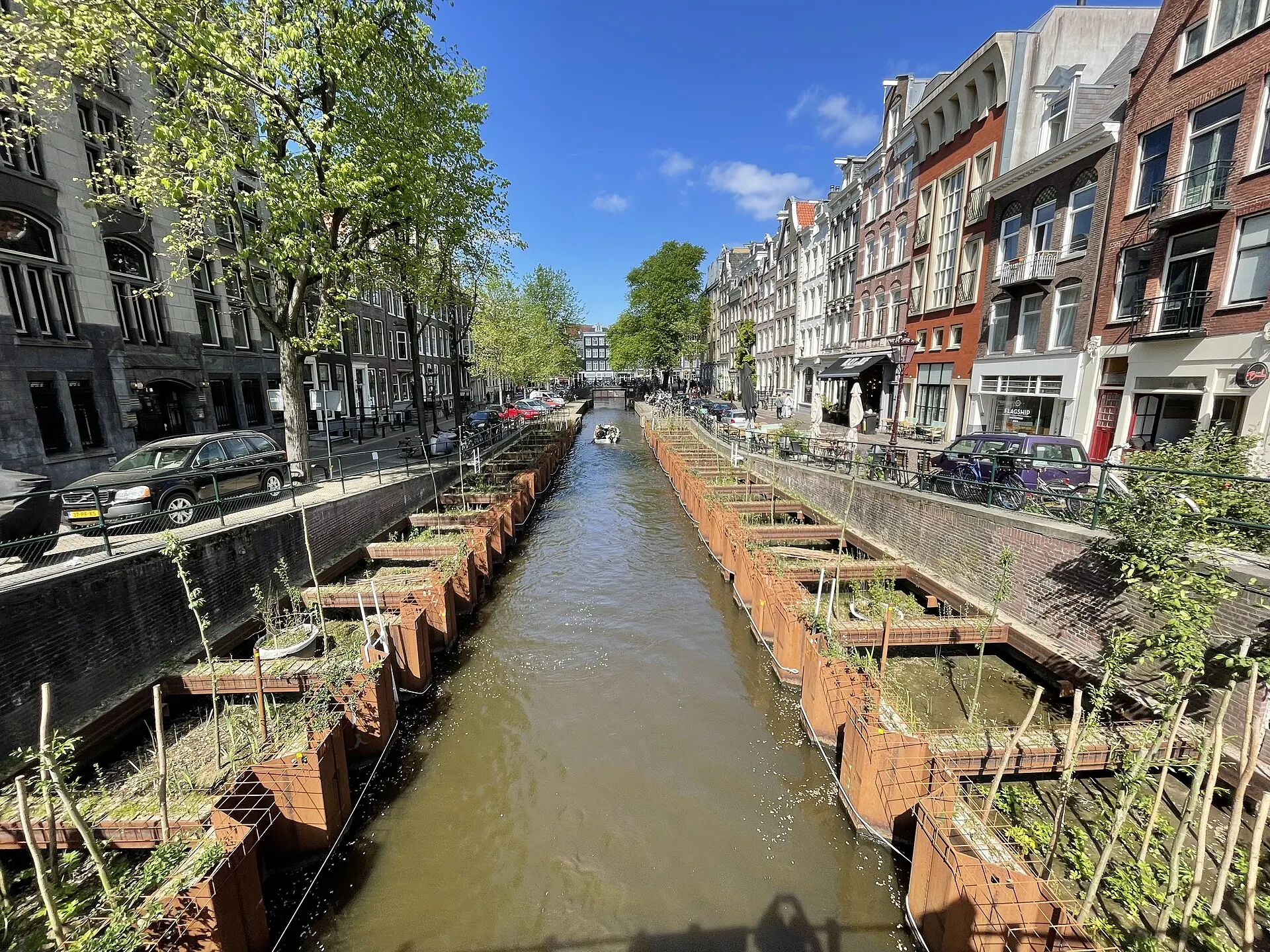
A visitor’s itinerary joins places into a convenient afternoon; a growing city does not work so neatly. At the meeting of Leliegracht and Keizersgracht, the short waterway interrupts a longer view. The junction makes two requirements tangible: following the canals and maintaining connections across the expanding district.
A generous frontage was also an allocation
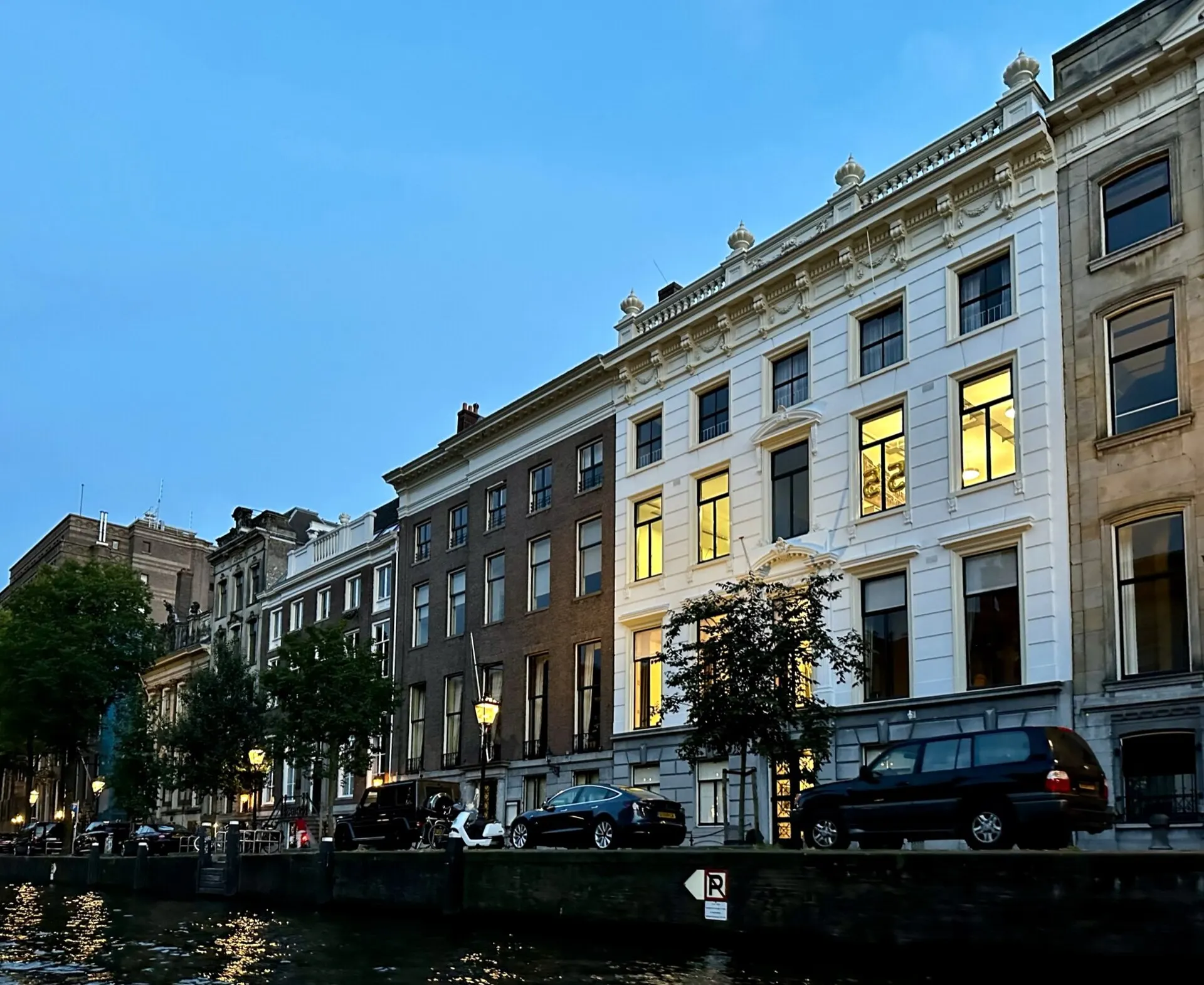
Around Herengracht’s Golden Bend, the canal plan becomes a setting for substantial houses. Frontage width, entrance steps and the alignment of buildings offer things to compare without pretending to identify an owner’s circumstances from a façade. Ask instead which positions offered room for display.
The City Archives explicitly discusses social separation and links part of the trading wealth to plantation products made with enslaved labour. That context belongs beside the handsome architecture. It does not identify the history of every building in a photograph; an individual address still requires its own documentary research.
Bridges repair the separation made by water
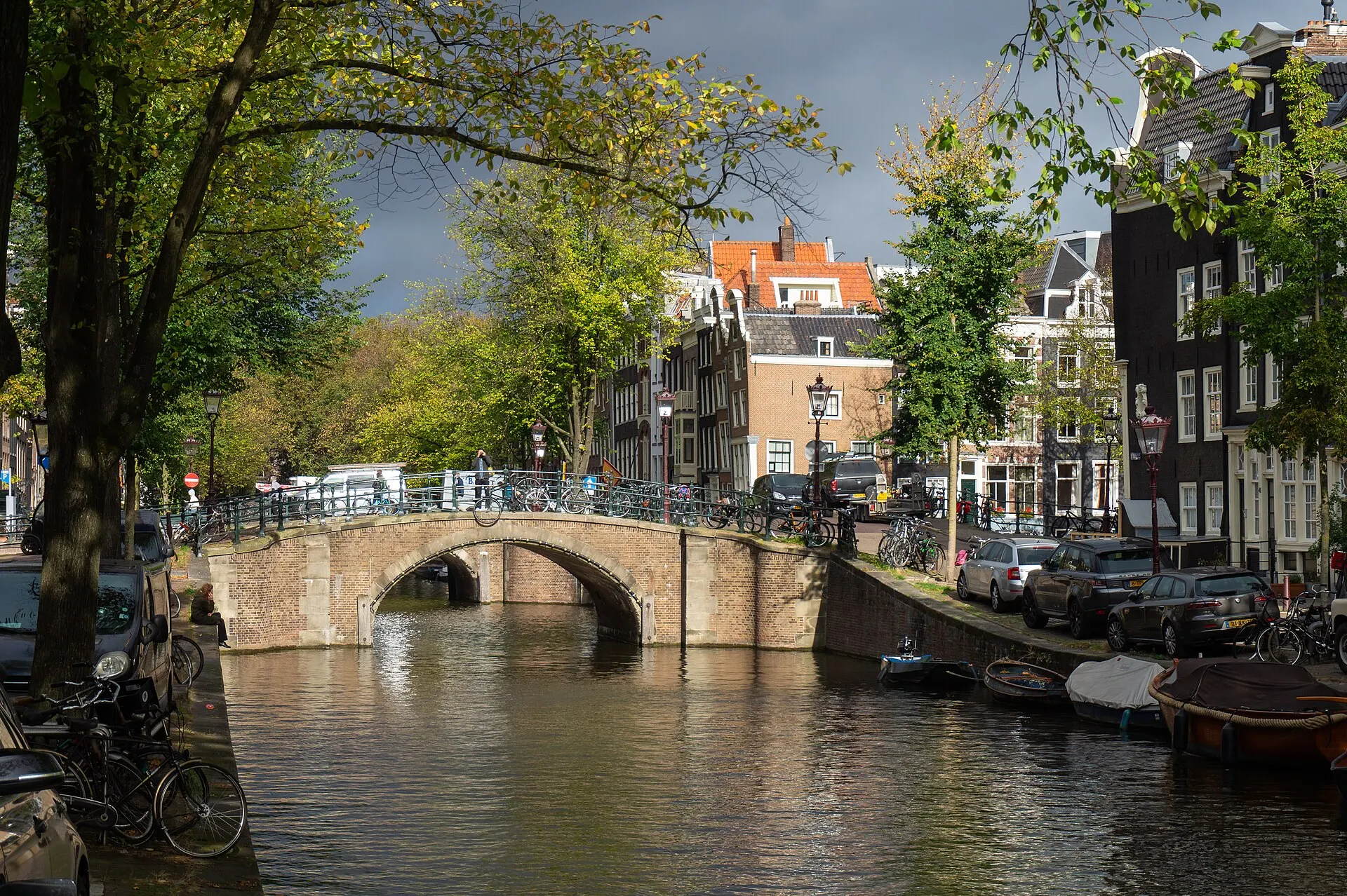
Following a canal can feel like an obvious route until the destination is across it. Two nearby places may require a detour to a crossing. A bridge does more than supply an attractive arch: it reconnects ground divided by the waterways.
The Reguliersgracht photograph offers a narrower setting than the Golden Bend. Compare bank-to-bank distance and the meeting of bridge and road before deciding which view is prettier. A map explains the network; a corner explains how that network becomes one particular change of direction.
The quay is not a permanent picture frame
The Leliegracht photograph dates from 2022 and records visible quay reinforcement. Keeping that detail in view brings engineering back into the scene. It does not establish present works, today’s access arrangements or the condition of an entire length of wall.
The municipality continues to inspect, monitor and renew bridges and quays. Preserving a historic city involves load, maintenance and access as well as appearance. Barriers and temporary structures may interrupt the tidy outline, but they also record the work required to keep the setting in use.
Follow water, edge and doorway together
On another waterside walk, give attention to those three layers in turn. What does the canal divide? How much room is available along its bank? How does an entrance address that boundary? The houses remain compelling, but they belong to a working arrangement rather than an isolated collection.
Construction phases, sources of wealth and maintenance are less easily compressed into a postcard than a row of gables. They make the place more particular. The canal ring contains carefully drawn lines and edges that must continually be repaired, negotiated and used.
References
These sources inform the essay’s historical and local context. Its observations and interpretations are original to WalkThere.
Amsterdam City Archives
1613: Canal RingPhased expansion from 1613 and the district’s social geography.
UNESCO World Heritage Centre
Seventeenth-Century Canal Ring Area of Amsterdam inside the SingelgrachtHeritage context for hydraulic engineering and urban planning.
Municipality of Amsterdam
Kademuren: maatregelen en vernieuwenMunicipal information about continuing bridge and quay renewal.
More journey background
Related journey sources
- Visit Westerkerk — Westerkerk
- Bridges of Amsterdam — I amsterdam
- Top markets for food and flowers — I amsterdam
- Amstel River walking route — I amsterdam