
Amsterdam: canal corners, house fronts and the Amstel
Explore Amsterdam’s canal ring in five chapters with three photographs per stop. Eight local street-view sequences and two independent panoramas invite a closer look, without pretending to join into one continuous walk.
Begin the visual journeyPlan a real visit to Amsterdam Canal RingExplore 10 reviewed views along the routeGuided visual journey
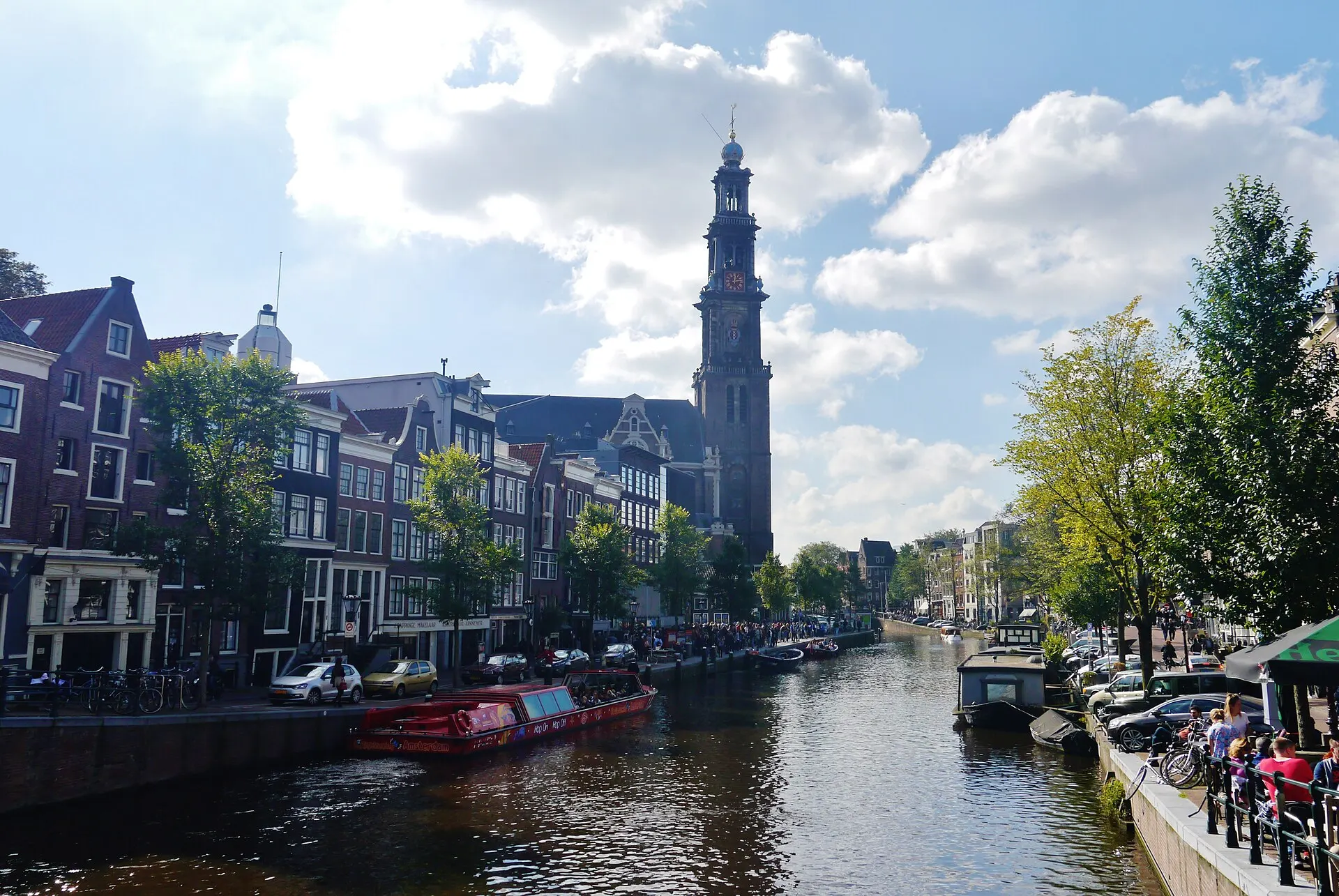
Westerkerk above the Prinsengracht · Zairon · CC BY-SA 4.0 · Resized and converted to WebP
Reading mode
Place stories to read at your own pace
Compare canal context, building detail and different dates or light.
Chapter 1 · A tower beside the water
Use Westerkerk to find your bearings on Prinsengracht
Start with a landmark that can be seen across the water. Westerkerk gives this part of Prinsengracht a vertical reference: canal edges lead sideways, while the tower draws the eye upward. The church’s own visitor information describes a building constructed between 1620 and 1631. This chapter introduces its exterior setting rather than assuming that a visible door means an included interior visit.
The September 2017 photographs offer two scales: a broad canal composition and a closer tower-and-street view. The January 2009 frame records winter evening light from another position. Switch among them before starting the interactive scene. Their differences in light, foliage and camera distance are useful observations, not the stages of one recorded walk or a forecast of today’s appearance.
The May 2024 Google fragment contains three linked Prinsengracht street positions beside the church. Blue wrapping and scaffolding partly cover the tower, so it is deliberately not presented as an unobstructed architectural portrait. Move a short distance and return to compare the street edge with the clearer older photographs. Along-route exploration adds Torensluis and a separate November 2017 church-interior panorama. The interior supports a full turn, not movement or current admission. For an actual church visit, check Westerkerk’s current visitor page; worship, restoration and tower access need separate preparation.
Real-travel note
May 2024 street imagery includes restoration wrapping. A separate historical interior panorama is in along-route exploration. No included admission, tower visit or verified pedestrian route.
Compare canal context, building detail and different dates or light.
Chapter 2 · Read the corner
Let Leliegracht interrupt the long canal view
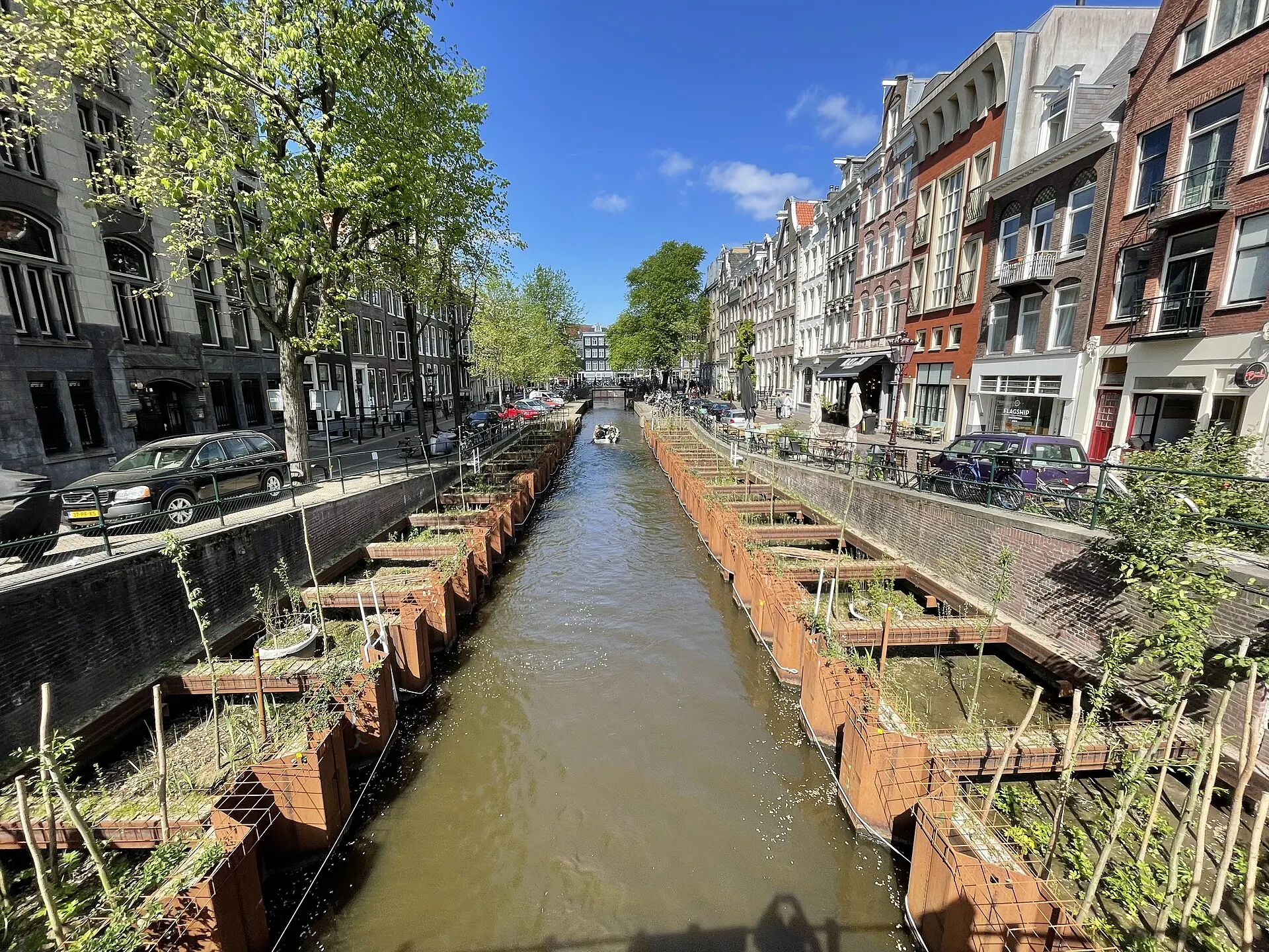
A canal corner changes the way the city is read. Along one bank, façades repeat into the distance; at a crossing, water and bridge edges turn that long view sideways. Here the subject is Leliegracht where it meets Keizersgracht. Look first at the relationship between the canal opening, the bridge and the corner building, rather than searching for a single compulsory photo spot.
The May 2022 photograph explicitly records quay reinforcement, including the temporary-looking steel edge in the foreground. It is a dated record of works, not a claim about current access. The January 2015 corner photograph brings the junction closer, while the August 2012 image isolates the façade at Leliegracht 25. All three files identify their subjects independently. Comparing them changes scale, not your virtual position along a continuous path.
The March 2023 interactive sequence begins on Keizersgracht just north of the junction. Its three positions let you turn toward the crossing, move along the adjoining street and return; they do not travel the whole length of Leliegracht. Low sunlight, parked vehicles and trees affect what can be seen. Later, the optional Leidsegracht crossing offers another way to compare water, bridge and corner geometry. For a real walk, use a current pedestrian map and leave space for residents, bicycles and other people at the narrow bridge approaches.
Read further: Amsterdam’s canal ring: water first, city afterwardsReal-travel note
The panorama is on Keizersgracht near the Leliegracht junction, not a full walk along Leliegracht. Quay works in the 2022 photograph may no longer reflect current conditions.
Compare canal context, building detail and different dates or light.
Chapter 3 · A wider house front
Read Herengracht’s Golden Bend through its façades
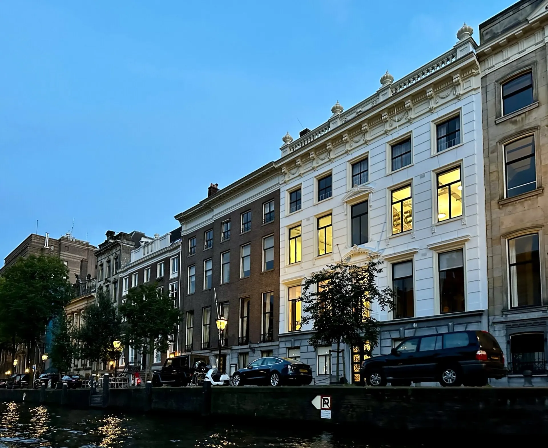
At the Golden Bend, pay attention to width as well as height. The Amsterdam City Archives describes this section of Herengracht in the history of the canal-ring expansion and its large houses. The useful visual question is how a façade meets the street: count window bays, notice doorways, and compare the broad frontage with the narrower buildings remembered from earlier canal corners.
Three independent photographs prevent the chapter from becoming a single postcard. The September 2023 water-facing view gives the façades a reflective foreground. The April 2025 photograph brings a broad historic row into clearer view, while the July 2017 frame concentrates on buildings and trees. They differ in position and light. None verifies that an attractive canal house is open to visitors, and a business name in a file title does not imply an invitation to enter.
The May 2024 Google fragment follows three nearby positions on the Herengracht street edge. Turn across the canal to compare the rhythm of the façades, then move a little and return. Parked vehicles and foliage remain part of the record, not obstacles digitally removed for a perfect scene. Bloemenmarkt, available separately in along-route exploration, changes the subject from house fronts to market stalls. For an actual visit, keep private entrances clear and plan the connections yourself: the five chapters are editorial stops, not a surveyed navigation track.
Real-travel note
Short historical road-side sequence only. Canal-house interiors, current businesses and onward pedestrian access are not verified by the photographs.
Compare canal context, building detail and different dates or light.
Chapter 4 · A smaller water corridor
Find a quieter visual rhythm on Reguliersgracht
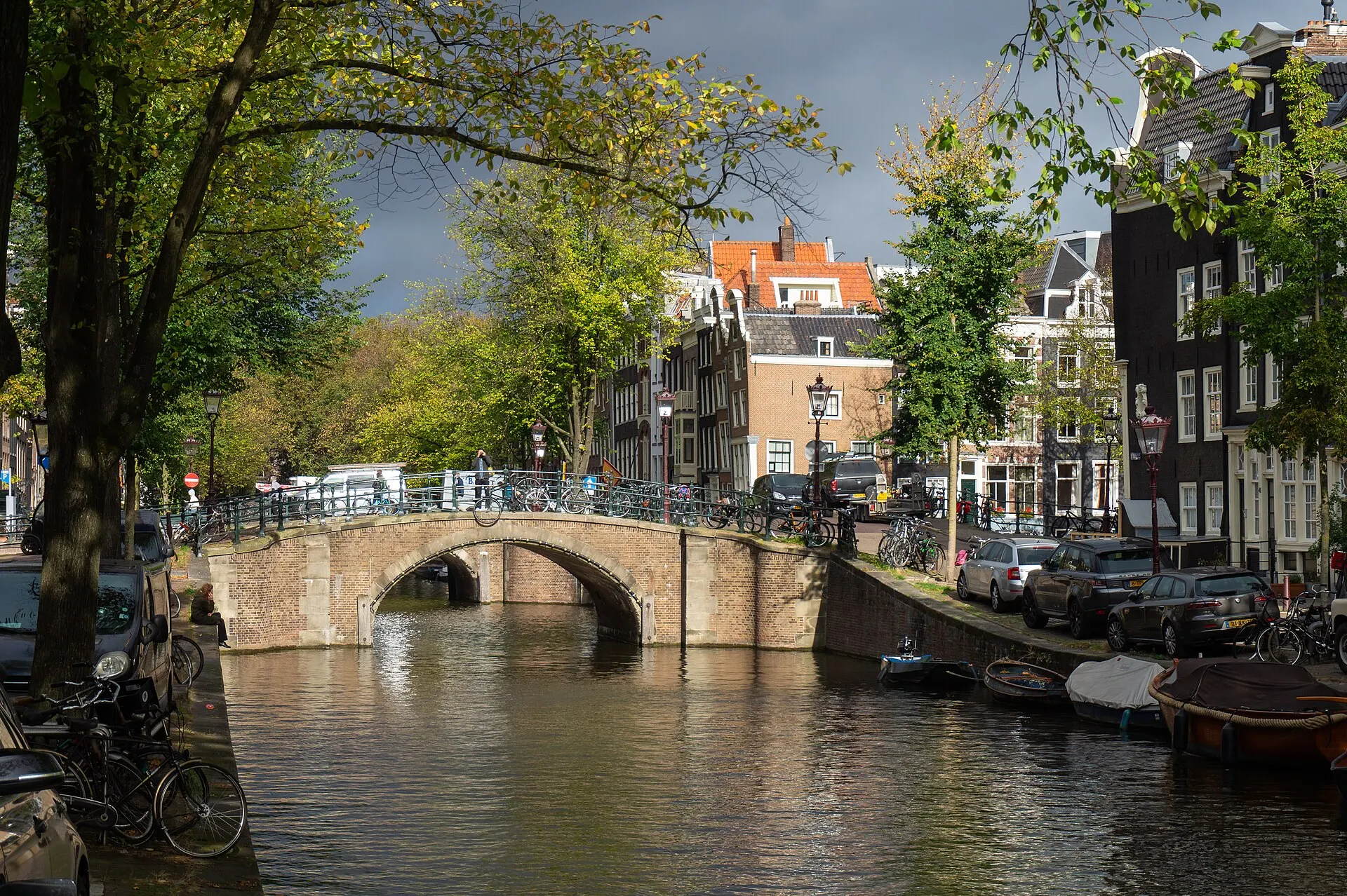
Reguliersgracht changes the scale again. Rather than treating the canal as a list of bridges to collect, look at the narrow strip of water, the rhythm of trees and the way house fronts hold the street together. The interaction here starts near number 30. It is a specific canal-side fragment, not the nearby Thorbeckeplein square and not a promise to show every celebrated bridge alignment.
Two October 2018 photographs show the canal and the houses near its Keizersgracht crossing. One sets the water and bridge in a broad composition; the other concentrates on façades and the bridge edge. An August 2010 image adds an older view of the canal-side buildings. These photographs are contextual records from different camera positions, including a lower water-facing perspective; they do not include a boat ride or establish that the camera stood on your walking route.
The June 2018 Google scene contains three linked street positions along the actual canal, with a verified return. Its sunlit paving and trees create a different impression from the photographs, which is a reason to compare them rather than replace one with the other. Do not infer a quiet street today from a historical frame. When visiting, pause somewhere that leaves the pavement clear, watch for cycles and check the bridge crossing independently before continuing toward the Amstel. The city’s bridge guide provides broader context without turning this small fragment into a complete bridge tour.
Real-travel note
Three positions near Reguliersgracht 30. Photographs near the Keizersgracht crossing have different viewpoints; no boat ride or multi-bridge sightline is promised.
Compare canal context, building detail and different dates or light.
Chapter 5 · Water opens out
Finish beside the Amstel, looking toward Magere Brug
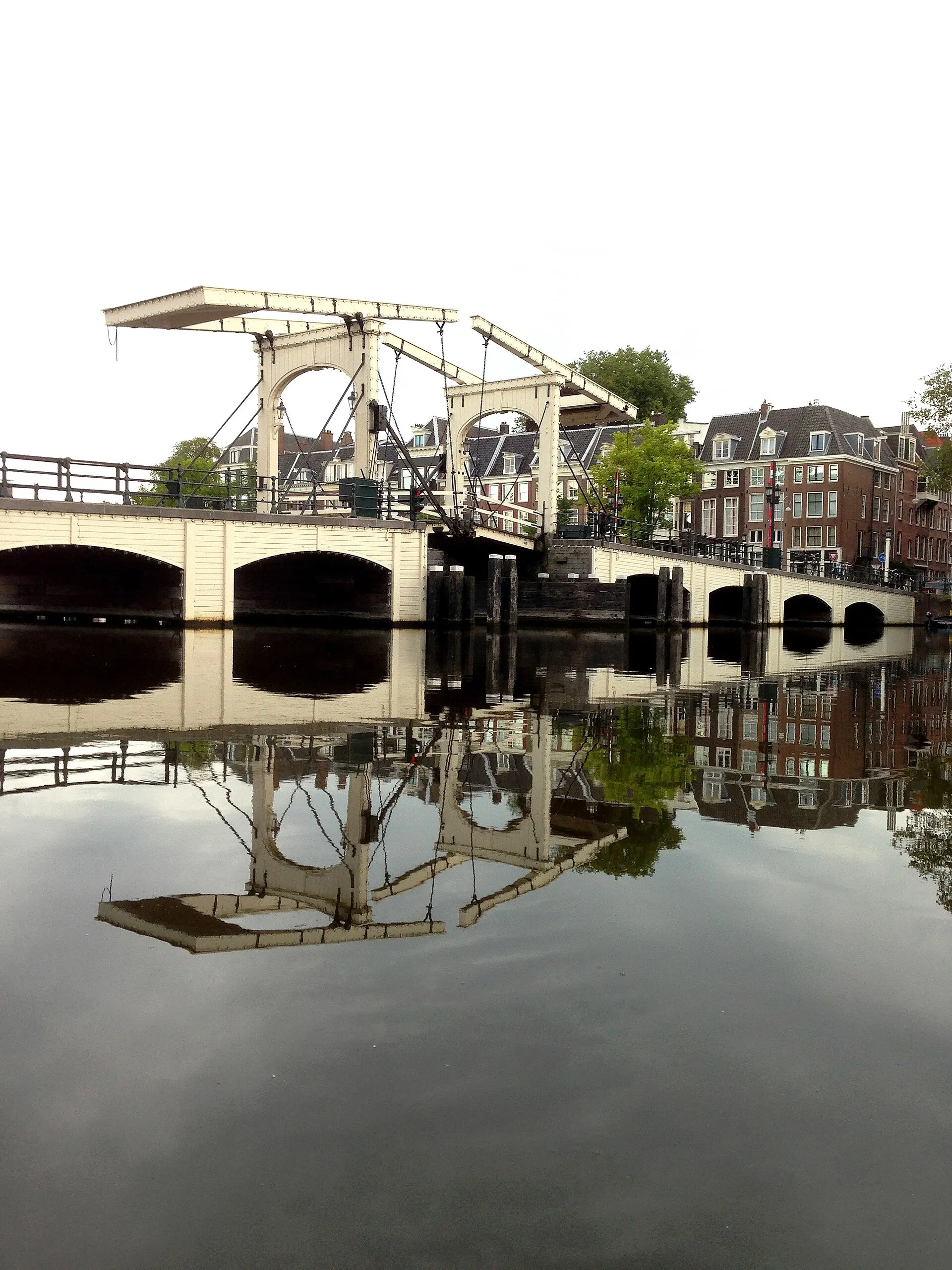
The Amstel opens the view beyond the narrower canal corridors. Magere Brug gives that wider water a light-coloured structure to look toward, but the chapter does not begin by placing you in the middle of the bridge. Separate the bridge as a subject from the bank as a camera position. This makes the change from an intimate canal to a broader river more legible.
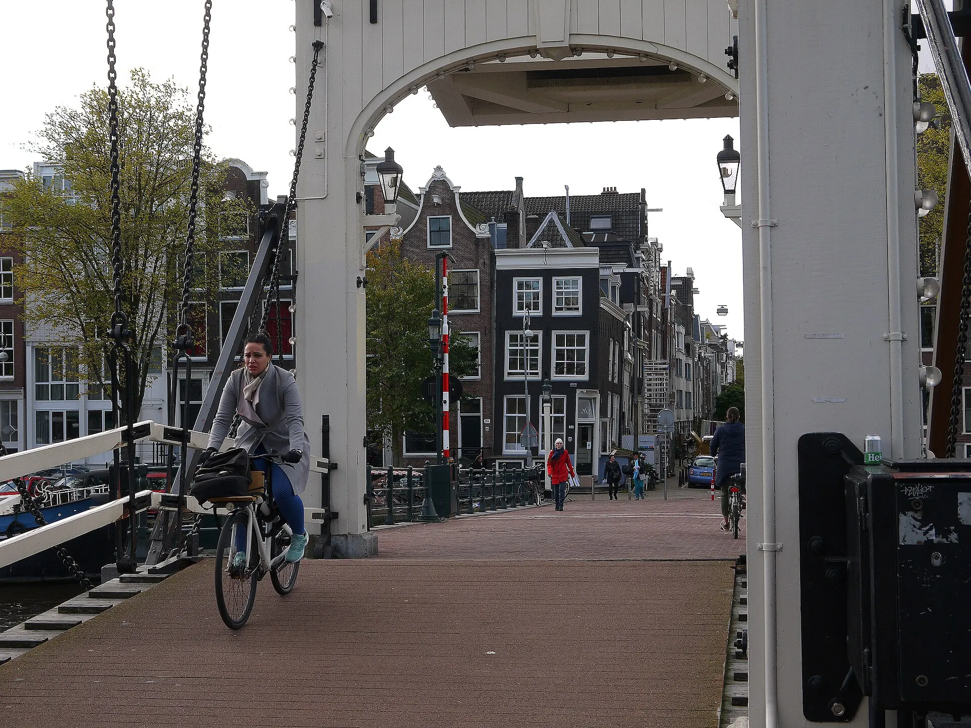
The August 2015 photograph records morning conditions around the white bridge and its reflection. The August 2016 frame looks along its structure at an evening hour; it is not a guarantee of darkness or illuminated bridge lights. The October 2021 photograph adds cyclists and the scale of people crossing. Use the visible left and right controls to compare all three. Their different dates and viewpoints do not form a continuous bridge traversal.
The March 2023 Google fragment is on the Amstel’s west bank, near number 270. Three linked street positions allow a short move along the bank and a return. Parked cars can occupy the foreground, with the white bridge visible off to the side; turn around to understand that relationship. There is no boat-level scene or verified crossing of Magere Brug. The separate Blauwbrug panorama offers another bridge-road viewpoint farther north. For your real finish, choose a safe bank-side pause, consult a current walking map and treat any onward bridge crossing or cruise as a separate decision.
Real-travel note
West-bank street fragment with parked cars, not on Magere Brug. No boat ride, bridge crossing, scheduled opening or evening illumination is included.
10 reviewed experiences
Explore along the route
Step into the places along this journey. Choose a view independently of the story chapters. Free previews do not count toward chapter progress. Return to the journey above to continue through its stops.
Use Westerkerk to find your bearings on Prinsengracht Short observation sequence
May 2024: three Prinsengracht street positions beside Westerkerk, with blue wrapping and scaffolding. Not a clear tower portrait, church interior or pedestrian route.
Reviewed 2026-10-19 · Nearby viewpoint
Explore at your own pace; these views do not count toward chapter completion. Check each point's coverage note before navigating provider imagery. Availability may change.
Sources
- Kademuren: maatregelen en vernieuwen — Municipality of Amsterdam
- Seventeenth-Century Canal Ring Area of Amsterdam inside the Singelgracht — UNESCO World Heritage Centre
- 1613: Canal Ring — Amsterdam City Archives
- Visit Westerkerk — Westerkerk
- Bridges of Amsterdam — I amsterdam
- Top markets for food and flowers — I amsterdam
- Amstel River walking route — I amsterdam
- Interior of Westerkerk (Amsterdam) 114220.jpg — Quahadi · Wikimedia Commons
- Amsterdam Prinsengracht & Westerkerk 1.jpg — Zairon · Wikimedia Commons
- Amsterdam - Prinsengracht - View SSW towards Westerkerk.jpg — Txllxt TxllxT · Wikimedia Commons
- Amsterdam Prinsengracht & Westerkerk 5.jpg — Zairon · Wikimedia Commons
- Leliegracht met nieuwe kadeversteviging.jpg — Alf van Beem · Wikimedia Commons
- Corner Keizersgracht Leliegracht (Amsterdam, Netherlands 2015) (16239849067).jpg — Paul Arps from The Netherlands · Wikimedia Commons
- RM518361 Amsterdam - Leliegracht 25.jpg — M.M.Minderhoud · Wikimedia Commons
- Buildings along Herengracht.jpg — APK · Wikimedia Commons
- Amsterdam Euroclear.jpg — Boubloub · Wikimedia Commons
- Amsterdam 45.jpg — Deavmi · Wikimedia Commons
- Reguliersgracht, Amsterdam.jpg — Marco Ober · Wikimedia Commons
- Houses in Amsterdam centre, Reguliersgracht.jpg — Marco Ober · Wikimedia Commons
- Amsterdam-464-Reguliersgracht-2010-gje.jpg — Gerd Eichmann · Wikimedia Commons
- Magerebrug (in the morning).jpg — Sylvain NGR · Wikimedia Commons
- Magere Brug 2048.jpg — C messier · Wikimedia Commons
- Biking over the Skinny Bridge (Magere Brug), over the Amstel river; free photo Amsterdam by Fons Heijnsbroek, 10-2021.jpg — Fons Heijnsbroek · Wikimedia Commons
- Torensluis OKT 2023 01.jpg — Milliped · Wikimedia Commons
- Keizersgracht meets Leidsegracht 7264.jpg — C messier · Wikimedia Commons
- Amsterdam- Bloemenmarkt.jpg — James Whisker · Wikimedia Commons
- Amsterdam, Blauwbrug in 2007.jpg — Matěj Baťha · Wikimedia Commons


Your journey, remembered.
Explored 0 of 5 stops. Explore every stop to unlock your keepsake.
5 stops to your keepsakeExplore every stop to share or download your keepsake.
Plan a canal-side visit
Choose where to linger in the images, then arrange safe walking connections and optional visits separately.
Official sources checked:
Connect five different water settings
Suggested order: Westerkerk → Leliegracht → Golden Bend → Reguliersgracht → Magere Brug west-bank setting. About 3 km is an editorial estimate, not a surveyed track. Allow 2–3 hours for outdoor pauses; Torensluis, Leidsegracht, Bloemenmarkt and Blauwbrug add detours. Consult a current pedestrian map.
Separate churches, homes and market visits
Check Westerkerk’s current arrangements for worship, visiting and tower access. Canal houses are not automatically public attractions. Bloemenmarkt’s 2014 imagery records a historical market setting, not present stall inventories or trading hours; use current destination information before visiting.
Make room for cycles and changing banks
Pause without blocking bridge approaches or private entrances; watch for cycle traffic and exposed water edges. Street-view road positions are not instructions to walk in a carriageway. Weather, quay repairs and crossings can change. Check mobility needs independently and plan any Amstel continuation or cruise separately.