
Vienna: from a patterned cathedral roof to the Ringstrasse
Explore Vienna’s old centre in five chapters, with fifteen switchable photographs and nine independently reviewed local Google scenes. Read the city’s changing scale without mistaking separate street fragments for one continuous walk.
Begin the visual journeyPlan a real visit to Vienna Old Town & RingstrasseExplore 9 reviewed views along the routeGuided visual journey
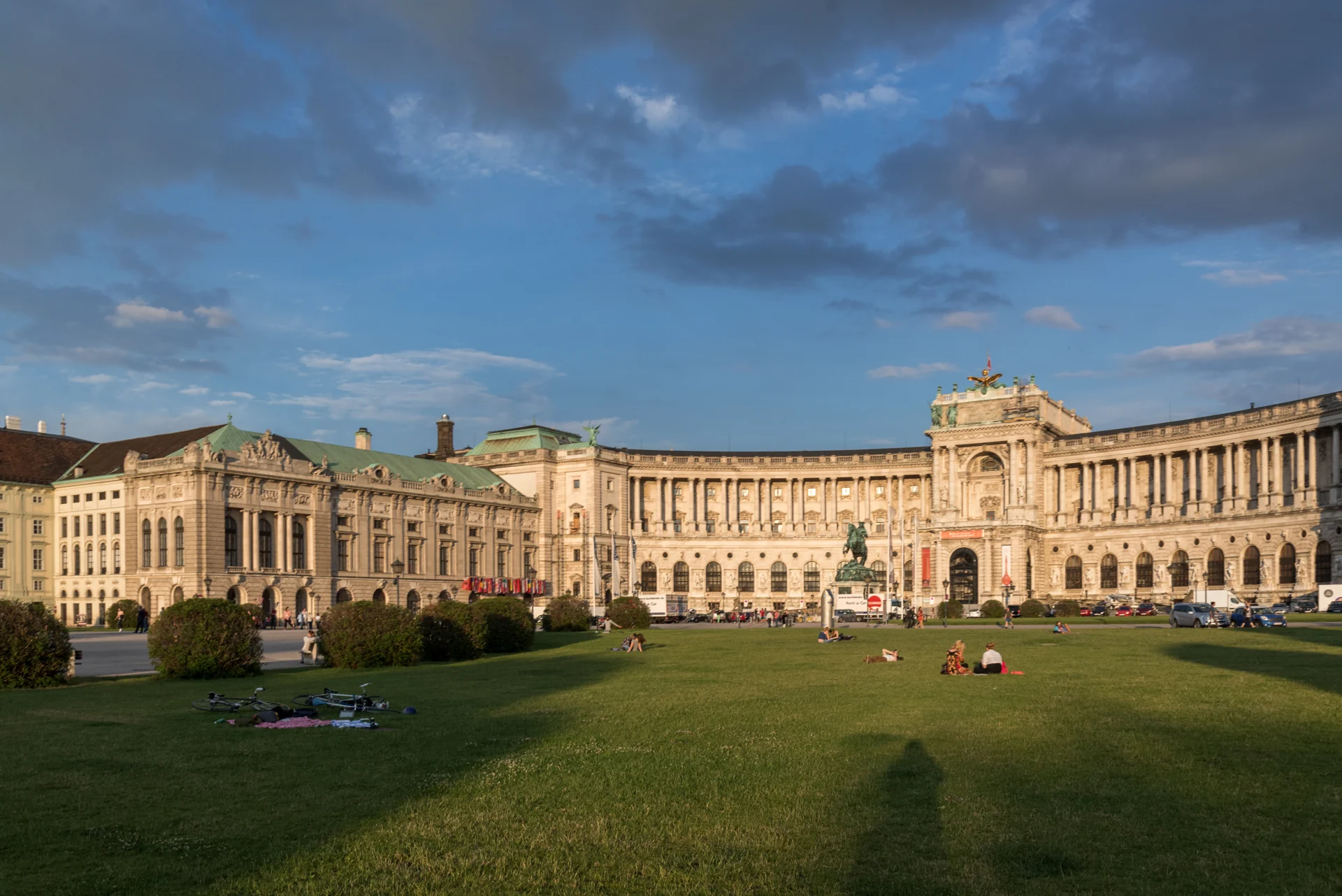
Neue Burg and Heldenplatz in evening light · Tilman2007 · CC BY-SA 4.0 · Resized and converted to WebP
Reading mode
Place stories to read at your own pace
Compare the wider setting, a closer detail and another viewpoint.
Chapter 1 · Roof, tower, doorway
Find your scale beside St Stephen’s Cathedral
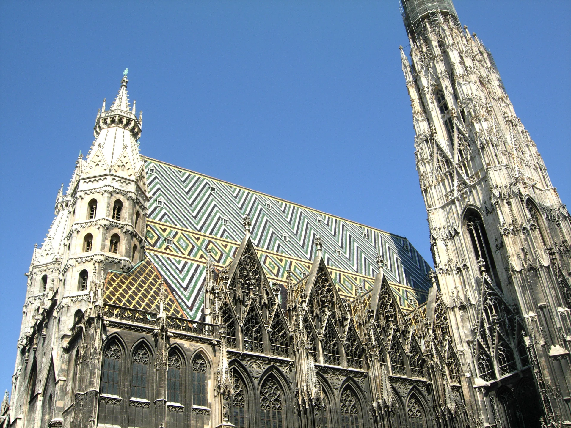
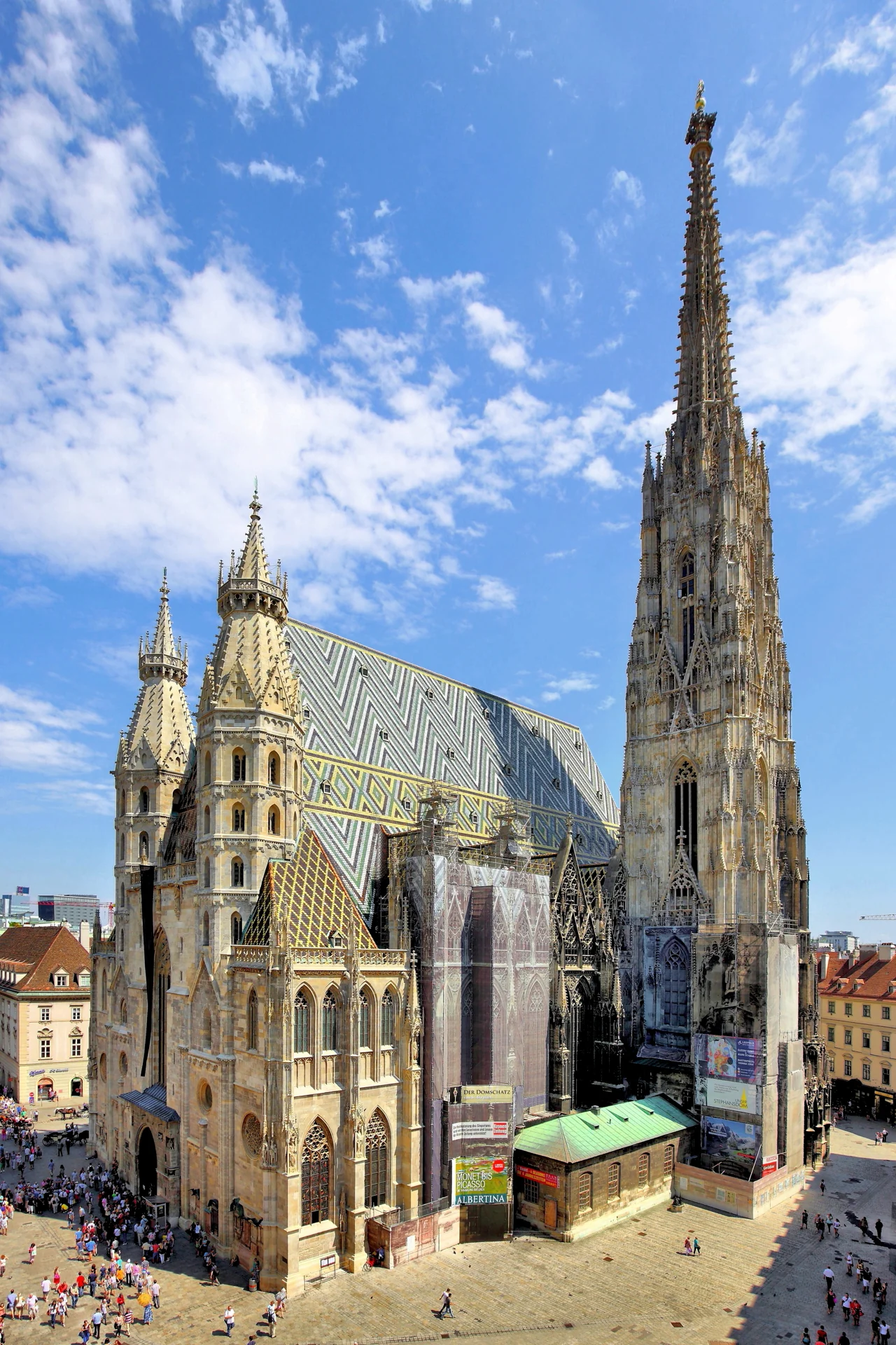
Begin by looking up, then deliberately look down again. St Stephen’s Cathedral can dominate a view so completely that the surrounding square disappears. Follow the coloured roof pattern, find the tower, and then compare the height of a door with the people near it. The tourist board identifies the cathedral at Stephansplatz; this chapter uses that setting as a place to orient yourself, not as an invitation to climb a tower without checking access.
The gallery changes scale rather than repeating the same postcard. A 2007 exterior photograph follows the patterned roof along the stone wall. A 2014 view shows the west front and south tower; a 2018 photograph isolates a portal and circular window. Use the visible arrows or thumbnails to move between all three. They were taken on different dates and from different positions, so a person, doorway or patch of sunlight cannot be tracked between them as if they were consecutive walking frames.
The optional July 2024 Google fragment has three linked positions beside the cathedral and a checked return. Turn to find the cathedral before moving: the camera direction and the photograph are not identical. This is a small exterior experience, not an indoor visit or a verified connection to Graben. For a physical visit, distinguish worship, sightseeing and tower access through current cathedral information. The square is shared with residents, visitors and service activity; leave doors and circulation routes clear.
Real-travel note
July 2024 exterior fragment only. Tower, catacomb and church access are separate decisions; historical imagery does not establish current admission.
Compare the wider setting, a closer detail and another viewpoint.
Chapter 2 · A street that feels like a square
Read Graben around its column
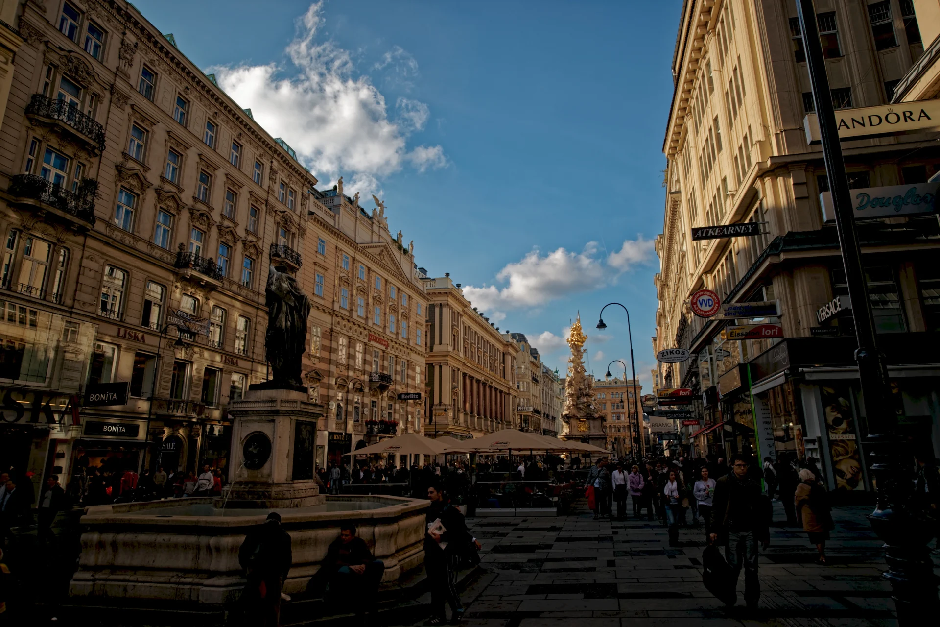
Graben changes the way the old centre holds you. Rather than a single church filling the frame, long building edges guide the eye through a broad street. Find a line of windows or a cornice and follow it into the distance. The Plague Column interrupts those horizontal rhythms with a much denser vertical composition. The Archdiocese of Vienna connects the monument with the epidemic of 1679: it is a religious and commemorative object, not simply a decorative marker for a shopping street.
The October 2010 photograph places the Leopold Fountain and column within the length of Graben. The February 2015 view concentrates on the column’s east side, while the November 2009 detail moves close to an inscribed panel at the base. These are three independent observations, not one camera walking from the fountain to the sculpture. A changed shopfront or street installation belongs to its recorded date. Read the captions before comparing light, crowds and seasonal dress.
In the September 2024 Google fragment, three local positions can be visited and retraced. Rotate before pressing next to see how much the column and façades shift relative to one another. The sequence does not take you all the way to the cathedral or through Kohlmarkt. Along-route exploration offers separate views near Petersplatz and on Kohlmarkt, so you can compare the broad street with a church frontage and a narrower shopping axis. For an actual walk, consult present-day crossings and keep passageways open rather than copying a road camera’s location.
Real-travel note
September 2024 local fragment; nearby explorations are separate scenes. Shops, street works and crowds may differ from the photographs.
Compare the wider setting, a closer detail and another viewpoint.
Chapter 3 · A curve at the end of a street
Let the Hofburg dome frame Michaelerplatz
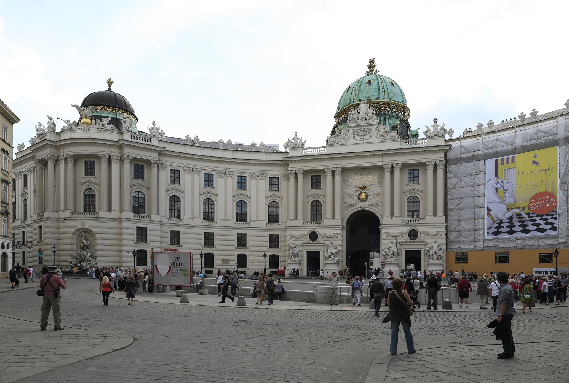
At Michaelerplatz, the street’s forward pull opens into a curved architectural setting. The Hofburg’s dome makes a useful distant reference, but the lower arcade and the edges of the square explain how the space works at walking scale. Turn away from the palace as well as towards it: St Michael’s Church and the surrounding façades make this a meeting of several streets, not just a single entrance photograph.
The May 2012 palace-facing image shows the Michaeler wing across the square, with the excavated area in the foreground. An August 2012 photograph reverses the emphasis towards the church. The January 2018 carriage photograph adds a closer view of how the space was occupied on that day. Carriages in a historical image do not establish current availability, price, pickup points or permission to enter their working area. The three views make the square easier to read, but they are not successive frames of an approach through the gate.
The June 2024 Google fragment remains outside and provides three positions with a return. Compare the dome’s position above the curved frontage while rotating. It does not enter palace apartments, the Spanish Riding School or a museum. The tourist board describes the Hofburg as a large complex with several different wings and cultural institutions; an exterior street sequence is not a ticket to any of them. If you continue physically towards another courtyard, check current permitted pedestrian connections rather than treating the next chapter as navigation. Along-route exploration at Josefsplatz is a separate exterior stop.
Real-travel note
June 2024 outside view. Palace visits, performances and carriage rides are not included; current entrances and pedestrian connections require independent checks.
Compare the wider setting, a closer detail and another viewpoint.
Chapter 4 · Open ground and public memory
Step back to read Neue Burg at Heldenplatz
Heldenplatz releases the close edges of the preceding streets. A long curved building can now be read against a large area of open ground. Find the ends of the Neue Burg frontage, then choose one smaller feature to return your eye to: a doorway, statue or repeated window bay. Scale is the point of this pause. The square and the building should not be reduced to an interchangeable palace backdrop.
An evening photograph from June 2016 shows Neue Burg and the open setting. The June 2019 view includes the Archduke Charles monument and a broader relationship between sculpture and frontage. A November 2013 detail isolates a double-headed eagle, photographed from the Volksgarten direction. That close-looking image uses a distant viewpoint: it is not a promise that the interactive camera reaches the roof or a terrace. Switch between the images to compare the broad composition with the small motif.
This is also a place of difficult public history. The House of Austrian History discusses Heldenplatz as a politically charged location rather than merely ceremonial scenery. Its historical context deserves a separate reading, including the square’s association with the Nazi annexation of Austria in 1938. The June 2022 Google scene is only a three-position exterior fragment and return. Neither the photograph nor the virtual scene predicts today’s public events, barriers or access. Compare the openness of the square with the enclosed streets you have already seen. Continue towards the opera only with a current pedestrian map, using permitted paths and crossings.
Real-travel note
June 2022 exterior fragment, not entry to Neue Burg or a verified garden passage. Events and temporary barriers can change use of the square.
Compare the wider setting, a closer detail and another viewpoint.
Chapter 5 · The edge of the Ringstrasse
Finish across from the Vienna State Opera
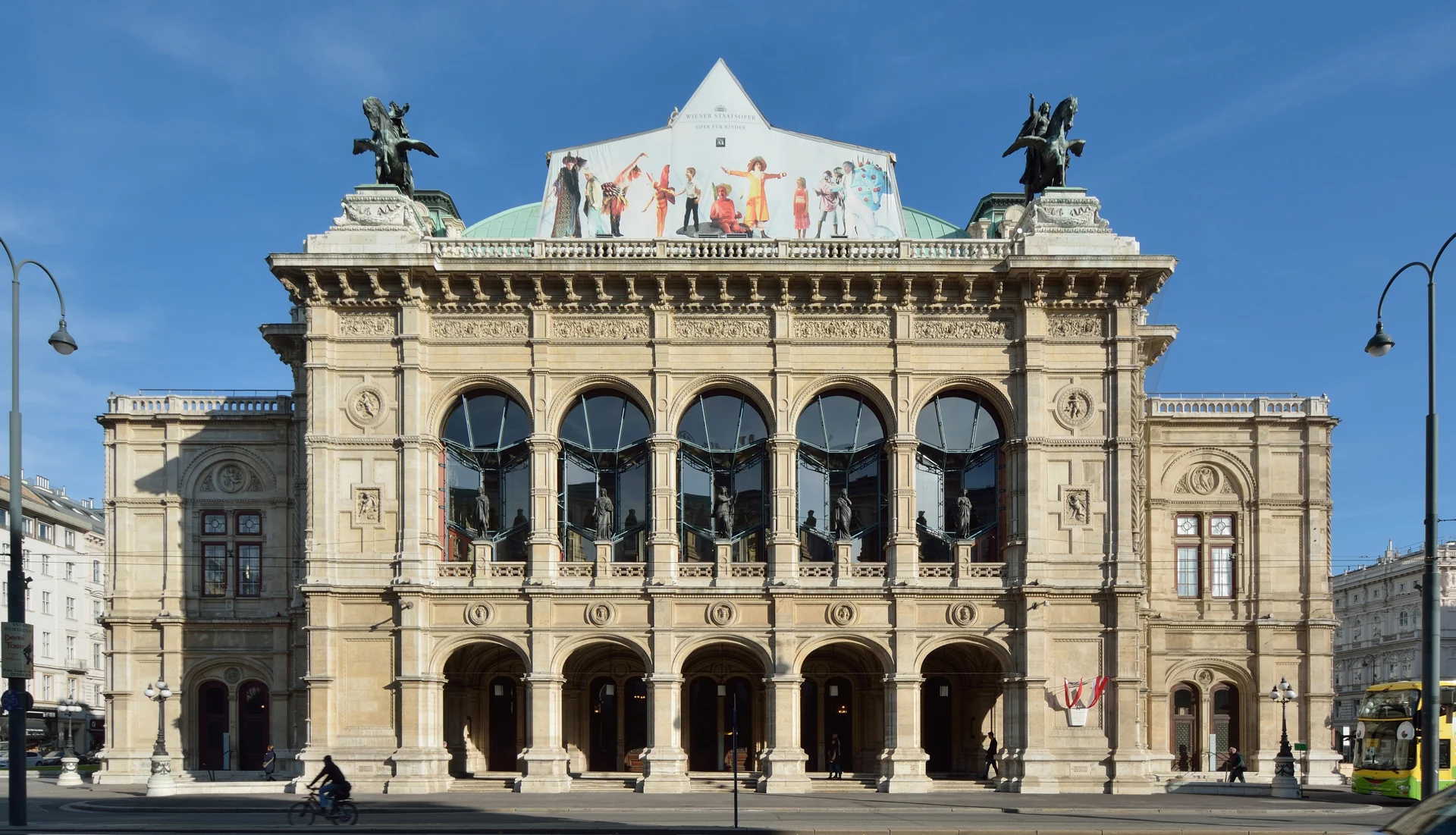
The Vienna State Opera brings the journey to a different kind of edge. The old centre meets a wider traffic corridor, and the building’s arches, roofs and corner volumes need to be read across that movement. Begin with the main façade, then follow one arch down to the ground. The building is a working performance venue, not an empty monument waiting for a virtual camera.
The November 2014 photograph gives a frontal architectural view. The July 2023 portal detail looks closely at the western side. The oblique street photograph was captured in June 2009 according to its file metadata, even though its filename contains “2013”; this gallery follows the capture information rather than guessing from a name. Different angles reveal different rooflines and traffic arrangements. None of these photos takes you into the auditorium, and a bus or pedestrian visible in one image belongs to that specific moment.
The April 2026 Google fragment has three positions on the Opernring side and a checked return. Traffic can obscure the lower frontage, so rotate and look upward rather than assuming a clear postcard view. Its road-camera position is not a recommended place for a pedestrian to stand, and moving through images does not verify a safe crossing. The nearby Albertinaplatz exploration is a separate stop, not an automatically connected final approach. To add an indoor experience, consult the State Opera’s own tours and performance information: dates, availability and access conditions are separate from this visual journey. End by choosing a view or detail to remember, not by assuming that virtual arrival includes a seat or admission.
Read further: Vienna State Opera: a familiar façade, a rebuilt theatreReal-travel note
April 2026 road-side fragment. Follow current crossings; do not stand at the camera position. Opera performances and indoor guided tours require separate arrangements.
9 reviewed experiences
Explore along the route
Step into the places along this journey. Choose a view independently of the story chapters. Free previews do not count toward chapter progress. Return to the journey above to continue through its stops.
Find your scale beside St Stephen’s Cathedral Short observation sequence
July 2024: three exterior positions beside St Stephen’s Cathedral and return. Not an indoor, tower or catacomb visit, and not a continuous connection to Graben.
Reviewed 2026-10-22 · At the place
Explore at your own pace; these views do not count toward chapter completion. Check each point's coverage note before navigating provider imagery. Availability may change.
Sources
- History of the Vienna State Opera — Vienna State Opera
- Zerstört und wiederaufgebaut: 80 Jahre nach den Bomben — Vienna State Opera
- St Stephen’s Cathedral — Vienna Tourist Board
- The plague column — a column of honour — Archdiocese of Vienna
- Hofburg and Heldenplatz — Vienna Tourist Board
- Heldenplatz: place and history — House of Austrian History
- Guided tours — Vienna State Opera
- State Hall — Austrian National Library
- Peterskirche — St Peter’s Church
- Stephansdom-Vienna-Austria.jpg — acediscovery · Wikimedia Commons
- Wien - Stephansdom (1).JPG — C.Stadler/Bwag · Wikimedia Commons
- Wien, Stephansdom -- 2018 -- 3194.jpg — Dietmar Rabich · Wikimedia Commons
- Wien - Graben - View NW on Leopoldsbunnen & Pestsäule 1692.jpg — Txllxt TxllxT · Wikimedia Commons
- Wien Graben Pestsäule Ostseite.jpg — Thomas Ledl · Wikimedia Commons
- Wien Graben Pestsäule detail.jpg — Photo: Andreas Praefcke · Wikimedia Commons
- I09 585 Michaelerplatz, Hofburg.jpg — Falk2 · Wikimedia Commons
- Wien 01 Michaelerplatz a.jpg — Gugerell · Wikimedia Commons
- Wien Michaelerplatz Fiaker-3265.jpg — Isiwal · Wikimedia Commons
- Wien, Hofburg, Heldenplatz, Neue Burg-20160621-001.jpg — Tilman2007 · Wikimedia Commons
- Hofburg Neue Burg section, Heldenplatz. Statue of Archduke Charles.jpg — Rosser1954 · Wikimedia Commons
- Heldenplatz - Neue Burg, View from Volksgarten IMG 6051-Bearbeitet.jpg — Hubertl · Wikimedia Commons
- Staatsoper Wien DSC 5273w.jpg — P e z i · Wikimedia Commons
- Staatsoper Wien 2023 Portal Seite west 01.jpg — Manfred Werner (Tsui) · Wikimedia Commons
- Wien-Staatsoper-122-2013-gje.jpg — Gerd Eichmann · Wikimedia Commons
- Wien - Kohlmarkt - View SW towards Hofburg.jpg — Txllxt TxllxT · Wikimedia Commons
- Wien 01 Josefsplatz b.jpg — Gugerell · Wikimedia Commons
- Wien 01 Albertinaplatz b.jpg — Gugerell · Wikimedia Commons
- Peterskirche, Petersplatz, 1010 Wien.jpg — HGT64 · Wikimedia Commons


Your journey, remembered.
Explored 0 of 5 stops. Explore every stop to unlock your keepsake.
5 stops to your keepsakeExplore every stop to share or download your keepsake.
Prepare a visit to Vienna’s old centre
Use the visual journey to choose your stops, then check current connections and admission independently.
Official sources checked:
Connect spaces, not camera positions
Suggested story order: Stephansplatz → Graben → Michaelerplatz → Heldenplatz → State Opera. About 2–3 km and 2–3 outdoor hours are planning estimates, not a measured route. Detours and indoor visits take extra time. Chapter transitions do not establish a route through palace gates or gardens.
Separate outside views from indoor visits
Church worship, tower access, palace collections, the National Library State Hall and opera visits have separate conditions. Check their own current pages; virtual images do not establish an open door, a performance date, a ticket or accessible admission.
Allow room for traffic and public history
Use current pedestrian crossings near the Ringstrasse and do not stand where a road camera was. Paving, curbs, crowds, events and temporary barriers need local judgement. Heldenplatz also deserves historical context, including its association with the Nazi annexation of Austria in 1938.