
Singapore Chinatown: five streetside stories
Explore Singapore Chinatown from Pagoda Street past two living places of worship to a Buddhist temple and Maxwell Food Centre. Five sourced chapters, ten licensed photographs and five optional, checked local 360° views.
Explore 5 reviewed views along the routeGuided visual journey
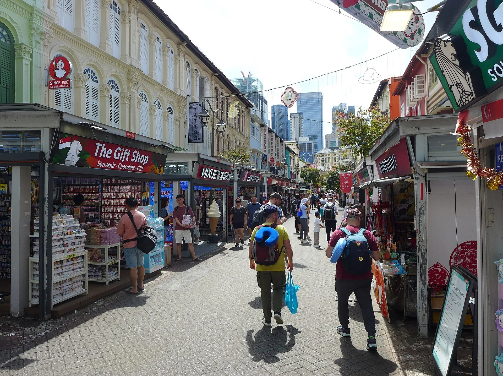
Shop houses and pedestrians along Pagoda Street · Bahnfrend · CC BY-SA 4.0
Reading mode
Place stories to read at your own pace
Chapter 1 · A street with many lives
Start on Pagoda Street
The two February 2025 photographs show Pagoda Street from different positions. Shop-house façades and souvenir displays fill both frames, but the people and storefronts remind us that these are particular moments, not a live shop directory. One optional Google panorama, photographed in October 2021, was visually checked on the pedestrian part of the street near No. 45. It lets you look around that one spot; a continuous route through the district has not been verified. A first candidate around this street actually landed in a back lane and was rejected.
The National Heritage Board explains that the street takes its name from the gopuram of Sri Mariamman Temple at its South Bridge Road end. Its collection account also describes early shop houses, lodging connected to migrant labour, later textiles and retail. Those layers are not all visible in a modern tourist photograph. Try reading the depth of the five-foot ways and the line of roofs before deciding what to browse. Chinatown Heritage Centre occupies restored shop houses at No. 48, but this journey does not claim that its current exhibitions or entry arrangements match an old listing.
The street is a useful beginning precisely because it resists a single label. It has been a place of migration, commerce and everyday use; today's shops tell only the newest part. Compare the two licensed stills for changes in angle and pedestrian activity. If visiting, allow time to leave the main shopping flow and read building details without blocking other people. Check any museum or shop you specifically want to enter. The next chapter is nearby, but the transition here is editorial, not a verified image-by-image walk.
Real-travel note
The optional Google image is a single dated viewpoint, not live coverage or a promise that you can move the length of the street. Follow current pedestrian signs and check individual venues.
Chapter 2 · A living mosque
Pause outside Jamae Mosque
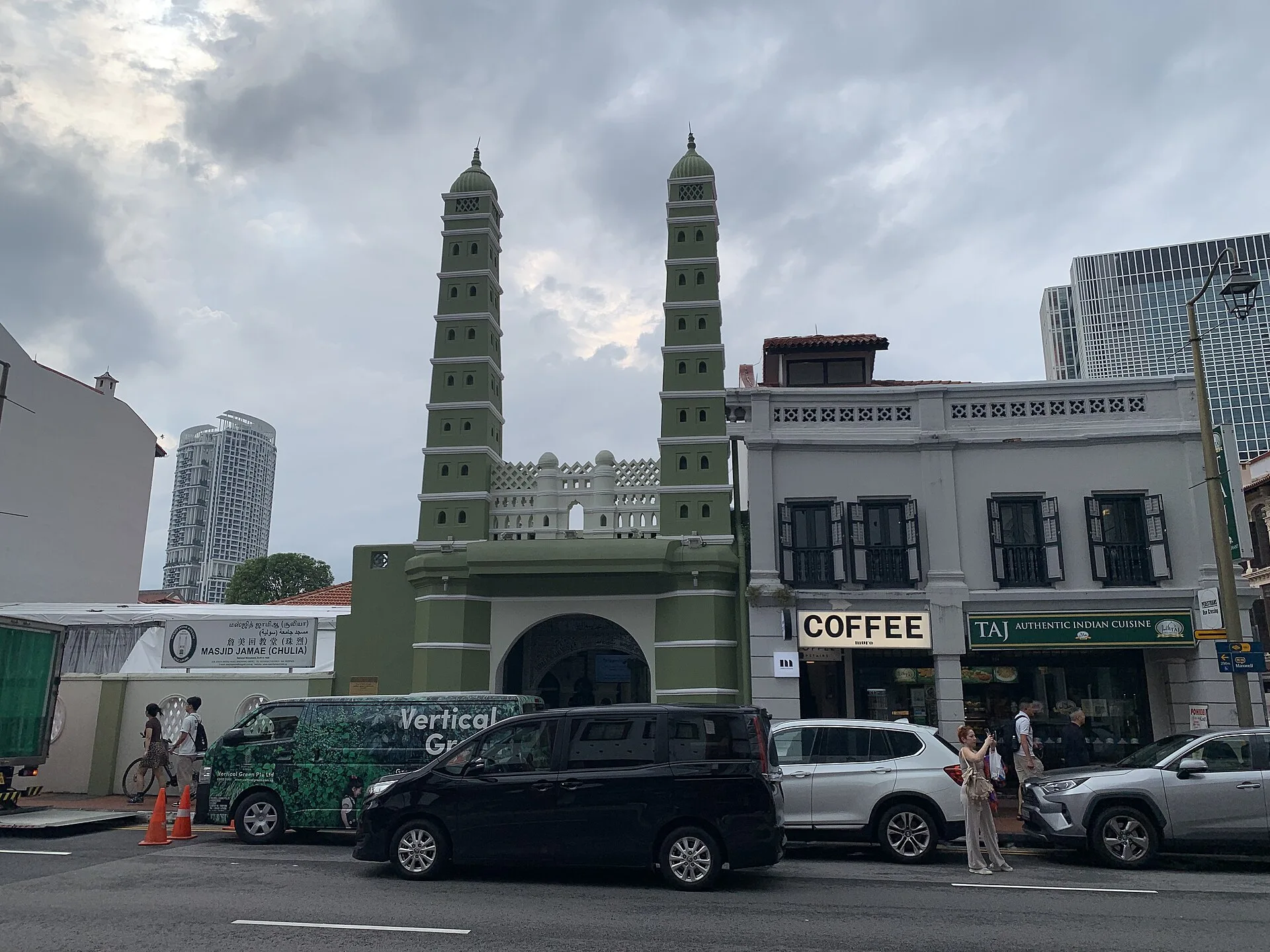
From the road, Jamae Mosque's paired minarets stand out against the shop-house rhythm. One March 2025 photograph frames the building across traffic; a September 2026 photograph moves closer to its gateway. These are different dates and camera positions. An optional June 2024 Google 360° view, checked from the opposite side of South Bridge Road, shows the façade and gateway from one roadside position. Neither the photos nor that panorama show what a visitor may do inside today, and they should not be read as a step-by-step approach to the entrance. Look at how a place of prayer is set directly into an active commercial street rather than isolated in a monumental precinct.
The National Heritage Board identifies the mosque at 218 South Bridge Road and traces its beginnings to the Chulia Tamil Muslim community in the 1820s. Its account places construction of the present structure in the 1830s and describes a mixture of South Indian and European architectural elements. This is a more useful story than calling the mosque an exotic façade: the architecture records people who lived, traded and worshipped in the area. It also helps explain why Chinatown is not a district with just one religious tradition.
Use the wider photograph to understand the street frontage and the closer one to study the gateway. Neither photo verifies today's prayer timetable, visitor access or photography rules. If you go, keep the threshold clear, dress and behave respectfully, and defer to current instructions at the mosque. The next site, Sri Mariamman Temple, is also on South Bridge Road, but this page does not claim a surveyed pedestrian route between their doors.
Real-travel note
An active place of worship: check current visitor arrangements, avoid prayer-time disruption and follow on-site guidance. The photos are dated exterior views.
Chapter 3 · A temple at the crossroads
Look closely at Sri Mariamman Temple
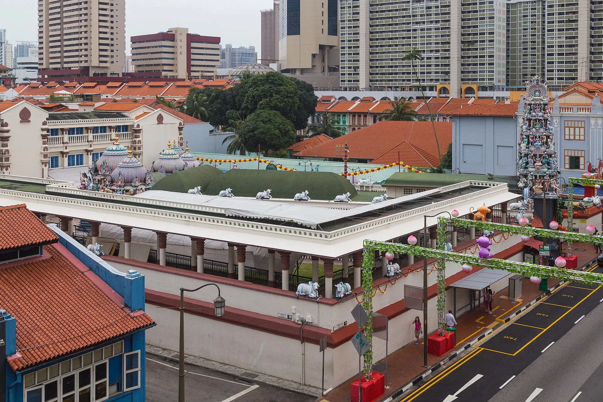
The 2016 photograph looks over Sri Mariamman Temple's compound toward its decorated entrance tower, while the January 2024 image examines colourful sculptural detail. The distance between these two viewpoints is useful: the first locates the temple in the dense city, the second asks you to slow down and look at workmanship. They are not the same camera angle, the same date or a guided route through the compound. A separately checked June 2024 Google 360° viewpoint across South Bridge Road faces the entrance tower; it does not take you inside.
The National Heritage Board calls this Singapore's oldest Hindu temple and names Naraina Pillai as its founder. Its South Bridge Road account records early nineteenth-century origins, later brick construction and a changing gopuram. The Board also notes that the temple served early immigrants as a place of shelter and social connection, beyond religious worship alone. Even Pagoda Street's name points back to the temple's entrance tower. The surrounding Chinatown streets therefore carry more than one community's history in their very names and buildings.
The temple is still a place of worship, not a static model of historic art. Sculpture and ceremony can be appreciated without treating worshippers as an attraction. If you intend to enter, check current dress, photography and event guidance; do not infer access from either dated photograph. Compare the roof forms with nearby shop houses, then continue the story toward the Buddhist temple in the next chapter. The page's transition is an editorial jump, not a verified continuous Street View sequence.
Real-travel note
Check current entrance, dress and photography rules. The elevated image is from 2016; it does not prove what is visible from the street or accessible today.
Chapter 4 · Devotion and museum
See the Buddha Tooth Relic Temple in context
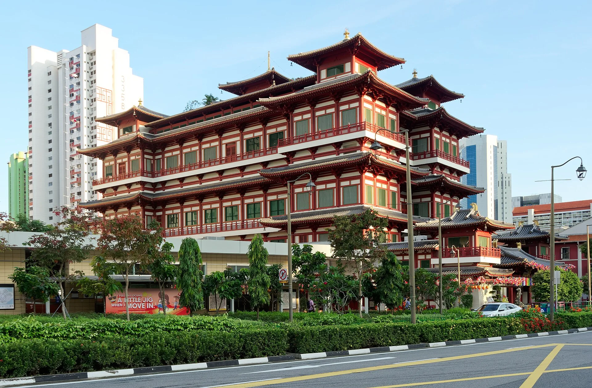
Across the road, the January 2024 exterior photograph shows the scale and layered roofs of the Buddha Tooth Relic Temple. A July 2026 interior photograph instead records an altar and worshippers. Moving between those stills is an editorial choice, not a digital doorway: the images were made in different years, with different access and framing. An optional Google 360° viewpoint was visually checked in a museum corridor inside the building, but its September 2018 capture date and isolated position do not establish current access or a walk from the street. The interior should be read as a lived religious space. It does not authorize visitors to photograph, linger or enter every area in the same way today.
Singapore Tourism Board says the temple opened in 2007 and describes its Buddhist museum and sacred relic displays. It explains that devotees regard the named relic as a tooth of the Buddha; this is a statement of religious belief, not a claim this page can independently authenticate. The building deliberately draws on Tang-style Chinese architectural language, so an imposing historic appearance does not mean the whole structure is ancient. The contrast with the older Hindu temple nearby makes the district's timelines and traditions easier to distinguish.
Look first at the exterior silhouette, then at how the interior photograph changes the mood from urban landmark to devotion. Respect people present in a place of worship; follow posted clothing and photography guidance. Museum displays, visiting conditions and ceremonies may change after the photos were taken, so use the operator's current information before setting out. Maxwell Food Centre follows as a shift from sacred spaces to everyday food culture, not as proof that every intermediate crossing was captured.
Real-travel note
The temple is active. Verify current visitor and museum information, dress respectfully and follow on-site photography rules. The two photographs are from different years.
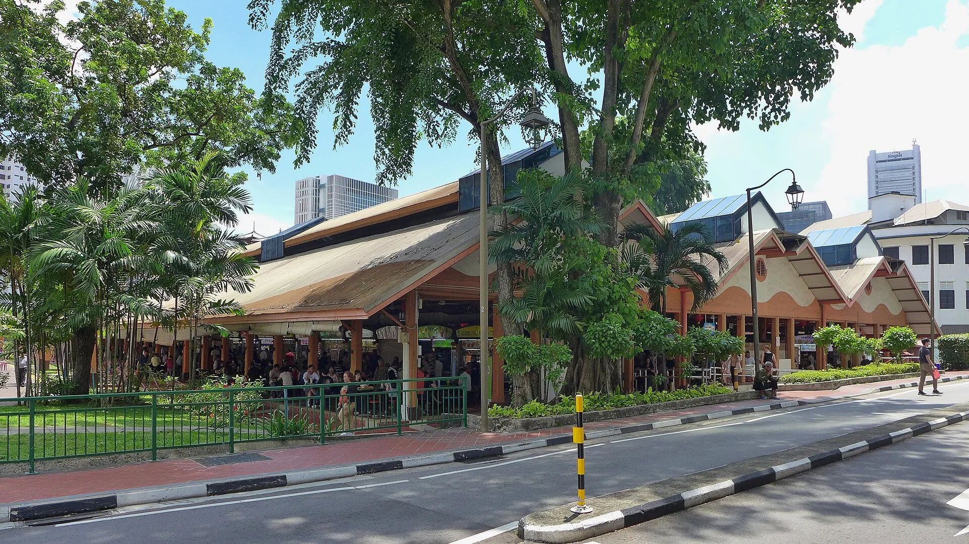
Chapter 5 · A working food hall
Finish at Maxwell Food Centre
The first May 2024 photograph shows the Maxwell Food Centre entrance; the second looks among diners and stalls inside. These two frames offer the change of scale missing from a single hero image. They were taken on the same day, but they are distinct stills, not a camera moving continuously between tables. A separately checked September 2019 Google 360° viewpoint shows one spot inside the food hall, not a continuous entry route. The faces, signs and stall fronts belong to their respective dates. Nothing in them proves what is open, available or priced the same way now.
The National Heritage Board traces the site from a wet market opened in 1929 to its later conversion into a food centre. Its fuller account connects the old market with street hawkers and post-war low-cost meals, showing that this is more than a convenient final lunch stop. Food culture here is part of the district's changing work and social life. The present-day hall cannot be reduced to a list of famous dishes, just as the old market cannot be recreated from a photograph. Listening to the room and noticing how queues, tables and circulation work may tell you more than choosing a stall from someone else's ranking.
If you visit, check any particular stall's hours and menu independently, carry a payment method accepted there, and leave space for diners and staff. The journey ends here because it brings the district's everyday rhythm back into view after streets, mosques and temples. These five chapters are an edited sequence of nearby places, not a GPS-tested route or a claim of continuous imagery between them.
Real-travel note
Stalls, prices and hours change. Use current listings or ask on site; the 2024 photographs are documentary context, not a live menu or crowd forecast.
5 reviewed experiences
Explore along the route
Step into the places along this journey. Choose a view independently of the story chapters.
Start on Pagoda Street 360° look-around
The October 2021 Google panorama was visually checked on the Pagoda Street pedestrian strip near No. 45. It is one viewpoint, not a continuous street or district walk.
Reviewed 2026-10-06 · At the place
Explore at your own pace; these views do not count toward chapter completion. Short sequences cover only the reviewed section. Imagery availability may change.
Sources
- The Pagoda Street Bazaar — National Heritage Board
- Chinatown Heritage Centre — National Heritage Board
- Jamae Mosque — National Heritage Board
- Sri Mariamman Temple — National Heritage Board
- Buddha Tooth Relic Temple & Museum — Singapore Tourism Board
- Maxwell Road Food Centre — National Heritage Board
- Pagoda Street, Singapore, 2025 (01).jpg — Wikimedia Commons
- Pagoda Street, Singapore, 2025 (02).jpg — Wikimedia Commons
- Masjid Jamae, Singapore (2025) - img 04.jpg — Wikimedia Commons
- Jamae Mosque gateway 02.jpg — Wikimedia Commons
- 2016 Singapur, Chinatown, Świątynia Sri Mariamman (01).jpg — Wikimedia Commons
- Sri Mariamman Temple, Singapore, 20240122 0843 2948.jpg — Wikimedia Commons
- Buddha Tooth Relic Temple, Singapore, 20240122 0810 2924 01.jpg — Wikimedia Commons
- Interior of Buddha Tooth Relic Temple.jpg — Wikimedia Commons
- Maxwell Food Centre, 2024 (01).jpg — Wikimedia Commons
- Maxwell Food Centre, 2024 (03).jpg — Wikimedia Commons
.jpg)
.jpg)
 - img 04.jpg)

.jpg)


.jpg)
.jpg)
Your journey, remembered.
The keepsake unlocks when you reach this section.