
Seville: from tiled bridges to the monumental river
Explore Seville in five outdoor chapters: Plaza de España, Puerta de Jerez, Plaza del Triunfo, the Giralda and Torre del Oro. Switch between three photographs per chapter and independently verified local street-view sequences.
Begin the visual journeyPlan a real visit to Seville Monumental RiverExplore 9 reviewed views along the routeGuided visual journey
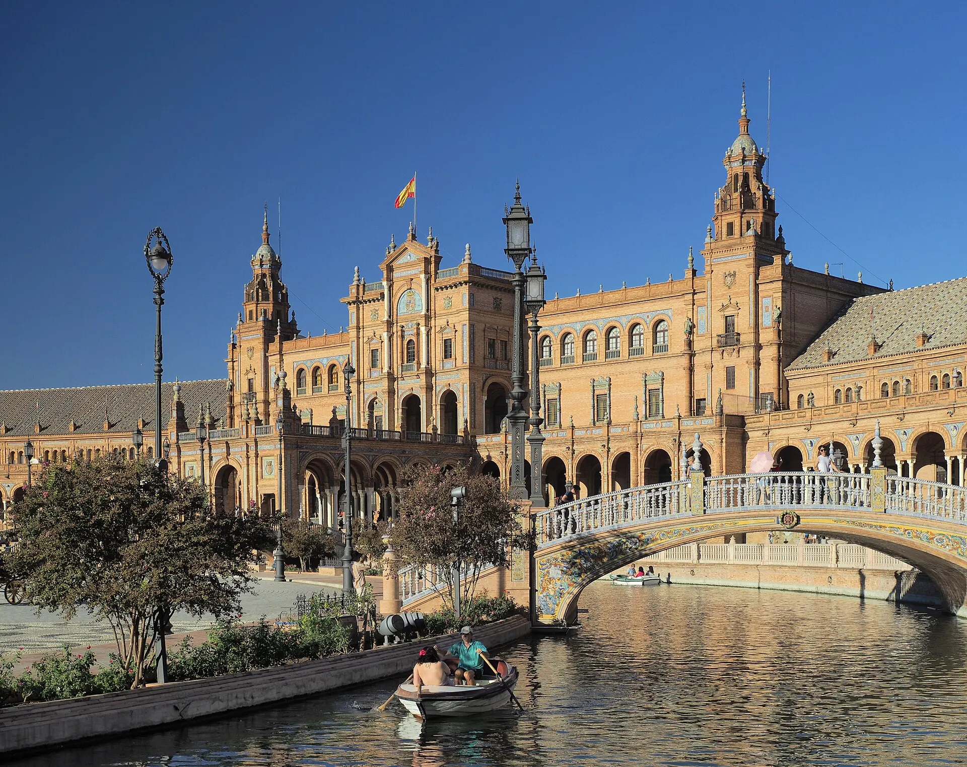
Plaza de España and its canal · Dmitry Dzhus from London · CC BY 2.0 · Resized and converted to WebP
Reading mode
Place stories to read at your own pace
Switch between place, detail and changing light.
Chapter 1 · A city staged in brick and tile
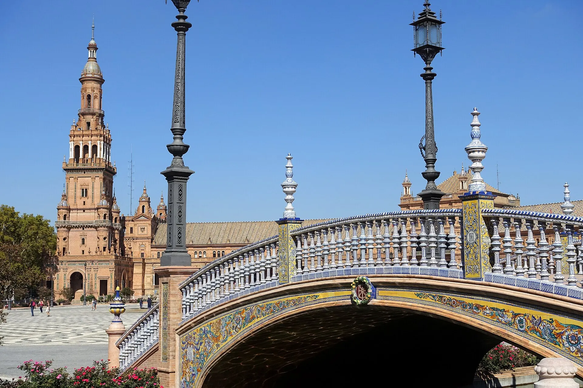
Cross the small bridges of Plaza de España with your eyes
Start with the curve rather than a single façade. Seville Tourism connects Plaza de España with Aníbal González and the Ibero-American Exhibition of 1929. Brick, glazed ceramics, bridges and a canal turn the space into more than a frontage for photographs. From the open paving, look at how the water holds visitors slightly away from the buildings before a small bridge brings them closer.
The 2017 canal photograph establishes the broad relationship between water and architecture. Two independent 2014 frames bring a tiled bridge and the arcade closer. They are not successive steps from one camera, even when the buildings seem to line up. Compare the railing patterns with the longer horizontal lines of the gallery, and notice how people give the otherwise enormous façade a human scale.
The optional Google sequence was captured in June 2018 near the central fountain. Three connected positions support local movement and a return, but do not carry you through the park to the next chapter. For a real visit, choose a suitable route through the surrounding public space using a current pedestrian map. Leave room beside the water, keep bridge approaches clear and consider sun exposure before committing to a longer outdoor walk.
Read further: Seville’s Plaza de España: geography in tileReal-travel note
Outdoor public-space preview only. The fountain sequence is historical and does not verify canal activities, current events or an entire park crossing.
Switch between place, detail and changing light.
Chapter 2 · A gate that became an opening
Find the city threshold at Puerta de Jerez
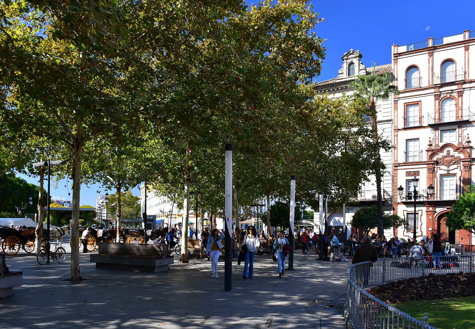
The name Puerta de Jerez recalls a former city entrance rather than a surviving monumental gate standing across the route. The municipal guide describes today's square in relation to that earlier threshold. Here, the useful change of pace is from the broad exhibition setting to an everyday junction where people meet, cross, wait and enter the historic centre.
Three photographs show different pieces of that junction: a tree-lined setting in 2019, the chapel and avenue entrance in 2014, and the Fuente de Híspalis in 2021. Read the fountain as an orientation point, then look beyond it to the smaller streets. These independent records do not establish today's traffic pattern or an unobstructed walking line. Temporary barriers, café areas and transport arrangements can change the way the square is used.
The April 2025 Google fragment lies on the Calle San Fernando edge, not directly beside the fountain. You can move between three nearby positions and return, observing the tram corridor and street frontage. Keep that offset in mind when switching back to the square photographs. Along-route exploration adds a separate San Telmo exterior view; neither sequence supplies a continuous link from Plaza de España. On foot, check crossings and give transit movements space.
Real-travel note
The interactive view is the San Fernando street edge near the square. It is not a promised pedestrian crossing or a fountain-side camera.
Switch between place, detail and changing light.
Chapter 3 · Between three institutions
Read Plaza del Triunfo from outside its doors
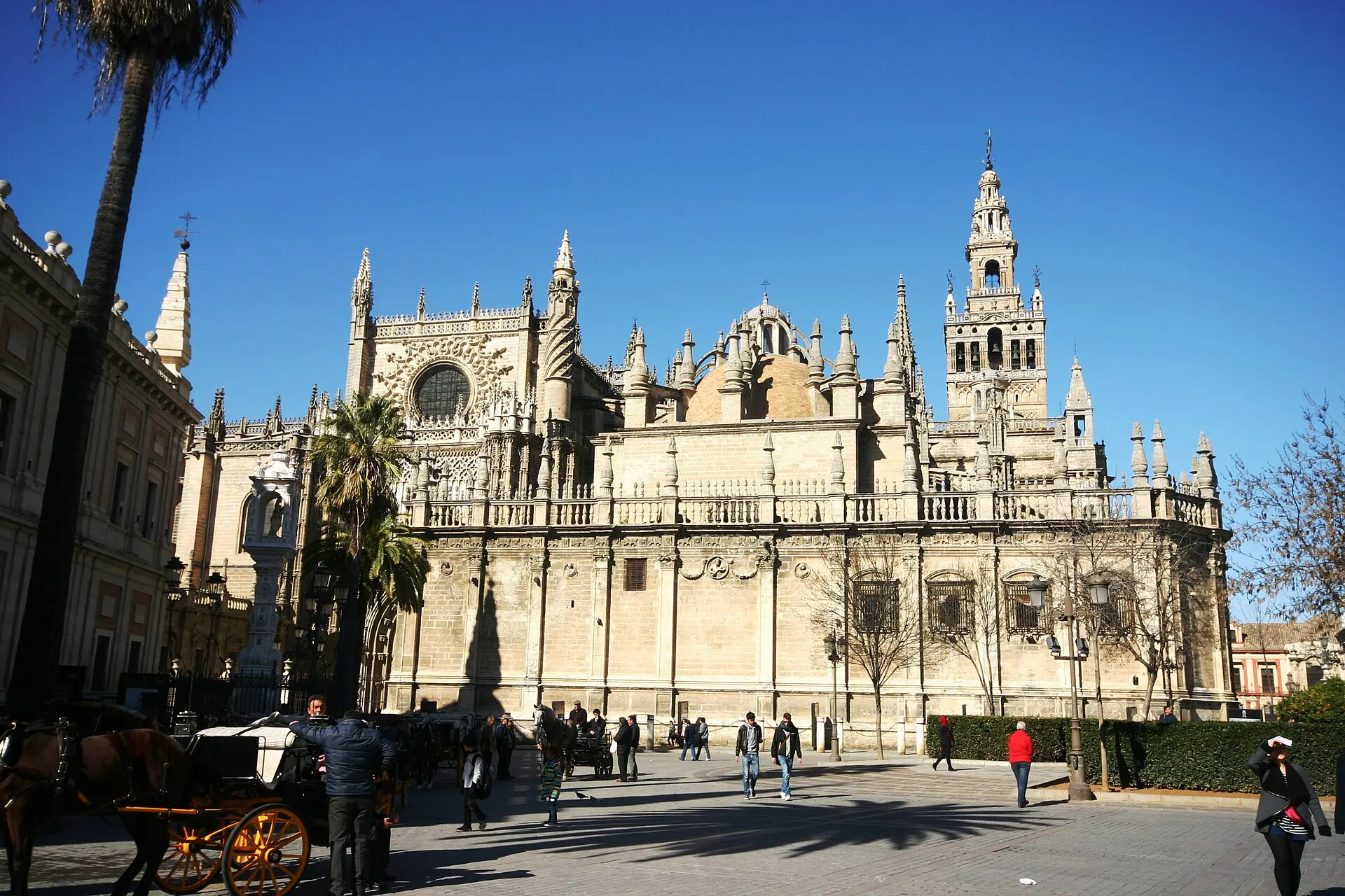
Plaza del Triunfo brings the cathedral precinct, the Alcázar and the Archive of the Indies into a small field of attention. UNESCO treats these institutions as one World Heritage property, while their entrances and uses remain distinct. Instead of thinking of the square as a shortcut to a ticket queue, pause to compare the different edges: palace wall, religious monument and archive façade.
The 2013 photograph establishes the cathedral side, the 2014 Lion Gate photograph isolates the palace threshold, and a different 2014 image looks down over the square. That elevated image is explicitly context, not the viewpoint you will obtain from the paving. The images invite comparison without pretending that the visitor has entered the palace. They also offer a way to read spaces whose historical roles involve royal power, religion and Spain's colonial relationships.
The May 2025 Google sequence follows three connected exterior positions on the Miguel Mañara side and supports a return. A separate archive-side sequence is available in along-route exploration. Neither provides an interior visit or verifies the current entrance queue. When planning a real stop, decide which institution you want to enter and check its own arrangements; keep the public passage clear while looking back toward the other two edges.
Real-travel note
The Lion Gate is shown from outside. The elevated photograph and street-level sequence have different camera positions; no palace or archive interior is included.
Switch between place, detail and changing light.
Chapter 4 · Look up, then step back
Give the Giralda enough sky
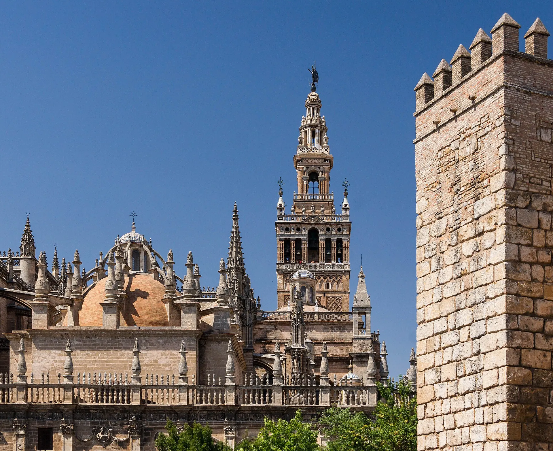
At Plaza Virgen de los Reyes, the Giralda demands a change in looking distance. The tourism guide identifies it as the cathedral's bell tower; UNESCO explains the earlier Almohad minaret in the history of the ensemble. From the public square, observe the tower as layers rather than as an invitation to tick off a summit. A wall that fills the foreground and a skyline that needs room above it can belong to the same building.
The 2012 broad photograph supplies a higher contextual angle on the tower and cathedral. A 2009 vertical street photograph brings the tower close, while a 2012 night image changes the contrast between masonry and sky. These three records differ in position, date and light. The higher frame is not an included climb, and the night image does not promise any current lighting schedule. Compare how much surrounding space each photographer chose to retain.
The May 2025 Google sequence stays outside on Plaza Virgen de los Reyes, using three connected positions and a return. Rotate upward to inspect the tower, then back down to notice how the public paving meets the cathedral boundary. Along-route exploration includes the adjacent Avenida de la Constitución fragment. Cathedral entry and tower access require a separate plan; the outdoor experience does not validate ticket availability, queues or access conditions.
Real-travel note
Exterior only; no tower ascent or cathedral interior. The broad photograph is elevated context, not the street-view camera position.
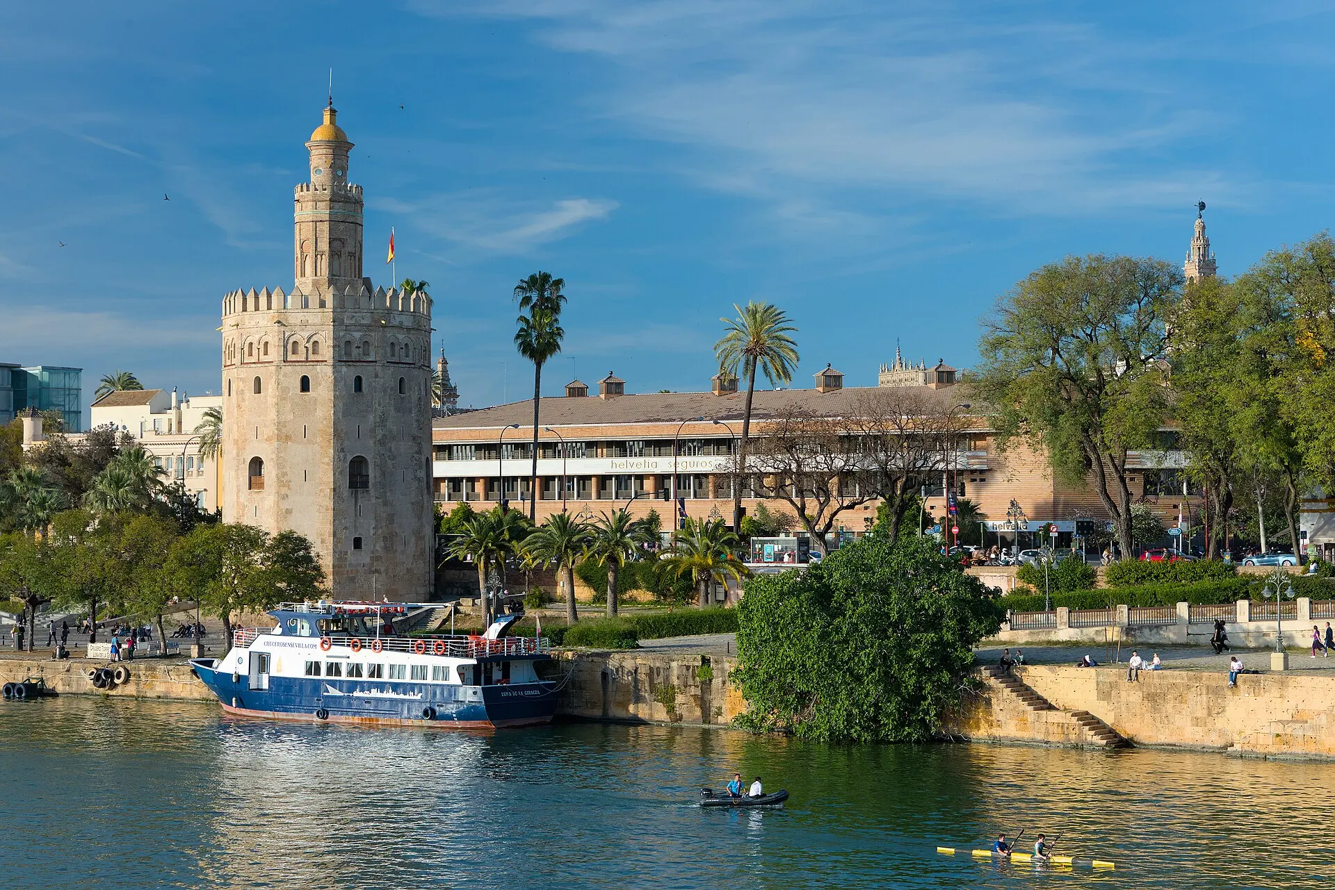
Switch between place, detail and changing light.
Chapter 5 · The river changes the horizon
Finish with Torre del Oro across the river edge
The route finishes by exchanging narrow urban edges for the Guadalquivir. The municipal river itinerary places Torre del Oro within a broader waterfront walk. From a photograph, the tower can appear to stand alone; on arrival, roads, planting, paths and the river all influence where you can safely stop. Treat the open horizon as a change of scale rather than assuming that the last block is a direct continuation of the preceding street.
The 2024 river photograph, a 2017 tower view and a separate 2024 night photograph provide three independent perspectives. Water, boats and reflected light help explain why a river-facing view feels different from a street-facing one. They do not record a boat trip, and the night scene is not a guarantee of today's illumination. Let the photographs establish the waterfront while keeping their viewpoints separate from the interactive camera.
The checked September 2025 Google sequence is on Paseo de Cristóbal Colón north of the tower. Three roadside positions face the monument and allow a return; the sequence does not descend to the riverside path. The road is visible in the imagery and must not be treated as an instruction to walk in it. Use a current pedestrian map for crossings and access to the bank. Finish here or plan a separate waterfront continuation using the official river itinerary.
Real-travel note
Interactive imagery is a roadside observation north of the tower, not the tower interior or a continuous waterfront walk. Crossings and river-path access need current checking.
9 reviewed experiences
Explore along the route
Step into the places along this journey. Choose a view independently of the story chapters. Free previews do not count toward chapter progress. Return to the journey above to continue through its stops.
Cross the small bridges of Plaza de España with your eyes Short observation sequence
June 2018: three linked outdoor positions by the central fountain. No continuous connection through the park.
Reviewed 2026-10-17 · At the place
Explore at your own pace; these views do not count toward chapter completion. Check each point's coverage note before navigating provider imagery. Availability may change.
Sources
- Plaza de España Square — Spain’s official tourism website
- Plaza de España — Seville Tourism
- Puerta de Jerez — Visita Sevilla
- Cathedral, Alcázar and Archivo de Indias in Seville — UNESCO World Heritage Centre
- Catedral de Sevilla y Giralda — Visita Sevilla
- A monumental river — Visita Sevilla
- Torre del Oro — Visita Sevilla
- La Sevilla árabe — Seville Tourism
- Seville, Plaza de España (38625005691) (edited).jpg — Dmitry Dzhus from London · Wikimedia Commons
- Plaza de España - Seville, Spain - DSC07289.JPG — Daderot · Wikimedia Commons
- Plaza de España - Seville, Spain - DSC07657.JPG — Daderot · Wikimedia Commons
- Puerta de Jerez Sevilla (1).jpg — Gzzz · Wikimedia Commons
- Capilla de Santa María de Jesús y entrada a la Avenida de la Constitución desde Puerta de Jerez.JPG — CarlosVdeHabsburgo · Wikimedia Commons
- Fuente de Híspalis.jpg — CarlosVdeHabsburgo · Wikimedia Commons
- Plaza del Triunfo - Seville (2).JPG — José Luiz · Wikimedia Commons
- Lion Gate at the Plaza del Triunfo, Alcázar of Seville.jpg — Ell Brown · Wikimedia Commons
- Plaza del Triunfo, Sevilla.jpg — Jl FilpoC · Wikimedia Commons
- Giralda cathédrale tour Seville Espagne.jpg — Jebulon · Wikimedia Commons
- La Giralda, Seville, Spain - Sep 2009.jpg — Diliff · Wikimedia Commons
- Giralda de Sevilla de noche.JPG — FerGainza · Wikimedia Commons
- Sevilla - Torre del Oro and river Guadalquivir - 1.jpg — Benjamin Smith · Wikimedia Commons
- Torre del Oro, Guadalquivir, Sevilla.jpg — Martinvl · Wikimedia Commons
- Sevilla - Torre del Oro and river Guadalquivir at night.jpg — Benjamin Smith · Wikimedia Commons
- Sevilla-Palacio de San Telmo-20110915.jpg — Daniel Villafruela. · Wikimedia Commons
- Fachada Archivo de Indias.jpg — CarlosVdeHabsburgo · Wikimedia Commons
- Sevilla - Avenida de la Constitución nº 12 (1).jpg — Zarateman · Wikimedia Commons
- Postigo del aceite 2020An001.jpg — Anual · Wikimedia Commons


Your journey, remembered.
Explored 0 of 5 stops. Explore every stop to unlock your keepsake.
5 stops to your keepsakeExplore every stop to share or download your keepsake.
Plan the outdoor Seville route
Use the chapters to decide where to pause; plan monument entry and the links between stops separately.
Official sources checked:
Connect the outdoor stops
Suggested order: Plaza de España → Puerta de Jerez → Plaza del Triunfo → Giralda exterior → Torre del Oro. The approximate distance is an editorial estimate, not a surveyed navigation track. Use a current pedestrian map for park exits and crossings.
Separate public-space viewing from entry
Cathedral visits, Giralda ascent and Alcázar entry have their own access and reservation arrangements. Check the relevant official institution rather than assuming the outdoor preview includes admission or an accessible indoor route.
Plan for exposure and changing transport
Allow pauses and choose a time suited to weather and mobility. Leave room beside water, watch tram movements, and find legitimate pedestrian crossings before accessing the riverbank. Optional imagery dates do not establish present-day conditions.