
Prague Old Town: follow the Royal Route from gate to river
Move through Prague from the Powder Gate and Celetná to Old Town Square, then follow Karlova to Charles Bridge and Kampa. Five chapters combine fifteen licensed photographs with ten checked local Google sequences without claiming one continuous recording.
Begin the visual journeyPlan a real visit to Prague Old TownExplore 10 reviewed views along the routeGuided visual journey
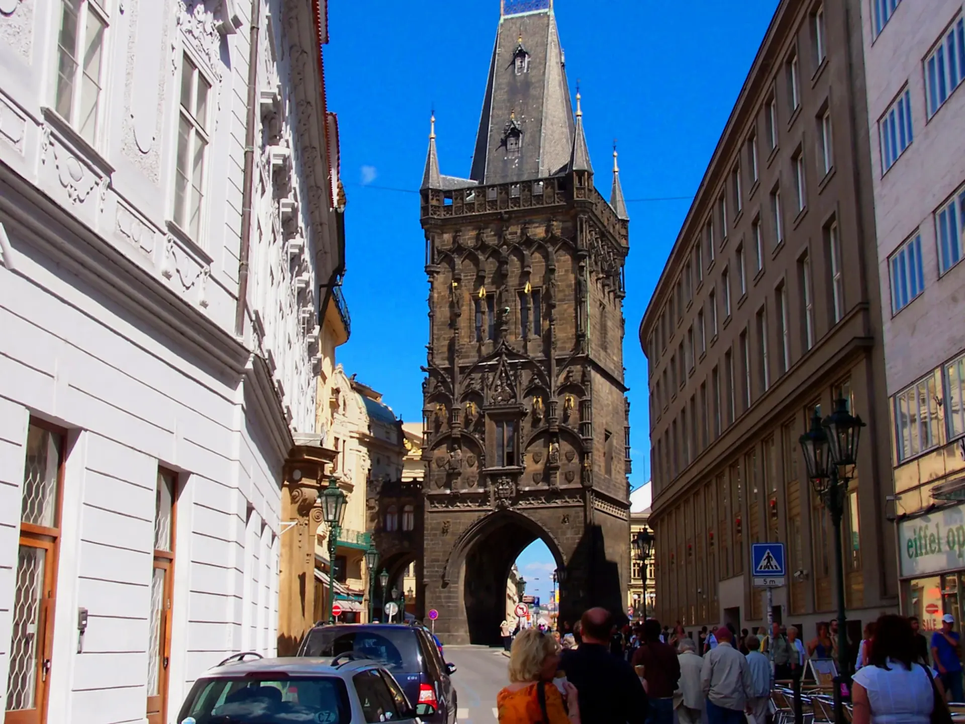
Celetna Street looking back toward the Powder Gate · Txllxt TxllxT · CC BY-SA 4.0 · Resized and converted to WebP
Reading mode
Place stories to read at your own pace
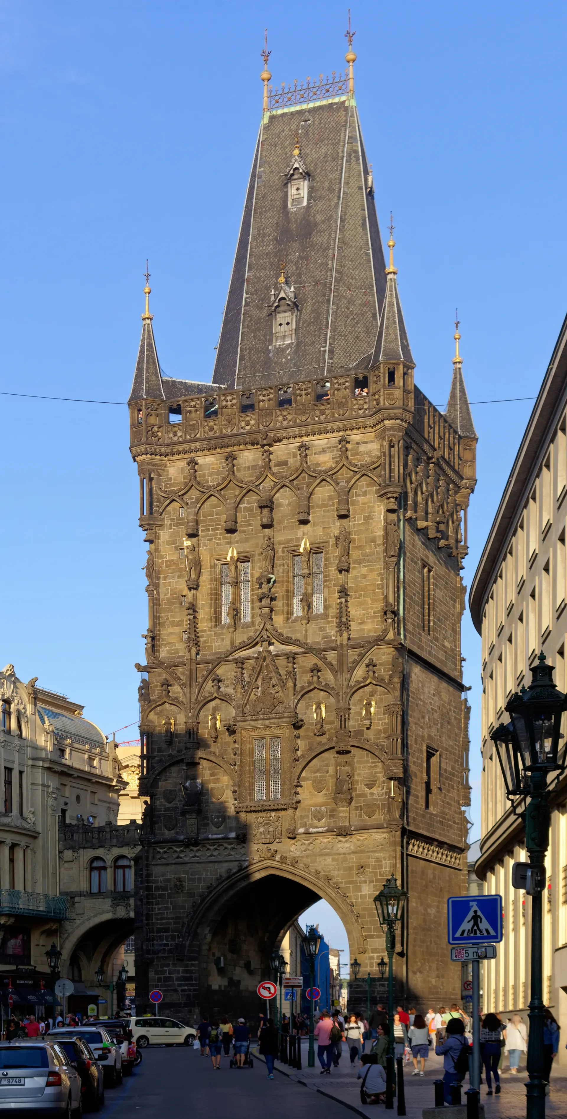
Use the arrows to change viewpoint and date. These licensed photographs are not consecutive walking frames.
Chapter 1 · Enter through a city threshold
Begin where the Royal Route meets the Powder Gate
Start with the Powder Gate as a threshold rather than a freestanding postcard. Prague City Tourism identifies it as the beginning of the Royal Route and dates its foundation to 1475. Its dark Gothic mass now stands among tram wires, shopfronts and the Municipal House, so the first useful question is not simply how old it is, but how a ceremonial entrance still controls the scale of an ordinary junction.
The three photographs preserve separate conditions. Jakub Hałun's August 2019 view gives the tower room above the street; Ank Kumar's 2014 frame stays lower and closer to the masonry; Mitsjol's December 2023 night image turns illumination and snow into part of the scene. They are not consecutive frames and cannot establish today's traffic, weather, scaffolding or opening hours. Switch between them to distinguish the durable silhouette from temporary atmosphere.
The optional May 2024 Google experience uses three independently checked positions beside the gate and can move between them before returning. It is a bounded street sequence, not the beginning of an uninterrupted recording to Kampa. The official page also notes 186 stairs and no barrier-free access to the tower interior. Use current signs for crossings, keep clear of tram and vehicle paths, and treat the climb as a separate access decision from the public street journey.
Real-travel note
The street sequence stays outside. Tower access includes 186 stairs and is not barrier-free; verify current hours, tickets and street works.
Use the arrows to change viewpoint and date. These licensed photographs are not consecutive walking frames.
Chapter 2 · Let the route become a street
Read Celetná through façades, crowds and changing light
Walk west into Celetná and let the gate recede. UNESCO describes Prague's historic centre as an urban ensemble whose buildings span many architectural periods. Celetná makes that accumulation legible at walking speed: narrow plots, projecting signs, decorated fronts and ground-floor commerce compress attention into a corridor. The Royal Route label explains direction, but it does not turn today's street into a preserved procession.
The 2006 photograph looks back toward the Powder Gate and keeps the route's eastern anchor visible. Jan Polák's February 2012 image concentrates on the street itself, while BugWarp's May 2025 photograph records a more recent set of signs, surfaces and pedestrians. Shops and façades can change, and a crowd in one frame is not evidence of present congestion. Use the three-image carousel as a comparison of street depth, not as a before-and-after claim.
Two optional Google sequences let you explore the eastern end in May 2024 and a western stretch in September 2024. Move through three linked viewpoints in each, then return to compare the street from the opposite direction. The two stretches are separate, so use them to read the changing facades rather than follow the whole street. In person, expect dense pedestrian movement, delivery activity and uneven historic surfaces; pause at the edge rather than blocking the narrow flow.
Real-travel note
Two local sequences have different capture months and are not joined. Businesses, signs, crowd levels and delivery conditions may differ now.
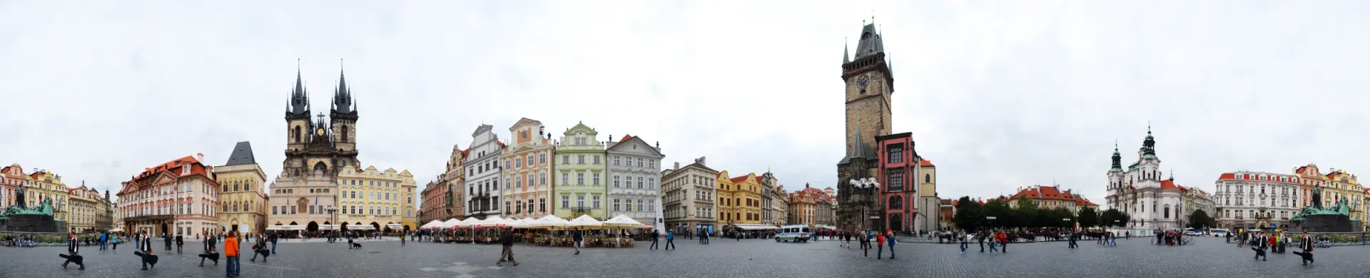
Use the arrows to change viewpoint and date. These licensed photographs are not consecutive walking frames.
Chapter 3 · Open the corridor into a civic room
Use Old Town Square to reset distance and orientation
Celetná releases into Old Town Square, where the useful scale changes abruptly. Prague City Tourism describes the square as the heart of the Old Town and traces its role as a marketplace back centuries. Instead of immediately chasing the astronomical clock, first notice how open paving allows the Old Town Hall, Týn Church and surrounding façades to compete across distance. The square works as a room whose edges were built at different moments.
Robert Young's September 2008 panorama gives that room breadth. Godot13's July 2013 detail isolates the astronomical dial, while Andrew Milligan's February 2017 night photograph shows how lighting changes the balance between square and skyline. None records the hourly performance as a promise, and none confirms current barriers, restoration or event structures. The close detail becomes more useful after the wide view because it belongs to a larger civic setting.
The optional June 2014 Google sequence links three checked positions on the square and returns. It supplies look-around and limited movement, not current crowd information or a route through every side street. The official Old Town Hall page is the right place to recheck access and opening details. Keep through-routes open when groups gather near the clock, watch for service vehicles, and remember that a famous timed event is only one layer of a working public square.
Read further: Prague’s Astronomical Clock: More Than the HourReal-travel note
The imagery cannot confirm current events, restoration, clock performance or tower access. Recheck the official Old Town Hall information.
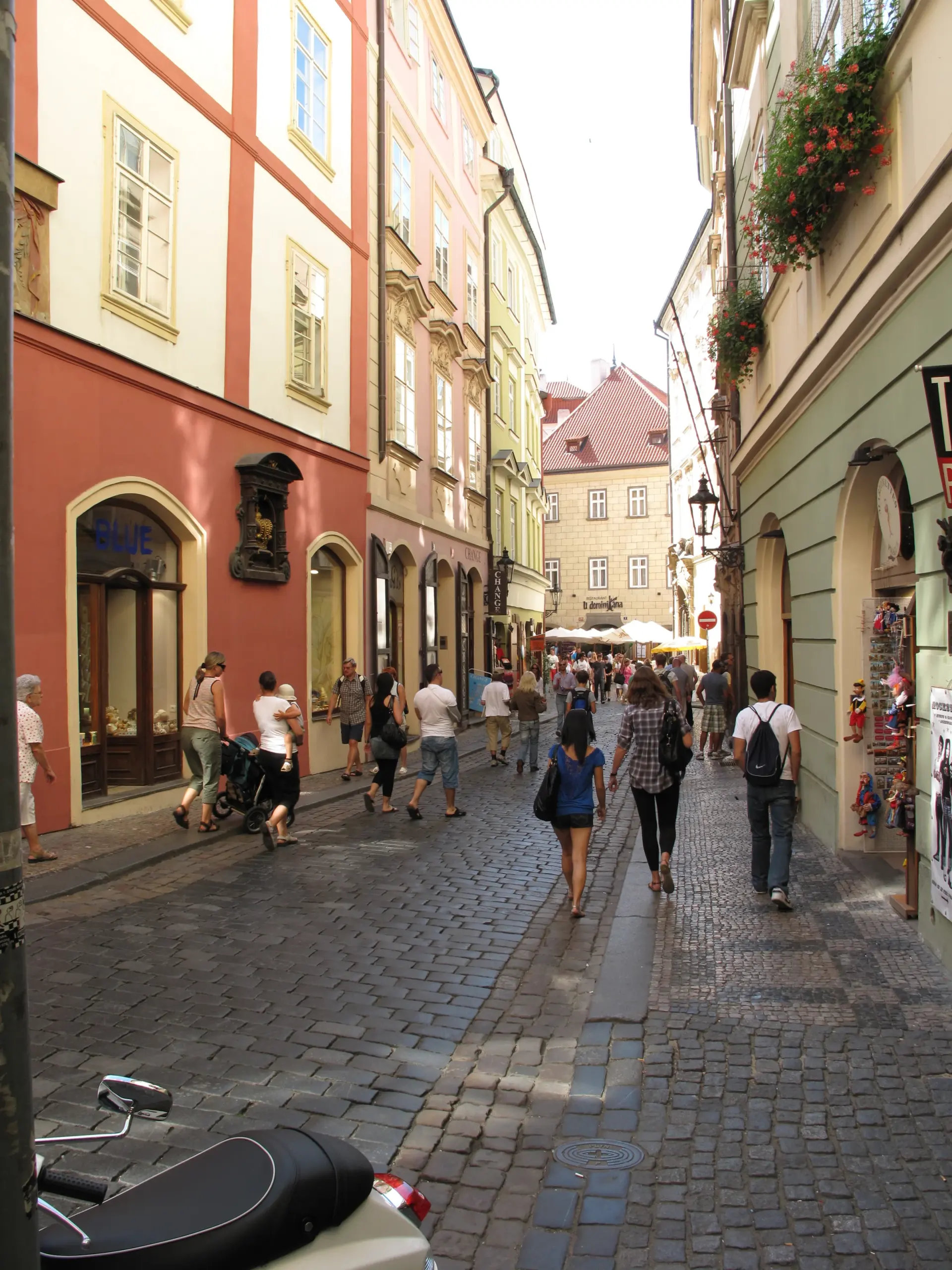
Use the arrows to change viewpoint and date. These licensed photographs are not consecutive walking frames.
Chapter 4 · Compress again toward the river
Follow Karlova until the bridge tower fills the route
Leave the square along Karlova, where the route narrows and turns. The street is not a straight visual axis: façades conceal the river until the Old Town Bridge Tower appears as another threshold. This compression matters. It explains why a route that looks short on a map can feel slow, and why orientation comes from glimpses, bends and crowd movement rather than a constant view of the destination.
Juan de Vojníkov's 2009 street photograph records the tight pedestrian corridor. Radler59's 2017 view from the bridge tower looks back east over the approach, while Volodymyr Vlasenko's 2015 image pulls outward to include the Vltava, Charles Bridge and tower together. The elevated images are explanatory context, not the same eye level as the street. Their different dates and heights should remain visible rather than being presented as one seamless approach.
Three optional Google sequences reveal different parts of the approach: Karlova east in June 2014, Karlova west in September 2024 and the bridge-tower threshold in June 2014. Each offers three linked viewpoints and a return. They cover separate stretches, allowing you to compare the narrow street with the open space by the river. Expect crowd compression, uneven surfaces and changing access near the tower; use the images to understand spatial order, then rely on present signage and considerate walking.
Real-travel note
Three short sequences have different dates and gaps. Tower viewpoints, street access and crowd controls must be checked independently.
Use the arrows to change viewpoint and date. These licensed photographs are not consecutive walking frames.
Chapter 5 · Cross water and choose a quieter ending
Read Charles Bridge before descending toward Kampa
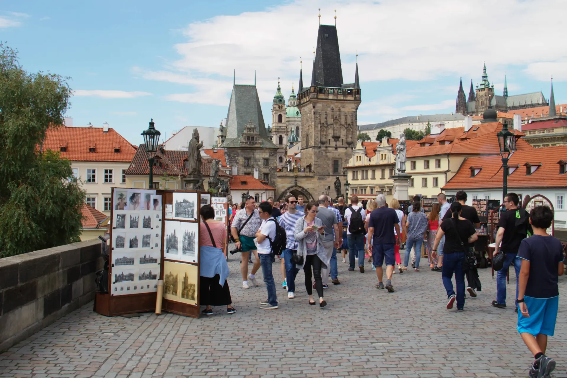
Charles Bridge changes the journey from enclosed street to river crossing. Prague City Tourism dates construction from 1357 to 1402 and gives a length of 515.76 metres, with thirty statues and sculptural groups now shaping the deck. Those figures help establish scale, but the experience depends just as much on wind, views between statues, crowd density and the moment when the Lesser Town bank begins to feel close.
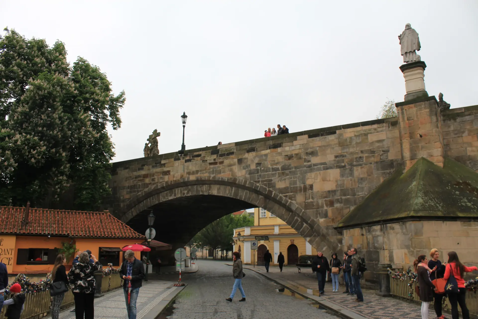
Ronnie Macdonald's July 2016 photograph looks west through pedestrians on the deck. Svobodat's June 2020 image looks toward the Old Town Bridge Tower under very different crowd conditions. Øyvind Holmstad's May 2014 view leaves the deck for the passage beneath the bridge toward Kampa. The three do not describe one day or one uninterrupted motion. They show a choice: continue across the monumental axis or descend toward a lower, more sheltered island edge.
Three separately verified Google sequences add limited movement: the eastern bridge in June 2014, the western end in September 2024 and the Kampa stair area in June 2019. The official bridge page notes that the stairs to Kampa were built in 1844; stairs also create an accessibility break. Prague City Tourism publishes a separate barrier-aware Lesser Town route, which should inform real planning. Check weather, crowd controls and step-free alternatives before travelling, and finish here without pretending the historical captures form a complete crossing.
Real-travel note
The Kampa descent includes stairs. Use current accessibility information and maps for step-free alternatives; crowd and weather conditions change quickly.
10 reviewed experiences
Explore along the route
Step into the places along this journey. Choose a view independently of the story chapters. Free previews do not count toward chapter progress. Return to the journey above to continue through its stops.
Begin where the Royal Route meets the Powder Gate Short observation sequence
May 2024: three checked positions beside the Powder Gate and a return. It remains outside the tower.
Reviewed 2026-10-15 · At the place
Explore at your own pace; these views do not count toward chapter completion. Check each point's coverage note before navigating provider imagery. Availability may change.
Sources
- Historic Centre of Prague — UNESCO World Heritage Centre
- Powder Gate Tower — Prague City Tourism
- Old Town Square — Prague City Tourism
- Old Town Hall with Astronomical Clock — Prague City Tourism
- Charles Bridge — Prague City Tourism
- Kampa — Prague City Tourism
- The Lesser Town without barriers — Prague City Tourism
- 20190816 Brama Prochowa w Pradze 1859 5460 DxO.jpg — Wikimedia Commons
- 2014- The Powder Tower or Powder Gate (Prašná brána) Prague, Czech Republic ( Ank Kumar ) 01.jpg — Wikimedia Commons
- Powder Tower, Prague, at night.jpg — Wikimedia Commons
- Praha - Staré Město - Celetná - View on Powder Tower.jpg — Wikimedia Commons
- Celetná ulice.JPG — Wikimedia Commons
- Celetná - BugWarp 02.jpg — Wikimedia Commons
- Old Town Square, Prague - Staroměstské náměstí, Praha.jpg — Wikimedia Commons
- Czech-2013-Prague-Astronomical clock face.jpg — Wikimedia Commons
- Old Town Square By Night, Staré Město, Prague (33157575962).jpg — Wikimedia Commons
- Karlova Street (summer 09).JPG — Wikimedia Commons
- Prague Charles Bridge Tower View East-02.jpg — Wikimedia Commons
- The Vltava, Charles Bridge, Old Town Bridge Tower and Church of St. Francis of Assisi. Prague, Czech Republic.jpg — Wikimedia Commons
- Charles Bridge 05 (28503116472).jpg — Wikimedia Commons
- 2020-06 Charles Bridge 01.jpg — Wikimedia Commons
- Ague Praha 2014 Holmstad The road under Charles Bridge Karluv Most Karlsbroa to Kampa Island.JPG — Wikimedia Commons


Your journey, remembered.
Explored 0 of 5 stops. Explore every stop to unlock your keepsake.
5 stops to your keepsakeExplore every stop to share or download your keepsake.
Plan a Prague Old Town walk
Use the five chapters to choose a pace from the Powder Gate to Charles Bridge and Kampa. This is an editorial sequence, not live navigation.
Official sources checked:
What order does the story follow?
The suggested order is Powder Gate → Celetná → Old Town Square → Karlova and the Old Town Bridge Tower → Charles Bridge and Kampa. Ten short virtual sequences have gaps, so use a current map to connect the real walk.
Which climbs and stairs need a separate decision?
The Powder Gate interior has 186 stairs and no barrier-free access. The descent from Charles Bridge to Kampa also uses stairs. Decide whether to climb or descend before setting out and consult the official barrier-aware Lesser Town route for alternatives.
Leave room for crowds and changing access
Narrow Celetná and Karlova, the astronomical clock area and Charles Bridge can be crowded. Check current opening, restoration, events and weather, then allow pauses rather than treating the chapters as a timed checklist.