
Osaka Namba and Dotonbori: from the station to the market
An Osaka walking route in five distinct scenes: Namba, Ebisu Bridge, the canal, Hozenji Yokocho and Kuromon Market. Real photographs come first; nearby 360° views are optional.
Explore 2 reviewed views along the routeGuided visual journey
Reading mode
Place stories to read at your own pace
Chapter 1 · Arrival
Begin outside Nankai Namba Station
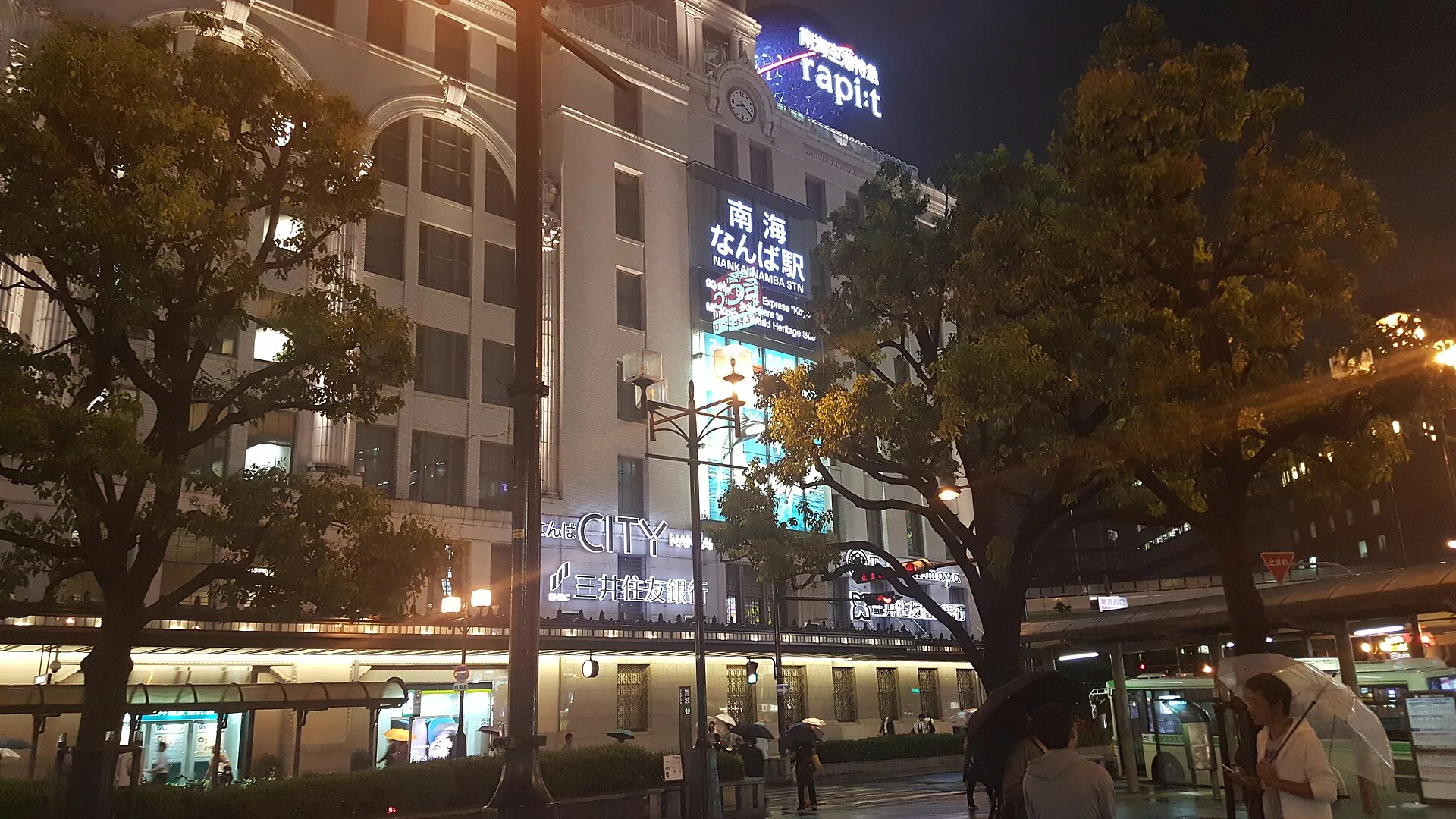
Begin at the street-facing side of Nankai Namba Station. The photograph shows the building on a rainy night in June 2016: a lit facade, trees and the street in front. It does not show the underground passages, ticket gates or the exact exit you will use today. “Namba” names a transport district with several rail and subway operators, so first confirm which station your ticket actually reaches. Use the current station signs to emerge onto the public street rather than treating a single picture as directions through a complex interchange.
This journey deliberately starts with the ordinary question of arrival. Dotonbori is close enough to feel like a continuation of the city, but the approach changes with your exit, the crossing lights and the time of day. Osaka’s official visitor information presents the district as a dense mix of shopping and eating streets. The visual route that follows does not certify one pedestrian path from this station to the bridge. The photographs and 360° points were made in different years and are editorial stops, not frames of one recorded walk.
Before you move, look back at the station frontage and decide how much time you want to give the busy central streets. Ebisu Bridge is the next chapter and the first sight of the canal. Follow current signs or a live map to reach it; do not rely on a line drawn between old images. At night the signs can dominate the view, but this route is equally useful in daylight when the shopfronts, crossings and canal become easier to read.
Real-travel note
Namba has multiple operators and exits. Confirm your arrival station and current street route; this page is not live navigation.
Chapter 2 · The threshold
Stand on Ebisu Bridge
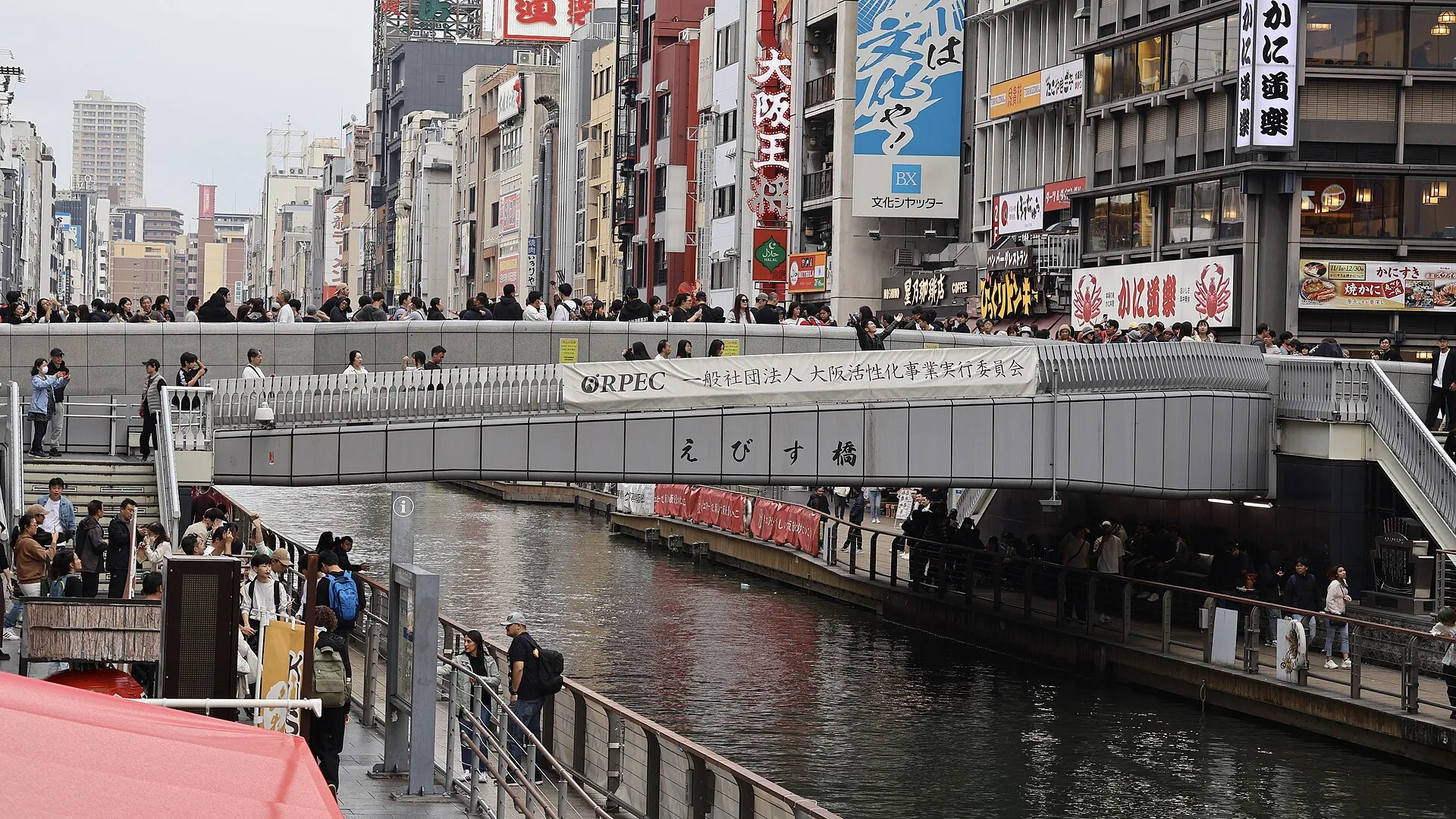
Ebisu Bridge is where the shopping streets meet the Dotonbori Canal. The November 2024 photograph shows people crossing above the water and the river-level walk on both banks. It is a useful orientation: you can see how a bridge, a canal and lower promenades occupy different levels. The picture records one afternoon, not the crowd you will meet or an instruction to stand in the middle of the crossing.
Osaka’s official visitor information describes this bridge as one of Dotonbori’s best-known meeting places. That fame can make it feel like a stage, but it is first a route for other pedestrians. The river below is not the same surface as the road or the bridge deck. If you want the water-level perspective, find a public access point and check the steps or lift in front of you. Do not infer from a photograph that every stair or ramp is open at every hour.
From the bridge, take time to compare the two banks. The next chapter focuses on the Tombori Riverwalk rather than another neon sign. A nearby optional panorama may let you look around from a separately recorded street position, but it does not prove that you can click through to the next chapter in one continuous image sequence. If the live view is unavailable, the licensed photograph and these notes remain the reliable layer.
Real-travel note
The bridge can be crowded. Keep the crossing clear and check current access to the lower promenade.
Chapter 3 · Beside the water
Read the canal from Tombori Riverwalk
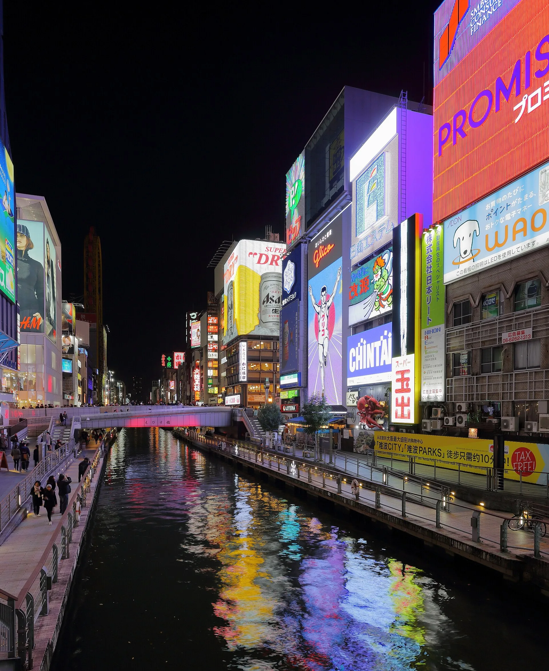
Along the Dotonbori Canal, the city is not only a row of signs. The Tombori Riverwalk brings the pedestrian perspective close to the water, below the busier street crossings. In this November 2016 photograph the canal holds reflections of bright commercial facades. The far bank, the bridge and the lower path are all visible. This is a night scene from one date, not a live promise that particular screens, colors or shop signs remain in place.
Osaka’s official riverwalk page describes a promenade along both banks of the canal. That sounds simple until you arrive with a stroller, luggage or limited mobility: the way down matters as much as the path itself. Look for a current public access point and read any closure notices. Boats also use the canal; they are not part of this walking chapter, and a boat ticket does not substitute for the route on foot.
This is a good place to decide what kind of Osaka evening you want. You can stay with the loud waterfront, cross back up to the shop streets, or turn away toward the quieter Hozenji lanes. Our next chapter makes that change of pace. Its photograph was taken seven years later and is not a frame following this canal image. Use the map and street signs for the real transition. Optional panoramas provide local orientation only; they do not stitch this entire district into verified Street View walking footage.
Real-travel note
Check the currently open way down to the riverside. Waterfront lighting and boat operations can change.
Chapter 4 · Change of pace
Turn into Hozenji Yokocho
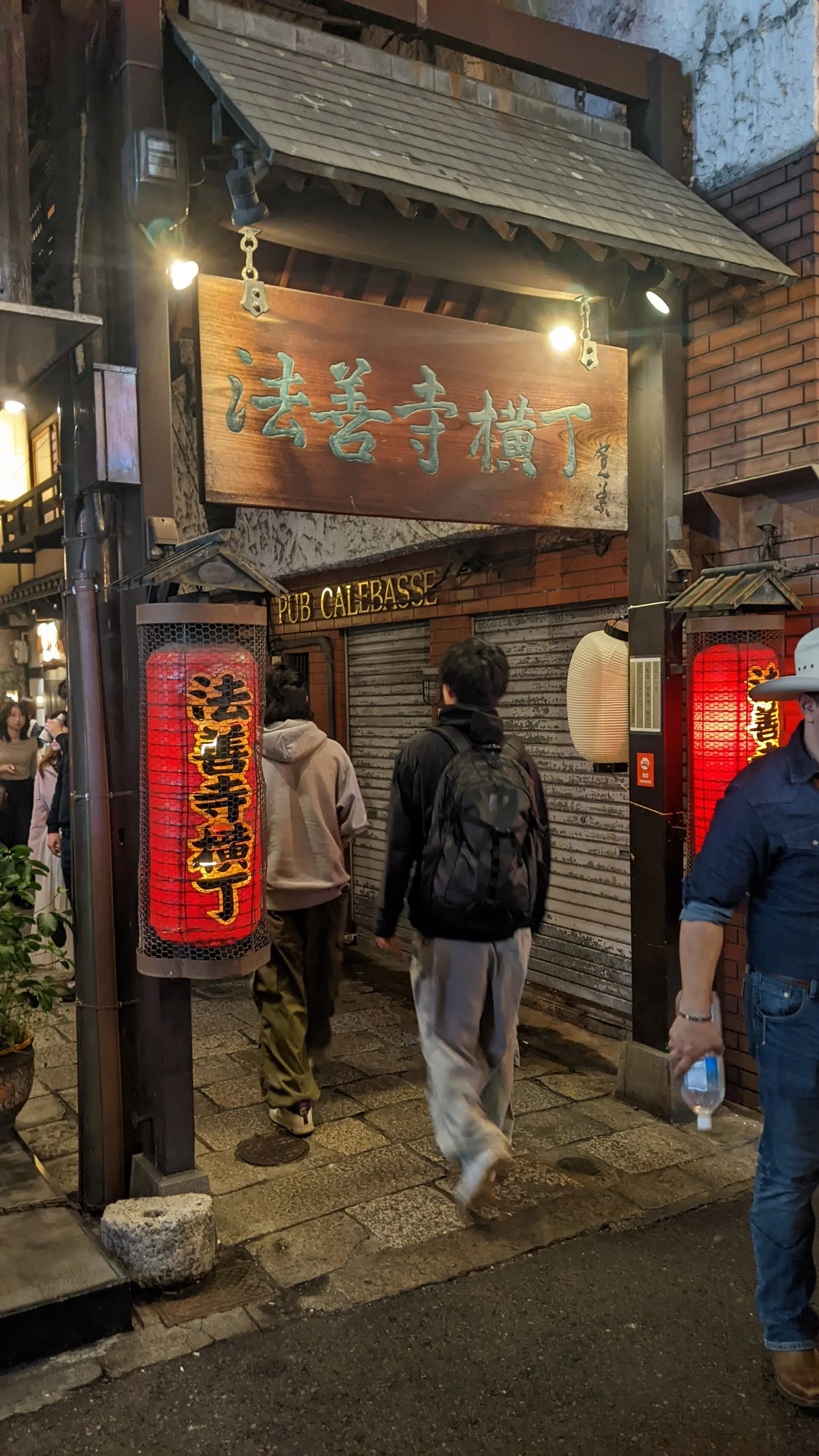
A short distance from Dotonbori’s bright waterfront, Hozenji Yokocho changes the scale of the visit. The November 2023 photograph frames the lane entrance beneath a wooden sign and lanterns. It makes the change visible without pretending to show the whole alley. Walk in slowly. This is a narrow working lane with businesses and a temple nearby, not a private film set arranged for the visitor.
Osaka’s official tourism page connects the alley to Hozenji temple and describes the atmosphere of its stone-paved side streets. The familiar stories of the area are best held alongside the place’s continuing use: people come to eat, work and worship. A legend or tourist anecdote can enrich a visit, but it is not evidence that a feature of the street was unchanged over time. Our photograph can identify the entrance; it cannot confirm today's opening hours, what is allowed near the temple, or whether an alley is crowded at the moment you arrive.
Notice how sound and pace shift as you leave the canal. If you stop to take pictures, do not obstruct the lane or point a camera at somebody praying. The final chapter turns southeast toward Kuromon Ichiba. That is another editorial change of scene rather than a recorded turn-by-turn passage. Check the current route before you leave the small lanes, especially if you are choosing between covered shopping arcades and open streets in bad weather.
Real-travel note
Hozenji is a place of worship. Follow current signs and make room for people using the narrow lane.
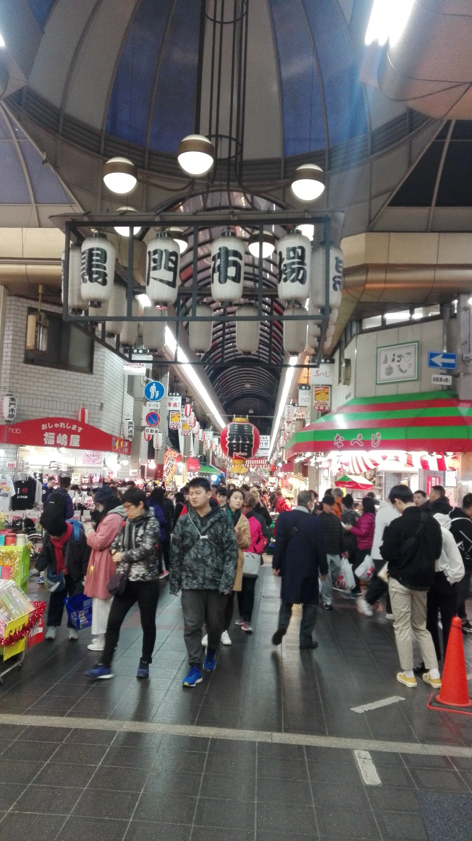
Chapter 5 · A working market
Finish at Kuromon Ichiba
Kuromon Ichiba is the final stop because it changes the meaning of looking. The December 2017 photograph shows a covered aisle, hanging market lanterns and people passing between shopfronts. It is a useful view of the market’s scale and the shelter overhead. It does not promise that the same stalls, people or products will be there when you arrive. Unlike a museum corridor, this is a business place whose rhythm depends on the day and on individual shops.
Osaka’s official tourism material introduces Kuromon as a food market in the Namba area. That introduction helps place it in a real neighbourhood, but one listing cannot supply a single reliable opening time for every seller. Come with curiosity rather than a checklist of foods that a photograph seemed to guarantee. If you buy something, respect shop rules about eating, queues and photography; leave the aisle usable for other shoppers and workers.
These five chapters have taken you from a station frontage to a bridge, the water, a small lane and a market. The main media are five independent, licensed photographs. Several optional 360° viewpoints may help you orient yourself, but they are recorded at other times and do not form a continuous route from Namba to Kuromon. Decide whether the real outing suits your energy and the current weather, then check a live map, transit information and individual business notices before you go. Staying longer by the canal, or choosing just the market, is a valid way to make this trip your own.
Real-travel note
Individual sellers set their own hours. Check current shop information; keep aisles clear and follow each vendor’s photography and eating rules.
2 reviewed experiences
Explore along the route
Step into the places along this journey. Choose a view independently of the story chapters.
Explore at your own pace; these views do not count toward chapter completion. Short sequences cover only the reviewed section. Imagery availability may change.
Sources
- Dotonbori — Osaka Convention & Tourism Bureau
- Ebisu Bridge — Osaka Convention & Tourism Bureau
- Tombori Riverwalk — Osaka Convention & Tourism Bureau
- Hozenji Yokocho — Osaka Convention & Tourism Bureau
- Kuromon Market — Osaka Convention & Tourism Bureau
- Nankai Namba Station vicinity — OpenStreetMap contributors
- Ebisu Bridge vicinity — OpenStreetMap contributors
- Dotonbori Canal vicinity — OpenStreetMap contributors
- Hozenji Yokocho vicinity — OpenStreetMap contributors
- Kuromon Ichiba vicinity — OpenStreetMap contributors
- Nankai Namba Station at night on June 16th, 2016 — Wikimedia Commons
- (JPN-Osaka) Ebisubashi 2024-11-17 — Wikimedia Commons
- Dotonbori, Osaka, at night, November 2016 — Wikimedia Commons
- Hozenji Yokocho 2023-11 — Wikimedia Commons
- Osaka Kuromon Ichiba Market 2017-12 (1) — Wikimedia Commons

_Ebisubashi_2024-11-17.jpg)


.jpg)
Your journey, remembered.
The keepsake unlocks when you reach this section.