
Old Town Central: from Possession Street to Tai Kwun
Climb from a vanished shoreline through hillside lanes, temples, schools and a working market, then finish inside Hong Kong’s former police and prison compound.
Guided visual journey
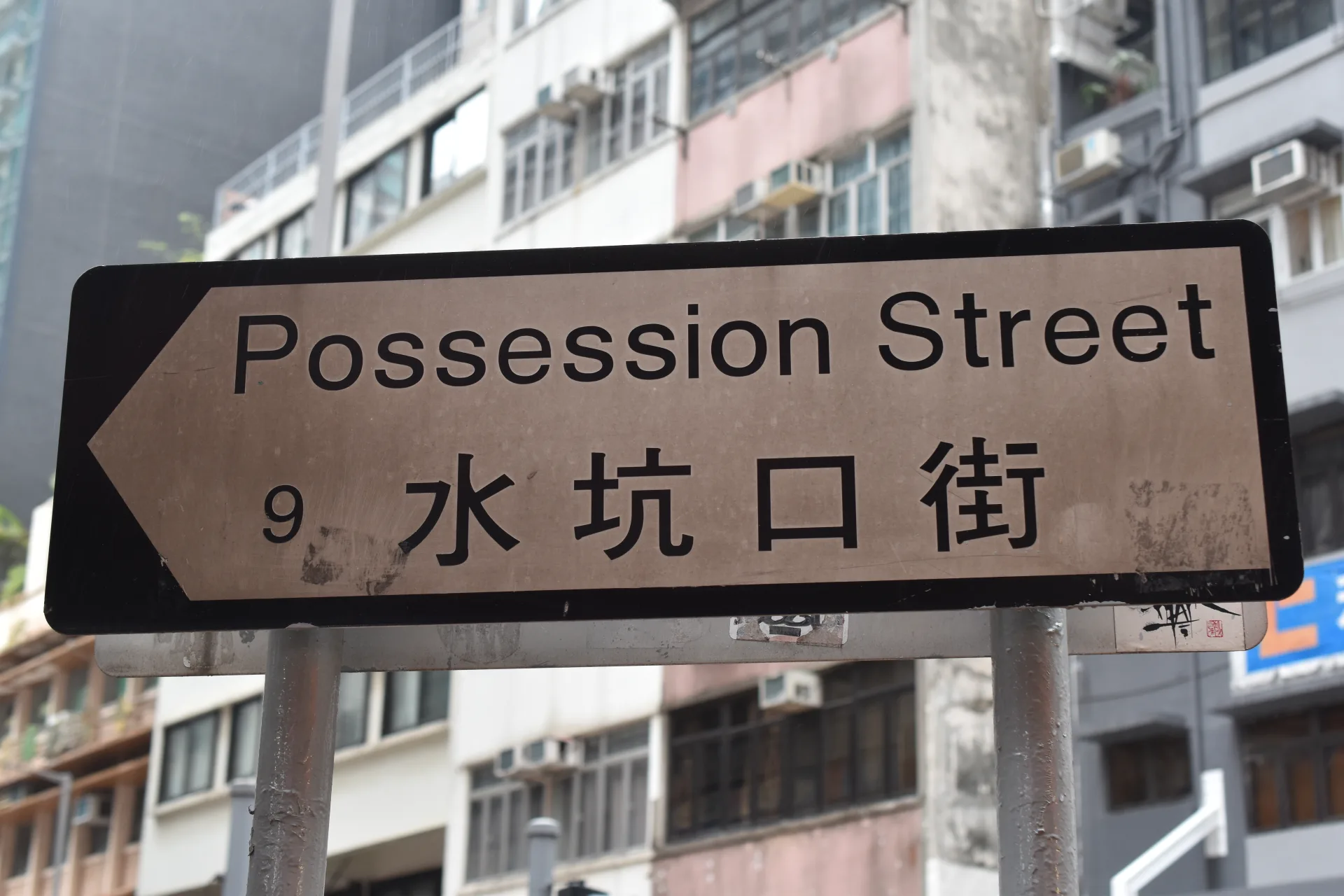
Licensed documentary photograph (resized for web) · Fred Cherrygarden · CC BY-SA 4.0
Reading mode
Six stories to read at your own pace
Chapter 1 · A shoreline remembered
Possession Street and the changing shoreline
Possession Street is an unassuming place to begin a history of Hong Kong. Buses, shop signs and apartment blocks now occupy a slope that runs inland from Queen’s Road West. In 1841, British forces landed near here and raised the Union flag at a headland subsequently called Possession Point. The official Old Town Central guide treats the place as a starting point for reading the city’s colonial beginnings, while the street name keeps that history visible in the everyday map. The geography is less obvious. Nineteenth-century maps placed the point beside the harbour; successive reclamation moved the water north, leaving Possession Street several blocks from today’s shoreline. That separation is useful evidence of change rather than a flaw in the story. Look downhill and imagine the former edge of the island, then look uphill toward Tai Ping Shan, where Chinese residents built homes, shops and temples. The short vertical distance between shore and hillside contained sharply unequal communities and institutions. No single corner can explain the transfer of Hong Kong or the lives already present on the island. The flag-raising story is part of the colonial record, not a complete origin story for the city. What the street offers is a physical question: how did a landing place become ordinary urban fabric? Begin with the road gradient, the compressed frontages and the lost view of water. They make clear that Old Town Central is not a preserved period set. It is a district repeatedly extended, rebuilt and inhabited.
- Recorded coordinates
- 22.2862, 114.1486
- Colonial record
- British forces landed near the later-named Possession Point and raised their flag in January 1841. Old Town Central
- Changed coast
- Land reclamation moved the harbour edge north of the original headland. Old Town Central self-guided walks
- Present location
- The verified chapter point is on Possession Street in Sheung Wan. Possession Street
Real-travel note
Start from the lower junction and expect an immediate climb. Pavements are narrow and crossings are active; use marked crossings and consult current transport information before setting out.
Chapter 2 · The hillside Chinese city
Tai Ping Shan Street and the early Chinese city
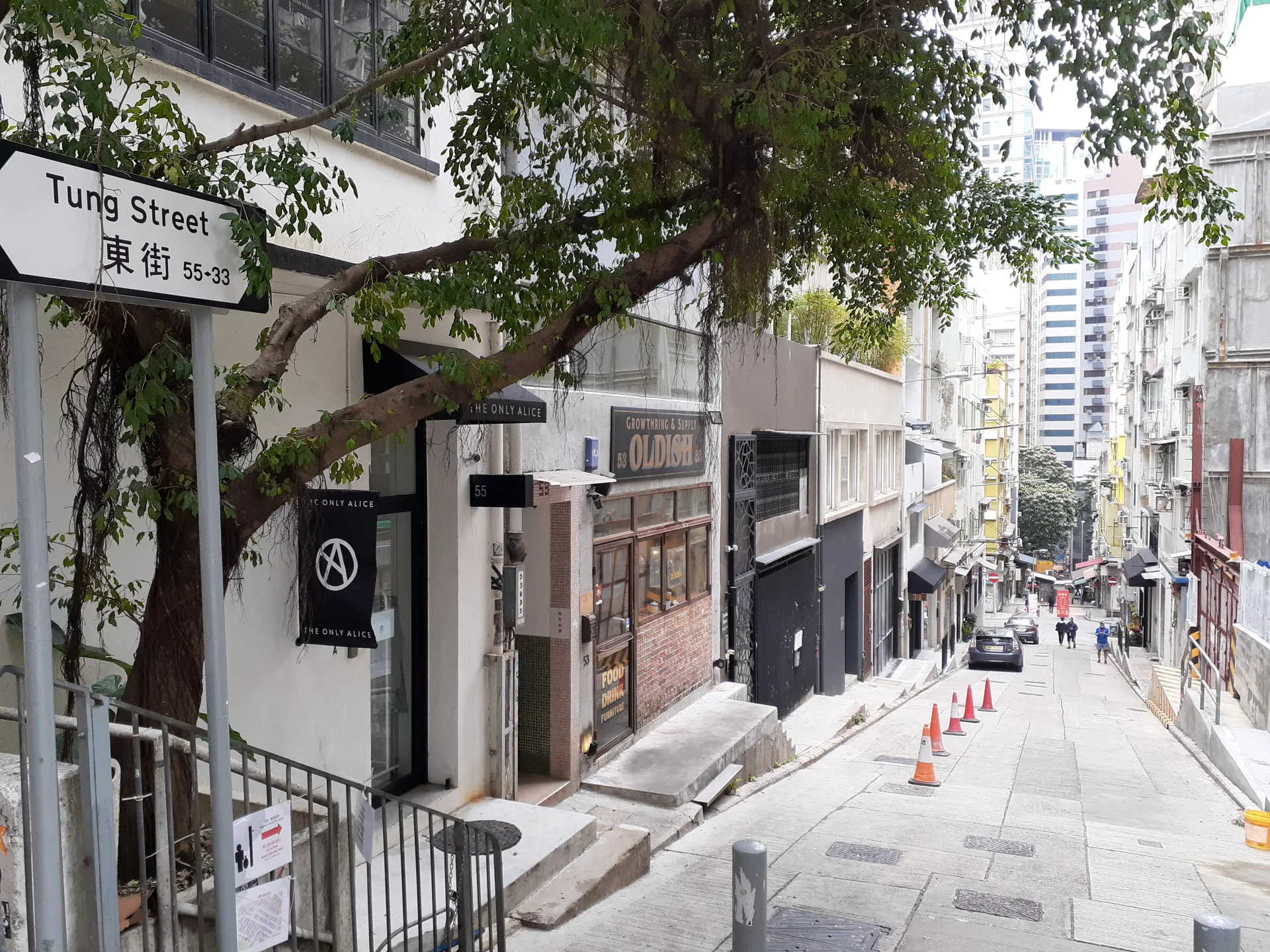
Tai Ping Shan Street feels quieter than the arterial roads below it. Small temples, cafés, workshops and residential entrances share a narrow pedestrian scale, and the slope keeps the harbour-side city close but partly out of sight. In the nineteenth century, the wider Tai Ping Shan district became a principal area of Chinese settlement. The official Old Town Central route uses these lanes to connect the colonial landing place with the community institutions that developed uphill. That growth should not be romanticised as picturesque crowding. Housing was dense, drainage and sanitation were poor, and the district became the centre of Hong Kong’s 1894 bubonic plague outbreak. Colonial authorities responded with house inspections, disinfection and extensive clearances. Those measures were bound up with racialised assumptions and coercive public-health powers, while residents faced disease, displacement and distrust. The site of Blake Garden, beyond this chapter’s street, records part of the cleared area. The episode belongs both to medical history and to the history of who had authority over homes and bodies. Today, Tai Ping Shan Street presents another layer: old religious sites and street proportions remain, but galleries and new businesses have changed rents and uses. It is better read as a living neighbourhood than as an untouched enclave. Notice how doorways open directly onto the lane and how stairs connect different levels of the hill. These modest spatial details explain why temples, meeting places and mutual-aid institutions mattered. In a district where government services were limited and living conditions precarious, community organisation was not decorative heritage; it was part of how daily life functioned.
- Recorded coordinates
- 22.28452, 114.1485
- Early community
- Tai Ping Shan developed as a major Chinese residential district in early colonial Hong Kong. Old Town Central self-guided walks
- 1894 plague
- The Tai Ping Shan area was at the centre of Hong Kong’s 1894 bubonic plague outbreak and subsequent clearances. Old Town Central self-guided walks
- Street position
- The verified chapter point lies on Tai Ping Shan Street below the higher Hollywood Road corridor. Tai Ping Shan Street
Real-travel note
The connection includes narrow lanes, steps and a noticeable rise. Move quietly around homes and small shrines, and do not treat doorways or worshippers as photo props.
Chapter 3 · Worship and public order
Man Mo Temple: incense, learning and community
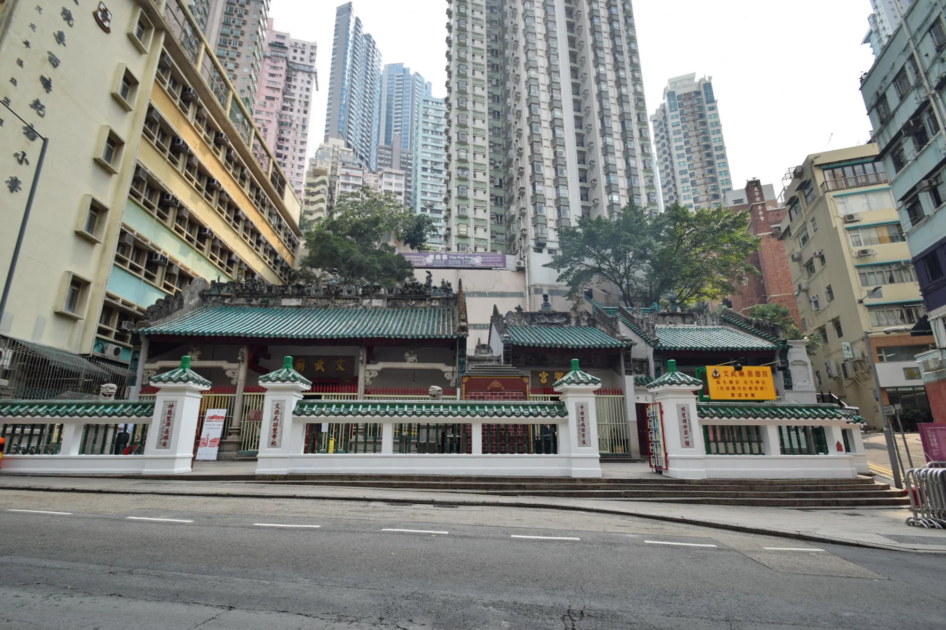
On Hollywood Road, the green-tiled roofs and granite doorway of Man Mo Temple interrupt the commercial frontage. Inside, coils of incense hang above altars dedicated to Man Cheong, associated with literature, and Kwan Tai, associated with martial valour and loyalty. The compound was built between 1847 and 1862. It includes the Man Mo Temple, Lit Shing Kung and Kung Sor, an assembly hall used by the Chinese community to discuss affairs and settle disputes. That combination matters. The temple was never only an atmospheric interior. In early colonial Hong Kong, Chinese merchants and community leaders used religious and charitable networks to organise services and mediate social order in a system that offered them limited formal representation. Tung Wah Group of Hospitals has managed the compound since 1908, and the government declared it a monument in 2010. These dates describe changing stewardship; they do not turn a living place of worship into a museum. Look closely before reaching for a camera. Incense smoke, offerings and divination belong to current religious practice, while plaques and furnishings record generations of donors. Literary and martial deities are often explained as a balanced pair, but visitors should avoid reducing a complex religious setting to a simple symbol. The assembly hall also reminds us that “community order” could involve negotiation, hierarchy and authority, not merely harmony. The street image for this chapter shows the compound from nearby rather than offering a panoramic interior. That exterior view is appropriate preparation: notice the temple’s low profile beneath later buildings, then enter on the terms of a worship space. Architecture, ritual and civic history remain layered together here.
- Recorded coordinates
- 22.283982, 114.150239
- Compound
- The site comprises Man Mo Temple, Lit Shing Kung and the Kung Sor assembly hall. Man Mo Temple Compound
- Stewardship
- Tung Wah Group of Hospitals has managed the compound since 1908. Man Mo Temple Compound
- Protection
- The compound was declared a monument in 2010. Man Mo Temple Compound
Real-travel note
This is an active place of worship. Dress and speak respectfully, follow photography notices, avoid blocking offerings, and verify current opening hours with Tung Wah Group of Hospitals.
Chapter 4 · Education remade
From Central School to PMQ
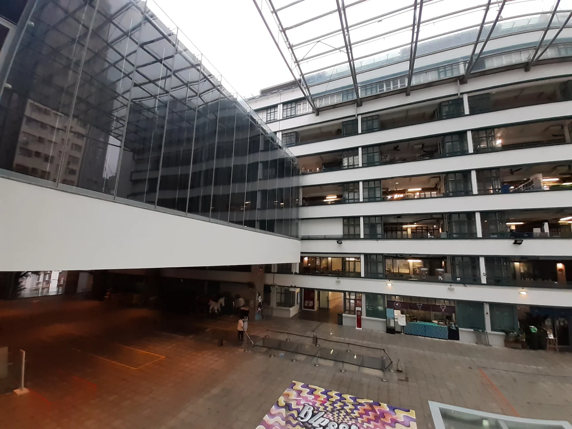
PMQ’s paired blocks and open courtyard look deliberately contemporary, but the site’s institutional history reaches back to the nineteenth century. The government’s Central School, founded in 1862, moved to this Hollywood Road site in 1889. It was an important government school offering Chinese and Western learning; it was renamed Victoria College and then Queen’s College before moving elsewhere. Wartime damage left the old school buildings beyond repair, and they were demolished in 1948. The Police Married Quarters opened on the site in 1951. Its accommodation reflects a post-war effort to house married junior police officers and their families close to Central Police Station. The surviving residential blocks therefore belong to a different period and purpose from the school. Treating them as one continuous institution would flatten the site’s history: education, police housing and the present design complex are successive uses connected by place, not by a single mission. After the quarters became vacant, a conservation and revitalisation project adapted the blocks as PMQ, which opened in 2014 as a venue for design studios, shops, exhibitions and events. Archaeological remains of the former Central School were retained as part of the site. The courtyard makes the adaptive reuse easy to read: repetitive balconies recall domestic circulation, while inserted bridges and public spaces support a new programme. PMQ can be busy or nearly quiet depending on exhibitions and shop hours. Its historical value does not depend on making a purchase. Walk the courtyard, compare old masonry traces with the mid-century blocks, and consider how public land in Central has repeatedly been assigned new purposes. Conservation here means managed change, not a return to one ideal date.
- Recorded coordinates
- 22.283354, 114.151862
- Central School
- The government Central School moved to this site in 1889. History of PMQ
- Police housing
- The Police Married Quarters were completed in 1951 for married junior officers and their families. History of PMQ
- Adaptive reuse
- The revitalised PMQ opened in 2014 as a design and creative venue. History of PMQ
Real-travel note
The courtyard is generally easier than the surrounding slopes, but individual studios and exhibitions keep their own hours. Check PMQ’s official site for current access and events.
Chapter 5 · The working market
Graham Street and a market in motion
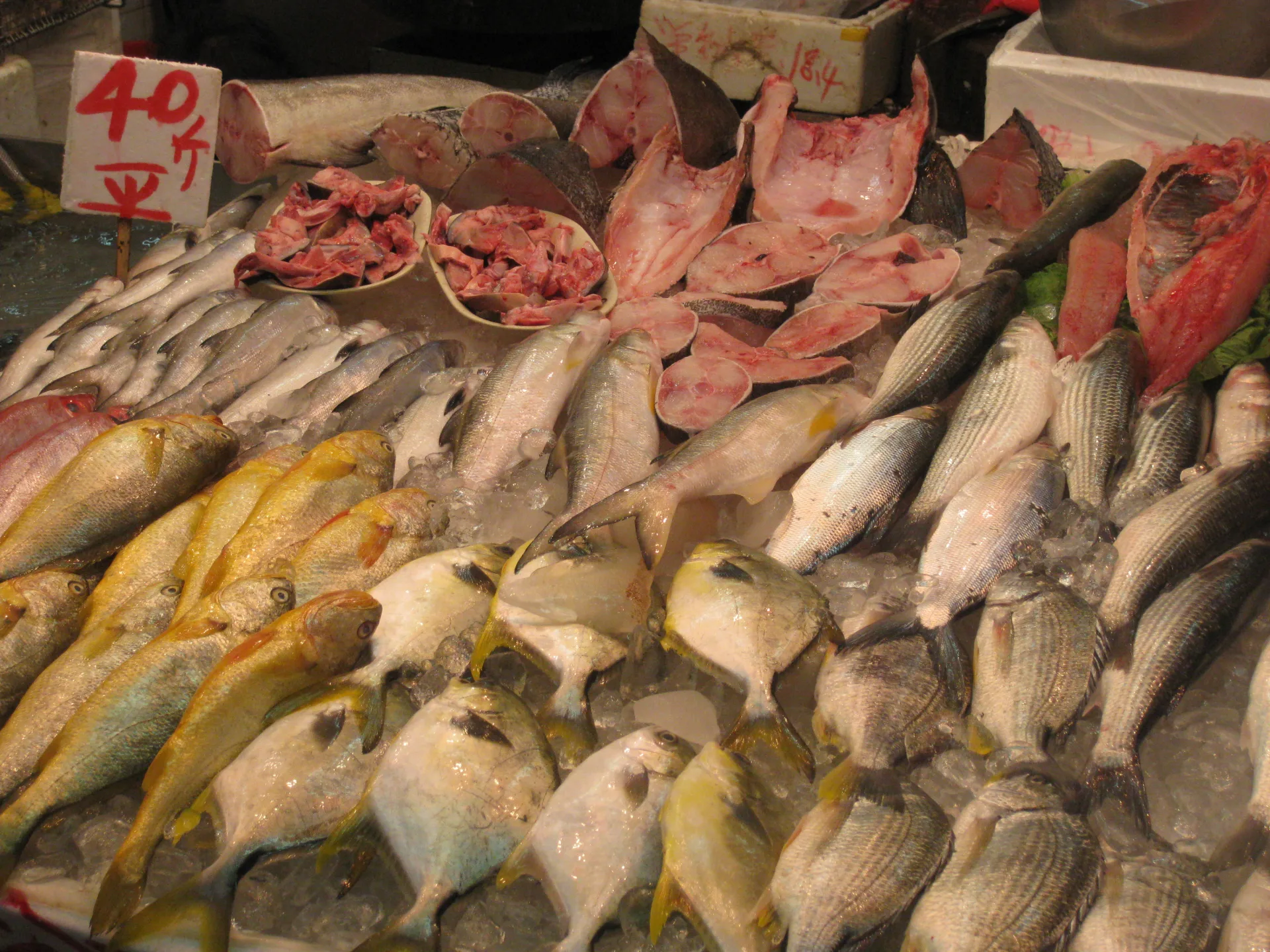
Graham Street Market is often described as one of Hong Kong’s oldest continuously operating street markets. Its significance is easiest to grasp at working pace: vegetables stacked close to the pavement, wet crates, handcarts and customers making brief exchanges on a steep lane. The market grew with the surrounding Chinese neighbourhood and supplied daily necessities long before supermarkets became common. “Old” does not mean unchanged. The Urban Renewal Authority’s redevelopment of the Graham Street area has demolished buildings and moved some traders into new facilities, while street stalls continue in parts of the district. Official tourism material presents the market as living heritage; that description is useful only if it leaves room for disruption, rent, regulation and the labour required to keep trading. A picturesque photograph cannot show those pressures by itself. Walk slowly and give priority to work. The lane is a workplace before it is a visitor attraction, and deliveries can narrow an already tight route. Look at how temporary displays meet permanent shopfronts and how the hill shapes every movement of goods. Smells, voices and seasonal produce change by hour, so this chapter should not promise a fixed scene or a particular stall. Nor should it imply that every business keeps the same schedule. The route from PMQ descends into this denser commercial fabric, then climbs again toward Tai Kwun. That dip is more than topography. It places everyday provisioning between major heritage compounds and reminds us that Central’s history is also made by vendors, porters and shoppers. Respectful attention to their present work is more valuable than nostalgia for an imagined market frozen in time.
- Recorded coordinates
- 22.28278, 114.15326
- Long-running trade
- Official tourism material identifies Graham Street as one of Hong Kong’s oldest street markets. Graham Street Market
- Everyday market
- The market is known for fresh food and household shopping rather than being solely a heritage display. Graham Street Market
- Hillside position
- The verified chapter point lies on Graham Street south of the Hollywood Road corridor. Graham Street
Real-travel note
Expect narrow passages, wet surfaces, delivery trolleys and peak shopping activity. Keep stall access clear, ask before photographing people, and do not rely on any individual vendor being open.
Chapter 6 · Law, confinement and reuse
Tai Kwun: inside a former justice compound
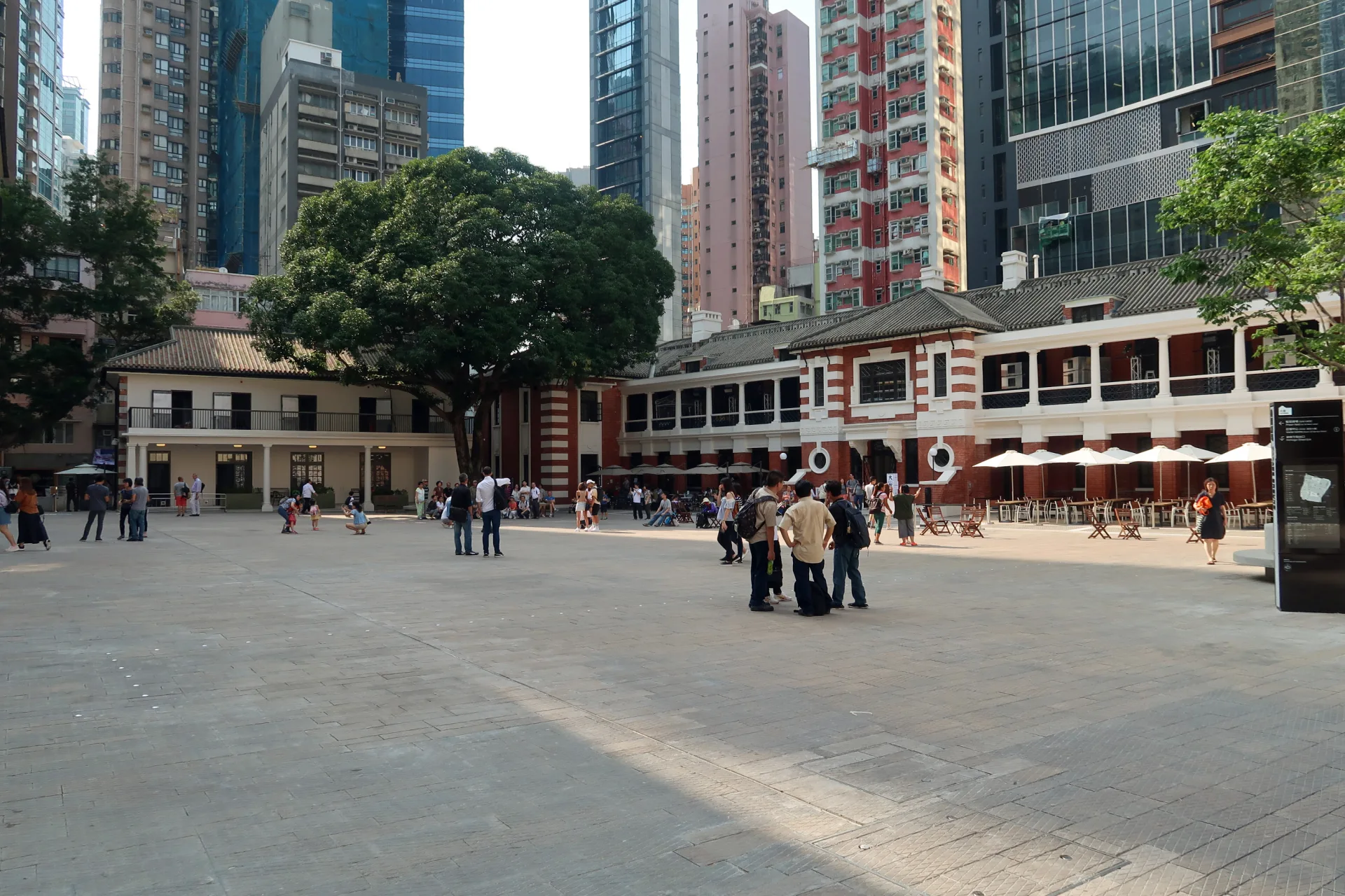
Tai Kwun brings three linked institutions together: the former Central Police Station, Central Magistracy and Victoria Prison. The compound developed over more than a century, beginning with early colonial police and prison buildings and expanding as Hong Kong’s systems of policing, trial and punishment grew. Its courtyards, cell blocks, offices and magistracy were never neutral backdrops. They structured encounters between state authority and people who were arrested, judged, employed or confined here. The official historical timeline distinguishes successive buildings and alterations rather than presenting the complex as a single moment. Victoria Prison ceased operation in 2006, and the conservation project later adapted the compound for heritage interpretation, art and public programmes. Tai Kwun opened to the public in 2018. New architecture sits beside repaired masonry, making the intervention visible instead of pretending that the site survived untouched. Adaptive reuse creates access, but it can also soften difficult history. A pleasant parade ground today should not erase the experiences of prisoners or turn confinement into atmosphere. Read the interpretation in the cell blocks and compare it with the administrative spaces. Individual testimony, when presented by the site, helps complicate an institutional timeline without claiming to represent every person held here. This is a fitting end to the walk because it gathers themes encountered earlier: colonial power, Chinese community life, public institutions and the repeated reassignment of urban land. Yet it is not a neat conclusion. The compound’s current cultural role and its history of coercion remain in tension. Allow time for both the open courtyards and the more demanding displays, then leave through the dense streets that still surround the walls.
- Recorded coordinates
- 22.281262, 114.154045
- Three institutions
- The compound comprises the former Central Police Station, Central Magistracy and Victoria Prison. Heritage at Tai Kwun
- Prison closure
- Victoria Prison ceased operation in 2006. Historical timeline
- Public reopening
- The conserved compound opened as Tai Kwun in 2018. Historical timeline
Real-travel note
Some galleries, cells and programmes have separate schedules or capacity limits. Check Tai Kwun’s official visitor information before arrival and allow more time if you plan to see exhibitions.
Sources
- Old Town Central — Hong Kong Tourism Board
- Old Town Central self-guided walks — Hong Kong Tourism Board
- Man Mo Temple Compound — Tung Wah Group of Hospitals
- Man Mo Temple Compound — Antiquities and Monuments Office
- History of PMQ — PMQ
- Graham Street Market — Hong Kong Tourism Board
- Historical timeline — Tai Kwun
- Heritage at Tai Kwun — Tai Kwun
- Possession Street — Wikidata
- Tai Ping Shan Street — Wikidata
- Man Mo Temple — Wikidata
- PMQ — Wikidata
- Graham Street — Wikidata
- Tai Kwun — Wikidata
- Possession Street — Wikimedia Commons
- Tai Ping Shan Street — Wikimedia Commons
- Man Mo Temple Compound — Wikimedia Commons
- PMQ courtyard — Wikimedia Commons
- Graham Street Food Market — Wikimedia Commons
- Tai Kwun Parade Ground — Wikimedia Commons


Your journey, remembered.
Visited 1 of 6 chapters. The keepsake unlocks automatically after every chapter has been entered.