
Miyajima, Hiroshima
Arrive by ferry, walk the shopping street to the great torii and Itsukushima Shrine, then climb to Daisho-in and stop in Momijidani Park.
Guided visual journey
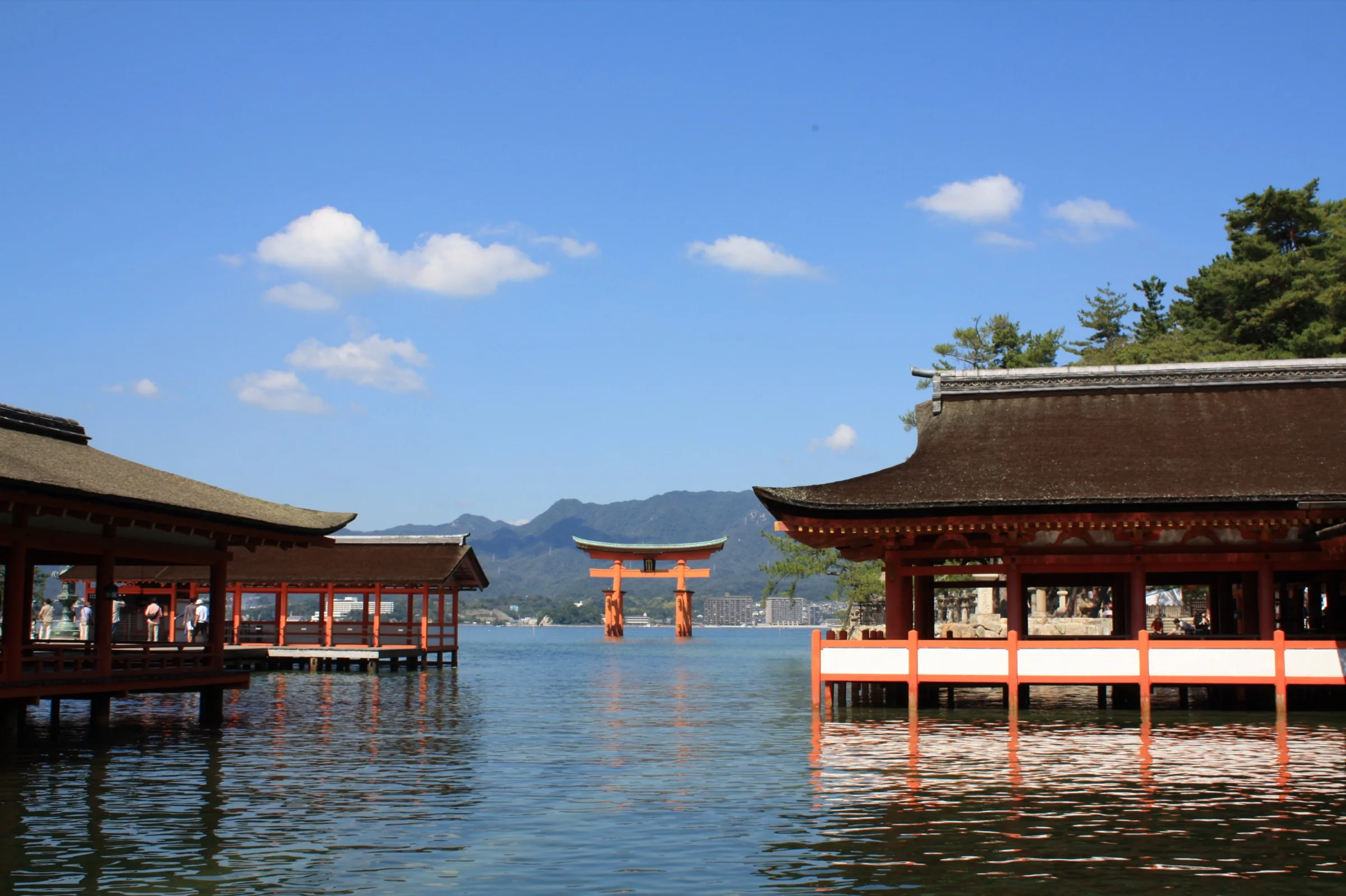
Licensed documentary photograph (resized for web) · Pistachio001 · CC BY-SA 3.0
Reading mode
Place stories to read at your own pace
Chapter 1 · The boat, then the island
Miyajima Pier
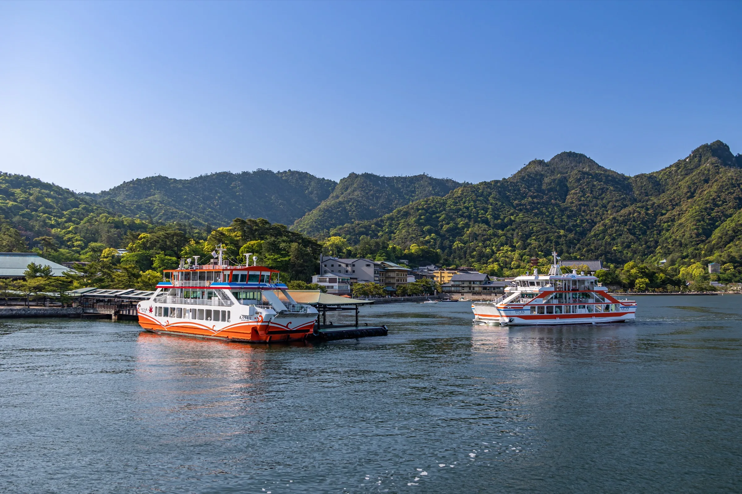
Miyajima first appears across the water. From Miyajimaguchi on the mainland, the ferry takes about ten minutes; only after you disembark does this walk begin. Two operators serve the island, JR West Miyajima Ferry and Miyajima Matsudai Kisen. The boats bring you to the same island, but tickets, passes and departures are worth checking with the operator you choose. Allow time for the crossing rather than treating the water as another stretch of pavement.
The photograph looks back at Pier 1: two ferries at their berths, the terminal, and the wooded slope rising behind the town. Step outside and the island feels compact. People collect their bearings in the plaza, the mountain is already above the roofs, and the approach to the shrine begins within a few minutes. This is a good place to decide whether to head straight for the shrine or linger in the shopping street. The optional 360° view shows the plaza outside the terminal. It is a chance to look around, not a crossing by boat or a way to travel along the shore.
The map in this journey starts here, on the island. The line across the water is not drawn, because that stretch is a ferry. Cars are a poor way to continue: the island has little convenient parking, and the official access page recommends leaving a car at Miyajimaguchi. From the plaza the next change is ordinary and immediate. The open water closes into a covered shopping street.
Real-travel note
The crossing is by ferry, not on foot. Recheck your chosen operator’s current fare, visitor tax, accepted passes and departures before travelling.
Chapter 2 · The street that takes you inland
Omotesando
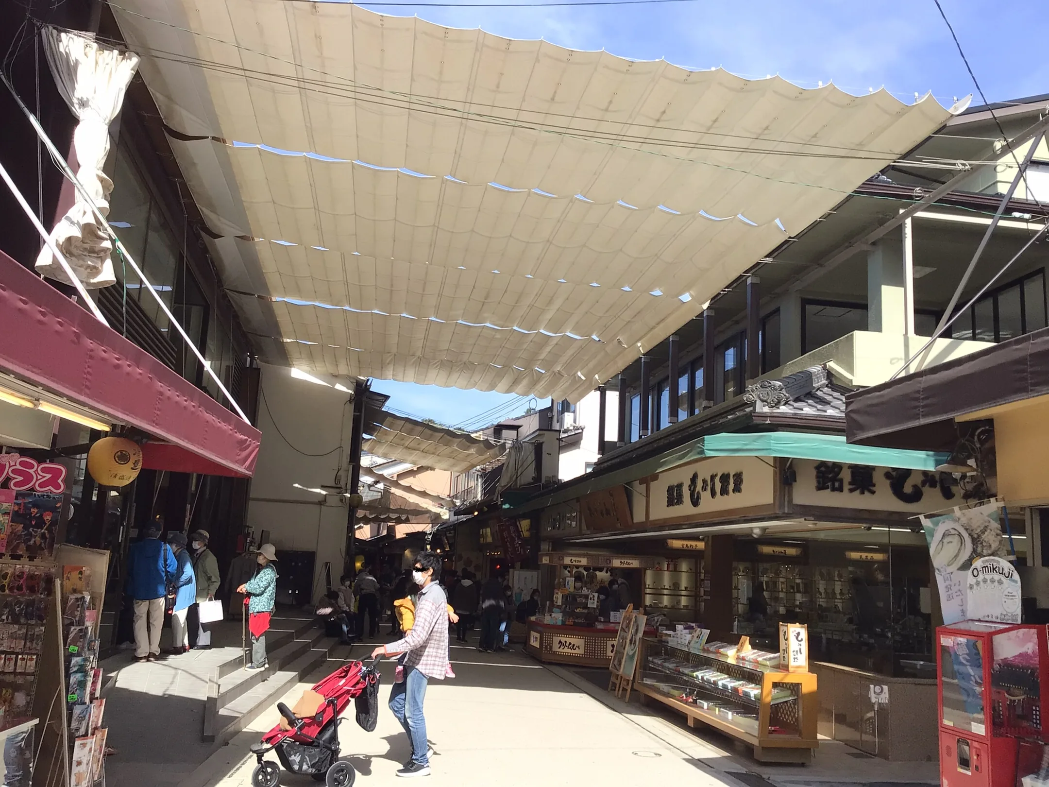
Leave the ferry plaza and the island becomes a street. The official day course allows only a few minutes to reach Omotesando, but you may spend much longer here. The route passes easily underfoot, close enough to the port that the sea still feels nearby. Instead of a grand avenue, you find a working shopping street with small entrances, awnings and people choosing where to stop.
Omotesando is the shopping street visitors use to reach the shrine. Awnings stretch between the eaves. Maple-leaf cakes, grills and souvenir shops open onto the same pavement; a confectioner sits beneath the canvas in the photograph. Stop for something warm, or simply notice how the sounds of the port give way to shopfronts and conversation. This part of the walk is about the approach, not checking off another monument. The optional 360° view lets you look around the arcade at one point on the street. It will not carry you all the way to the shrine.
The street is easy underfoot and often busy. Give shop staff room, and do not treat the lane as a studio. The spatial change at the end of the street is the one that matters. The awnings stop, the water opens again, and the vermilion buildings stand out over the tide.
Real-travel note
The street is public, narrow and often crowded. Leave room for shoppers and shop staff; recheck festival schedules before you go.
Chapter 3 · The tide decides the view
The great torii and Itsukushima Shrine
The street ends and the sea takes over the picture. Itsukushima Shrine stands on piers over a tidal inlet, with corridors, roofs and a stage the colour of vermilion. Offshore, the great torii marks the edge of the sacred precinct. The shrine’s own English page says the shrine was established in 593, that Taira no Kiyomori built the present shrine in 1168, and that it was registered as a World Heritage Site in 1996. Japan’s national tourism page repeats the 1996 listing and adds that it recognises the primeval forests of Mount Misen as well as the shrine. The same national page says worshippers once approached by boat, passing under the offshore gate.
The gate you see today dates to the nineteenth century. The local tourism page calls it the eighth great torii and describes camphor pillars supporting a structure more than sixteen metres high. Knowing that the gate has been remade over generations changes the view: this is not a frozen relic, but a place people have repeatedly kept in use. The shallow sea between the gate and the shrine is part of the experience, not just a backdrop for a photograph.
Tide is the decision this place forces on you. The tourism tide page, still online on 25 September 2026, says the shrine takes on its floating look when the tide is above 250 centimetres, and that people can walk to the foot of the torii when the tide is under 100 centimetres. At low water the sand of Mikasanohama is exposed. At high water that sand is covered. OpenStreetMap describes the same inlet as tidal sand: walkable toward the torii at low tide, submerged at high tide. The photograph here is the high-water view, from among the shrine buildings, with the gate standing in the sea. It is one condition, recorded in September 2011. It is not a forecast. Do not plan a day on the promise that you will walk to the gate, and do not plan it on the promise that the gate will look afloat. Check a current tide table. This page does not predict the tide.
The shrine’s English page lists year-round opening, with hours that change by season: generally from 6:30am, closing between 5:00pm and 6:30pm, and from midnight on 1 January. The page shows no revision date. Individual adults were listed at 300 yen for the shrine, 300 yen for the treasure hall, and 500 yen for a combined ticket. The corridors have gaps between the floorboards, the shrine says, to ease the pressure of the sea. Comfortable shoes matter more than they do on an ordinary street. High water can change what you are able to approach. The optional look-around is the landward approach and its steps, not a circle taken at the offshore gate, and not a walk across the sand.
The mapped line stops at that landward entrance. It does not cross Mikasanohama to the torii. That crossing exists only at some states of the tide, so it is not drawn as a path. From here the island changes again: you leave the decks and climb toward a temple on the slope.
Real-travel note
Check a current tide table before you promise yourself either the floating gate or a walk to its foot. Shrine hours and the 300 yen adult charge were listed on the shrine’s English page on 25 September 2026. Recheck both before you go.
Chapter 4 · Off the water and up the slope
Daisho-in
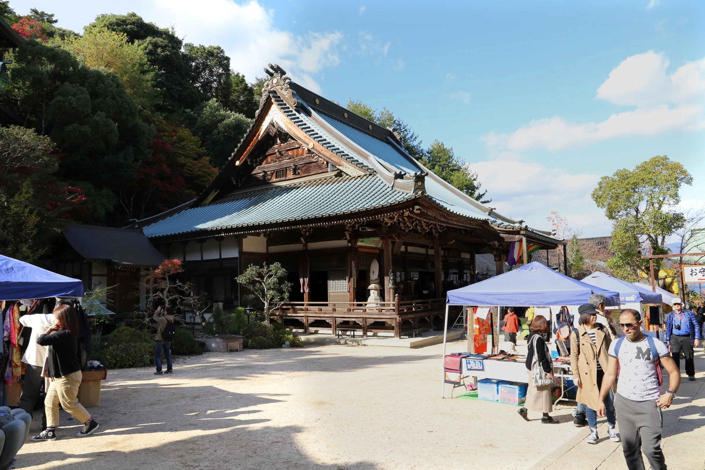
The shore decks give way to a slope. Daisho-in sits against the trees above the town, a Shingon temple where, according to the temple itself, prayer has continued for about twelve hundred years. After the openness of the tidal shore, the approach feels enclosed by steps, trees and buildings. In the photograph, market stalls occupy part of the gravel courtyard; they belong to that particular day. The timber hall, tiled roof and hillside are the more lasting landmarks.
From the shrine, allow time to climb toward the temple rather than expecting another level waterfront path. The official day course takes the lane of Takinokoji; the temple says the whole walk from the pier is roughly half an hour. It is a useful change of pace. There is no parking in the grounds, and the journey here follows the walking approach rather than a taxi or local shuttle.
The access page still showed gate hours of 8:00 to 17:00 when read on 25 September 2026. A notice dated 1 March 2025 said reception, visiting and prayer hours had changed, and put the detail in a PDF. Read that notice as well as the access page. In May 2026 the temple reported a fire at the Reikado, the hall of the eternal flame, and later posted about clearing the damaged material and about offerings for reconstruction. That is a reason to recheck which halls you can enter. It is not a reason to treat the whole temple as closed, and it is not something a 2017 photograph can show.
The optional look-around is a lane inside the precinct, with an ema office and lanterns, not the broad courtyard in the photograph. It does not climb the mountain. A guidepost near the temple records a Misen path of about 2.5 kilometres by the Daisho-in course. That sign is the start of a different walk. This edition does not follow it. After the temple, the town’s last change is into the maple valley.
Real-travel note
The access page listed gates from 8:00 to 17:00, and a March 2025 notice said those hours had changed. A fire at the Reikado was reported in May 2026. Recheck the temple before you go.
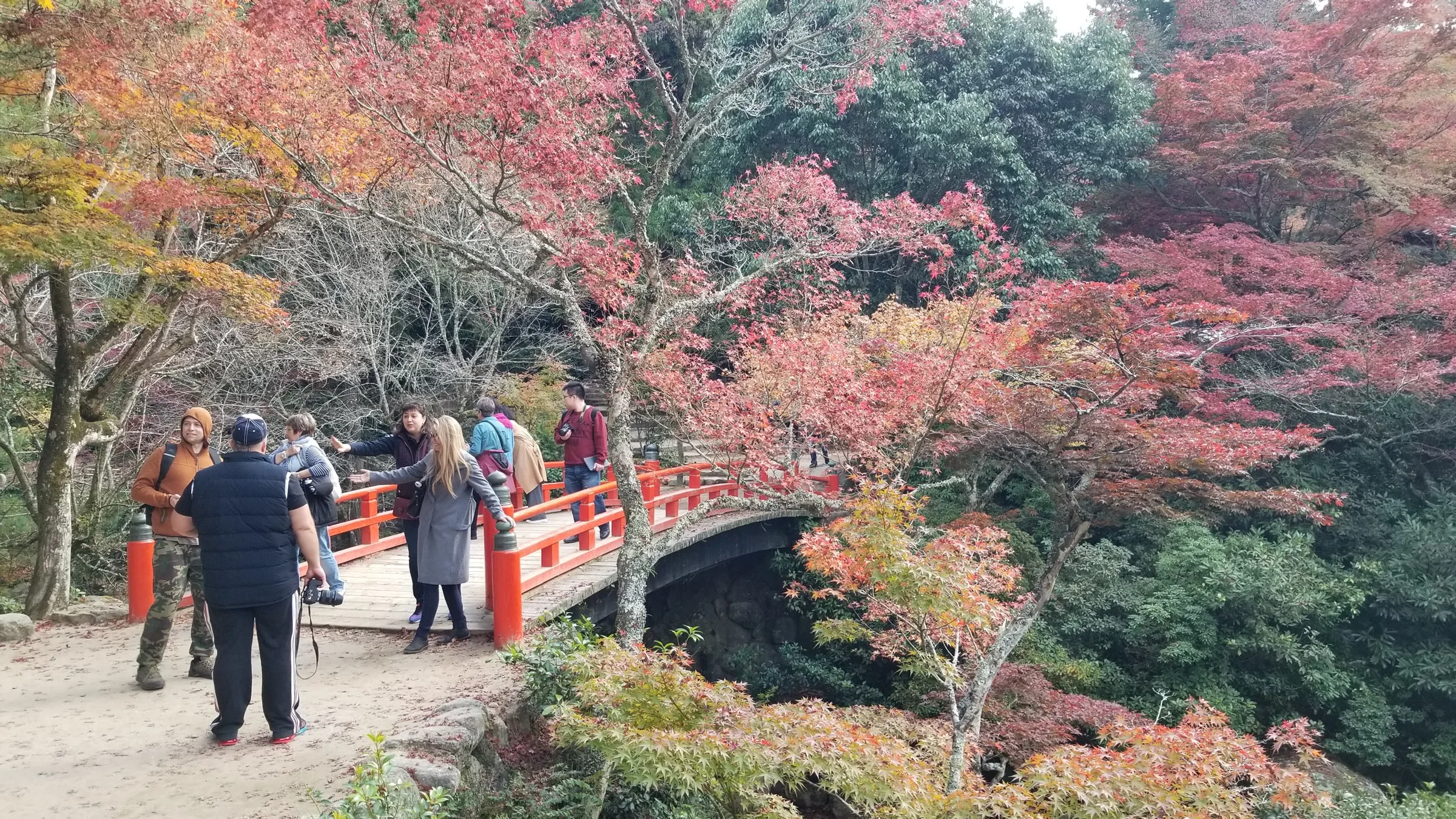
Chapter 5 · The valley, and the choice to stop
Momijidani Park
The last change is from temple courtyard to valley. Momijidani Park follows the stream at the foot of Mount Misen. The local tourism page says maple saplings were planted here in the Edo period; today the trees carry a different mood through the year, from early green to autumn colour. The photograph catches that autumn colour around a vermilion bridge near the town end of the valley. It is a view of the park, not a promise that the leaves will look like this when you visit, and not a picture of the ropeway or summit.
The official day course allows about twenty-five minutes for Momijidani after the temple. The mapped line is shorter: about 851 metres and eleven minutes on 25 September 2026, on paths that OpenStreetMap does not name. Use the longer official allowance if you want time to walk the valley rather than only to reach the pin. The line ends at the park. It does not continue up the mountain and it does not follow the cable.
Mount Misen is a real next decision, and it is a different kind of effort. The ropeway goes part of the way up, but the summit still calls for a further walk; a footpath from the valley is another option. Neither is part of the route drawn here. Choosing the summit means allowing more time, checking the weather higher up, and checking the ropeway operator if you plan to ride. Choosing to stop here means you have already experienced an unusually varied island walk: the boat, the street, the tide, the temple, and finally a quiet valley.
The optional look-around is a maple path in the park, one viewpoint from 2014. It does not walk you to the ropeway or the summit. When you turn back, the ferry plaza is the way off the island. The return boat is the same kind of crossing you arrived on, and it is still not a path on this map.
Real-travel note
This walk ends in the park. If you want to continue to Misen, recheck the ropeway operator, trail conditions and weather before you go.
Sources
- 1 day course — Miyajima Official Tourism Website
- The great Torii — Miyajima Official Tourism Website
- Weather Forecast, Tide Table — Miyajima Official Tourism Website
- Access — Miyajima Official Tourism Website
- Momijidani Park — Miyajima Official Tourism Website
- Transportation on the Island — Miyajima Official Tourism Website
- Itsukushima-jinja Shrine — Japan National Tourism Organization
- Itsukushima Shrine — Itsukushima Shrine
- Admission — Itsukushima Shrine
- Fares — JR West Miyajima Ferry
- Time Schedule — JR West Miyajima Ferry
- Fares — Miyajima Matsudai Kisen
- 交通アクセス — Daisho-in
- お知らせ — Daisho-in
- Miyajima Ferry Terminal and the landward plaza — OpenStreetMap
- 厳島港厳島神社線, the shopping approach — OpenStreetMap
- Itsukushima Shrine landward entrance — OpenStreetMap
- Daisho-in — OpenStreetMap
- Momijidani Park — OpenStreetMap
- Miyajima Ferry Terminal 001 — Wikimedia Commons
- 宮島表参道商店街 — Wikimedia Commons
- 厳島神社と大鳥居 — Wikimedia Commons
- Miyajima, daisho-in, 05 — Wikimedia Commons
- 紅葉谷公園 - 31092129457 — Wikimedia Commons


Your journey, remembered.
The keepsake unlocks when you reach this section.