
Luang Prabang: between mountain, temples and two rivers
Read Luang Prabang’s historic peninsula through five places and ten licensed photographs, then optionally step through reviewed Mapillary street sequences near each stop. This is a photo-led editorial sequence, not a surveyed continuous walk.
Begin the visual journeyExplore 5 reviewed views along the routeGuided visual journey
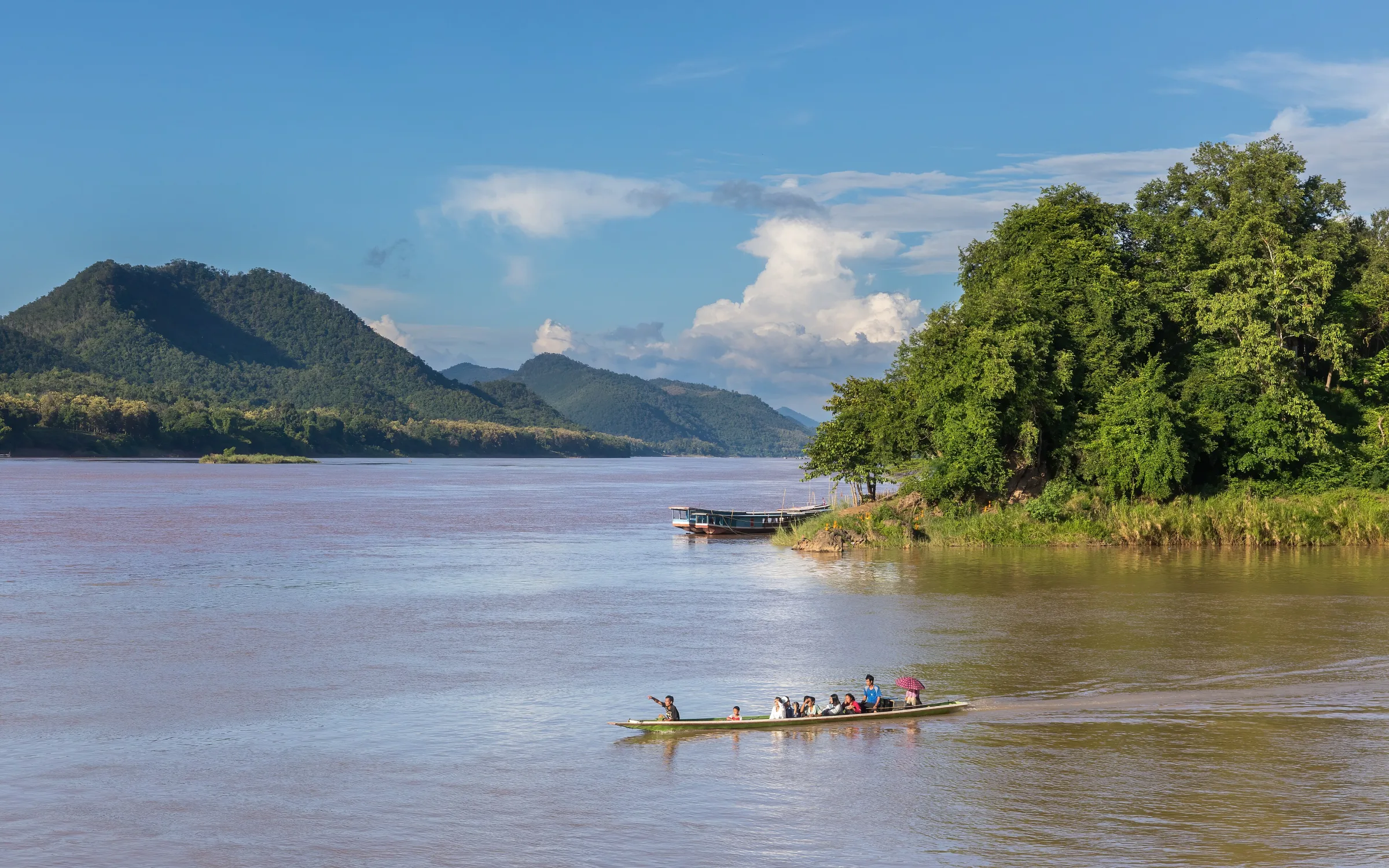
A pirogue crossing between the Nam Khan and Mekong at Luang Prabang · Basile Morin · CC BY-SA 4.0
Reading mode
Place stories to read at your own pace
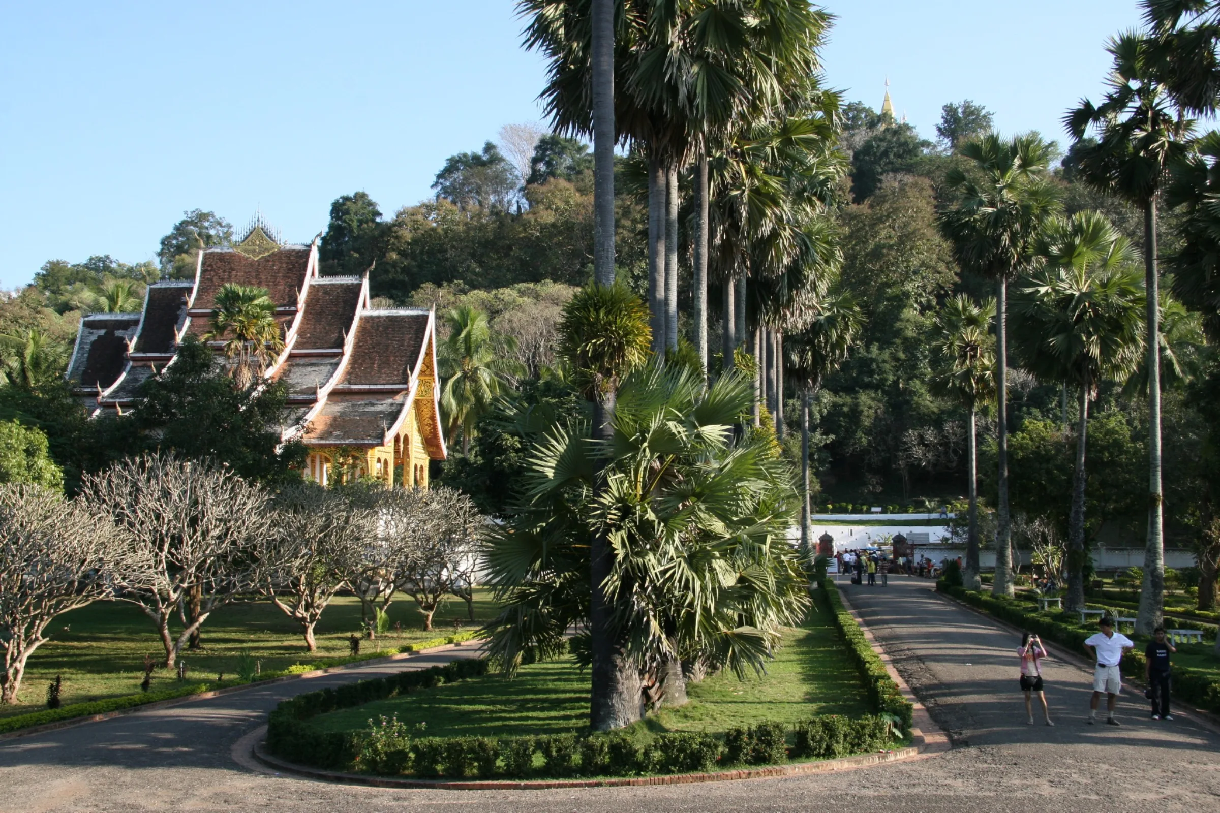
A broad view and a frontal approach establish the palace at the foot of Mount Phousi.
Chapter 1 · A civic centre below the hill
Begin between the Royal Palace and Mount Phousi
The former Royal Palace, now a museum, sits opposite Mount Phousi near the centre of the protected town. Rebeccamack’s 2007 photograph looks across the grounds and roofline; Christophe95’s 2018 view places the entrance at the end of a palm-lined approach. The weather, vegetation and camera positions differ, so the pair should be read as two dated records rather than consecutive frames.
UNESCO describes Luang Prabang as a town on a peninsula formed by the Mekong and Nam Khan, with Mount Phousi at its heart. It also identifies the meeting of traditional Lao urban forms and buildings from the colonial period as a defining part of the townscape. Around the palace, those layers are close enough to compare without pretending they tell one uncomplicated story: royal history, a national museum, religious topography and visitor streets occupy the same centre.
An optional Mapillary sequence follows the public road near the palace. It cannot show the museum interior, confirm admission or prove that gates are open today. Respect signs about photography, especially around collections and sacred objects, and check current opening information locally. The photographs and their dates remain the dependable evidence when third-party imagery changes or fails.
Real-travel note
Confirm museum hours, tickets and photography rules locally. The exposed avenue can be hot, while wet paving can be slippery.
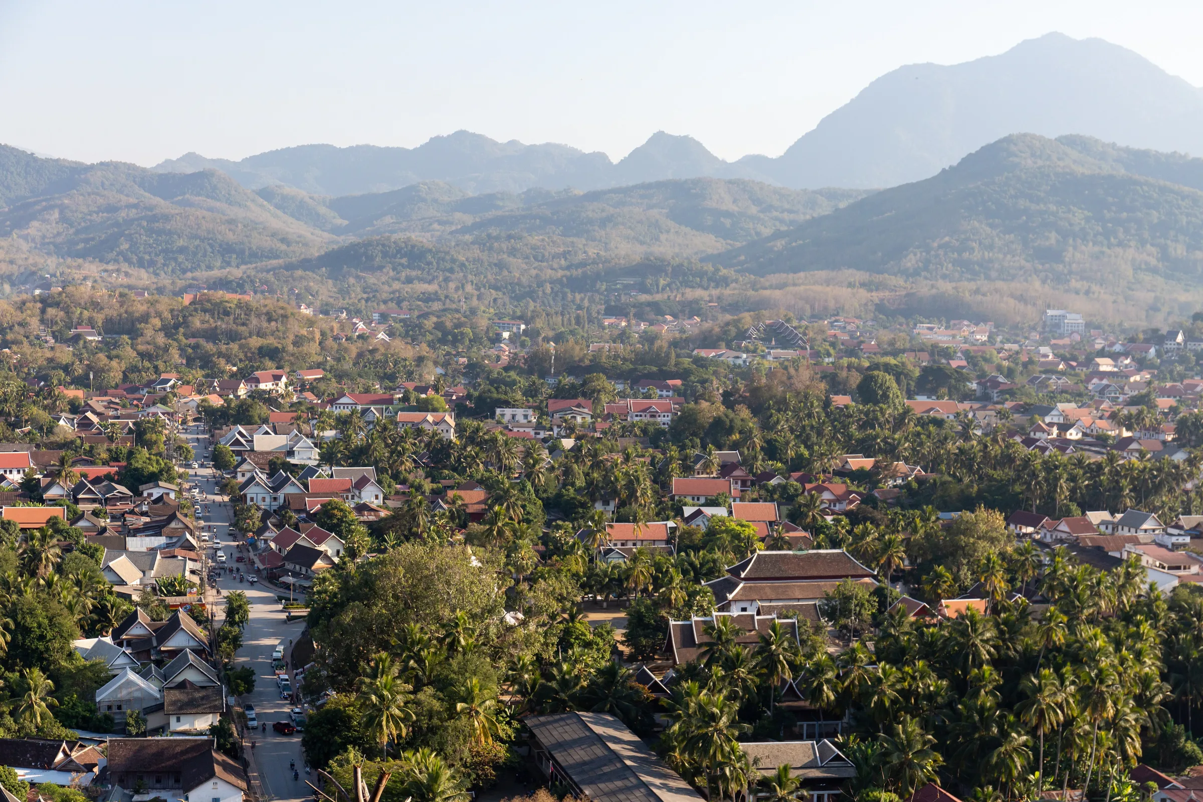
One image opens the whole town; the other returns the hill to street level.
Chapter 2 · Read the peninsula from above
Use Mount Phousi as a viewpoint, not a shortcut
Mount Phousi changes how the peninsula is understood. Christophe95’s 2018 photograph keeps the hill close to the wet street, where its wooded slope rises abruptly behind traffic and roofs. Balon Greyjoy’s 2019 view reverses the relationship: the town spreads below, framed by palms and distant mountains. Together they explain why the hill works as orientation rather than simply as a sunset backdrop.
The summit is reached by steps, and the experience depends on heat, rain, footwear, crowding and personal mobility. Those conditions are absent from the wide photograph. The view also compresses distances: a temple roof that appears nearby may still require descending, crossing a street and approaching through a separate entrance. WalkThere therefore does not draw a continuous virtual climb or publish an unverified step count.
The main chapter stays photo-led because a short street sequence near the base cannot establish summit access, stair condition or crowd management. Check the current entrance and any site instructions before climbing, carry water, and do not block narrow landings for photographs. Use the optional nearby sequence only to understand the base of the hill and its relationship to the surrounding streets.
Real-travel note
Expect stairs, humidity and limited shade. Check the current entrance and weather, carry water and allow descending visitors room on narrow sections.
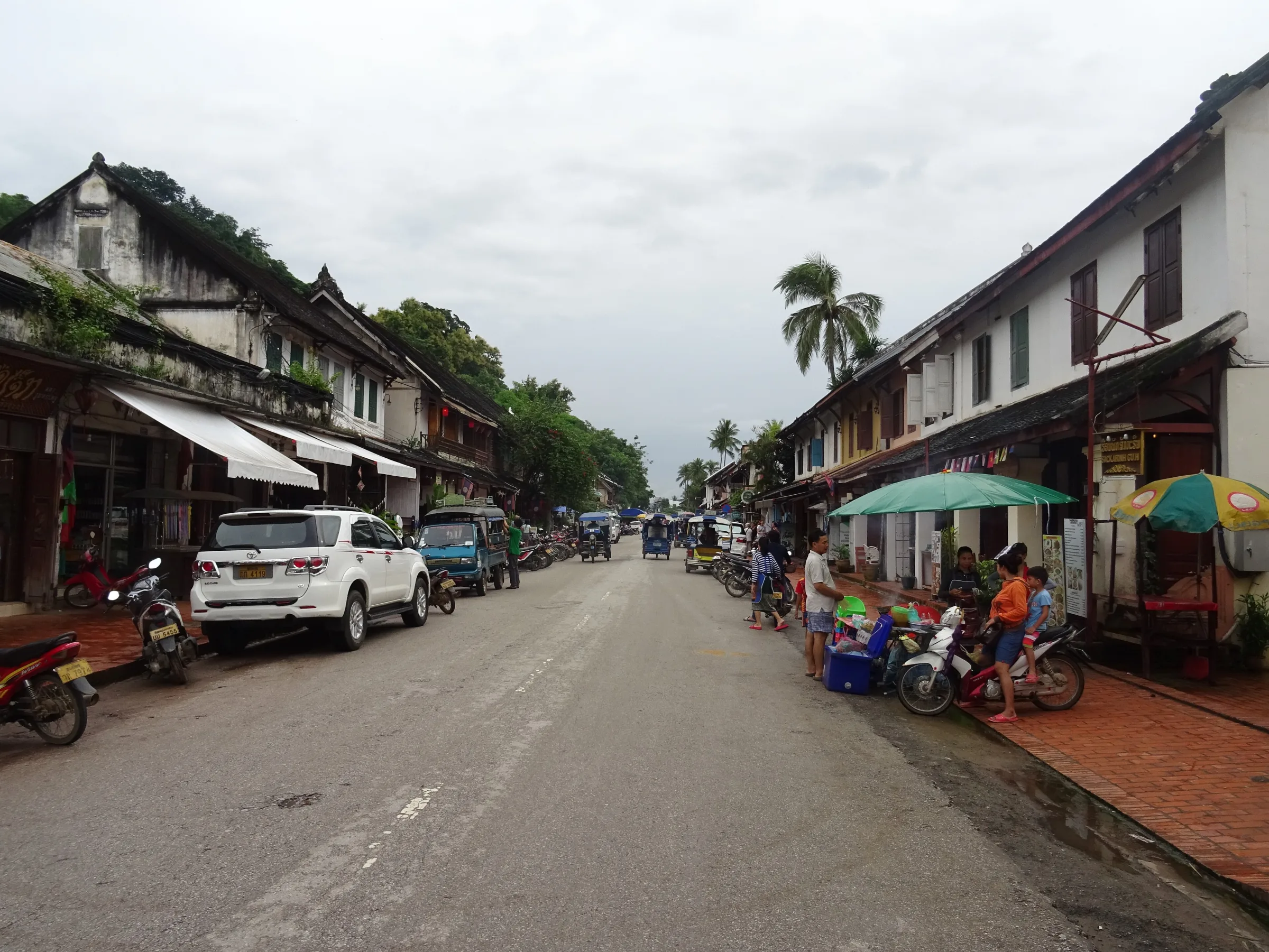
Traffic, roof edges, shutters, balconies and planting reveal an inhabited heritage street.
Chapter 3 · Heritage at street speed
Look past the postcard façades
Sisavangvong Road and its continuation through the old town make Luang Prabang’s architecture readable at walking speed. Christophe95’s 2018 frame includes tuk-tuks, cars, motorcycles, shops and families under deep roof edges. Balon Greyjoy’s 2019 photograph moves closer to shutters, balconies, plaster, timber and potted planting. Neither image represents a timeless street; their differences are part of the record.
UNESCO links the town’s significance to the fusion of traditional Lao architecture and nineteenth- and twentieth-century colonial-era urban structures. That statement is most useful here when it directs attention to scale and adaptation instead of reducing every building to a style label. Eaves create shade, narrow frontages meet the pavement, and active homes and businesses continually reshape how the heritage street is experienced.
The reviewed Mapillary starting view opens an archived provider sequence near the old-town street. Its available navigation is controlled by Mapillary, does not represent a reviewed route through every frame, and does not report current shops, road works or traffic. Keep entrances clear, ask before photographing people at close range, and use live navigation for a real visit. The two licensed photographs stay visible so the chapter still works without a third-party viewer.
Real-travel note
Share the narrow street with residents, deliveries and motorcycles. Keep doorways clear and check live traffic rather than relying on archived imagery.
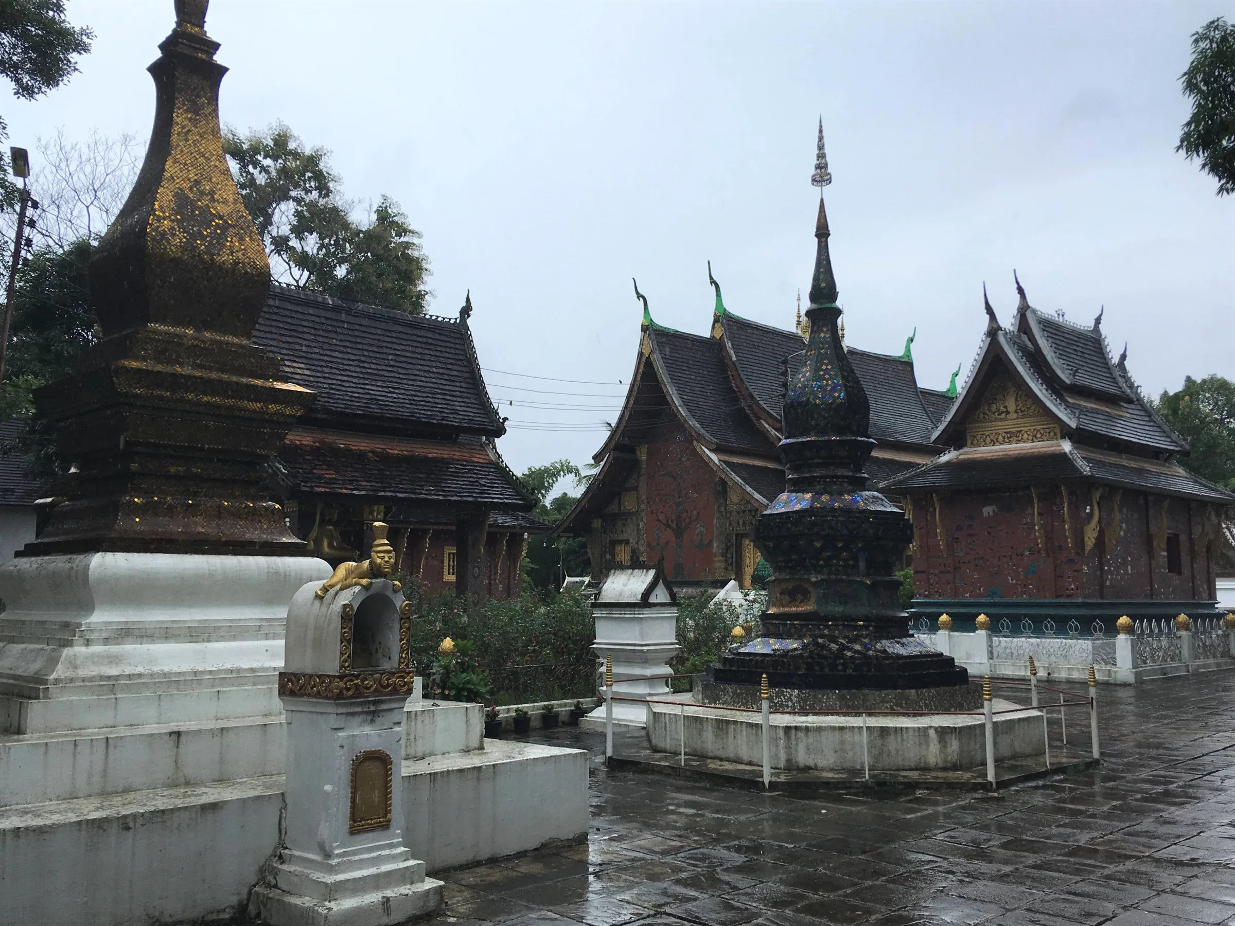
Two independent visits reveal different paths, light and weather inside the compound.
Chapter 4 · A living religious compound
Slow down inside Wat Xieng Thong
Wat Xieng Thong is not a single façade. Christophe95’s 2018 rainy photograph moves among stupas, chapels and the sim. Gerd Eichmann’s 2007 view places the low, layered temple roofs within a sunlit courtyard and palms. The eleven-year gap, different light and different paths through the compound make the pair more useful than a single polished hero image.
UNESCO explicitly names Wat Xieng Thong among Luang Prabang’s most notable religious structures and describes living Buddhist practice as part of the town’s heritage. That means the compound must be approached as a place of worship rather than an architectural display. Services, offerings, maintenance and visitor access can change what is appropriate to enter or photograph.
An optional street sequence near the public approach can help locate the compound within the peninsula, but it does not reveal interior rules or guarantee that every gate is open. Dress respectfully, keep voices low, follow posted instructions and avoid interrupting worship. Current temple guidance takes priority over both the 2007 and 2018 photographs, and WalkThere does not infer a route through sacred spaces from exterior imagery.
Real-travel note
Dress for an active Buddhist site, remove footwear where instructed, keep quiet and confirm photography rules before entering chapels.
A moving pirogue and an illuminated bank show two relationships between town and water.
Chapter 5 · The peninsula becomes visible
Finish where the Nam Khan meets the Mekong
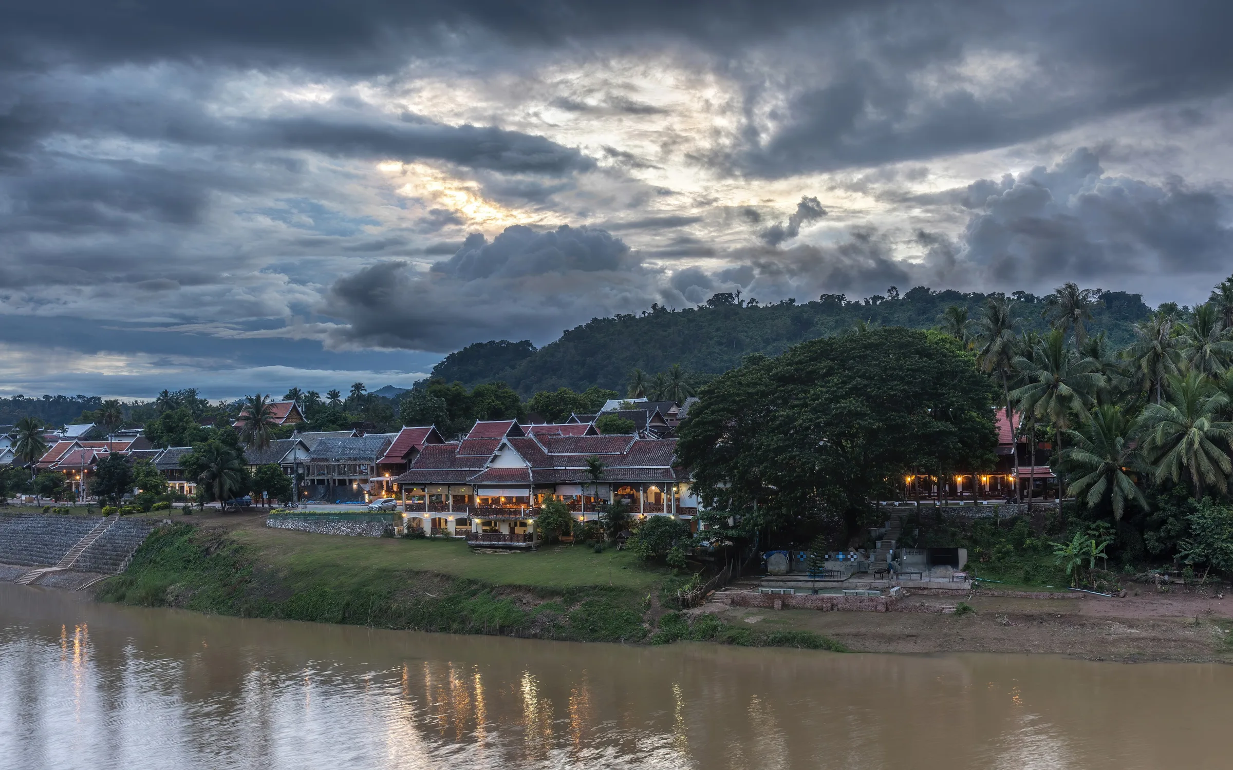
At the peninsula’s northern end, the relationship between town and water becomes direct. Basile Morin’s sunny 2023 photograph catches a pirogue moving from the Nam Khan toward the Mekong, with the meeting of differently coloured water visible around it. A second photograph made three days later looks back toward illuminated buildings beneath a stormy sunset. One records river movement; the other records the inhabited bank.
UNESCO’s description begins with this geography because the Mekong and Nam Khan are not decorative edges. They define the peninsula, shape views and connect Luang Prabang to wider river landscapes. Yet a photograph cannot establish water level, current, landing condition or whether a boat operator is running safely today. Seasonal change can be more important than the calm appearance of a single frame.
The optional short street sequence near the riverside remains land-based. It is not a live river camera and does not authorize access to a bank, jetty or boat. Stay behind barriers, use established paths, and check current local guidance before approaching water or arranging a crossing. The journey ends with two accountable photographs and an open horizon, not an instruction to enter the river landscape.
Real-travel note
River level, current and bank access change seasonally. Use established approaches and verify boat operators and weather locally.
5 reviewed experiences
Explore along the route
Step into the places along this journey. Choose a view independently of the story chapters. Free previews do not count toward chapter progress. Return to the journey above to continue through its stops.
Begin between the Royal Palace and Mount Phousi Short observation sequence
A short street sequence passes the palace grounds but cannot verify museum entry.
Captured on
Reviewed 2026-10-09 · Nearby viewpoint
Explore at your own pace; these views do not count toward chapter completion. Check each point's coverage note before navigating provider imagery. Availability may change.
Sources
- Town of Luang Prabang — UNESCO World Heritage Centre
- Luang Prabang Museum.jpg — Wikimedia Commons
- Royal Palace in Luang Prabang.jpg — Wikimedia Commons
- 20191212 Luang Prabang view Phousi Hill-11.jpg — Wikimedia Commons
- Mount Phou Si.jpg — Wikimedia Commons
- Sisavangvong Road 1.jpg — Wikimedia Commons
- 20191213 Sisavangvong Road building-1.jpg — Wikimedia Commons
- Wat Xieng Thong Luang Prabang.jpg — Wikimedia Commons
- Luang Prabang-Wat Xieng Thong-60-Sim-gje.jpg — Wikimedia Commons
- Pirogue running from the Nam Khan river to the Mekong a sunny day in Luang Prabang Laos.jpg — Wikimedia Commons
- Illuminated buildings on Nam Khan river bank with cloudy sky at sunset in Luang Prabang Laos.jpg — Wikimedia Commons


Your journey, remembered.
Explored 0 of 5 stops. Explore every stop to unlock your keepsake.
5 stops to your keepsakeExplore every stop to share or download your keepsake.