
London: from Westminster’s stone to the South Bank’s everyday spaces
Explore London: read an abbey doorway, cross the river in photographs, and follow music, small shops and an old power station along the Thames. Five chapters, fifteen credited photographs and optional dated local 360° scenes, with four extra discoveries along the way.
Begin the visual journeyPlan a real visit to London Westminster & South BankExplore 9 reviewed views along the routeGuided visual journey
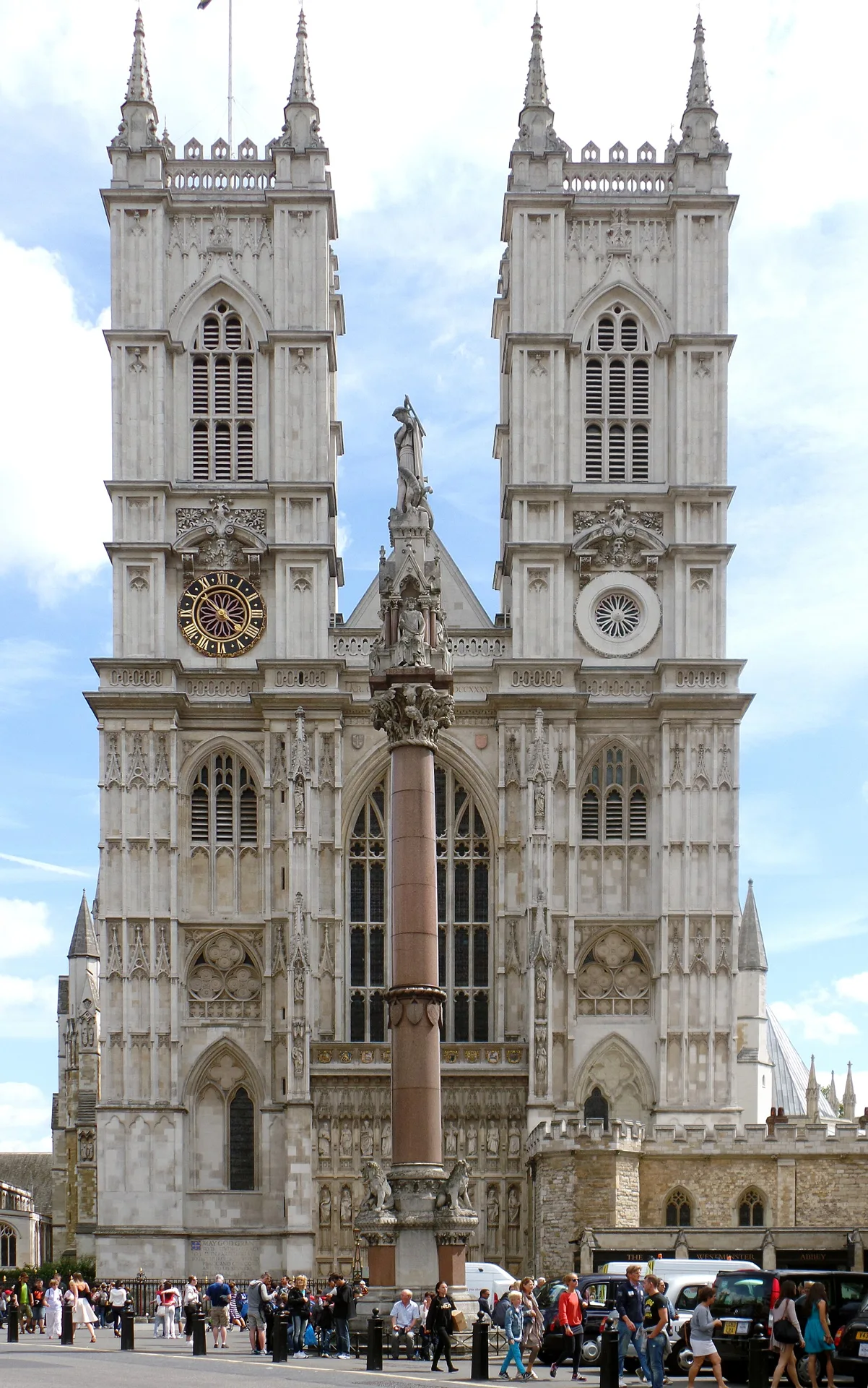
Westminster Abbey west front · Cody Logan · CC BY-SA 4.0 · Resized and converted to WebP
Reading mode
Place stories to read at your own pace
Use arrows or thumbnails to compare the wider setting, another viewpoint and a closer study; the photos have separate dates.
Chapter 1 · A doorway across time
Read Westminster Abbey from the pavement
Begin outside, where the Abbey’s tall front has to share your attention with trees, traffic and people waiting at its edge. In the broad photograph the towers pull the eye upwards, but the doorway study brings it back to hand-sized carving and repeated pointed arches. Try following one line of moulding all the way around the opening. From the pavement, details can merge into a textured surface; the separate close photograph makes it possible to pause over a single face.
The Abbey’s architectural history dates the main Gothic rebuilding to Henry III’s reign, beginning in 1245. Its own account also dates the ten modern martyr figures above the west entrance to 1998. The gallery’s four-figure detail is therefore a useful reminder that a historic front can keep acquiring new meanings. Compare the August 2014 west front and doorway photograph with the April 2011 figures. Their dates and positions differ; they are three studies of the exterior, rather than successive steps through a door.
The July 2022 local panorama stays in the street-side setting. Turn towards the building, compare the nearby reviewed positions and return, then notice how the road changes the distance between you and the stone. Parliament Square offers a separate discovery about memorials in public space. Admission, services and the present visitor entrance belong to the Abbey’s current arrangements; the next chapter moves to the bridge through an editorial transition.
Real-travel note
July 2022 exterior street fragment; Abbey admission and current entrances require separate planning.
Use arrows or thumbnails to compare the wider setting, another viewpoint and a closer study; the photos have separate dates.
Chapter 2 · Two sides of a crossing
Compare Westminster Bridge from road, river and lion
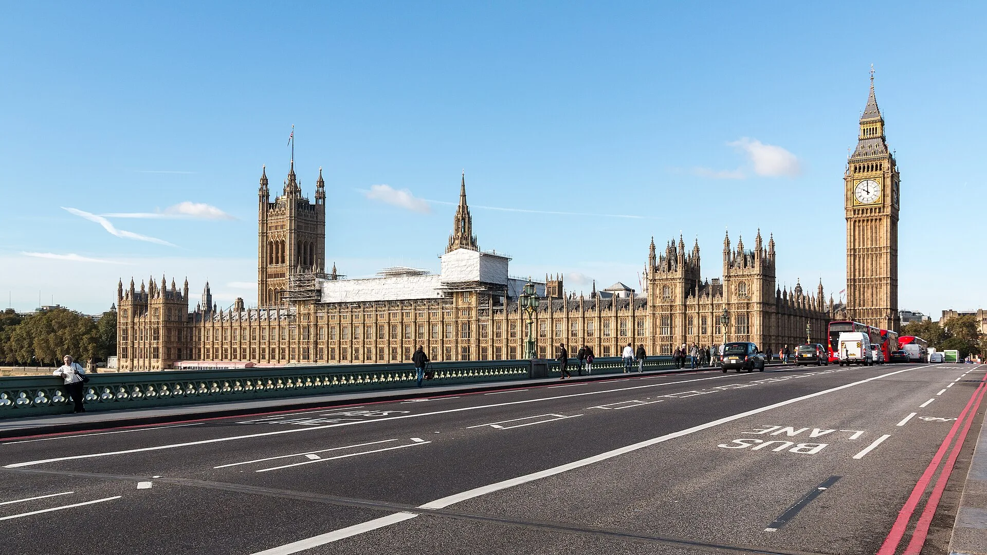
The bridge offers a long view, but its width is easier to understand when the photographs disagree about distance. One frame puts the Palace of Westminster beside the road; another watches a bus pass over the green ironwork from a separate riverside position. The lion detail is closer again. Look for the difference between the bridge’s structural rhythm and the decorative rhythm of lamps and parapets. The water opens the view while moving traffic repeatedly interrupts it.
Historic England’s listing dates the present road bridge to 1862 and identifies Thomas Page as its designer. Its description of cast iron, granite supports and Gothic detailing helps explain why the bridge sits comfortably beside the palace without being part of it. The gallery uses photographs from May 2014 and October 2016. Read the vehicles and riverside activity as details of those days. The separate July 2025 panorama records a later moment, after the period of Elizabeth Tower conservation described by Parliament.
Open the local sequence and look towards the tower, then turn along the river before comparing the reviewed positions. The camera is in a road/bridge setting and vehicles may obscure the first view; rotation is useful here. This small fragment does not establish a pedestrian crossing or a complete bridge traverse. On a real visit, use current pavements and crossings, then give yourself time to notice how the lower river walk and upper bridge connect at different levels.
Real-travel note
July 2025 bridge-area imagery; traffic can obscure views. Follow current pedestrian facilities on a real visit.
Compare the winter façade, independent elevated terrace view and February 2024 setting.
Chapter 3 · A cultural building meets the city
Look around Royal Festival Hall before a performance
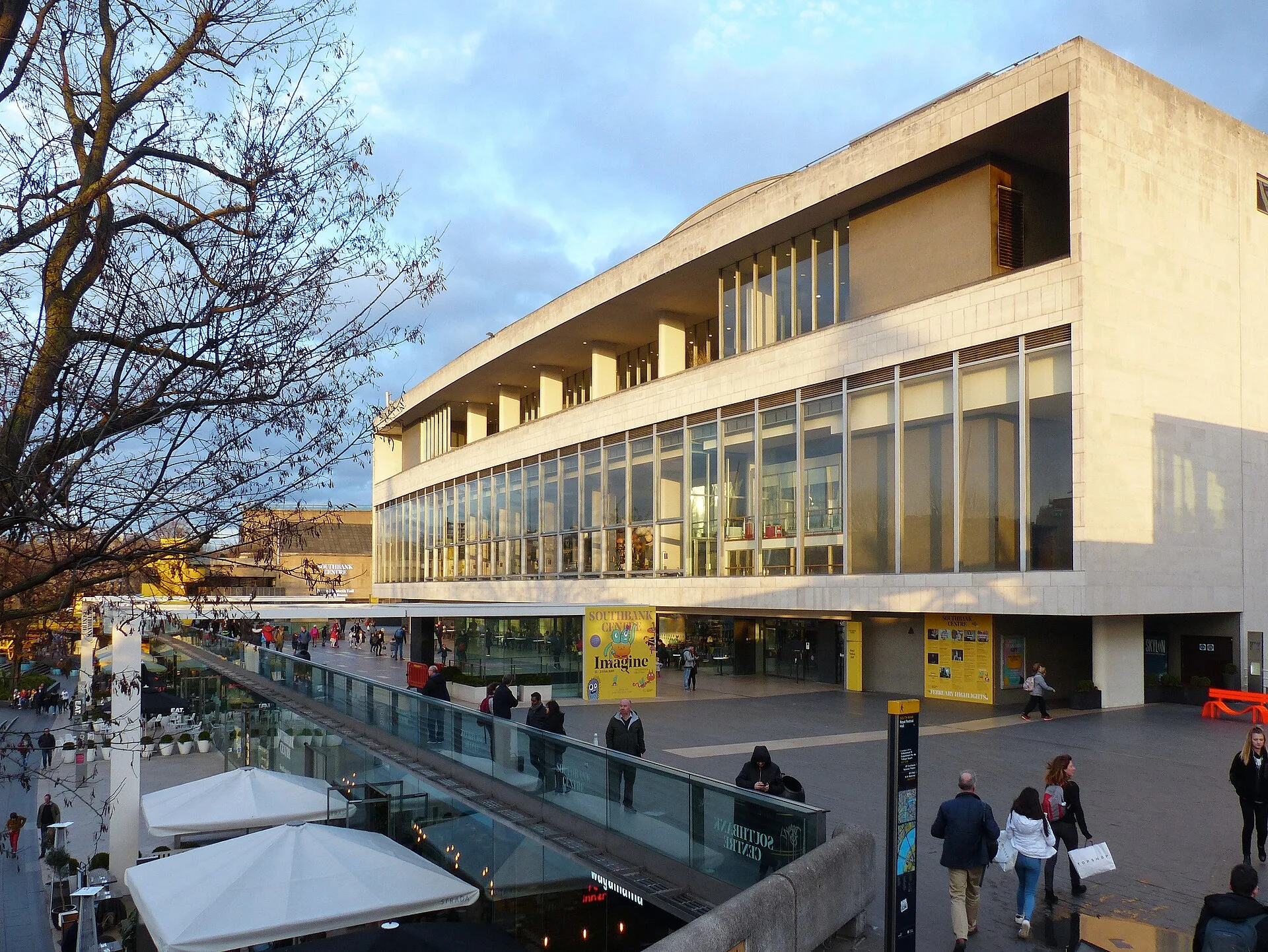
After the Abbey’s pointed arches, the hall asks you to notice long horizontal edges. Its glazing, blank walls and terraces produce different faces depending on where you stand. Start with the winter sunshine photograph and follow the line where the façade meets the open space. Switch to the view taken outside the Hayward Gallery: the change of level brings another wall and roofline into view. The February 2024 photograph places the building back among trees and people.
Southbank Centre’s history connects Royal Festival Hall with the 1951 Festival of Britain. Its venue information also describes the later Open Foyer policy. These accounts make the outside worth studying in its own right: a concert hall has a public life before anyone takes a seat in the auditorium. The photographs from February and May 2019 and February 2024 show different approaches, not an interior tour. The terrace-side frame is an independent elevated position, so its line of sight should not be read as a step-free route from the river.
Use the dated local 360° fragment to compare the hall with the surrounding paths and buildings, moving between the reviewed positions and back. Keep the distinction between the riverside, upper terraces and street approaches in mind. The Undercroft discovery nearby changes the question from a designed cultural venue to a space adopted by its users. For a performance or a specific accessible entrance, use Southbank Centre’s current venue and access maps.
Real-travel note
Local July 2022 exterior imagery; terrace photographs and street panoramas are separate viewpoints.
Use arrows or thumbnails to compare the wider setting, another viewpoint and a closer study; the photos have separate dates.
Chapter 4 · A smaller scale beside the water
Slow down at Gabriel’s Wharf
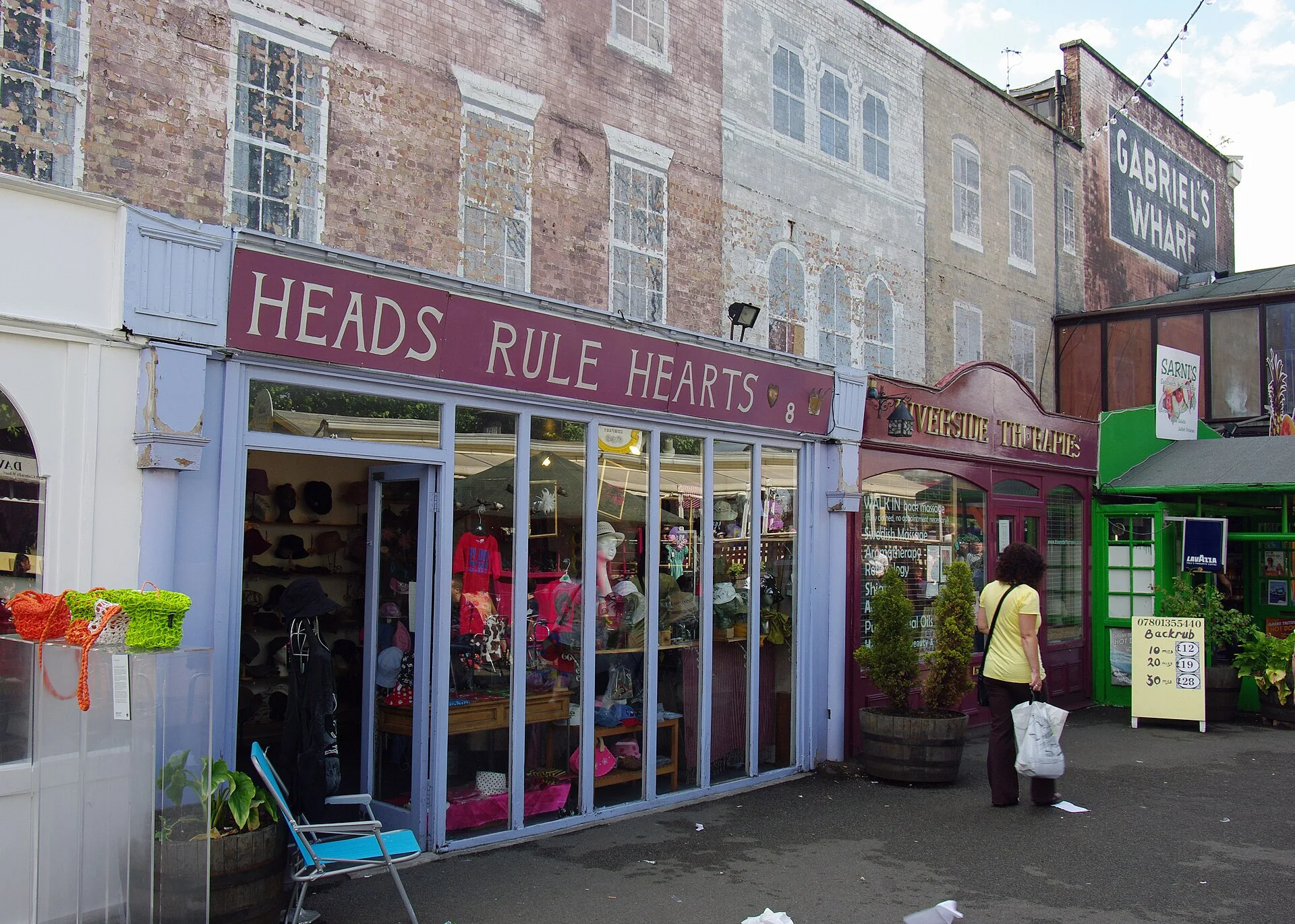
Here the river journey becomes smaller and more uneven. A shop window, a painted sign and a gap between low units can hold your attention for as long as a monumental façade. In the July 2009 photograph, look at how each shop makes an identity within a repeated frontage. The January 2016 courtyard view steps back to show how the units gather around open ground. Signs and tenants are details of the photographs’ dates, rather than recommendations for businesses trading today.
Coin Street describes Gabriel’s Wharf as a former warehouse and construction compound that opened to the public in 1988, with designer studios in adapted factory-built garage units. That history gives the modest buildings a useful place in the sequence. Their scale offers a different kind of encounter from the Abbey or concert hall: you can read a whole frontage without tilting your head. The September 2004 river photograph adds boats and the opposite bank, showing how a small inland-looking space still belongs to a much wider river setting.
Coin Street’s transition statement records the previous form through 27 September 2026 and plans a new meanwhile use. Its details need current checking. The July 2014 local panorama is another dated viewpoint. Compare the reviewed positions, turn between the river and the wharf, and return to your starting scene. Individual shops, garden edges and open spaces can be partly hidden depending on the camera’s position. Oxo Tower is a separate discovery further along, where workshops and homes share a much larger building. Real connections, current businesses and any closures need present information; the online chapter order supplies no surveyed continuous path.
Read further: Gabriel’s Wharf: the temporary shops that became familiarReal-travel note
Historical imagery only. Coin Street records the previous form through 27 September 2026 and plans a new meanwhile use; old shop signs are not current business listings.
Compare the 2015 bridge view with the extension and exterior entrance in January 2024. These dates and viewpoints are separate.
Chapter 5 · An industrial shape stays in the skyline
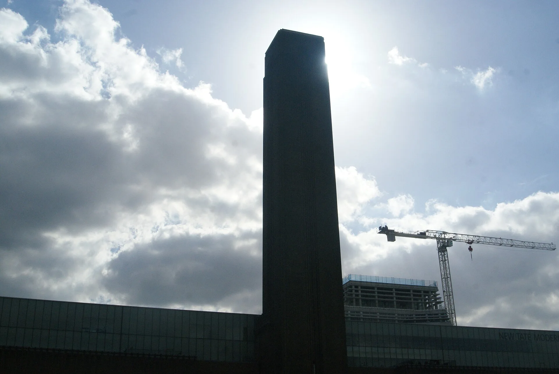
Find the power station inside Tate Modern’s exterior
The chimney makes a strong final landmark, but the gallery gives you three ways to resist treating the building as a single silhouette. The September 2015 view from Millennium Bridge connects the vertical shaft with the river approach. A January 2024 photograph studies the newer extension’s brick surface and sloping form. Another from the same month pauses at an exterior entrance. Switch between them and ask how brick can make both a broad, heavy wall and a more finely patterned skin.
Tate’s own project archive records the conversion of Bankside Power Station and the opening of Tate Modern in May 2000. The photographs let you read that change through the outside: retained industrial scale, later additions and a threshold used by visitors. They do not form a connected tour through the turbine hall or collection. The bridge photograph is also an independent viewpoint, separate from the local panorama beside the building.
The July 2014 fragment looks towards the original power-station exterior from the surrounding open space. Trees can screen parts of the brickwork, so turn slowly and compare the nearby positions before returning. This camera date predates the newer extension shown in the 2024 gallery. Millennium Bridge offers one more independent discovery, allowing the river and St Paul’s to enter the picture again. Plan any gallery visit through Tate’s current information; this journey ends with the building’s relationship to its neighbourhood.
Real-travel note
July 2014 exterior fragment predating the newer extension; gallery, entrance and bridge photos use separate dates and positions.
9 reviewed experiences
Explore along the route
Step into the places along this journey. Choose a view independently of the story chapters. Free previews do not count toward chapter progress. Return to the journey above to continue through its stops.
Read Westminster Abbey from the pavement Short observation sequence
July 2022: three street-side exterior positions and return at Westminster Abbey. Rotate to compare the façade and road; Abbey rooms, services and admission are separate.
Reviewed 2026-10-27 · Nearby viewpoint
Explore at your own pace; these views do not count toward chapter completion. Check each point's coverage note before navigating provider imagery. Availability may change.
Sources
- Architecture of Westminster Abbey — Westminster Abbey
- Visit the Abbey — Westminster Abbey
- Modern martyrs above the west entrance — Westminster Abbey
- Westminster Bridge listing — Historic England
- Conservation of Elizabeth Tower and Big Ben — UK Parliament
- Parliament Square Garden — Greater London Authority
- Southbank Centre history — Southbank Centre
- Royal Festival Hall — Southbank Centre
- Access maps and floor plans — Southbank Centre
- Undercroft Skate Space — Southbank Centre
- Gabriel’s Wharf: a new meanwhile use — Coin Street
- Development of Gabriel’s Wharf — Coin Street
- Oxo Tower Wharf development and history — Coin Street
- Tate Modern Project archive: administrative history — Tate Archive
- Visit Tate Modern — Tate
- Bridges: Millennium Bridge — City of London
- Westminster Abbey, west facade, August 2014.jpg — Cody Logan · Wikimedia Commons
- Abadía de Westminster, Londres, Inglaterra, 2014-08-07, DD 025.JPG — Diego Delso · Wikimedia Commons
- Westminster Abbey C20th martyrs.jpg — photographer- T.Taylor · Wikimedia Commons
- London, Palace of Westminster -- 2016 -- 4800.jpg — Dietmar Rabich · Wikimedia Commons
- London MMB »0Y0 Westminster Bridge.jpg — mattbuck (category) · Wikimedia Commons
- London, Westminster Bridge -- 2016 -- 4622.jpg — Dietmar Rabich · Wikimedia Commons
- London's Royal Festival Hall Bathed In Winter Sunshine. Geograph.org.uk - 7112890-edit.jpg — Geograph project user: Ruth Sharville, edited by MenkinAlRire · Wikimedia Commons
- Royal Festival Hall as seen from outside the Hayward Gallery-edit.jpg — Ethan Doyle White, edited by MenkinAlRire · Wikimedia Commons
- Royal Festival Hall - geograph.org.uk - 8006281.jpg — N Chadwick · Wikimedia Commons
- Gabriels Wharf Shops.jpg — MikeStnly · Wikimedia Commons
- Gabriel's Wharf, London - geograph.org.uk - 4789398.jpg — Alan Hunt · Wikimedia Commons
- Gabriels-Wharf-20040918-022.jpg — Gary Houston · Wikimedia Commons
- View of the Tate Modern chimney from the Millennium Bridge - geograph.org.uk - 4675959.jpg — Robert Lamb · Wikimedia Commons
- Exterior of Tate Modern (January 2024) 02.jpg — DiscoA340 · Wikimedia Commons
- Exterior of Tate Modern (January 2024) 07.jpg — DiscoA340 · Wikimedia Commons
- Parliament Square (00769p).jpg — Rhododendrites · Wikimedia Commons
- Skatepark, Southbank Centre - geograph.org.uk - 7424377.jpg — Bryn Holmes · Wikimedia Commons
- Looking up at OXO Tower, 2017-05-27.jpg — Lewis Hulbert · Wikimedia Commons
- Millennium Bridge London.jpg — Telemaque MySon · Wikimedia Commons


Your journey, remembered.
Explored 0 of 5 stops. Explore every stop to unlock your keepsake.
5 stops to your keepsakeExplore every stop to share or download your keepsake.
Plan time beside the Thames
Choose the places you want to see, then arrange real connections and venue visits separately.
Official sources checked:
Allow time for river levels and crossings
Half a day outdoors is a planning estimate, not a measured walking duration. Busy bridge pavements, roads and raised terraces interrupt the river edge. Use current pedestrian facilities and Southbank Centre’s access maps for the approach you need.
Keep three institutions separate
Abbey visits, concert performances and Tate gallery visits have different arrangements. The panoramas remain outside and cannot substitute for booking or current entrance information.
Expect changes since the camera passed
These local scenes date from 2014 to 2025; photographs include other dates. Tate’s 2014 panorama predates its newer extension. Shop signs, temporary displays, works and entrances can change.