
Fushimi Inari: from the gate into the sacred mountain
A photo-led walking route through five Fushimi Inari Taisha stops, from the entrance gate and torii corridor to the upper mountain shrine.
Explore 4 reviewed views along the routeGuided visual journey
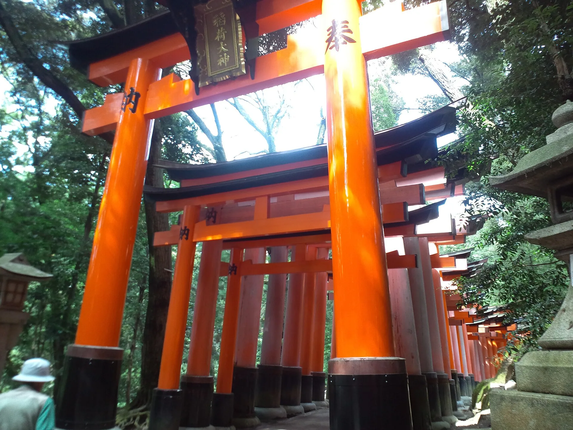
Closely spaced vermilion gates of Fushimi Inari’s Senbon Torii · Yanajin33 · CC BY-SA 3.0
Reading mode
Place stories to read at your own pace
Chapter 1 · Enter the precinct
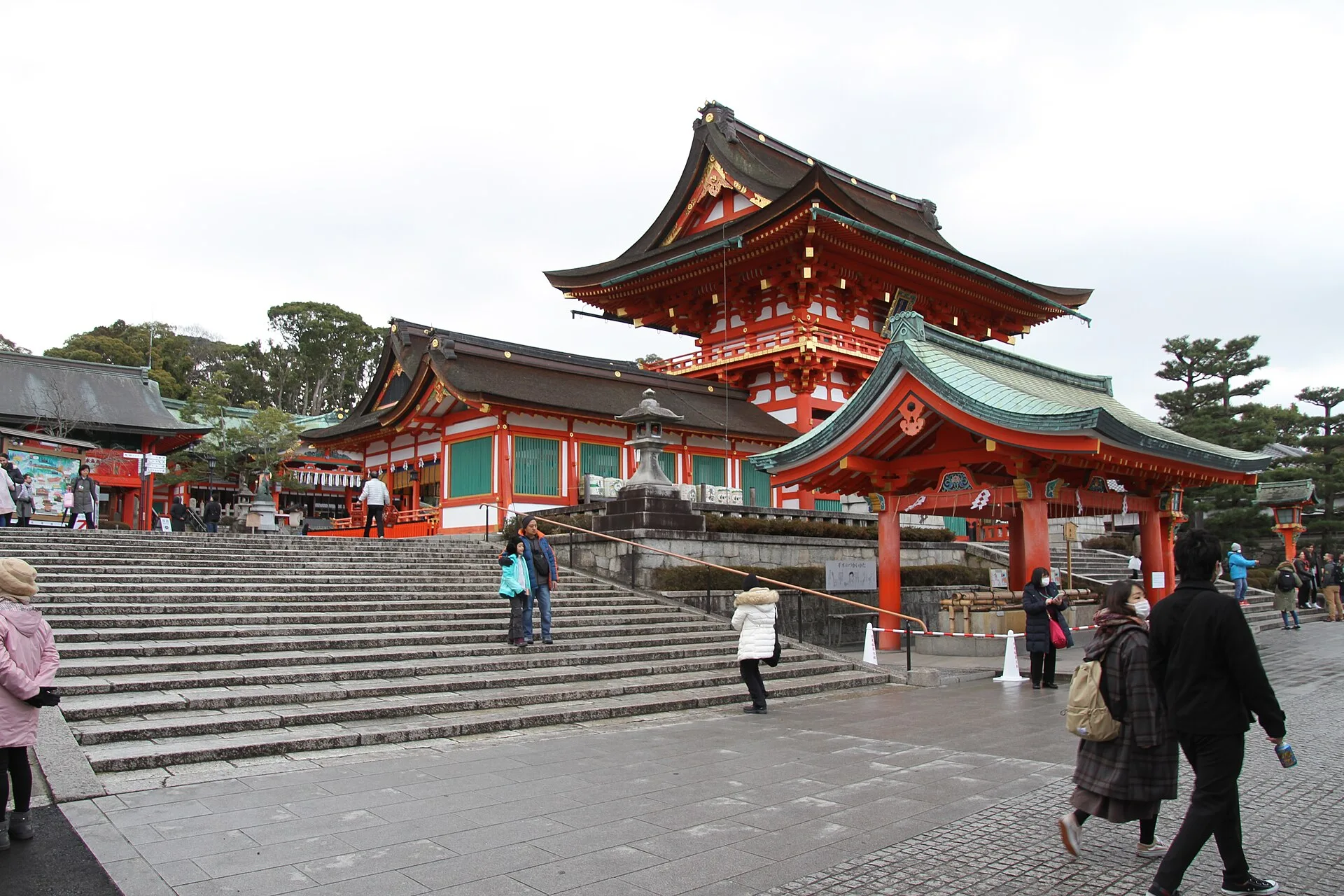
The gate before the mountain
The first stop is not a tunnel of vermilion gates. It is the large Rōmon at the front of Fushimi Inari Taisha, where the movement of visitors meets an active place of worship. In this February 2020 photograph, the broad stair and gate frame people arriving from different directions. The image can help you recognise the entrance, but it cannot tell you what the crowds, barriers or ceremonies will be like today.
The shrine dates the present Rōmon to a 1589 donation by Toyotomi Hideyoshi. Its account also describes a story that Hideyoshi promised to donate the gate while praying for his mother's recovery, and says the historical document confirming that pledge was found during repairs. This is a more specific history than a generic claim that every red gate on the mountain is the same age. The mountain and shrine have changed over many centuries; the present pilgrimage is also a living practice.
Pause before following the chapter order. The main hall and other worship areas sit beyond this gate, and people here may be praying rather than sightseeing. Keep access clear, follow posted rules and consider whether you have the time and stamina for the climb ahead. This journey uses photographs taken in different years, not a continuous recording of one ascent. The next image jumps farther into the precinct, to the famous donated torii corridor.
Real-travel note
JR Inari Station is beside the shrine approach; Keihan Fushimi Inari Station is a short walk away. Check current trains and signs. Make space for worshippers.
Chapter 2 · Donated gates
Inside the Senbon Torii
The gates bring the mountain down to the scale of a person's shoulders. In this July 2012 photograph, one vermilion frame fills much of the view while many others recede behind it. It is easy to see why a visitor remembers the rhythm of light and shadow more vividly than a single gate. It is also easy to overlook the people who use this corridor for prayer, maintenance and ordinary passage.
The shrine explains that donating a torii became a way to express prayers and thanks, a practice that spread from the Edo period onward. “Senbon” evokes a thousand, but this photograph cannot count every gate on the mountain, establish their ages or tell you which dedication is current. The inscriptions and differing states of the wood matter: they make the view a record of successive offerings rather than one historical installation built all at once.
This is a particularly narrow and popular section. The shrine asks visitors not to block paths for photography; a long photo session in the centre of the corridor would make the experience worse for everyone. Move with the flow, give way to worshippers, and use the photograph to decide whether the atmosphere appeals to you. The next stop, Okusha Hōhaisho, is reached beyond the two famous torii paths, but no frame-by-frame walk between them is available in this guide.
Real-travel note
Expect a confined passage and variable crowds. Do not stop in the middle of the torii corridor for a staged photograph.
Chapter 3 · A place to pray
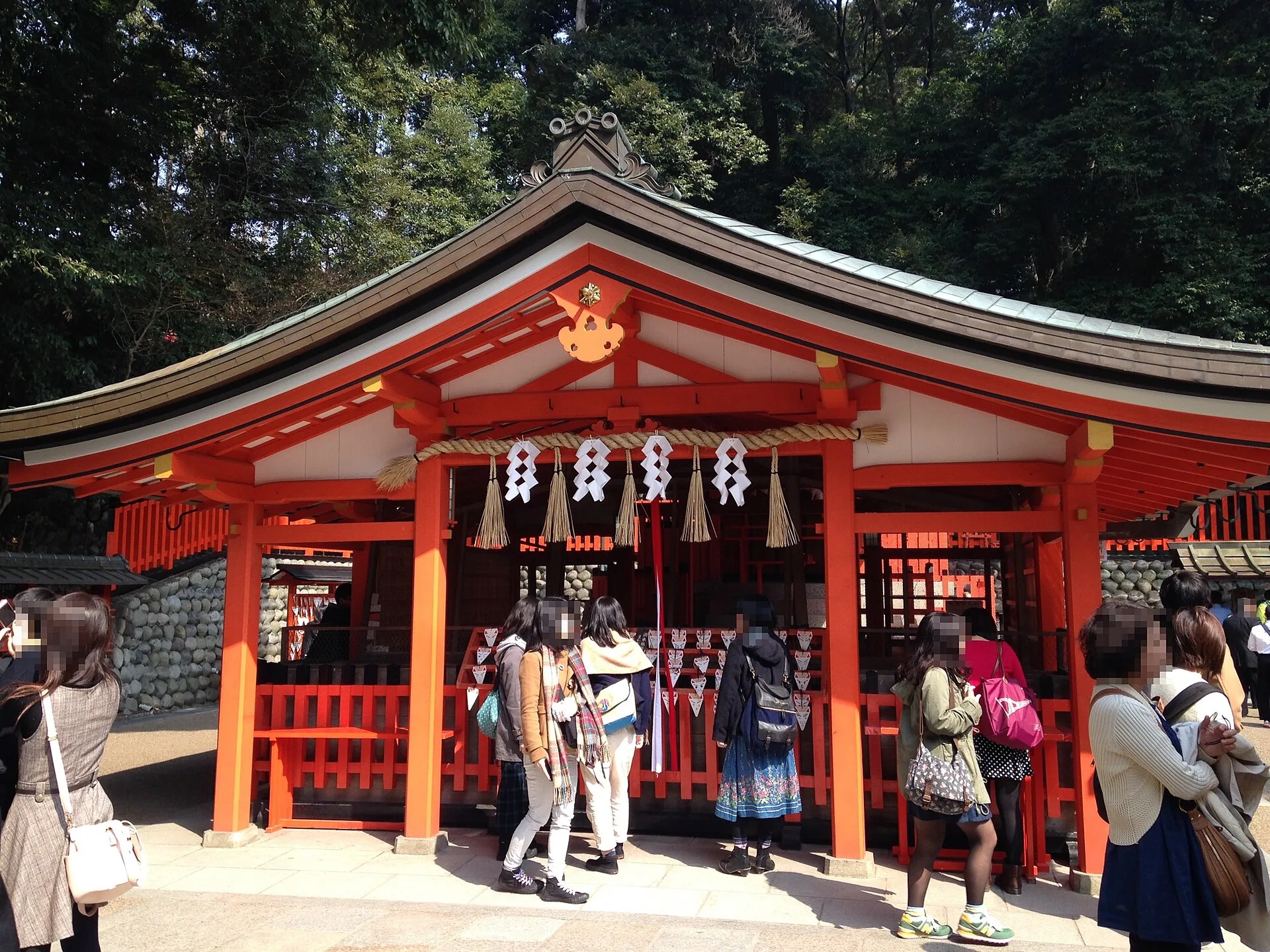
Beyond the gates at Okusha
The torii corridor opens into a different kind of pause. The March 2014 image shows the buildings and visitors at Okusha Hōhaisho, sometimes called the inner shrine prayer place. The picture includes people rather than a cleared architectural study. That is useful context: this is not simply a photo stop on the way up the hill. The shrine says it stands at the end of the Senbon Torii and is where people pray toward the three peaks of Inariyama.
One of the stories associated with this stop is the “omokaru” stone. According to the shrine's explanation, a person makes a wish, lifts a stone lantern top, and compares its felt weight with what they expected: lighter is taken as an encouraging sign. This is a devotional custom and local interpretation, not a measurable prediction that a wish will come true. If you are interested, observe how visitors approach the place before joining in; if not, there is no need to treat another person's prayer as a spectacle.
From here, the choice becomes more substantial. You can return after the lower shrine experience or continue uphill toward Yotsutsuji. The five chapter images were taken in separate years and cannot verify the present path surface or any temporary closure. Check current shrine signs and allow more time than a quick photo circuit if you intend to climb. The next frame skips a long ascent and opens onto a view over Kyoto.
Real-travel note
Okusha is an active worship area. Follow local etiquette; treat the stone custom as a tradition, not a guarantee.
Chapter 4 · The city opens up
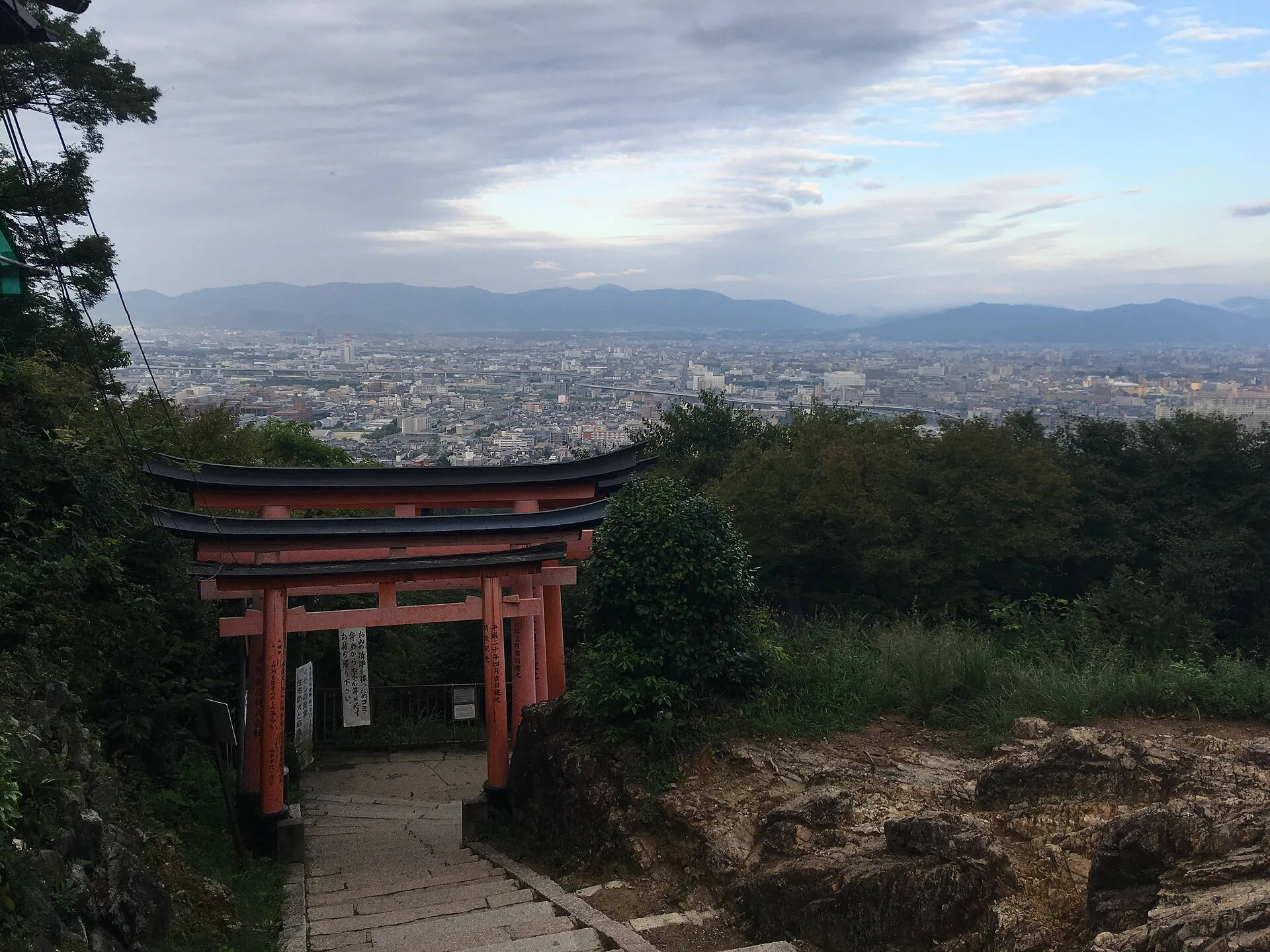
A pause at Yotsutsuji
After the tight view inside the gates, the fourth photograph opens outward. Kyoto spreads across the horizon, while a torii and steps remain in the foreground. The Commons file identifies this September 2018 view as from Mount Inari's Yotsutsuji area. It is a useful reminder that this ascent is not only a corridor of gates: the mountain repeatedly changes the scale of what you can see. Weather, haze, foliage and crowds will change the view on a different day.
Kyoto City's tourism guide uses Yotsutsuji as a junction on a beginner trekking route from Fushimi Inari through the mountain. A junction means a decision, not a promise that every branch is the same length or difficulty. Our chapter order turns toward the upper sacred route, but the photograph does not survey the branches or supply turn-by-turn directions. Read the current signs before choosing whether to continue, and keep enough time and energy to descend safely.
It is tempting to treat the viewpoint as a finish line because it delivers the broadest city scene in this set of photographs. Yet the mountain's highest shrine lies beyond it. If you mainly want the gates and a sense of elevation, this could be a satisfying point to reconsider the climb. If you continue, expect a quieter emphasis on worship and stone shrines rather than a bigger skyline. The last photograph is deliberately of a summit altar, not a promised panoramic reward.
Real-travel note
Yotsutsuji is a route decision. Check current junction signs, daylight, weather and your ability to descend before continuing.
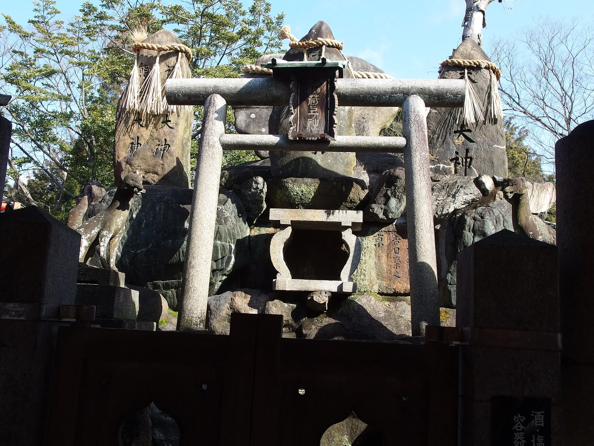
Chapter 5 · Upper Inariyama
The summit is a shrine, not just a view
The final frame is deliberately less postcard-like than the viewpoint below. Stone lanterns and the small sacred setting at the summit fill this March 2014 photograph. The file identifies it as the summit of Mount Inariyama. It shows why an ascent here is not only a search for city scenery: the upper mountain is part of the shrine itself. The current appearance may differ, and one photograph cannot identify every altar or path branch around it.
The shrine describes Inariyama as a 233-metre mountain with three peaks and many worship stones. It names Ichinomine, or Kamisha Shinden, as the highest point, associated with Suehiro Ōkami. These are religious names and places within a living tradition. Treat them with the same care you would give a main hall: make room for worshippers and avoid turning a quiet prayer spot into a blocked photo queue. The shrine's visitor rules also ask people to keep to permitted areas and not eat outside rest spaces.
This page ends here, but it does not tell you which trail to take down, what is open today or how long your own ascent will take. The five dated photographs introduce distinct moments rather than a navigable video route. If you decide to go, use current shrine information and a live map, wear shoes suitable for steps and slopes, and make the descent part of the plan. If you decide the lower precinct is enough, you have not “failed” the journey: the choice is the point of previewing the place.
Real-travel note
The summit is a worship place. Allow for the descent; check current access, weather and light. The shrine lists the mountain height as 233 metres.
4 reviewed experiences
Explore along the route
Step into the places along this journey. Choose a view independently of the story chapters.
Explore at your own pace; these views do not count toward chapter completion. Short sequences cover only the reviewed section. Imagery availability may change.
Sources
- Rōmon Gate — Fushimi Inari Taisha
- Senbon Torii — Fushimi Inari Taisha
- Okusha Hōhaisho — Fushimi Inari Taisha
- Inariyama — Fushimi Inari Taisha
- Ichinomine — Fushimi Inari Taisha
- Requests to Visitors — Fushimi Inari Taisha
- Trail Running and Trekking: Beginners Course — Kyoto City Official Travel Guide
- Comfortable Access to Fushimi Inari Taisha Shrine — Kyoto City Official Travel Guide
- Fushimi Inari Taisha Romon — Wikimedia Commons
- Romon, Fushimi Inari-taisha (location reference) — Wikimedia Commons
- Fushimi Inari Senbon Torii — Wikimedia Commons
- Okusha-Hohaijo of Fushimi Inari Grand Shrine — Wikimedia Commons
- View of Kyoto from Mount Inari — Wikimedia Commons
- Summit of Mount Inariyama at Fushimi Inari Shrine — Wikimedia Commons


.jpg)
Your journey, remembered.
The keepsake unlocks when you reach this section.