
Istanbul: from the old racecourse to the Golden Horn
Explore Istanbul’s historic peninsula in five photo-rich chapters, from Sultanahmet to Eminönü. Compare three photographs at every stop, seven local Google street-view sequences and two independent 360° panoramas.
Begin the visual journeyPlan a real visit to Istanbul Historic PeninsulaExplore 9 reviewed views along the routeGuided visual journey
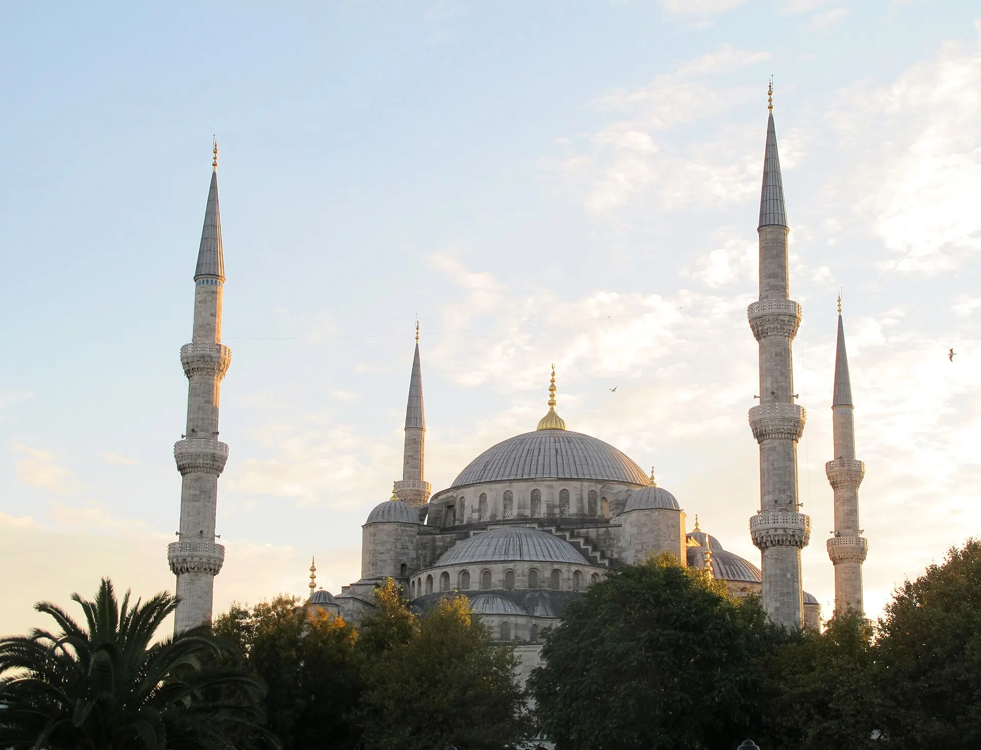
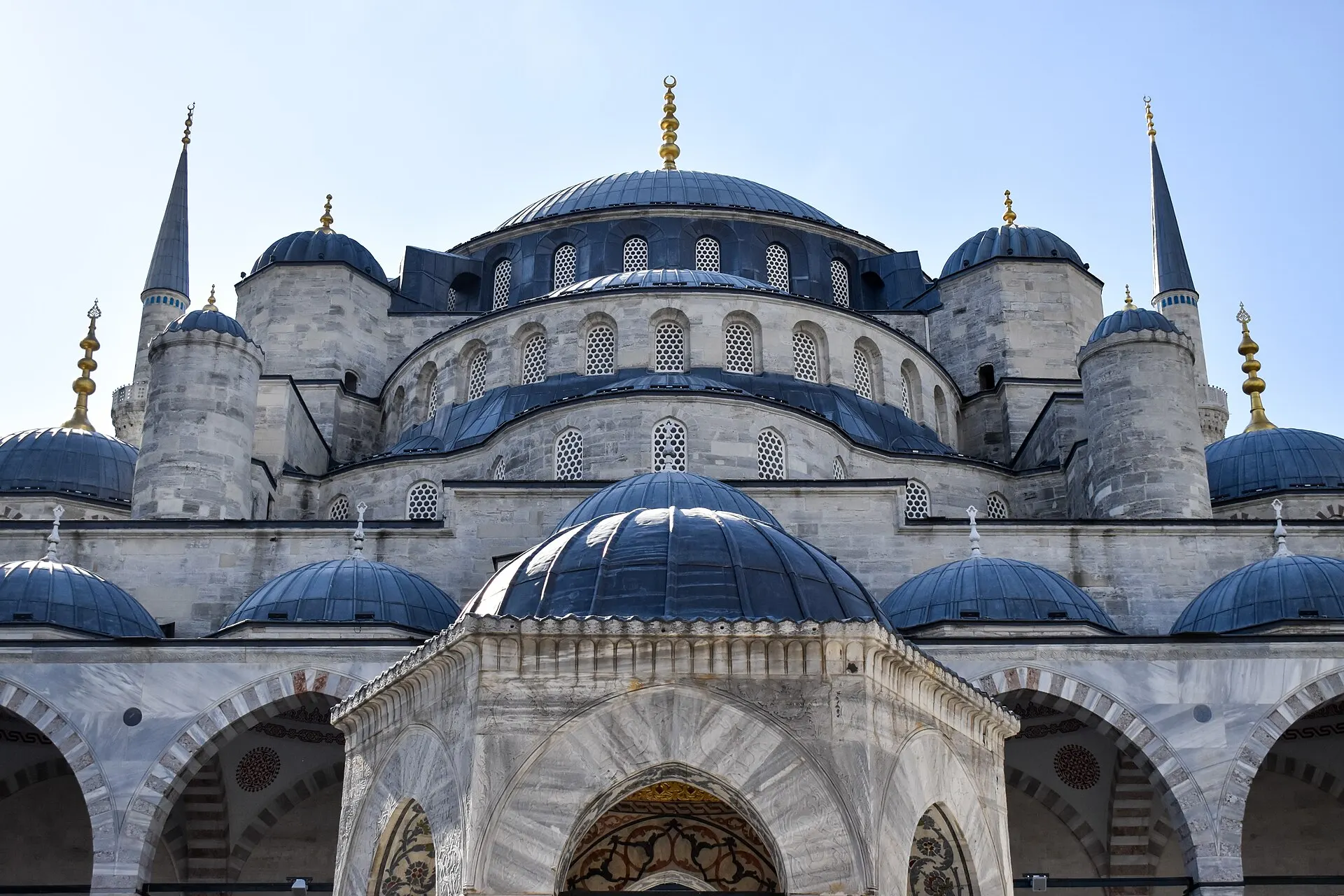
Domes and minarets of the Blue Mosque · Acediscovery · CC BY 4.0 · Resized and converted to WebP
Reading mode
Place stories to read at your own pace
Compare a wider setting, architectural detail and changing conditions.
Chapter 1 · A long open room
Read the old racecourse through its surviving monuments
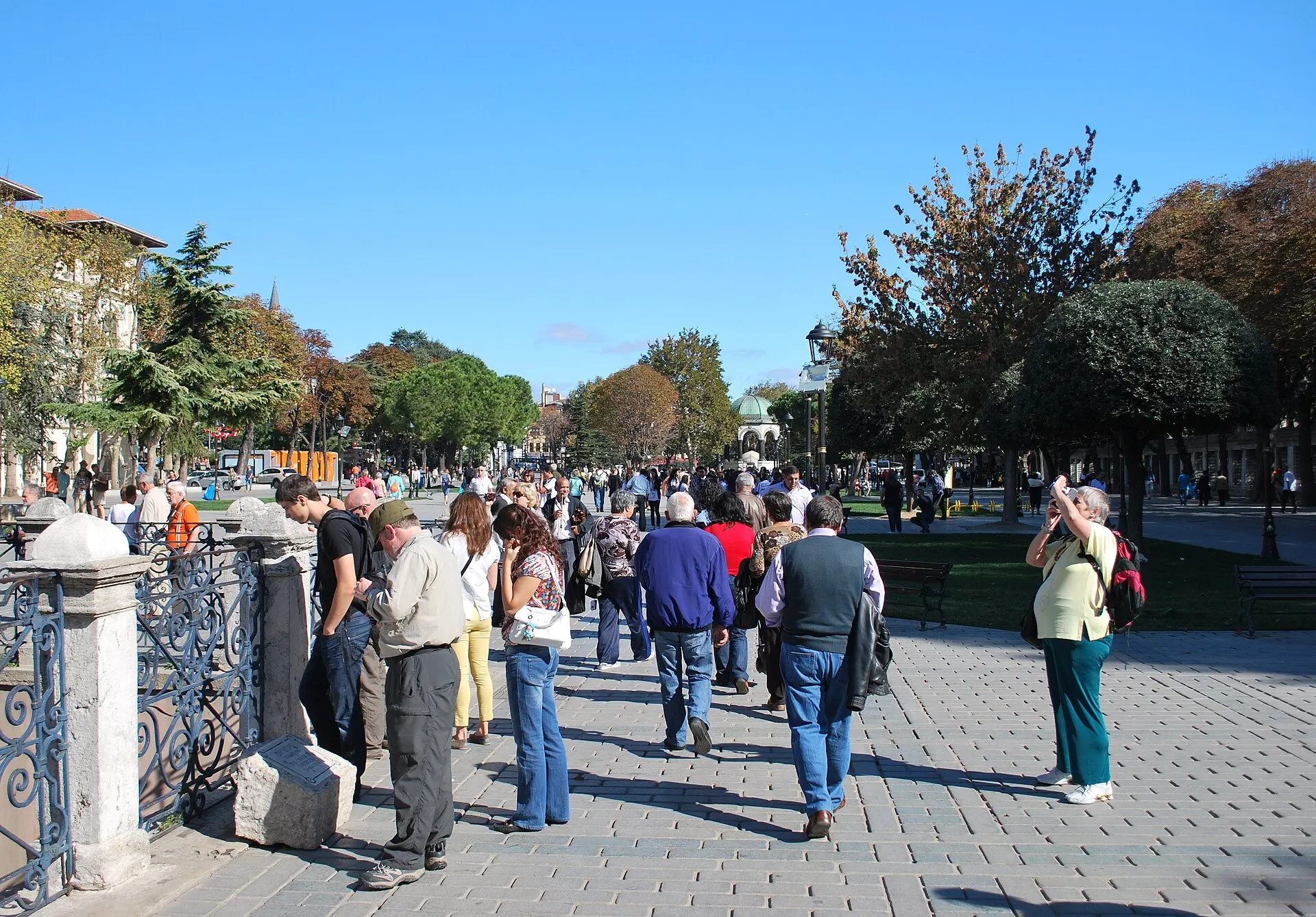
Begin with the distance between monuments. The old Hippodrome is now read through the open space of Sultanahmet Square rather than through a complete surviving stadium. GoTürkiye identifies its Eastern Roman chariot-racing past. Stand back in the photographs and notice how slender vertical objects give direction to an otherwise long, open public room.
The 2012 square photograph sets people beside the monuments. A December 2014 night image isolates the Obelisk of Theodosius, while the July 2023 photograph comes close to the carved base. Switch between them to move from urban scale to material detail. These are independent photographs, not consecutive steps; their changing light and camera heights are part of the comparison, not evidence of a single walk.
The optional October 2015 Google fragment has three linked outdoor positions and a verified return. It establishes the paved setting but does not carry you across the peninsula. Along-route exploration adds the German Fountain as a separate stop. For a real visit, give others room beside the monuments, locate a safe pedestrian approach and decide how much of the square to explore before looking toward the mosque.
Read further: Istanbul’s Hippodrome: before the monuments came hereReal-travel note
Historical outdoor imagery only. The three-position fragment does not verify present-day barriers, events, crowds or a continuous onward route.
Compare a wider setting, architectural detail and changing conditions.
Chapter 2 · A skyline with a working threshold
Look at the Blue Mosque from the outside
From the square, the Blue Mosque is a composition of domes, towers and changing foregrounds. The official guide identifies Sultanahmet Camii with six minarets. Rather than trying to count everything at once, begin with the low edges that meet the public space and follow the building upward. The name does not mean that the outer stone will appear blue in every photograph.
The 2024 façade photograph was made within the courtyard setting. It brings the arch and cascading domes close; it is not the viewpoint of the public-square street camera. A February 2015 winter scene gives the open foreground a very different surface, while the October 2012 view sets the mosque against a wider sky. Snow, lighting and access in these records are historical conditions, not a promise for your visit.
The October 2015 interactive fragment remains outside the mosque building, on the paved area beside it. Three connected positions allow a short move and return, with no interior tour. Mosque visits need their own preparation because this is an active place of worship: check current visitor arrangements, respect prayer and dress guidance, and do not assume that the outdoor sequence validates admission or step-free entry.
Real-travel note
Exterior sequence, not an interior tour. The close façade photograph comes from a different courtyard-side viewpoint; access to that setting must be checked separately.
Compare a wider setting, architectural detail and changing conditions.
Chapter 3 · A monument and its busy edges
Separate Hagia Sophia’s skyline from its street-side approach
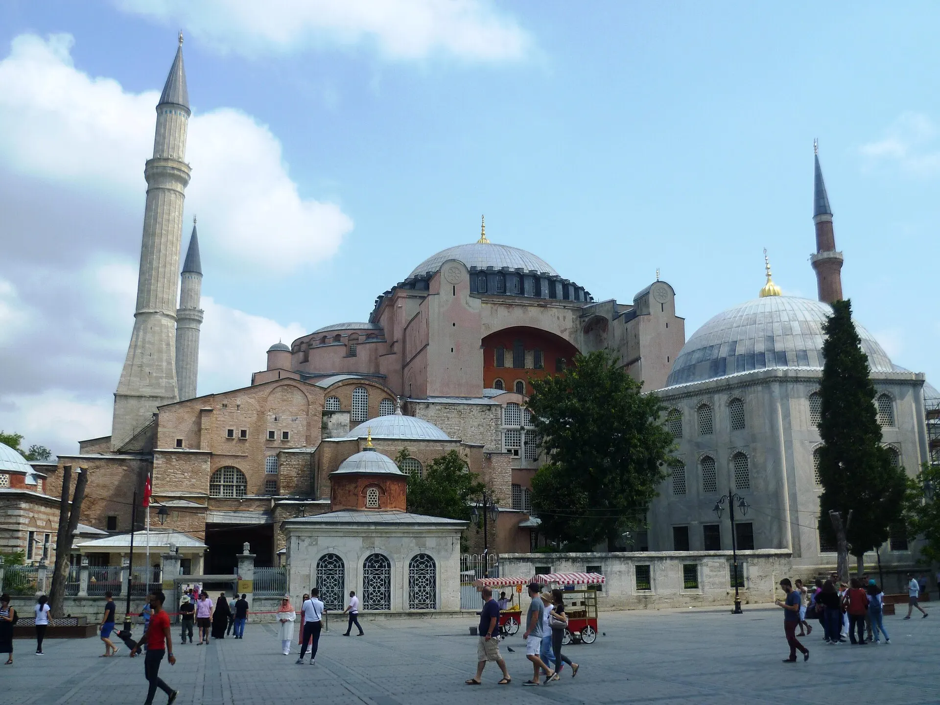
Turn the broad square into a frame for Hagia Sophia. UNESCO places this sixth-century building among the peninsula's major monuments, while the current official mosque information identifies its present religious use. Here the chapter stays outside. Its subject is the difference between recognizing a famous silhouette and understanding the crowded, changing edges around it.
The 2017 photograph looks from Sultanahmet Square toward the dome and minarets. The 2022 photograph brings an exterior pavilion and masonry closer; a February 2020 night photograph changes the balance of light and darkness. Do not read the older dates or file titles as a statement about today's institution, entrance arrangements or restoration. The photographs document different conditions and do not form an indoor itinerary.
The October 2024 Google fragment follows three linked positions on the Kabasakal side. It shows street activity, boundary buildings and visible restoration scaffolding rather than an unobstructed dome panorama. That is useful context, but it is not the same viewpoint as the chapter's broad photograph. The nearby Basilica Cistern exterior is an optional, separate exploration. For either interior, consult the responsible institution; queues and access rules cannot be inferred from these images.
Real-travel note
Kabasakal-side exterior imagery includes scaffolding and crowds in October 2024. No mosque interior, museum experience, current queue or admission is included.
Compare a wider setting, architectural detail and changing conditions.
Chapter 4 · Let the trees change the pace
Pause along the planted paths of Gülhane Park
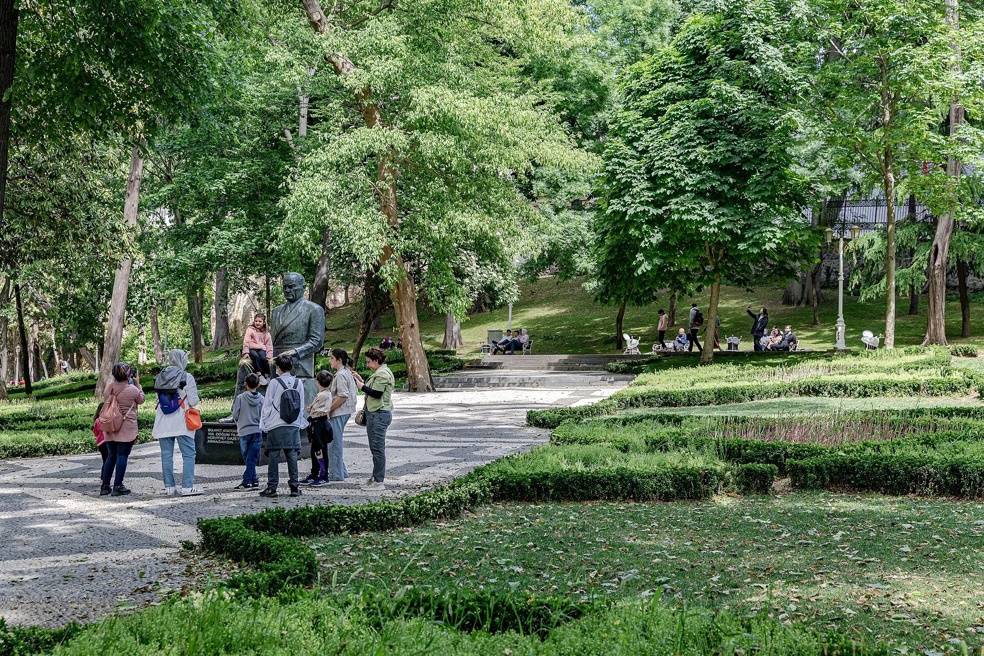
Let the scale come down from domes to trees and people. GoTürkiye describes Gülhane as a former outer garden of Topkapı Palace that became a public park. In the photographs, its interest is not a single compulsory sight but the relationship between paths, planting and places to pause. Look at where benches sit relative to shade and where a planted edge directs the eye.
Three photographs provide different ways into that landscape: a May 2022 path, April 2015 spring planting and April 2023 fountains. They do not all record one season's planting plan. Flowers, water features and tree cover can change, so compare the composition rather than treating any frame as a current horticultural forecast. The wide image shows how people share the path; the closer fountain view changes the rhythm without pretending to take another step.
The optional April 2022 panorama really is inside the park and supports a full turn. It has no verified linked movement, so it is labelled 360° look-around, not a walk. The separate archaeology-museum courtyard in along-route exploration is not part of the public park and does not establish free museum access. Plan your actual park entrance and exit with a current map, then make a separate decision about continuing to Sirkeci and the waterfront.
Real-travel note
The park experience is a single panorama with no verified forward movement. Spring planting is historical; the separate museum courtyard has its own access arrangements.
Compare a wider setting, architectural detail and changing conditions.
Chapter 5 · The city opens across water
Finish at Eminönü, with the Golden Horn beyond the square
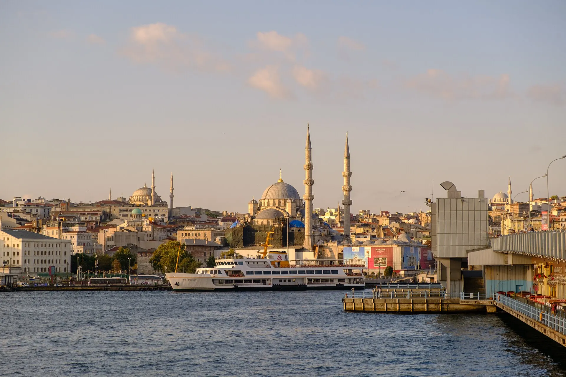
The last chapter exchanges enclosed paths for the broad horizon of the Golden Horn. GoTürkiye describes this inlet as part of Istanbul's historical and cultural life. From Eminönü, the visual field is made of more than water: ferries, bridge edges, streets, crowds and the opposite bank compete for attention. Before choosing a viewpoint, separate the shore you stand on from the skyline you look toward.
The September 2020 photograph looks back at Eminönü from Galata Bridge. The August 2024 photograph looks across the water toward Galata, and the other 2020 waterfront frame shows Karaköy on the opposite bank. The three are deliberately contextual: they are not identical camera positions and do not imply that the chapter includes a bridge crossing or ferry ride. Compare how the water opens space between the buildings.
The October 2019 interactive panorama stands in the busy square near the Spice Bazaar and waterfront approaches, not on a boat or down at the water's edge. It supports a full turn but no verified linked movement. A separate Sirkeci exterior fragment lets you examine a station façade before finishing here. For a real visit, check pedestrian crossings and the current ferry operator if continuing by water; a boat in an old image does not verify today's route or departure.
Real-travel note
The 360° camera is in the busy square near the Spice Bazaar, not on the quay or a boat. Bridge and opposite-bank photographs are contextual; transport and crossings need current checking.
9 reviewed experiences
Explore along the route
Step into the places along this journey. Choose a view independently of the story chapters. Free previews do not count toward chapter progress. Return to the journey above to continue through its stops.
Read the old racecourse through its surviving monuments Short observation sequence
October 2015: three linked positions on the former Hippodrome paving. No continuous link to other chapters.
Reviewed 2026-10-18 · At the place
Explore at your own pace; these views do not count toward chapter completion. Check each point's coverage note before navigating provider imagery. Availability may change.
Sources
- Hippodrome — GoTürkiye
- Blue Mosque — GoTürkiye
- Hagia Sophia Mosque — Hagia Sophia Mosque official information
- Historic Areas of Istanbul — UNESCO World Heritage Centre
- Gülhane Park — GoTürkiye
- Golden Horn — GoTürkiye
- Istanbul Mosque Route — GoTürkiye
- Hippodrome of Cionstanople Sultanahmet Square.JPG — Helge Høifødt · Wikimedia Commons
- Obelisk of Theodosius, Hippodrome of Constantinople, Istanbul, Turkey (Ank Kumar) 03.jpg — Ank Kumar · Wikimedia Commons
- Istanbul Hippodrome 12.jpg — Jaba1977 · Wikimedia Commons
- Sultan Ahmed Mosque Front Façade, 2024.jpg — Julian Lupyan · Wikimedia Commons
- Exterior of Sultan Ahmed Mosque in winter.jpg — Maurice Flesier · Wikimedia Commons
- Blue-Mosque-Istanbul-October-2012.jpg — Acediscovery · Wikimedia Commons
- Hagia Sophia from the Sultanahmet Square 2017 (1).jpg — Radosław Botev · Wikimedia Commons
- Exterior of Hagia Sophia (1) - Istanbul (2022).jpg — ImanFakhri · Wikimedia Commons
- Ayasofya from Sultanahmet Square at night.jpg — Mustafa-trit20 · Wikimedia Commons
- Gülhane Park, Istanbul (52121367936).jpg — Ninara · Wikimedia Commons
- Gülhane Park, Istanbul.jpg — Maurice Flesier · Wikimedia Commons
- Gülhane Park-Fountains.jpg — Yair Haklai · Wikimedia Commons
- Eminonu waterfront with Yeni Cami and Suleymaniye Mosque from Galata Bridge, Istanbul - Tarik Kaan Muslu.jpg — Tarikkaanmuslu · Wikimedia Commons
- Galata Tower from Eminönü in August 2024.jpg — Kurmanbek · Wikimedia Commons
- Eminönü turkey istanbul.jpg — Takiehsan · Wikimedia Commons
- The German Fountain (AP4M2781 1PS) (29144764955).jpg — Alexandru Panoiu from Bucharest, Romania · Wikimedia Commons
- Entrance to the Istanbul Archaeology Museums complex. Eminönü quarter of Istanbul, Turkey, near Gülhane Park and Topkapı Palace.jpg — Osama Shukir Muhammed Amin FRCP(Glasg) · Wikimedia Commons
- Sirkeci 4.jpg — Mathemonkey · Wikimedia Commons
- Turkey-03218 - Basilica Cistern Entrance (11312542774).jpg — Dennis G. Jarvis · Wikimedia Commons


Your journey, remembered.
Explored 0 of 5 stops. Explore every stop to unlock your keepsake.
5 stops to your keepsakeExplore every stop to share or download your keepsake.
Plan your historic-peninsula visit
Use the chapters to choose places to pause, then plan the walking connections and any indoor visits independently.
Official sources checked:
Connect the outdoor stops
Suggested order: Hippodrome → Blue Mosque exterior → Hagia Sophia exterior → Gülhane Park → Eminönü. About 3 km is an editorial estimate, not a surveyed track. Allow 2–3 hours outdoors, longer for optional detours; use a current pedestrian map for gates, slopes and crossings.
Treat religious and museum access separately
Check current mosque visitor, prayer and dress guidance before entering. Hagia Sophia, the Basilica Cistern, Topkapı and the archaeology museums have distinct arrangements. An outdoor photograph or visible gate does not establish admission, the right queue or accessible entry.
Leave room for crowds and transport
Plan pauses, sun and rain protection, and a route suitable for your mobility. Keep worship and station entrances clear; do not treat road-camera positions as pedestrian instructions. For a ferry continuation, check the current operator and boarding point separately.