
Galle Fort: from the clock tower to Flag Rock
Read five places inside Galle Fort, Sri Lanka’s living fortified town, through ten licensed photographs and optional, separately reviewed Google 360° viewpoints. This is an editorial sequence, not a surveyed continuous walk.
Begin the visual journeyExplore 4 reviewed views along the routeGuided visual journey
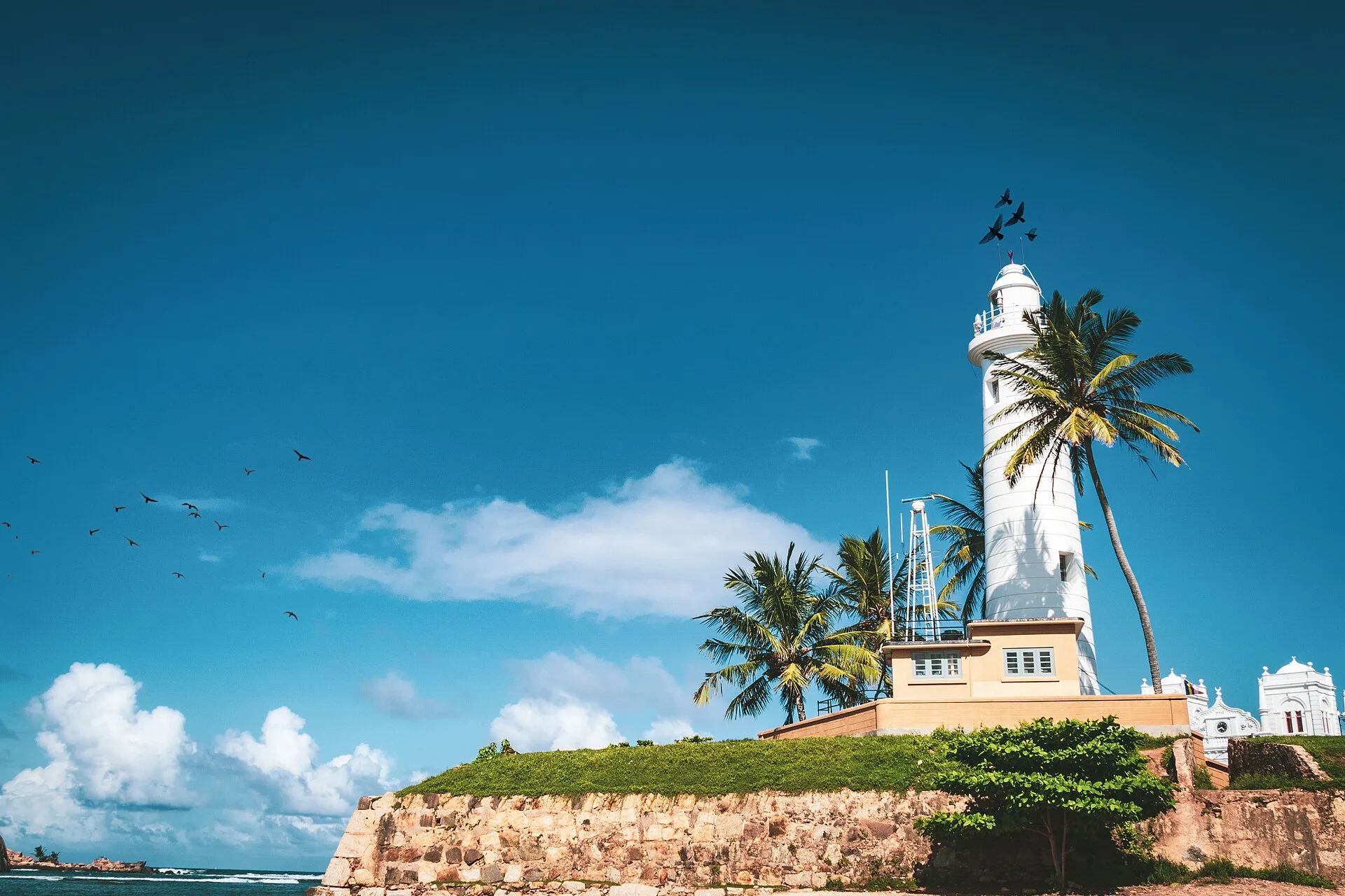
Galle lighthouse among palms beside the seaward rampart · Samal Nadeeshan · CC BY-SA 4.0
Reading mode
Place stories to read at your own pace
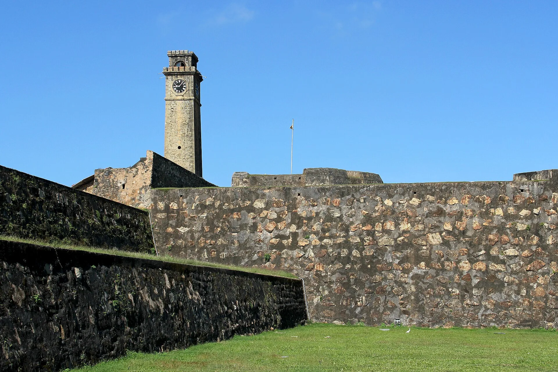
Two independently dated views establish the fort’s landward edge.
Chapter 1 · Above the landward gate
Begin below the clock tower and Moon Bastion
The clock tower gives Galle Fort a clear landward landmark, but the two photographs show why one postcard angle is not enough. Sylvia Berger’s 2015 view places the tower above the stone walls and surrounding town; Shehal Joseph’s 2008 photograph brings Moon Bastion and the inner side of the tower closer. The years, weather and camera positions differ. Read them together for orientation rather than as consecutive frames of a walk.
UNESCO describes Galle as a fortified town shaped first by the Portuguese and then extensively developed under Dutch rule, with a street plan and architecture adapted to South Asian conditions. That history is visible here as a defensive edge, not as a sealed museum object. Traffic, residents and visitors still move around the fort, while the old walls establish a boundary between the modern city and the historic grid inside.
If an optional Google 360° control is available, it opens third-party historical imagery resolved near the reviewed coordinate. It cannot tell you whether a gate, road or wall section is open now, and it does not connect every chapter. Before visiting, use a current map and local advice for crossings, heat and access. The chapter’s dependable evidence remains the two licensed, dated photographs and their stated limits.
Real-travel note
The approach is exposed and busy. Check current traffic, pedestrian access and weather before walking toward the fort entrance.
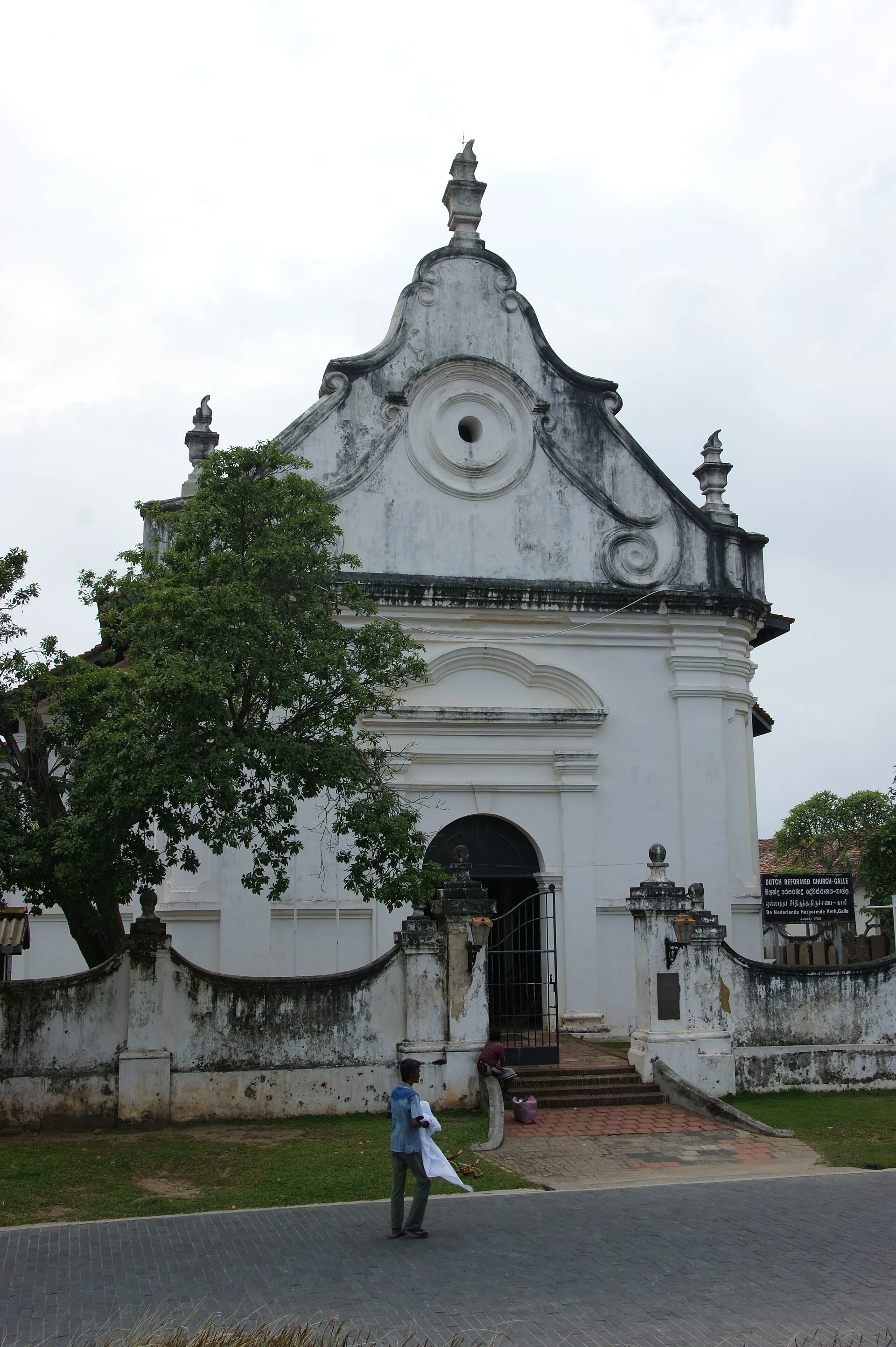
A street-facing façade and a separately photographed interior.
Chapter 2 · A civic and religious interior
Step from the street into the Groote Kerk
The Dutch Reformed Church, often called the Groote Kerk, changes the scale of the journey. Dan Arndt’s exterior photograph shows a restrained white façade facing the fort’s street network. A.Savin’s 2020 interior view shifts attention to the volume, pale walls and furnishing inside. They were made eight years apart and are presented as a comparison, not as proof that a visitor can move directly from one camera position to the other today.
UNESCO’s account of Galle emphasizes the meeting of European architectural forms and South Asian traditions. A church inside an inhabited fort makes that layering tangible, but it should not be reduced to scenery. It remains a place with religious associations and local rules. Quiet behaviour, appropriate clothing and respect for any service or closure matter more than reproducing a photograph.
Historic interiors are particularly vulnerable to misleading virtual coverage: an exterior panorama can appear close on a map while revealing nothing about entry or current conditions. WalkThere therefore keeps the licensed interior photograph available even if an optional street-level 360° view resolves nearby. Check opening information locally, do not assume photography is permitted, and treat the image date as part of the evidence rather than decoration.
Real-travel note
Treat the church as an active religious place. Confirm opening, dress expectations and photography rules before entering.
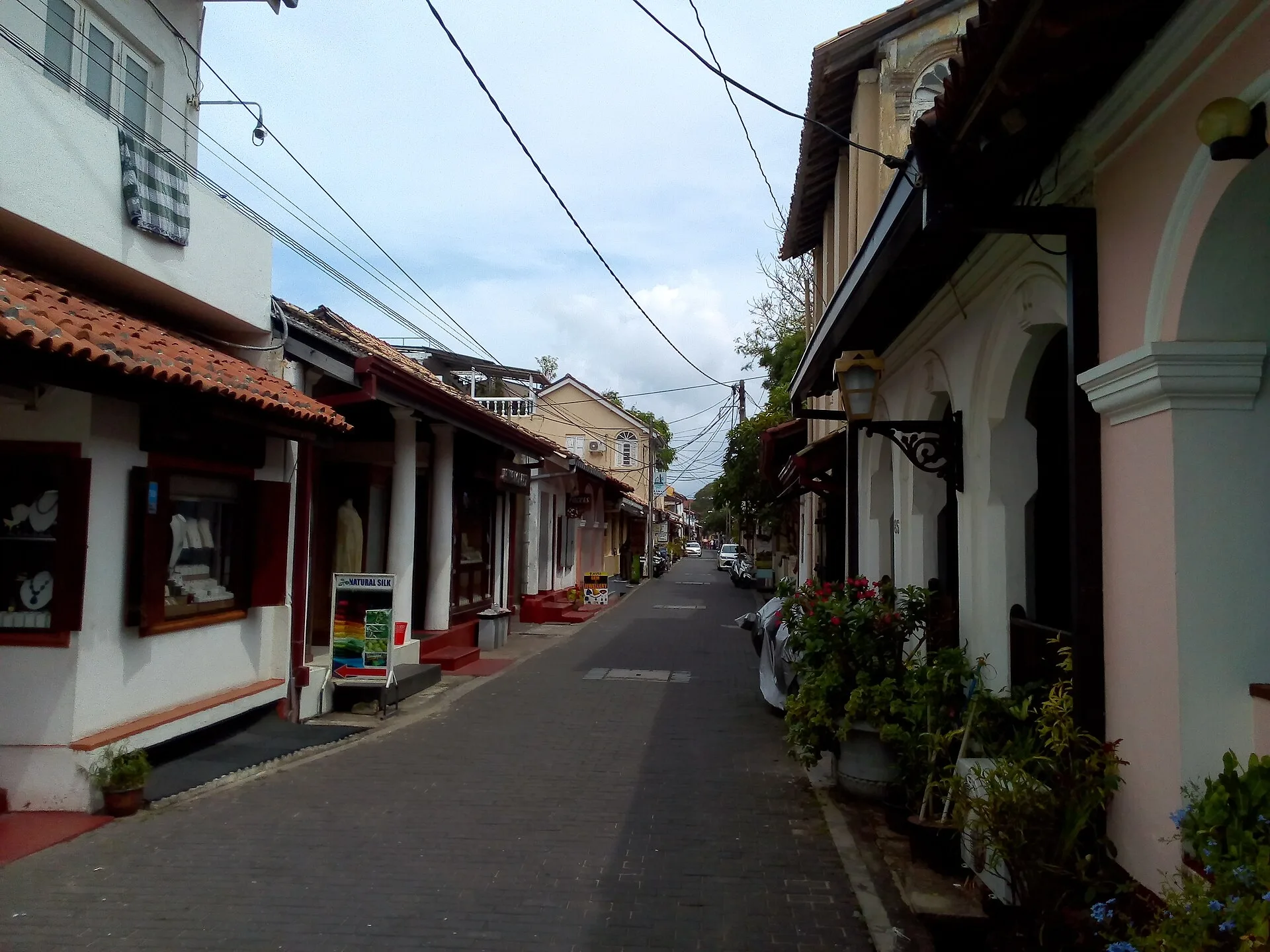
A broad street view and a closer look at lived-in façades.
Chapter 3 · Inside the grid
Read the fort as a living neighbourhood
Between monuments, the fort is made legible by ordinary streets. Tom Worthington’s 2018 view looks along a road lined with historic buildings; Rudolph A. Furtado’s 2012 photograph pays closer attention to houses, verandas and entrances. The pair helps you notice how façades, shade and street width shape daily movement, while making no claim that every business, sign or surface still looks the same.
This chapter is central to the product rather than filler between landmarks. UNESCO calls Galle an outstanding example of a fortified city whose European plan was adapted to local geography and cultural context. That adaptation is encountered at walking speed: in deep eaves, courtyards, changing uses and the tension between visitor activity and residential life. A route that only jumps from tower to lighthouse would miss the place people actually inhabit.
Optional panoramic imagery, where verified, can add the ability to turn and inspect an intersection. It still cannot guarantee a continuous path or show today’s traffic. Give residents room, ask before photographing people, and avoid treating doorways as public sets. The two dated photographs stay visible because they provide accountable evidence even when third-party imagery changes or fails to load.
Real-travel note
These are working residential and commercial streets. Keep entrances clear, moderate noise and ask before close photography.
Two frames reveal the mixed religious and maritime landscape.
Chapter 4 · The seaward edge
See the lighthouse and Meeran Mosque together
The white lighthouse is an immediate visual marker, yet the broader edge of the fort is more interesting than the tower alone. Samal Nadeeshan’s 2019 photograph places the lighthouse among palms and the sea wall. Radek Oliwa’s wide 2011 frame brings the Meeran Mosque and lighthouse into the same coastal strip. The second file is unusually panoramic, so its role is contextual rather than a promise of close architectural detail.
Placing these images together avoids presenting the fort as culturally uniform. Galle’s protected urban landscape contains buildings associated with different communities and periods, all within the defensive geometry of the peninsula. The mosque is not a prop for a lighthouse view, and the lighthouse is not evidence that the rampart is safe or unrestricted. Observe religious etiquette and any local barriers independently.
If a reviewed 360° viewpoint opens here, use it to look around the exterior setting and understand the relationship between wall, street and coast. It is not an interior view, live weather feed or route guarantee. Strong sun, wind, rain and sea conditions can transform this exposed edge. Current warnings and on-site instructions must take priority over every archived image on the page.
Real-travel note
The seaward edge is exposed. Respect worship around the mosque and follow current barriers or weather warnings on the ramparts.
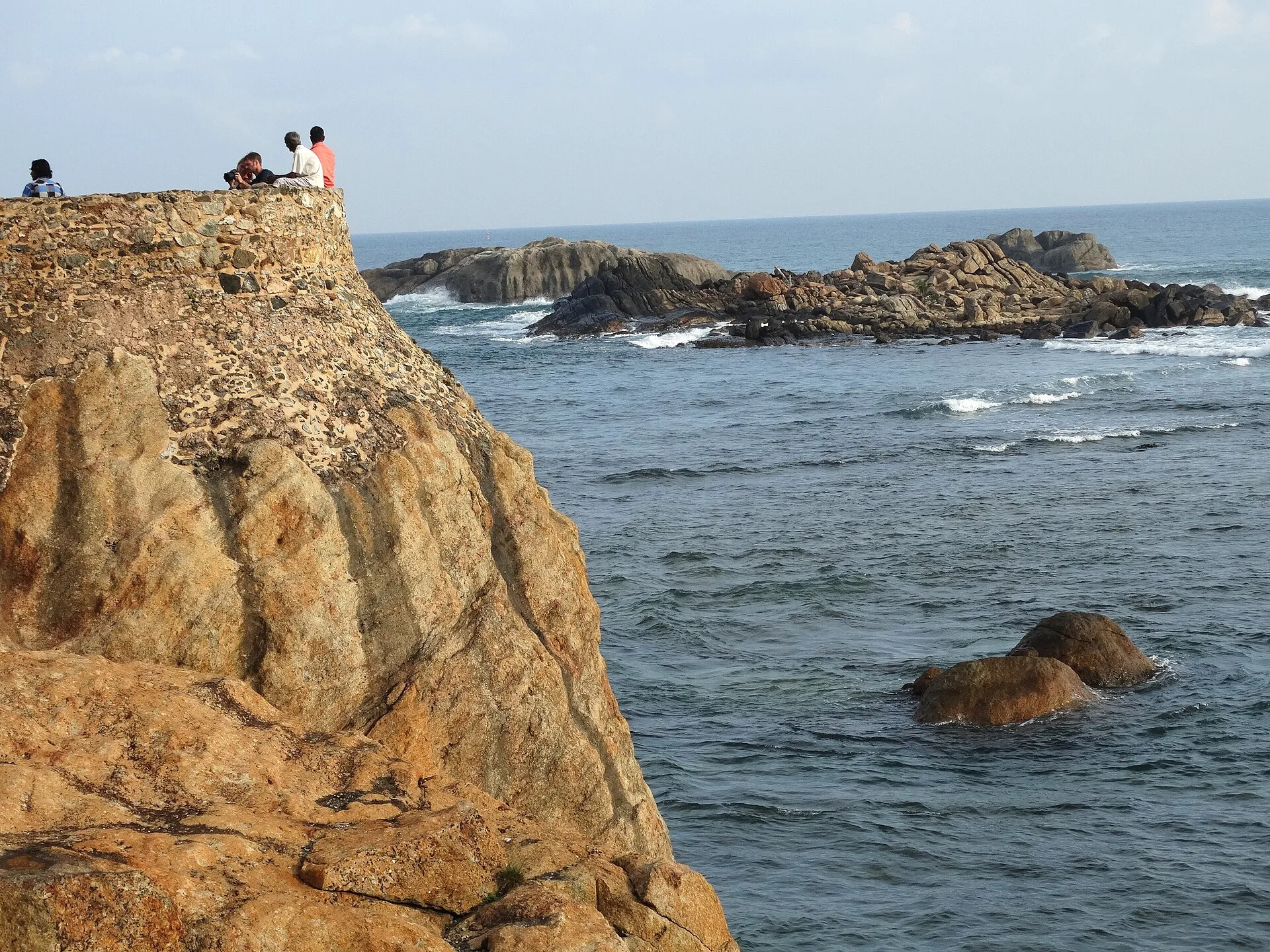
A recent seaward view and an older historic frame from Flag Rock.
Chapter 5 · Where the wall meets the ocean
Finish at Flag Rock and the ramparts
At Flag Rock, the fort’s defensive outline meets open sea and a wide horizon. Adam Jones’s 2014 photograph shows the rampart masonry and water at close range. Jan Kranendonk’s 1992 image looks along the wall from an earlier moment, with different colour, vegetation and urban background. The age gap is useful: heritage places are maintained, weathered and inhabited rather than frozen at one visual date.
UNESCO’s listing explains why the walls matter as part of an integrated fortified town. From this edge, it is possible to understand the relationship between bastions, the street grid behind them and the harbour landscape beyond. It is also the place where a beautiful frame can conceal practical risk. Wet stone, wind, heat, crowds and unprotected drops are not captured reliably by a still photograph or panorama.
Any optional Google 360° viewpoint remains a bounded historical observation point. Even if arrows appear, WalkThere does not describe the five chapters as a continuous surveyed route. Use the virtual view to decide whether the exposed coastal atmosphere appeals to you, then check present conditions and keep behind barriers. The journey ends with a choice, not an instruction to complete every edge of the wall.
Real-travel note
Keep back from exposed edges, especially in wind or rain. Do not copy risky behaviour seen in old images or other visitors.
4 reviewed experiences
Explore along the route
Step into the places along this journey. Choose a view independently of the story chapters. Free previews do not count toward chapter progress. Return to the journey above to continue through its stops.
Begin below the clock tower and Moon Bastion 360° look-around
The October 2021 viewpoint adds orientation near the landward wall; it is not current gate guidance or a continuous route.
Reviewed 2026-10-08 · At the place
Explore at your own pace; these views do not count toward chapter completion. Short sequences cover only the reviewed section. Imagery availability may change.
Sources
- Old Town of Galle and its Fortifications — UNESCO World Heritage Centre
- Galle Fort with Clock Tower.jpg — Wikimedia Commons
- Galle Fort clock tower & moon bastion (2181754025).jpg — Wikimedia Commons
- Dutch Reformed Church, Galle Fort.JPG — Wikimedia Commons
- SL Galle Fort asv2020-01 img15.jpg — Wikimedia Commons
- Galle Fort Street (45436649062).jpg — Wikimedia Commons
- Galle Fort houses..JPG — Wikimedia Commons
- Lighthouse Galle, Sri Lanka.jpg — Wikimedia Commons
- Galle-fort-mosque-lighthouse.jpg — Wikimedia Commons
- Sea and Ramparts - Fort District - Galle - Sri Lanka (14050149046).jpg — Wikimedia Commons
- GalleFortMuurVlaggeklipNaarTriton.jpg — Wikimedia Commons

.jpg)


.jpg)


.jpg)

Your journey, remembered.
Explored 0 of 5 stops. Explore every stop to unlock your keepsake.
5 stops to your keepsakeExplore every stop to share or download your keepsake.