
Buenos Aires San Telmo: read Defensa from the civic square to the park
Walk south from Plaza de Mayo through San Telmo’s street fronts, iron market, paved square and green southern edge. Five chapters, fifteen licensed photographs and eight checked local Google sequences add depth without pretending the whole route is one continuous recording.
Begin the visual journeyExplore 8 reviewed views along the routeGuided visual journey
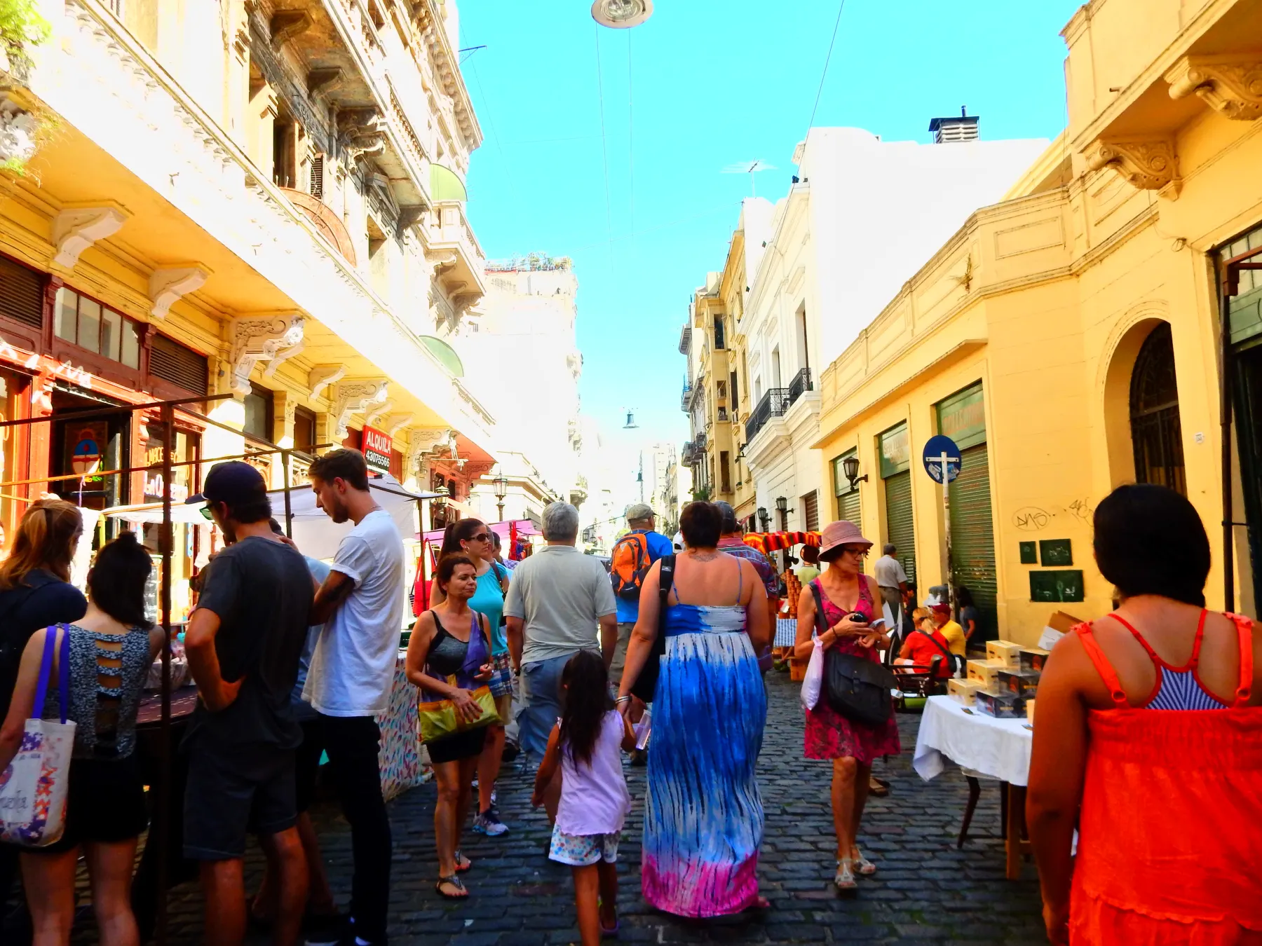
Defensa Street near Chile with pedestrians and stalls · Andrew Milligan sumo · CC BY 2.0 · Resized and converted to WebP
Reading mode
Place stories to read at your own pace
Use the arrows to change viewpoint and date. These licensed photographs are not consecutive walking frames.
Chapter 1 · Begin with the civic room
Use Plaza de Mayo to establish the city’s scale
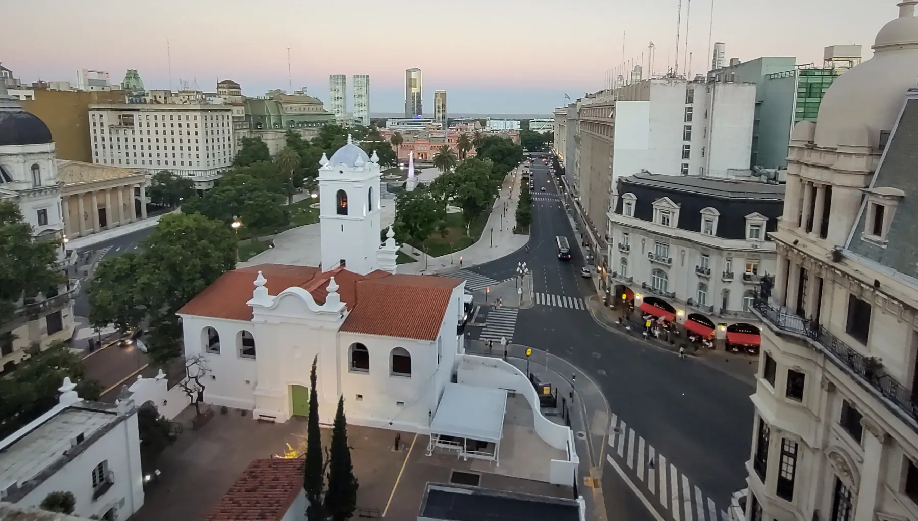
Begin in the open space rather than at a single façade. Buenos Aires Ciudad describes Plaza de Mayo as the city’s oldest square, a place around which national institutions and repeated political gatherings accumulated. That history can make the plaza feel like a checklist of monuments. A slower reading starts with distance: the Cabildo’s white arcades occupy one side, the Casa Rosada another, and the broad paving keeps them in a shared civic room rather than a row of unrelated attractions.
The photographs separate that room into three independent observations. Crazychubut’s August 2023 image centres the Cabildo. Roberto Fiadone’s July 2019 view gives the low colonial frontage more of the square, while the January 2022 panorama places Cabildo and Casa Rosada in the same wider field. They were made in different years and conditions, so flags, barriers, assemblies, restoration and traffic must not be read as current. Use the carousel to see how a change of camera position changes the balance between building and public space.
The optional October 2025 Google sequence moves across three checked positions on the south edge and returns to its starting view. It is a local orientation aid, not a continuous recording that reaches San Telmo. The official city page identifies the plaza’s historic role; it cannot tell you what event or restriction will occupy it when you arrive. Recheck demonstrations, ceremonies, museum access and street closures, leave generous space around gatherings, and treat the square as a working political place before treating it as an image.
Real-travel note
Events, demonstrations and security arrangements can change access without notice. The optional sequence remains on the public edge and does not enter the Cabildo or Casa Rosada.
Use the arrows to change viewpoint and date. These licensed photographs are not consecutive walking frames.
Chapter 2 · Let the street replace the monument
Read Defensa through changing ordinary frontage
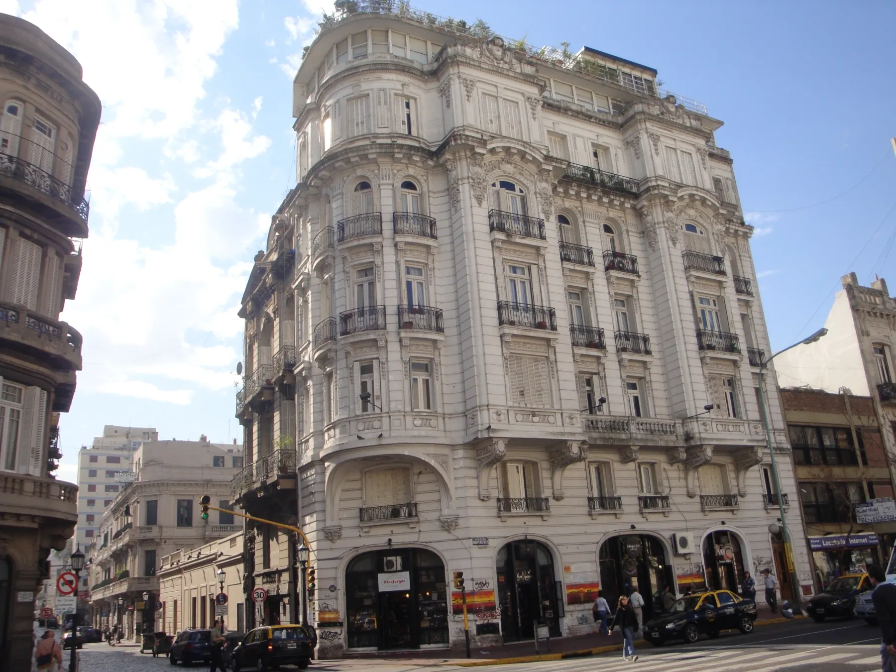
Turn south and allow Defensa to become the subject. San Telmo’s identity is not contained in one preserved building: it appears in narrow plots, balconies, shutters, shop signs, worn paving and the way a major avenue cuts across a much finer street. Buenos Aires Tourism describes the district through its colonial fabric, antiques, tango and Sunday activity, but those labels are only useful if you can still see the working street beneath them.
Three dated photographs keep that difference visible. Andrew Milligan’s May 2016 view near Chile catches pedestrians and temporary stalls. Banfield’s May 2011 frame at Avenida Independencia shows how a broad traffic corridor interrupts Defensa. Roberto Fiadone’s April 2025 image at Avenida San Juan records a later southern crossing. They do not prove that a fair, a shop or a traffic pattern is present today. Together they show why a route that sounds like one street contains several distinct urban situations.
The optional June 2024 Google sequence uses three checked positions beside Chile and returns. Two additional Defensa sequences appear in Along-route exploration, at Estados Unidos and farther south, because those capture dates and gaps should remain explicit. None of the eight sequences is joined into a false end-to-end walk. Sunday can bring denser market activity, while another day may feel very different. Keep doorways and loading space clear, watch uneven paving and moving vehicles, and use current signs—not historical imagery—to decide where pedestrians may pass.
Real-travel note
The Sunday fair and individual shops are not guaranteed by the imagery. Expect uneven paving, traffic at major crossings and changing crowd levels.
Use the arrows to change viewpoint and date. These licensed photographs are not consecutive walking frames.
Chapter 3 · Enter beneath iron and glass
See the market as a structure before a food stop
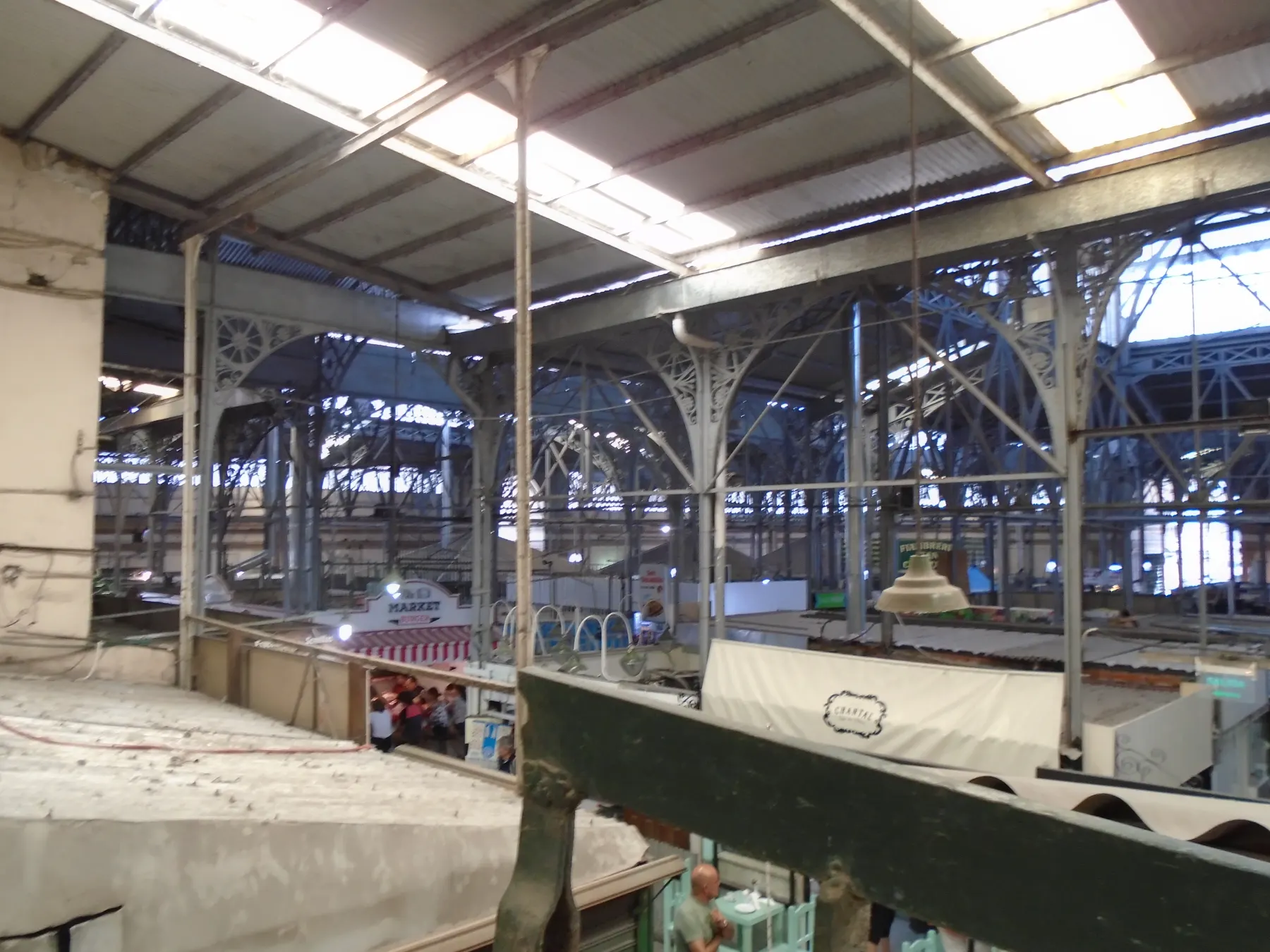
The Mercado de San Telmo is easy to reduce to a list of things to eat. First look up. The official tourism account dates the market to 1897, attributes its design to Juan Antonio Buschiazzo and points to the surviving iron beams, arches and sheet-metal-and-glass roof. It also records the building’s designation as a National Historic Monument in 2000. Those details turn the market from a convenient stop into an example of how a neighbourhood still uses a nineteenth-century commercial frame.
Eugenio Hansen’s February 2018 image opens the iron structure above the stalls. Matias Garabedian’s January 2009 photograph holds the central hall and its roof geometry, while Phillip Capper’s January 2011 frame brings produce, counters and people back into the building. These are three distinct visits. Tenants, goods, crowding and circulation can change, and a quiet photograph does not promise a quiet aisle. The images provide interior context precisely because Google street imagery does not enter the covered hall here.
The optional June 2025 sequence stays outside on the market’s western Carlos Calvo edge, moves through three checked positions and returns. It can orient an entrance façade, but it is not an indoor tour and not proof of present opening. Consult current market information before travelling, give workers room, and do not photograph people or counters as if they were displays. The useful transition is from structure to use: notice the roof, then the changing stalls beneath it, and keep those two time scales separate.
Real-travel note
The Google sequence is exterior only. Opening days, entrances and tenants can change; recheck the official market page and respect workers and customers inside.
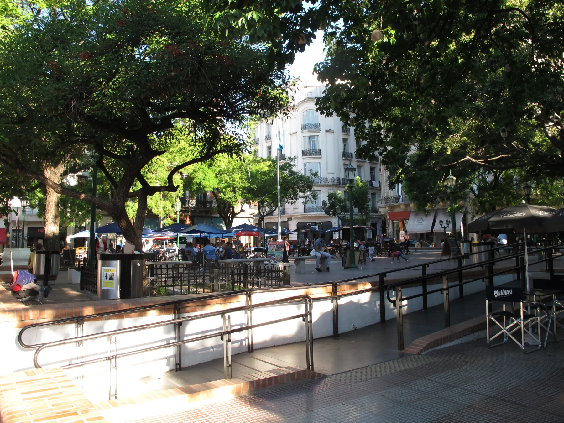
Use the arrows to change viewpoint and date. These licensed photographs are not consecutive walking frames.
Chapter 4 · A paved square with several tempos
Separate Plaza Dorrego from the performance you hope to see
Plaza Dorrego is a small paved room, not a permanent stage set. Buenos Aires Tourism records that the declaration of independence was announced here in 1816 and that the Sunday antiques fair began in 1970. Those facts help explain why civic memory, commerce and performance overlap, but they do not promise that every visit contains the same stalls, music or crowd.
Andrzej Otrębski’s November 2018 photograph gives the paving, trees and surrounding façades enough room to establish the square. Brian Barbutti’s October 2009 image records one tango performance, a specific encounter rather than a daily service. Banfield’s December 2012 photograph turns back to Defensa at the edge, where movement into the square matters as much as the centre. The carousel deliberately places ordinary space beside spectacle so that the spectacle does not overwrite the place.
The optional June 2025 Google sequence follows three checked positions on the Humberto edge west of the plaza and returns. It remains on the public street edge; it cannot confirm the current layout of the fair, café seating or an event. If the square is busy, protect through-routes and avoid turning residents or performers into scenery. If it is quiet, the architecture is not a failed version of the fair. It is another valid condition of the same place. Check the official programme if a Sunday fair is central to your plan.
Read further: San Telmo: Where Old Objects Go After Leaving HomeReal-travel note
A 2009 tango photograph is evidence of that performance, not a promise. Sunday fair layouts, performances and café seating vary; verify current information.
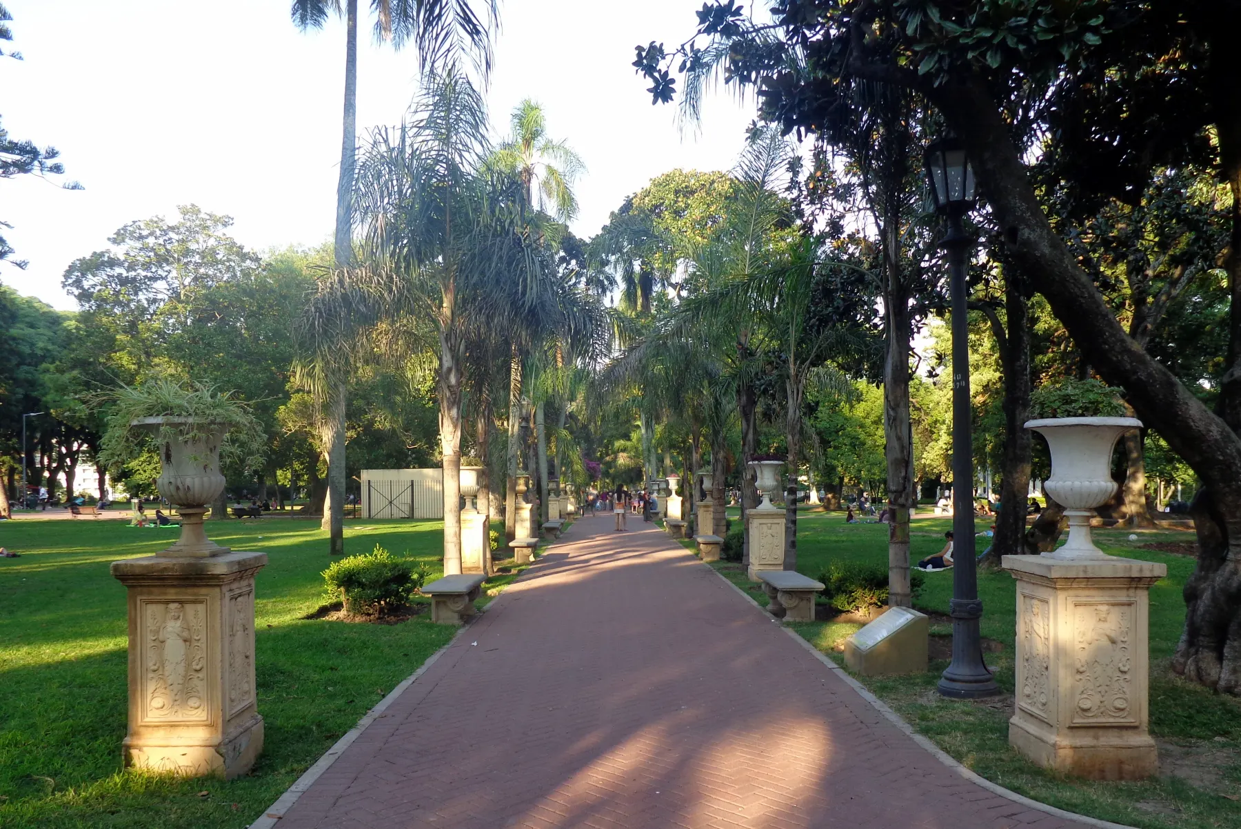
Use the arrows to change viewpoint and date. These licensed photographs are not consecutive walking frames.
Chapter 5 · Finish where the street releases into green
Let Parque Lezama change the ending
Continue past Avenida San Juan until the hard street frontage gives way to the edge of Parque Lezama. The City’s own San Telmo circuit begins around this park and heads north along Defensa; this WalkThere story deliberately reads the same relationship in reverse. That is an editorial choice, not an official prescribed route and not live navigation. Finishing here lets the dense sequence of square, market and street end with slope, canopy and a broader horizon.
Roberto Fiadone’s March 2019 photograph provides the most useful ground-level view: paths and mature trees define an interior landscape rather than another plaza. MartaVitigo’s March 2023 aerial image explains the park’s size relative to surrounding blocks. Vlasta x’s July 2024 dawn frame is atmospheric evidence from the park, not a guaranteed sunrise or a substitute for path detail. Together the three images change scale from walking surface to neighbourhood context to sky, and none is presented as a consecutive frame.
The optional July 2021 Google sequence stays on the Avenida Brasil edge, moves through three checked positions and returns. It does not prove that an internal path, gate, lighting condition or facility is open today. The three additional Along-route sequences end before the park, so there is still no continuous virtual walk from Plaza de Mayo. In person, use signed entrances, keep awareness around crossings and slopes, and check current park conditions. The journey finishes when the city opens out—not when a historical camera claims to have completed your route.
Real-travel note
The interactive sequence remains on Avenida Brasil outside the park. Internal paths, lighting, events and facilities need current local confirmation.
8 reviewed experiences
Explore along the route
Step into the places along this journey. Choose a view independently of the story chapters. Free previews do not count toward chapter progress. Return to the journey above to continue through its stops.
Use Plaza de Mayo to establish the city’s scale Short observation sequence
October 2025: three checked positions on Plaza de Mayo’s south edge and a return. Events or barriers seen there are historical.
Reviewed 2026-10-14 · At the place
Explore at your own pace; these views do not count toward chapter completion. Check each point's coverage note before navigating provider imagery. Availability may change.
Sources
- Plaza de Mayo — Buenos Aires Ciudad
- El Cabildo — Buenos Aires Tourism
- San Telmo — Buenos Aires Tourism
- Mercado de San Telmo — Buenos Aires Tourism
- Plaza Dorrego — Buenos Aires Tourism
- San Telmo historic circuit — Buenos Aires Ciudad
- Cabildo Plaza de Mayo Buenos Aires 5 de Agosto 2023.jpg — Wikimedia Commons
- Plaza de Mayo - Cabildo.jpg — Wikimedia Commons
- Vista Plaza de Mayo, Cabildo, Casa Rosada 02.jpg — Wikimedia Commons
- Calle Defensa between Chile y San Lorenzo, San Telmo, Buenos Aires (26970856506).jpg — Wikimedia Commons
- Calle Defensa y la Avenida Independencia, San Telmo, Buenos Aires.jpg — Wikimedia Commons
- Defensa y San Juan, San Telmo.jpg — Wikimedia Commons
- Mercado San Telmo, Buenos Aires 0.jpg — Wikimedia Commons
- Mercado San Telmo 0020087.jpg — Wikimedia Commons
- San Telmo Market, Buenos Aires, Argentina.jpg — Wikimedia Commons
- Buenos Aires Plaza Dorrego.jpg — Wikimedia Commons
- Tango in Plaza Dorrego.jpg — Wikimedia Commons
- Calle Defensa - Plaza Dorrego.jpg — Wikimedia Commons
- Amanecer Parque Lezama, Buenos Aires, Argentina.jpg — Wikimedia Commons
- Parque Lezama 2019.jpg — Wikimedia Commons
- Vista aérea del Parque Lezama, Ciudad de Buenos Aires, 2023.jpg — Wikimedia Commons


Your journey, remembered.
Explored 0 of 5 stops. Explore every stop to unlock your keepsake.
5 stops to your keepsakeExplore every stop to share or download your keepsake.