
Budapest: a hill, a bridge and two ways to read the river
Compare Budapest’s palace courtyards, patterned roofs, bridge chains and riverside parliament in five chapters. Fifteen switchable photographs accompany optional local imagery; separate viewpoints are not a continuous walk across the city.
Begin the visual journeyPlan a real visit to Budapest Castle & DanubeExplore 9 reviewed views along the routeGuided visual journey
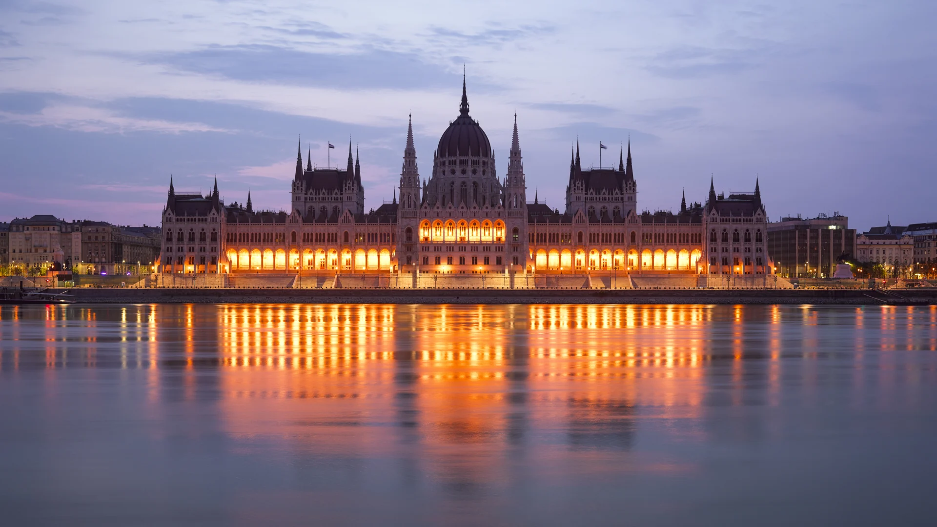
The Hungarian Parliament Building seen across the Danube · Godot13 · CC BY-SA 4.0 · Resized and converted to WebP
Reading mode
Place stories to read at your own pace
Compare an exterior, a closer feature and another viewpoint using the visible gallery controls.
Chapter 1 · Begin above the river
Read Buda Castle at courtyard scale
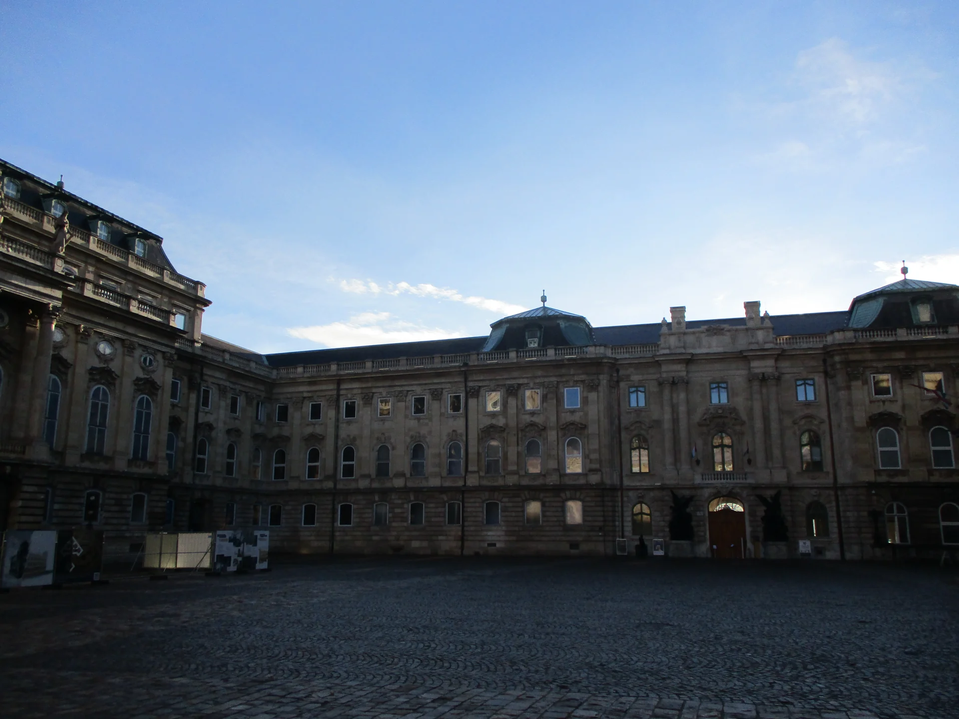
Start with a building edge rather than a skyline. Buda Castle can appear to be one distant dome when seen from the other bank, but a closer visit breaks that image into courtyards, doorways, stonework and changes of level. Find an entrance in the first photograph and compare it with the people or paving nearby. This chapter stays with exterior observations; the palace’s cultural institutions are separate visits, not rooms unlocked by entering a virtual scene.
The gallery deliberately changes scale. A December 2021 photograph records the History Museum exterior. The June 2019 view moves to Matthias Fountain and its forecourt, while the third file identifies medieval window and door frames in an eastern courtyard. That last file only supplies the year 2015: it does not establish a particular day. These are different positions within the wider castle complex, not consecutive frames on one approach. Use the arrows and thumbnails to compare what a broad wall, a sculptural group and a stone opening each reveal.
The optional May 2026 Mapillary panorama stands on an outside path beside a palace wall and an equestrian statue. Turn to compare the wall with the open edge towards the city. It is offered as a single look-around, not a checked walk through the courtyards, a ride on the funicular or admission to a museum. For a physical visit, decide how to handle Castle Hill’s slopes and steps before setting out. BKK publishes separate information about the funicular and its service interruptions; a photograph of a path does not prove that every connection is open or step-free.
Real-travel note
One exterior May 2026 panorama, not a linked castle walk. Check current hillside connections, works, museum admission and funicular service separately.
Compare an exterior, a closer feature and another viewpoint using the visible gallery controls.
Chapter 2 · Roof and open edge
Compare Matthias Church with Fisherman’s Bastion
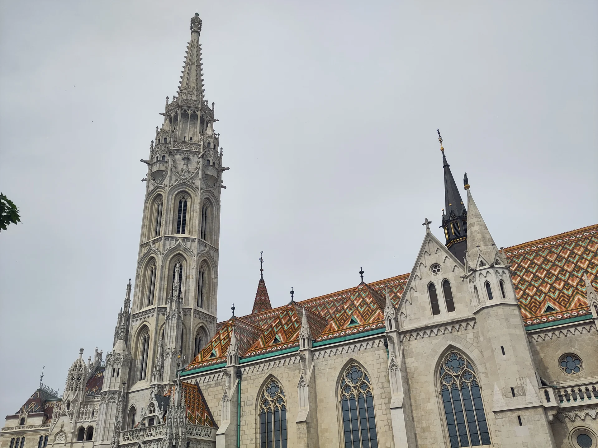
The church and the bastion ask for two different kinds of looking. Matthias Church draws the eye upwards through its tower and patterned roof. Nearby, the pale arches and parapets of Fisherman’s Bastion frame views outward. Before seeking a panorama, compare those edges: a steep roof, a vertical tower, and a low opening can all organise the same small area differently. The church’s own website identifies its address on Szentháromság tér and separates worship and visitor information.
The April 2024 side view establishes the church exterior, the March 2023 image concentrates on the roof, and the May 2014 photograph turns towards part of the bastion. They do not share a single date, lens or camera position. The third photograph expands the chapter into the neighbouring space; it does not show the view from a church tower or establish that a terrace is currently accessible. Switch between them before deciding which detail matters most to you.
The optional August 2024 Google fragment is outside on the square, with three local positions and a checked return. Turn before moving so that the tower and the square remain your references. A separate exploration near the bastion’s approach offers another short fragment; it is not a verified connection to the upper terraces. Keep church admission, terrace access and the physical route between them as separate decisions. Crowds and steps can make an apparently short detour feel very different on the ground. Leave entrances and circulation space clear, and consult current arrangements rather than assuming that a historical image is an access instruction.
Real-travel note
August 2024 square fragment. The bastion approach is a separate optional scene; neither experience includes church, tower or terrace admission.
Compare an exterior, a closer feature and another viewpoint using the visible gallery controls.
Chapter 3 · Across a changing horizon
Read the Chain Bridge through its structure
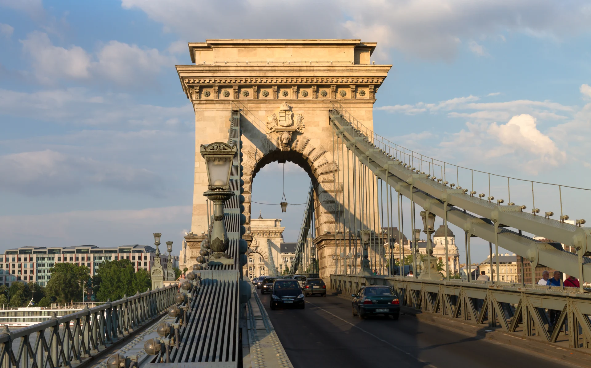
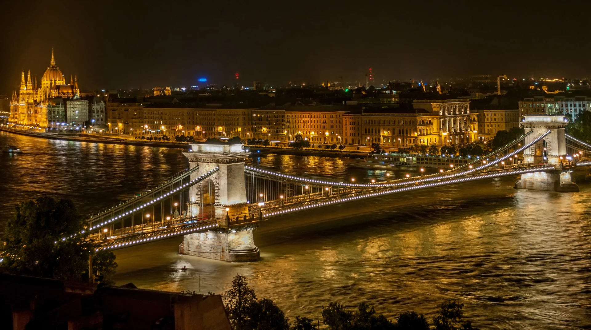
A bridge is more than the line that joins two pins on a map. At the Chain Bridge, look along the chains and towards a stone opening, then turn sideways to the river. The banks no longer occupy the same part of the frame when you change direction. This chapter uses that change of orientation to connect the hillside story with the streets of Pest, without pretending that the virtual journey has already checked every metre between them.
The June 2013 daylight photograph describes the bridge structure. A second image from that month is a night view taken from the castle side, while the May 2019 image looks down along the bridge in daylight. The two elevated photographs are overviews, not the viewpoint of somebody standing on the bridge deck. Traffic, lighting and physical arrangements belong to the capture dates. None of these images establishes today’s crossing rules, lighting schedule or available pavement width.
The optional August 2024 Google scene contains three local bridge positions and a checked return. Look for the deck and railings before moving; the controls compare nearby observations rather than guide a person into the carriageway. A separate Clark Ádám Square fragment helps read the Buda bridgehead, but it does not connect continuously to this sequence or verify a route up the hill. Use current pedestrian facilities and BKK information for an actual crossing. If weather, maintenance or crowds make the bridge inconvenient, pause the story here rather than treating completion of the digital route as a reason to continue physically.
Read further: Budapest’s Chain Bridge: a crossing before one cityReal-travel note
August 2024 local bridge imagery, not a verified bank-to-bank pedestrian itinerary. Do not stand at a road-camera location; check current crossing conditions.
Compare an exterior, a closer feature and another viewpoint using the visible gallery controls.
Chapter 4 · A façade at the end of a view
Let St Stephen’s Basilica close the square
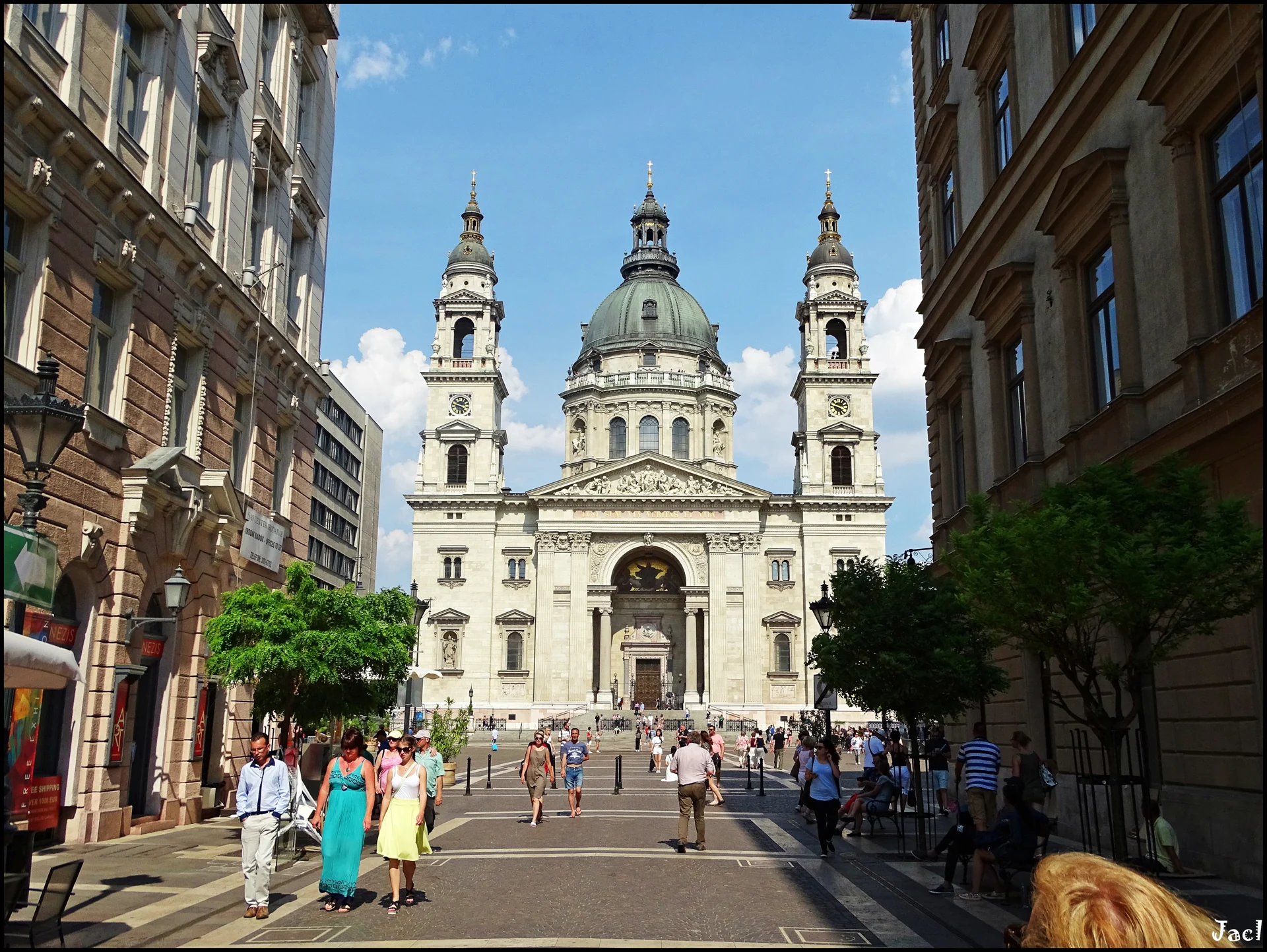
After the river’s wide horizon, the basilica gives the eye a building to settle on. Start at the lower entrance and trace a line up towards a tower, then compare the open space in front with the height of the façade. A church square is not just a viewing platform: doors, worshippers, visitors and everyday movement share it. Leave enough visual and physical space for those uses when you imagine a visit.
The June 2017 photograph places the basilica at the end of a pedestrian street. A September 2012 clock-tower image isolates a smaller feature high above the street, and an August 2007 photograph shows the western façade more closely. The dates explain why people, light and temporary features do not match. Use the gallery to change your question—from the whole frontage to the clock and back to the square—rather than trying to reconstruct one person’s walk from independent photographs.
The optional Google fragment dates to August 2024. Its three exterior positions along the southern edge of the square let you move locally and return while looking towards the façade. This is not a continuous route from the bridge or a survey of current conditions. The basilica’s website separates faith, cultural activities, tourism and tickets: this exterior experience includes none of those admissions and does not reach the panoramic lookout. For a river-side contrast, the optional Vigadó-area scene is a separate detour, not the next verified step out of the church square. Check present-day entrances and conditions through the basilica rather than assuming that a doorway in dated imagery is open now.
Real-travel note
August 2024 exterior imagery covers three local positions only. No church-interior, treasury or lookout visit is included; current access and events must be checked independently.
Compare an exterior, a closer feature and another viewpoint using the visible gallery controls.
Chapter 5 · Near detail, distant silhouette
Read Parliament from the square and the river
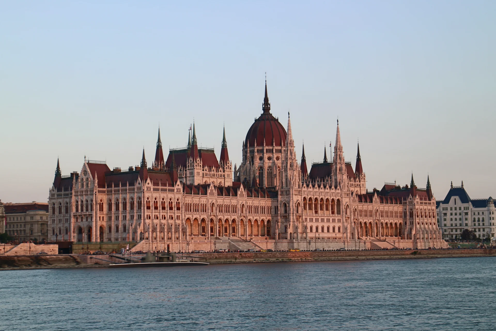
End with a deliberate change of distance. From close to Parliament, an arch or a window bay can occupy the whole view; from the opposite bank, those details become part of a long roofline. Neither distance is the complete building. Find one repeated form in a close image, then see whether it remains legible in the broad river view. The difference gives the final chapter its rhythm without needing to enter a room.
The exterior photograph has a capture date of 24 August 2015 in its metadata, despite the filename ending in 20150823. The August 2018 arch photograph moves closer, while the August 2015 image across the Danube restores the building’s broad composition. These are credited independent images. A photo made from the other bank is not evidence that the chapter’s interactive camera crosses the river or that the same view is visible from Kossuth Square.
The July 2024 Google fragment offers three local exterior positions near Parliament and a return. Rotate to place the building against the open square before moving. The separate Batthyány riverbank exploration is on the Buda side and gives an opposing viewpoint; treat it as an optional detour, not the continuation of this scene. Indoor Parliament visits follow the institution’s own visitor arrangements and are not part of this journey. Public events, security arrangements, tram movements and riverbank conditions can change. Choose a final photograph or detail to remember, then use current local information if you intend to turn the visual sequence into a physical day out.
Real-travel note
July 2024 local exterior scene. Batthyány Square is across the river, not the next linked camera position. No Parliament admission or verified road/tram crossing is included.
9 reviewed experiences
Explore along the route
Step into the places along this journey. Choose a view independently of the story chapters. Free previews do not count toward chapter progress. Return to the journey above to continue through its stops.
Read Buda Castle at courtyard scale 360° look-around
May 2026: one Mapillary panorama on an exterior palace path near an equestrian statue. Rotation only; no linked courtyard walk or museum admission. The gallery contains other castle-complex viewpoints.
Captured on
Reviewed 2026-10-23 · Nearby viewpoint
Explore at your own pace; these views do not count toward chapter completion. Check each point's coverage note before navigating provider imagery. Availability may change.
Sources
- Chain Bridge Budapest — Institution of Civil Engineers
- Chain Bridge — The Castle of Buda · Zoltán Fónagy
- Early development of Budapest transport — BKV
- Top attractions of Budapest — Budapest Tourist Board
- Church of Our Lady of Buda Castle — Matthias Church
- Saint Stephen’s Basilica — Saint Stephen’s Basilica
- Buda Castle Funicular — BKK
- Visitor route at the House of Parliament — Hungarian National Assembly
- Historical Museum, Buda Castle, Budapest, Hungary 2021.jpg — August Dominus · Wikimedia Commons
- Matthias Fountain in Budapest.jpg — Carl von Einem (Einemnet) · Wikimedia Commons
- Castle Hill, Medieval window and door frames, Buda Royal Palace.JPG — Globetrotter19 · Wikimedia Commons
- Larger view of the church on the buda castle hill.jpg — Alex Sirac · Wikimedia Commons
- Matthias Church 3.jpg — kallerna · Wikimedia Commons
- Fisherman's Bastion 2014.jpg — Perituss · Wikimedia Commons
- Széchenyi Chain Bridge, June 2013.jpg — Frank Schulenburg · Wikimedia Commons
- Széchenyi Chain Bridge in Budapest at night.jpg — Wilfredor · Wikimedia Commons
- 20190502 Most Łańcuchowy w Budapeszcie 1103 2033 DxO.jpg — Jakub Hałun · Wikimedia Commons
- St. Stephen's Basilica 2017.jpg — Jose A. · Wikimedia Commons
- St-Stephens-Basilica-Clock-Tower-Budapest-2012.jpg — Acediscovery · Wikimedia Commons
- Budapest, St. Stephen's Basilica the western facade.jpg — Dguendel · Wikimedia Commons
- Exterior of the Hungarian Parliament Building 20150823.jpg — Suicasmo · Wikimedia Commons
- Arch of the Hungarian Parliament Building, at twilight.jpg — Jules Verne Times Two · Wikimedia Commons
- HUN-2015-Budapest-Hungarian Parliament (Budapest) 2015-02.jpg — Godot13 · Wikimedia Commons
- 20190502 Baszta Rybacka w Budapeszcie 1029 1974 DxO.jpg — Jakub Hałun · Wikimedia Commons
- Vigado of Pest 2014.jpg — Perituss · Wikimedia Commons
- Budapest 20260411 182708.jpg — Vauia Rex · Wikimedia Commons
- Budapest bridge 4.jpg — Wilfredor · Wikimedia Commons


Your journey, remembered.
Explored 0 of 5 stops. Explore every stop to unlock your keepsake.
5 stops to your keepsakeExplore every stop to share or download your keepsake.
Prepare a Budapest visit
Use these observations to choose stops, not as turn-by-turn navigation.
Official sources checked:
Separate the hill from the river crossing
Story order: Buda Castle → Matthias Church → Chain Bridge → St Stephen’s Basilica → Parliament. Roughly 5–6 km and half a day outdoors are editorial planning estimates, not a measured or verified path. Optional riverbank detours and indoor visits add time.
Check slopes, steps and transport
Castle Hill involves height changes. Check BKK’s current funicular and transport information, including maintenance, rather than assuming a service is running. Images do not verify an accessible hill connection, a safe road/tram crossing or today’s bridge arrangements.
Keep outside views and admission separate
Church worship, tower or terrace access, museums and Parliament visits have their own conditions. Check current institutional information. A virtual scene is not an open-door promise, a ticket or a verified visitor entrance.