
Angkor Wat: from the western causeway to the Bakan
Preview five places inside Angkor Wat through ten licensed photographs and optional reviewed Google 360° viewpoints. The chapters form an editorial story, not a continuous surveyed walk.
Explore 3 reviewed views along the routeGuided visual journey
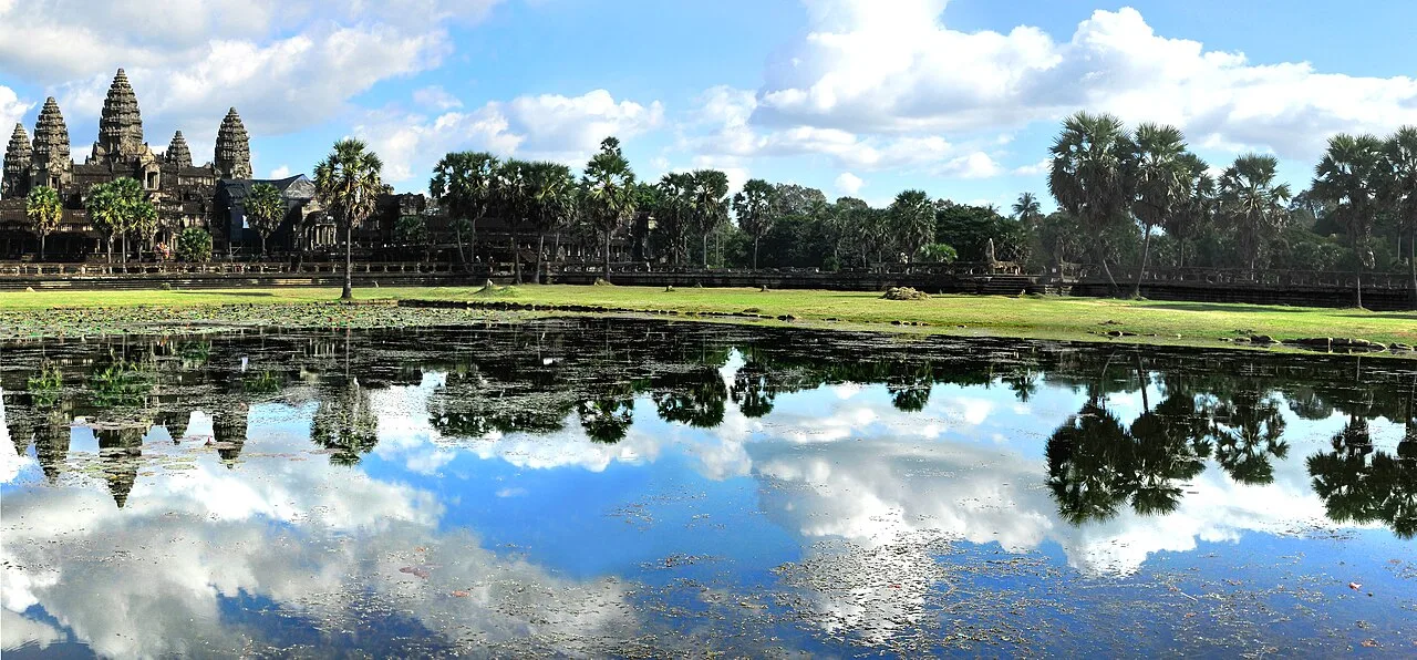
Angkor Wat reflected in a pond west of the temple · LBM1948 · CC BY-SA 4.0
Reading mode
Place stories to read at your own pace
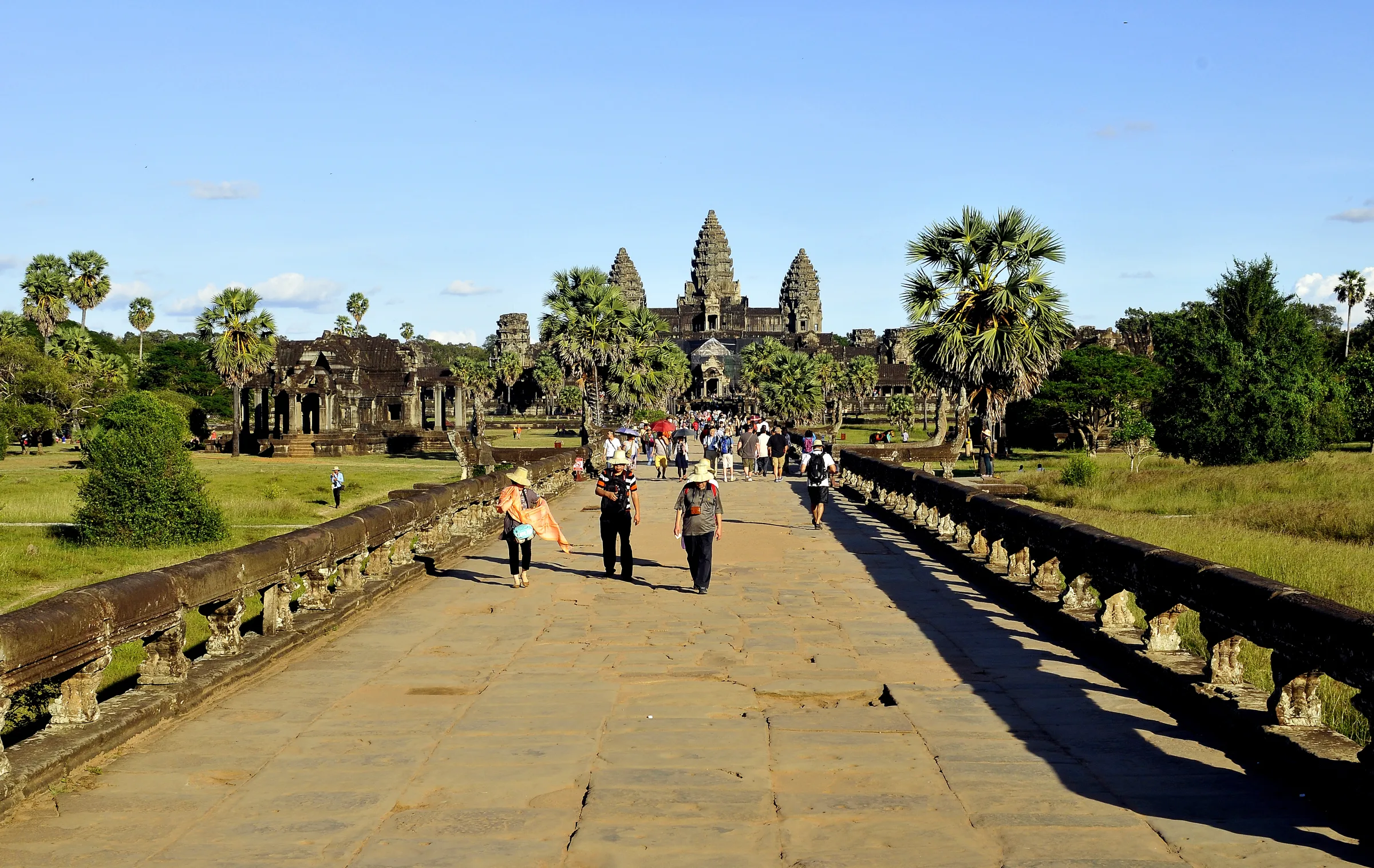
A broad approach and a closer causeway view from different dates and positions.
Chapter 1 · Crossing the moat
Approach on the western causeway
Angkor Wat first reveals its scale across water. From the western bank, the causeway draws a straight line over the moat toward the outer enclosure, while the central towers appear farther away than a postcard composition suggests. The two photographs in this chapter were made in different years and from different positions. One gives the broad approach; the other makes the sandstone surface and naga balustrade easier to inspect. Together they help you judge distance and exposure, but they do not record every step or show the state of the temporary and historic crossings today.
UNESCO places Angkor Wat inside the much larger Angkor archaeological site, which extends far beyond this one temple. This journey deliberately stays within the temple’s core west-to-east sequence rather than pretending to walk the whole park. APSARA National Authority manages the archaeological area and publishes the visitor code. That means the causeway is not merely an establishing shot: it is the moment to slow down, keep the passage clear and remember that conservation work can alter the route visitors actually use.
An optional Google 360° viewpoint may let you look around near this approach after you choose to open it. Its imagery is historical third-party coverage, not a camera controlled by WalkThere. Use it to understand proportions, then use current official information and on-site directions for the real entrance. Heat, rain, crowding and restoration barriers can all change what this open crossing feels like.
Real-travel note
The approach is exposed to sun and rain. Check the current entrance arrangement, dress code and Angkor visitor guidance before travelling.
A wide view of the western gopura and a separate closer view of its stone entrance.
Chapter 2 · Through the outer wall
Read the western gopura as a threshold
The western gopura turns the distant silhouette into a sequence of stone chambers, doorways and towers. A frontal photograph explains the gate’s breadth; a closer square-format image concentrates on the weight and texture of an entrance. They are not before-and-after pictures, and their dates do not describe the condition of the masonry now. Their value is spatial: the enclosure is not crossed through one tiny door but through an architectural threshold that filters movement from the causeway into the temple grounds.
Google’s official account of its Angkor Street View project says the collection used cars, Trekker backpacks and tripods across more than one hundred historic sites. That unusual coverage is why a visitor may find panoramic viewpoints in places where ordinary road Street View would never go. It does not mean every arrow remains connected or that a panorama proves a corridor is open today. The coordinate checked for this gate resolved farther east on the inner causeway rather than at the gopura, so WalkThere keeps this chapter as an honest two-photo comparison instead of showing a mismatched 360° control.
At the actual gopura, this is still part of a sacred and protected monument. APSARA’s visitor code asks people not to touch carvings or climb on loose and fragile structures. Let the close photograph replace the urge to handle the stone. Once through the gateway, the long central axis continues toward libraries, pools and the main temple, but this chapter does not claim that the photographed positions form a navigable line.
Real-travel note
Follow current one-way signs and staff instructions. Do not sit, lean or climb on carved masonry, even when other visitors do.
Two independently framed photographs from the same December 2014 day.
Chapter 3 · The central axis opens
Pause by the libraries and reflection pools
Beyond the western gate, the central sanctuary becomes visible across a broad precinct. The reflection ponds are famous camera positions, but the photographs here are useful precisely because they do not pretend to be live. Both were recorded in December 2014. One is a broad landscape; the other stretches the water, palms and towers into a panoramic frame. Their calm surfaces cannot promise the same water level, weather, vegetation or crowd when you arrive.
This is a good place to separate looking from collecting. A reflection can make Angkor Wat seem symmetrical and self-contained, while the real precinct includes libraries, paths, grass, visitors and working conservation. UNESCO’s listing covers an inhabited cultural landscape and a great archaeological ensemble, not an isolated decorative façade. Turn away from the iconic composition occasionally and notice how people move along the central axis and around the smaller buildings.
No matching panorama was verified within the bounded lookup around the reflection pools, so this chapter remains photo-only. The two documented frames let you compare composition without implying that an unrelated 360° scene belongs here. The next chapter moves into the outer gallery by editorial choice; no continuous imagery is claimed between the pool edge and the carved corridor.
Real-travel note
Do not block narrow paths or damage pond edges for a photograph. Weather and water level determine whether any reflection appears.
A visitor-scale corridor view and an independently photographed relief detail.
Chapter 4 · A story carved in stone
Slow down in the outer gallery
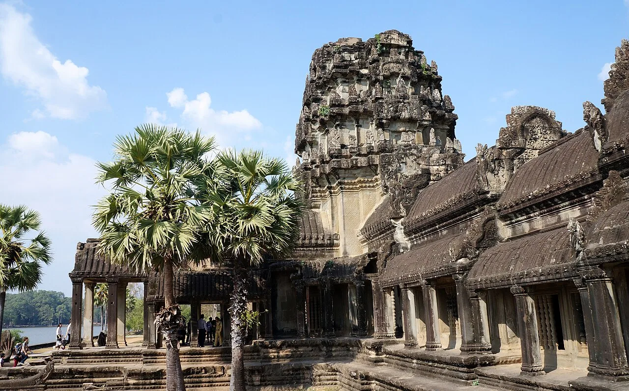
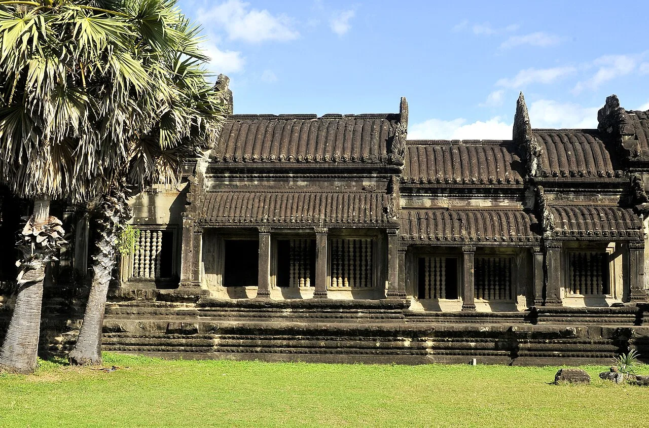
The outer gallery changes the visit from distant architecture to close reading. One photograph shows the gallery building from outside, placing its steps, windows and long roofline in the wider precinct. The second isolates figures in a relief. It is easy to reduce these surfaces to decoration, but the galleries carry extended narrative scenes that require time, changing light and careful movement along the wall. A single cropped detail cannot identify every figure or replace a qualified guide and current interpretive material.
The files also demonstrate why source information matters. LBM1948’s exterior photograph and Gary Todd’s CC0 detail were made on different dates, with different cameras and intentions. WalkThere presents them as complementary evidence, not as consecutive frames. The close view can reveal overlapping bodies and carved lines; the exterior view shows the architectural shell that contains the narrative walls. Neither justifies touching the stone, using flash where prohibited or stopping in a way that blocks circulation.
Google’s Angkor project included interior and tripod imagery, but old panoramas can disappear or lose connections. Any optional 360° view at this chapter is therefore labelled only with the capability we verified: looking around, or a very short bounded sequence if adjacent nodes were checked. It is not a full digital walk through every gallery. Before a real visit, consult current APSARA guidance and accept that conservation closures may redirect you to a different panel or side of the enclosure.
Real-travel note
Keep hands and bags away from the reliefs, follow photography restrictions and leave room for others in the narrow gallery.
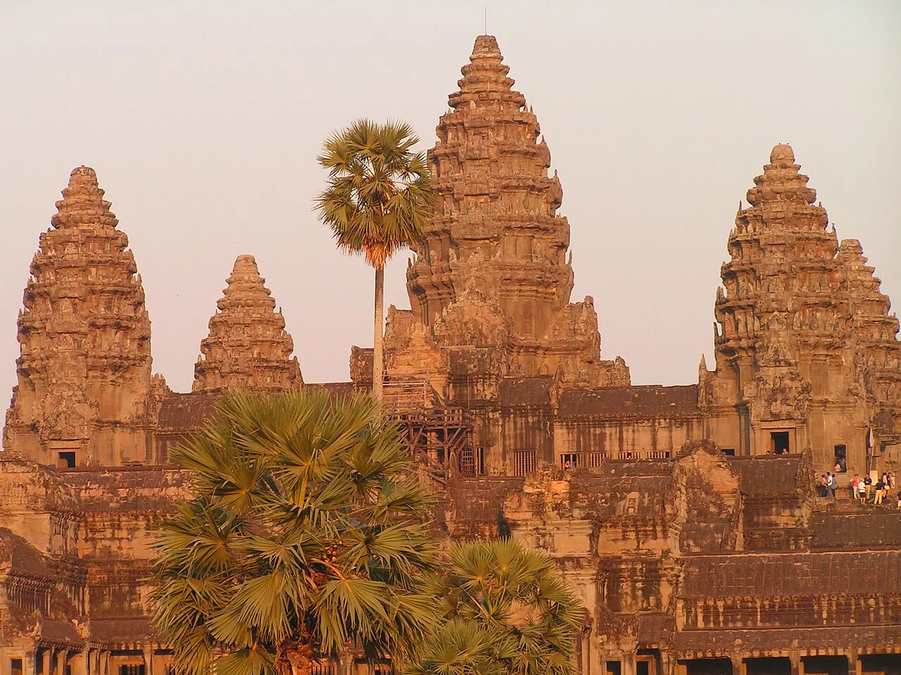
A view of the central towers and a separately dated devata inside the highest gallery.
Chapter 5 · The upper sanctuary
Look up toward the Bakan
The Bakan is the elevated centre of Angkor Wat, where the architecture becomes steeper and more compressed. A 2005 tower photograph introduces the mass of the upper sanctuary; a 2007 photograph records a devata carving inside its highest gallery. They offer an exterior and a detail rather than a step-by-step ascent. The age of the images is explicit because access arrangements, stairs and conservation measures are more important than preserving an illusion of timeless availability.
This final chapter is also where a visual preview should help someone decide not to continue. The approach can involve steep stairs, height and exposure. APSARA’s visitor code requires respectful clothing at sacred sites, including covered shoulders and knees, and present-day staff directions take priority over any old image. Check whether the upper level is open, whether your clothing meets the rules and whether the climb suits your mobility and comfort. Completing every chapter is not the purpose of the product.
An optional 360° viewpoint may add orientation around the central structure if current Google coverage still resolves at the reviewed anchor. It does not prove entry to the upper sanctuary, and WalkThere does not store a supposedly permanent panorama ID. Across all five chapters, the honest product is ten documented still photographs plus only the panoramic capabilities that survive a fresh runtime lookup. Use the preview to choose your pace, then rely on APSARA, your ticket conditions and on-site staff for the real visit.
Real-travel note
Upper-level access may be restricted. Cover shoulders and knees, check the current rules, and skip the steep ascent if it does not suit you.
3 reviewed experiences
Explore along the route
Step into the places along this journey. Choose a view independently of the story chapters.
Approach on the western causeway 360° look-around
The optional panorama is a reviewed viewpoint near the west causeway, not current entrance guidance or a continuous walk.
Reviewed 2026-10-07 · At the place
Explore at your own pace; these views do not count toward chapter completion. Short sequences cover only the reviewed section. Imagery availability may change.
Sources
- Angkor — UNESCO World Heritage Centre
- Tourism information and Angkor visitor code — APSARA National Authority
- Wander through Angkor’s thousand-year history with Street View — Google Maps Blog
- Angkor Wat, calzada oeste.jpg — Wikimedia Commons
- Sandstone causeway - Angkor Wat (6202440794).jpg — Wikimedia Commons
- Angkor Wat western gopura of the outer wall.jpg — Wikimedia Commons
- Western Gopura, Angkor Wat, Siem Reap, Cambodia - panoramio.jpg — Wikimedia Commons
- Angkor Wat reflejado en un estanque 01.jpg — Wikimedia Commons
- Angkor Wat reflejado en un estanque 07.jpg — Wikimedia Commons
- Angkor Wat, galería exterior 03.jpg — Wikimedia Commons
- Angkor Wat bas-reliefs (9727985325).jpg — Wikimedia Commons
- Angkor Wat Towers.jpg — Wikimedia Commons
- Angkor Wat Level A1 Inside 011 Kent Davis 2007 02 08.jpg — Wikimedia Commons

.jpg)


.jpg)


Your journey, remembered.
The keepsake unlocks when you reach this section.