
Utrecht from the cathedral square to the wharves
Five chapters through Utrecht at street and water level, from Domplein and City Hall to the canals and Twijnstraat.
Begin the visual journeyPlan a real visit to Utrecht Old TownExplore 9 reviewed views along the routeGuided visual journey
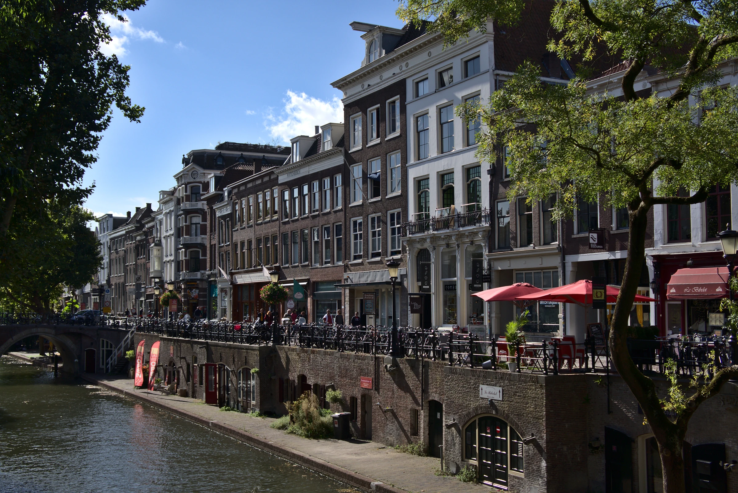
Wharves along Utrecht’s Oudegracht · Robert von Oliva (naruciakk) · CC0 · Resized, WebP
Reading mode
Place stories to read at your own pace
Each photograph has its own camera position and capture date.
Chapter 1
Domplein, a square where the nave stood
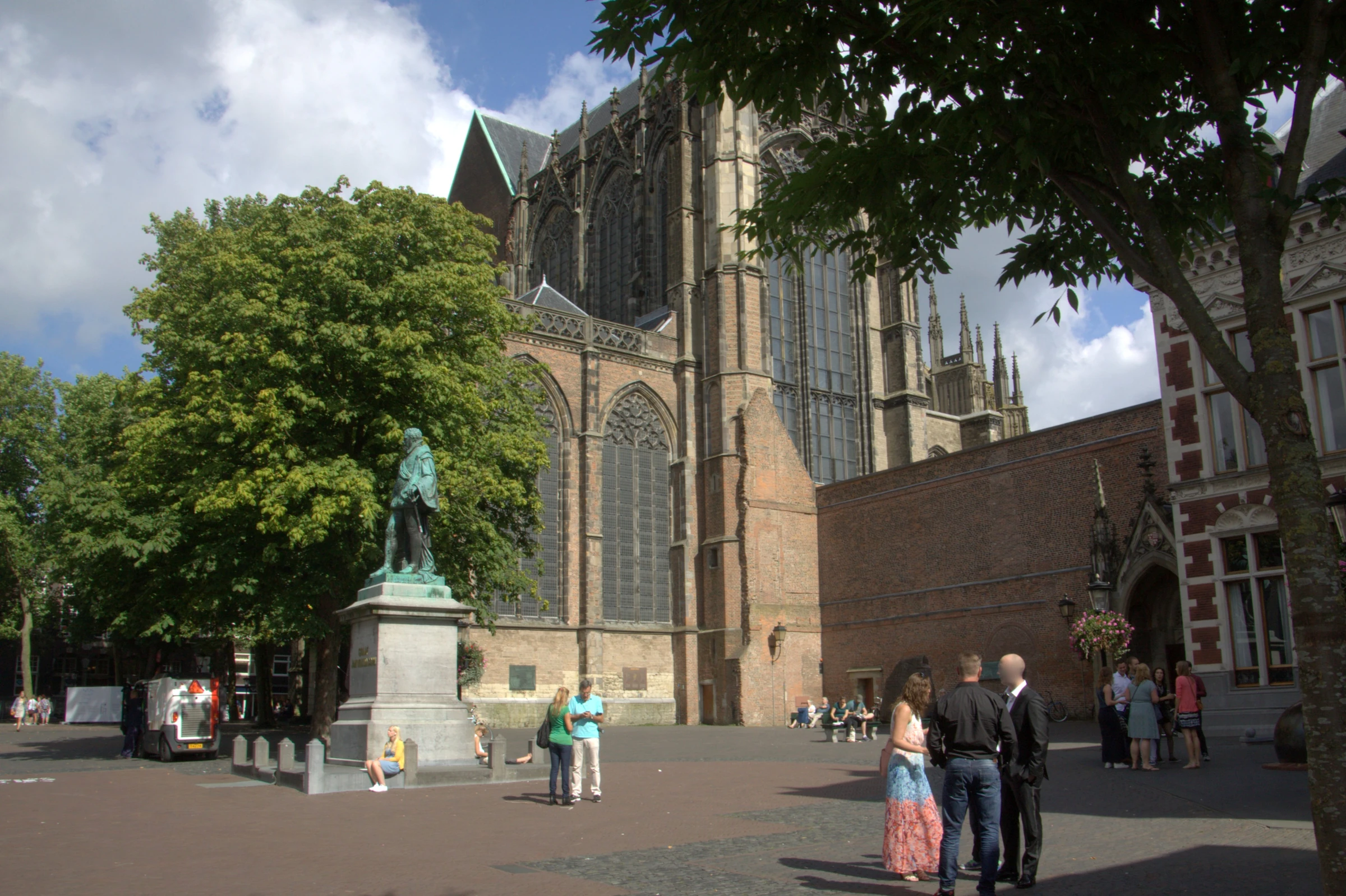
Start on the paving of Domplein. The distance from the Dom Tower to the wall of the church tells a story as clearly as either building. The tower was once joined to the church through its nave. A severe storm on 1 August 1674 brought the nave down, while the tower survived. The exposed end of the surviving church was closed up and the ruins remained on the site for generations. The city’s heritage office dates their removal to 1826. The square people now cross incorporates ground that was once occupied by the church. Give the space between the buildings the same attention you give their height.
The ground has an older history. Around the middle of the first century, the Romans built the fort of Traiectum here. The Rhine marked part of the imperial frontier and the fort occupied a position in that chain. Utrecht-Domplein is one component of the Lower German Limes World Heritage property. Those archaeological remains are evidence of a much earlier use of the site. The standing tower and the church walls belong to the medieval and later chapters of that history.
Start the gallery with the church behind the Jan van Nassau statue. Look where the church wall meets the paving, then trace the edge of the square toward the University Hall in the aerial view. The close photograph records a much smaller object, the carved plaque at the Jelling stone. It sits against brick, at the scale of someone stopping to read. For the tower itself, switch to the optional 360° view. There, follow its stonework down to the vaulted passage at ground level.
The Pandhof nearby offers a change of scale. Its enclosed garden belonged to the cathedral complex. Put that space beside the square in your mind. One makes the old buildings legible through an open interval, while the other brings the buildings close around a small patch of ground.
Real-travel note
Consult the Domplein visitor information for separate access to the church, tower and underground archaeology.
Each photograph has its own camera position and capture date.
Chapter 2
City Hall, between the bridge and the council chamber
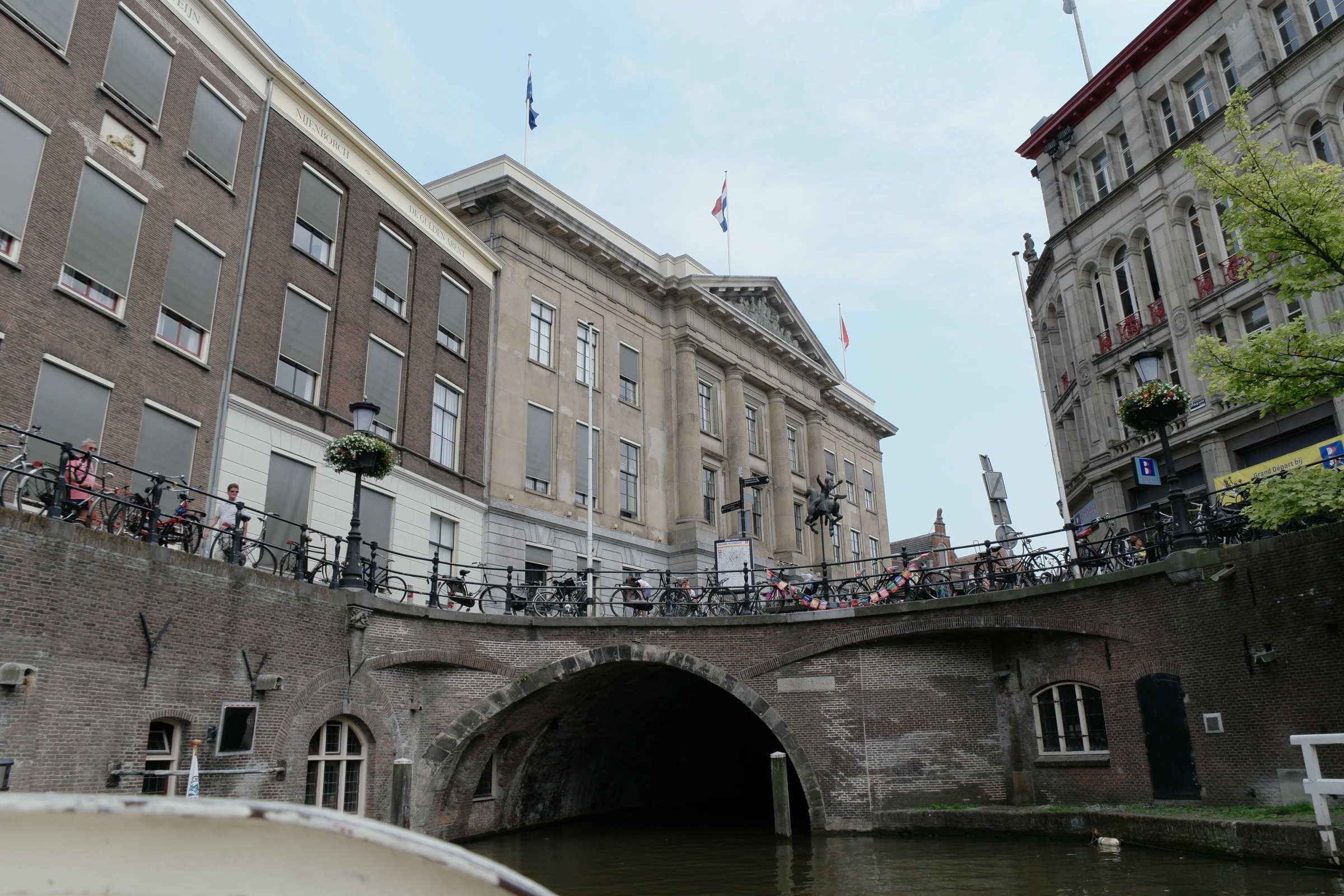
Begin on the Oudegracht side of City Hall. Follow the front from its stone base upward and take in the width of the building. The canal-facing elevation makes a group of municipal rooms look like a single public institution. There is another reason the setting feels unusually open. Stadhuisbrug spans the Oudegracht immediately alongside the building. Water runs under a piece of ground broad enough to be read as part of the civic space.
Utrecht’s city government came together here over centuries. In 1343 the city judges moved into a house called Hasenberg. In the sixteenth century the city acquired the neighbouring Lichtenberg for the council. The façade most closely associated with City Hall today comes from the neoclassical rebuilding completed in 1830. Medieval cellars from the Lichtenberg survive beneath the building. The outwardly unified front and the date of the oldest surviving fabric tell two different parts of its history.
Try to put the building and the bridge in the same mental picture. Utrecht’s archaeologists describe the present Stadhuisbrug as an assembly of four historic crossings, including the thirteenth-century Broodbrug. The wider stretch of paving makes it easy to overlook how much the old street network depended on passage across the canal. The canal-level photograph puts the bridge arch below the neoclassical front. The context photograph shows the stairs between street and wharf, and the detail moves close to a sculpture beside the red ironwork beneath the building’s windows. In the optional 360° view the paving above the arch fills the foreground.
A renovation designed by Enric Miralles at the turn of the twenty-first century changed the main entrance and made the old divisions within the complex more legible. The city’s own account follows these changes from the medieval houses to the modern rooms. Carry the question of levels to the next chapter. Above the canal, a bridge forms room for a public building’s approach. Along the same waterway, parallel wharves made room for the daily work of a port.
Real-travel note
Consult the city’s visitor information for current access to City Hall and civic events.
Each photograph has its own camera position and capture date.
Chapter 3
Oudegracht, a port below the street
Start with the water in the broad view. Find the narrow strip of ground beside it and then the line of the street above. When those two levels are visible together, the usual image of a canal between two rows of houses starts to change. A Utrecht wharf sits close to the water, with cellar space behind it. The higher street gives access to the buildings above. From a bridge it is possible to read several parts of the arrangement at once. From nearer the wharf, the lower level has enough space to register as a place in its own right.
The municipal heritage office traces that arrangement to a practical difficulty. Goods unloaded at the water had to go up the bank and then down again into house cellars. By the end of the twelfth century some merchants were connecting the landing places to their cellars with passages. The passages widened over time and acquired room for storage. By about 1500 the two banks together formed a port roughly two kilometres long through the city. The clearest evidence in an exterior photograph is the succession of entrances and the relationship of the bank to the water. The rooms extend beyond the walls seen from the canal.
Later changes are visible in the way people use this space today. The city acquired most wharves starting in 1948 and removed old boundaries to open routes along the water. Wharf cellars remained under separate ownership. Repairs to the banks and vaults have kept up the physical connections between water, public space and buildings. A single photograph of a terrace captures one use of a structure that served many others.
Compare the sunlit wharf in the broad photograph with the terrace beneath the trees in the view toward Smeebrug. At the scale of one object, the carved Drakenburgh lamp bracket shows how a small fitting can occupy a place in the brick bank. In the 360° view, use the steps across from Weesbrug to connect the two levels in your mind. Nieuwegracht repeats some of those levels while giving the water different work to do.
Real-travel note
Check the city’s notices for canal-side works and access to individual wharves.
Each photograph has its own camera position and capture date.
Chapter 4
Nieuwegracht, the canal behind the houses
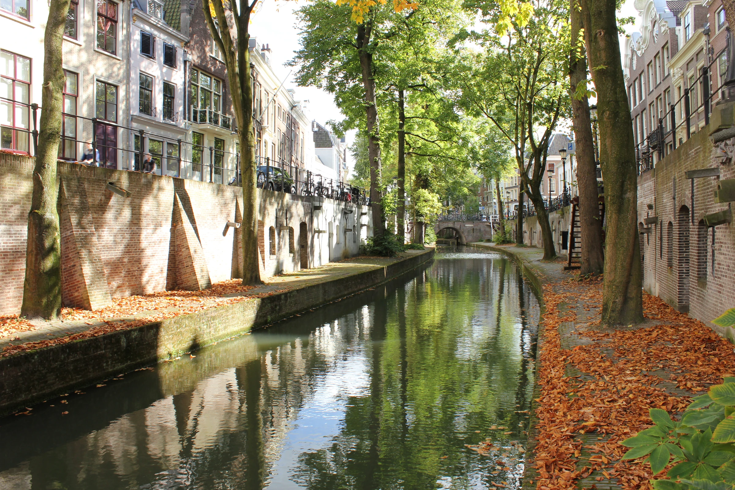
Begin with the two tree-lined banks in the long photograph toward Paulusbrug. Use the waterline to judge where the houses and paths stand. The small brick arch in the detail photo meets the water almost directly, with the street just above the top of the arch. In the third photograph, the lower bank stretches past a row of openings beneath the houses. Put the three observations together before looking along the canal again. A view of the full channel shows where the narrow spaces continue, while the close frame lets you gauge the distance between water and street.
The city’s heritage office dates the digging of this canal to 1391–1393. It describes drainage and supplies to houses and monasteries as its main purposes. The Oudegracht carried considerably more trade. Both waterways acquired wharf cellars, but the ground available for a landing varied along the newer canal system. At narrow reaches such as Kromme Nieuwegracht, some cellars open straight onto the water. Where a ledge is present, it gives the canal a second edge inside the higher street. The two arrangements make sense once you take the width of the channel and the buildings around it into account.
Look from one photograph to the next for how the two banks enter the picture. A rail, a bridge or a projecting wall can provide a firm reference when trees and reflections make the boundary of the canal hard to follow. Keep the taller façades in mind even where the camera draws attention downward. The riverward wall of a cellar and the wall of the house above can belong to the same arrangement, even when they read as separate parts of an image.
Paushuize offers a close look at a house where the Kromme Nieuwegracht meets Pausdam. Its brick and stone exterior gives the canal corner a distinct address. The southern city is the next change of scale. At Twijnstraat the journey returns to street level, where the width of an individual shop becomes a useful measure of urban space.
Real-travel note
Use the individual site listings for visiting arrangements near the Nieuwegracht.
Each photograph has its own camera position and capture date.
Chapter 5
Twijnstraat, the old town at shopfront level
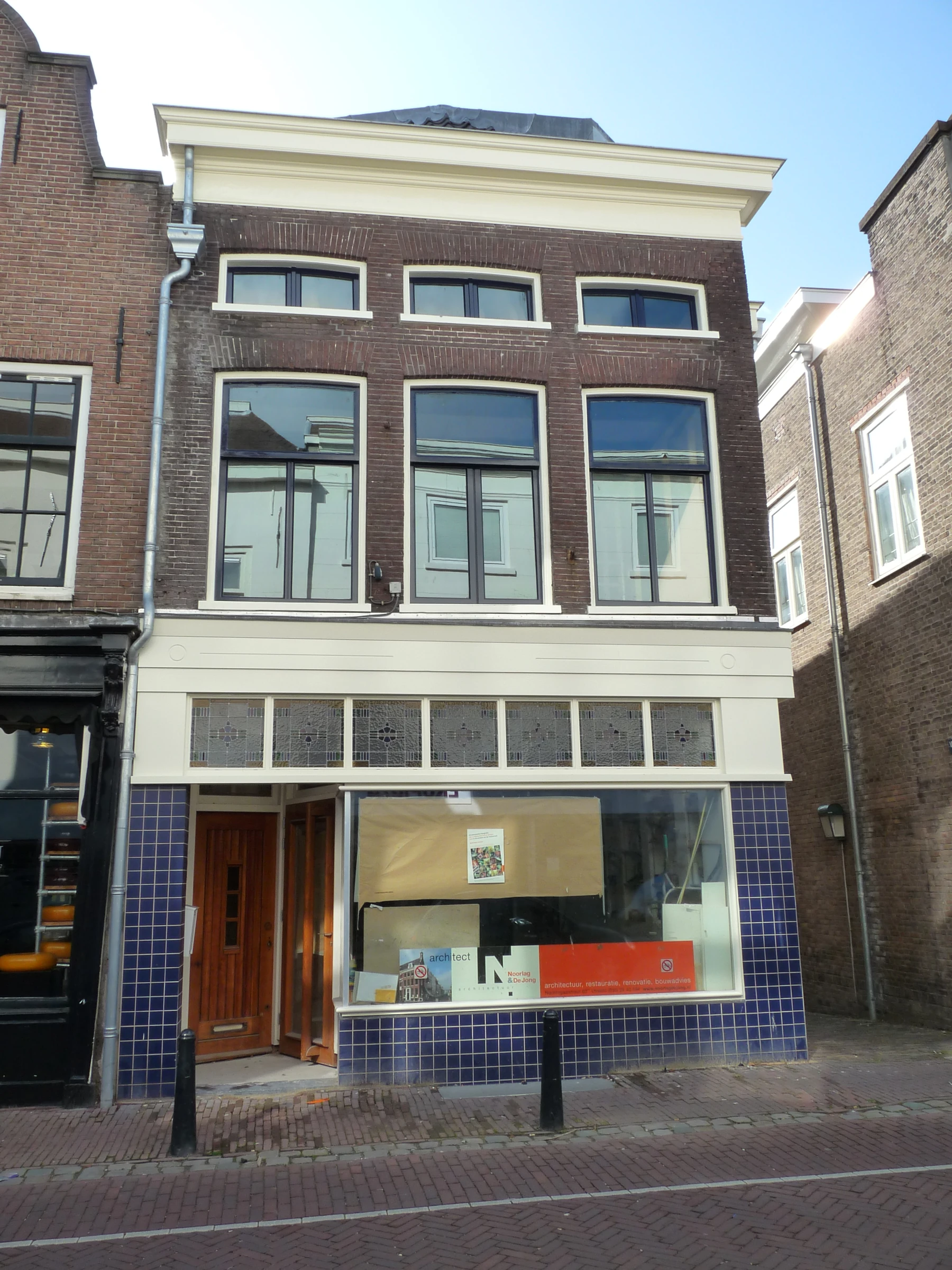
At Twijnstraat, begin at street level. Near the southern end of the Oudegracht, the old town’s scale can be read through the width of a single shopfront. Pick one frontage and follow it upward from the doorway. Then look at the distance to the next entrance. On this scale, many opportunities to stop or turn come within the space occupied by a single public building back at City Hall. A photograph can hold the upper storeys and the public face of the shop together, even though each has a different relationship to the person passing by.
Discover Utrecht describes Twijnstraat as one of the city’s oldest shopping streets and places it in the Museum Quarter at the end of the Oudegracht. Its mix of food shops, independent retailers and places to sit explains the appeal of the address for people living nearby. The office’s walking guide puts Ledig Erf at its southern end. In the stills, start at number 65, where a shop window takes up much of the base of a tall brick façade. Compare the window and benches outside KEEK, then look from Ledig Erf toward Twijnstraat aan de Werf for the canal side of the neighbourhood. The optional 360° view supplies a view along the shopping street itself.
The canal mattered to this end of town, though its layered wharves offer a different way to look at the buildings. At water level the working frontage ran parallel to the flow. On Twijnstraat the doors are met in succession along the pavement. Think of the points where a person enters, crosses or pauses, and how little of that movement can be guessed from a roofline alone.
Return in your mind to the first chapter. Domplein became open after a large part of a building disappeared. Twijnstraat is held closely by many small frontages. In between were the civic bridge and two canals, each of which gave people a different place to meet the same city. The photographs put two thresholds at street level beside a view of the wharf below.
Real-travel note
Check the individual businesses and museums for visiting information.
9 reviewed experiences
Explore along the route
Step into the places along this journey. Choose a view independently of the story chapters. Free previews do not count toward chapter progress. Return to the journey above to continue through its stops.
Domplein, a square where the nave stood Short observation sequence
360° capture month 2025-07. 3 connected local positions with movement in either direction. Look up at the Dom Tower from the square, then approach the vaulted passage under it. Still photograph taken 2016-09-09.
Reviewed 2026-11-20 · Nearby viewpoint
Explore at your own pace; these views do not count toward chapter completion. Check each point's coverage note before navigating provider imagery. Availability may change.
Sources
- Domplein through the centuries — Gemeente Utrecht
- Dom Tower and the lost nave — Gemeente Utrecht
- Discover Domplein and the Pandhof — Discover Utrecht
- Lower German Limes component sites — UNESCO World Heritage Centre
- History of Utrecht City Hall — Gemeente Utrecht
- Archaeological report on the Broodbrug and De Gulden Arent — Gemeente Utrecht
- Utrecht’s wharves and wharf cellars — Gemeente Utrecht
- Conservation of Utrecht’s wharves — Gemeente Utrecht
- Twijnstraat in the Museum Quarter — Discover Utrecht
- Twijnstraat and Ledig Erf — Discover Utrecht
- Paushuize and Adrian VI — Het Koninklijk Huis
- The bastion and observatory — Sonnenborgh museum & sterrenwacht
- History of the observatory — Sonnenborgh museum & sterrenwacht
- The Jacobikerk building — Jacobikerk Utrecht
- The Jacobikerk clock and bells — Jacobikerk Utrecht
- The Dom Church and Jan van Nassau statue across Domplein in Utrecht — Jan dijkstra
- A plaque with carved lettering mounted against a brick wall at the Jelling stone on Domplein — Autopilot
- The University Hall and the Dom Church courtyard seen from above Domplein — Choinowski
- Utrecht City Hall and the arch of Stadhuisbrug seen from canal level — StagiaireMGIMO
- A sculpture beside tall windows and a red iron balcony on Utrecht City Hall — Arjandb
- Utrecht City Hall beside the steps and lower quays of the Oudegracht — Sargas
- Daylight on the Oudegracht canal, the lower wharf and the buildings above it — Robert von Oliva (naruciakk)
- The carved Drakenburgh lamp bracket set into the Oudegracht’s brickwork — Sonty567
- A lower Oudegracht wharf with a terrace under trees, looking toward Smeebrug — Jan dijkstra
- The tree-lined Nieuwegracht and its low banks leading toward Paulusbrug — Sargas
- A low brick arch meeting the water below the Nieuwegracht’s street level — Basvb
- Lower wharf and openings along the Nieuwegracht, with houses and parked cars above — Havang(nl)
- The tall brick frontage at Twijnstraat 65 with a shop window at street level — AnneDon
- The KEEK shopfront on Twijnstraat, with pale trim and benches outside — Andy Li
- The Oudegracht and Twijnstraat aan de Werf seen from Ledig Erf — Jan dijkstra
- Gothic tracery, trimmed beds and a fountain in the Pandhof cloister garden — Marcelmulder68
- Paushuize’s striped brick façade and stepped gable at Pausdam — China Crisis
- Sonnenborgh’s brick bastion and observatory seen across the water — Japiot
- The tower and roof of Jacobikerk seen down a neighbourhood street — Japiot


Your journey, remembered.
Explored 0 of 5 stops. Explore every stop to unlock your keepsake.
5 stops to your keepsakeExplore every stop to share or download your keepsake.
Plan your Utrecht visits
Use the chapters to get oriented and consult each site for visiting information.
Official sources checked:
Chapter order
The five chapters cover Domplein, City Hall, Oudegracht, Nieuwegracht and Twijnstraat, in that order.
Visiting information
Check opening hours, tickets and accessibility for each visit.