
Edinburgh Royal Mile: read the ridge from castle to palace
Follow Edinburgh’s historic spine through changing street widths, closes, civic buildings and two royal precincts. Five chapters, fifteen licensed photographs and eight optional local Google sequences reveal the route without pretending that historical imagery is a live, continuous walk.
Begin the visual journeyExplore 8 reviewed views along the routeGuided visual journey
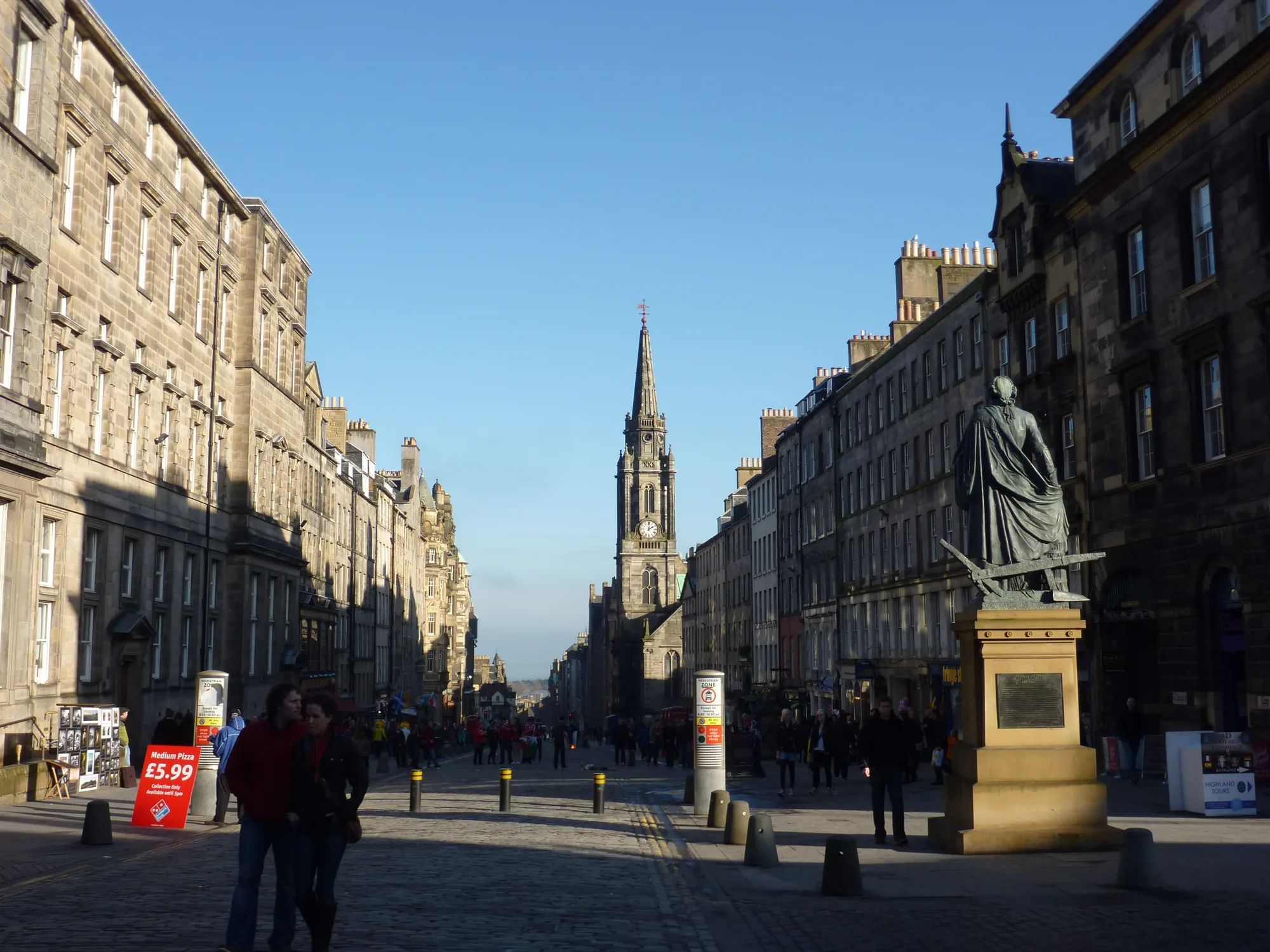
Lawnmarket tenements leading toward the crown spire of St Giles · Richard West · CC BY-SA 2.0
Reading mode
Place stories to read at your own pace
Use the arrows to change viewpoint and date. These licensed photographs are not consecutive walking frames.
Chapter 1 · Begin on the volcanic ridge
Let Castlehill establish the scale
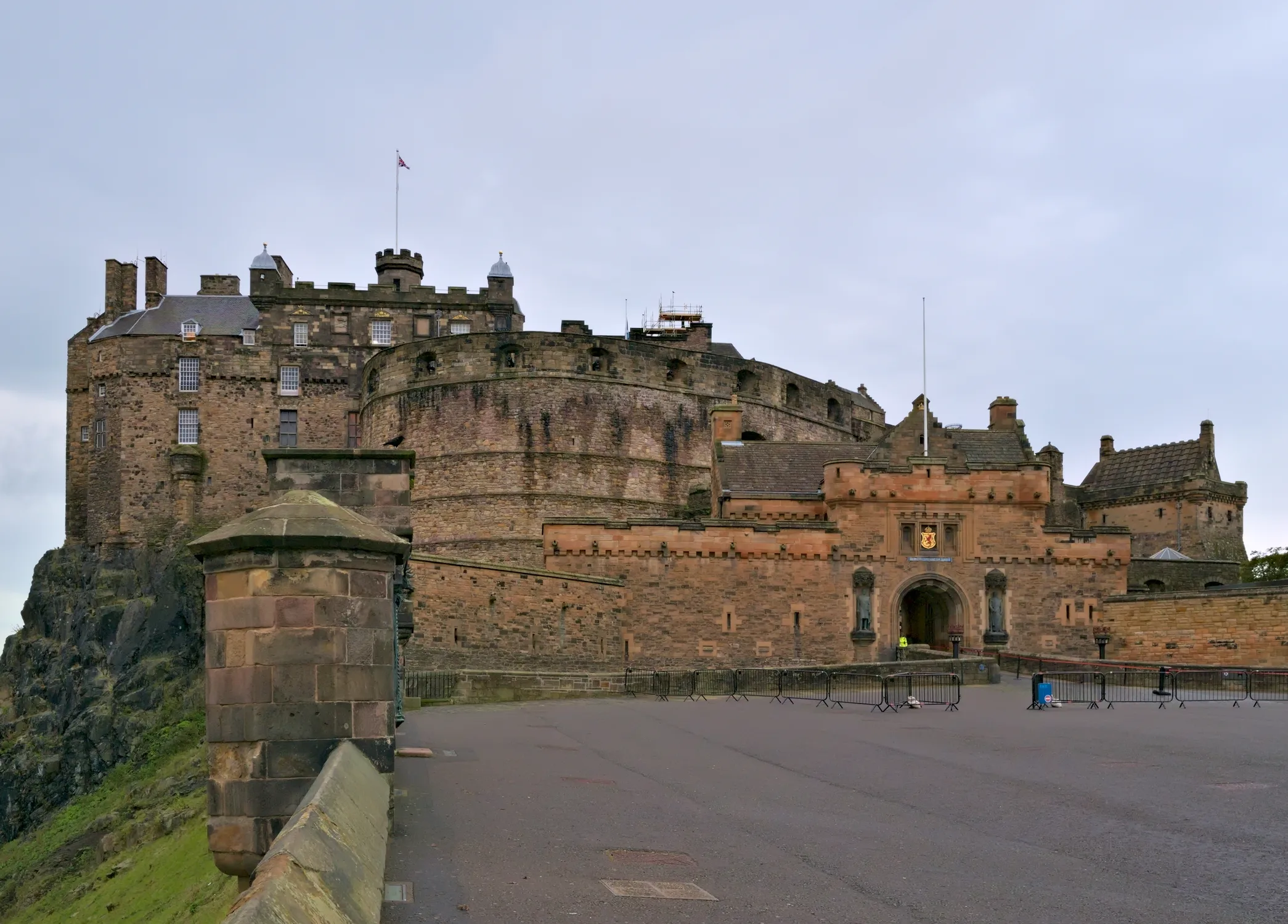
Start outside the ticket barrier, where the broad esplanade turns a dense Old Town street into exposed sky and stone. The castle occupies the end of a ridge shaped by geology long before it became a royal stronghold. Edinburgh World Heritage describes the Old Town as a “crag and tail” landscape: the rock holds the castle while the long descending tail became the Royal Mile. That relationship is easier to understand from the approach than from a close view of one doorway.
The three photographs separate weather, distance and defensive form. Daniel Kraft looks across the esplanade in October 2021. Olliebailie moves closer to the stone approach in April 2023, while Peulle’s December photograph places towers and curved walls under winter light. They are independent observations, not consecutive frames. Use the carousel to ask what disappears as the camera approaches: skyline becomes masonry, then gates and surfaces begin to matter.
The optional Google sequence is deliberately smaller. It follows three checked June 2023 positions east along Castlehill, below the esplanade, and lets you return to the starting point. It does not enter the castle, cross the ticket line or prove current crowding. Historic Environment Scotland identifies the castle at the top of the Royal Mile and warns that the interior route includes steep cobbles and steps. Recheck tickets, security, event structures and accessibility before treating this visual opening as a travel plan.
Real-travel note
The interactive camera remains on Castlehill. Castle entry, event structures, luggage rules and step-free options can change; use the official access guide before visiting.
Use the arrows to change viewpoint and date. These licensed photographs are not consecutive walking frames.
Chapter 2 · Read the city sideways
Look beyond Lawnmarket’s main frontage
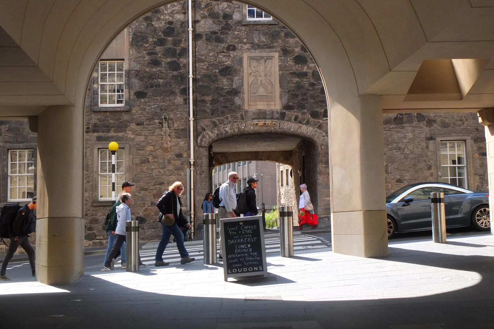
Lawnmarket looks linear on a map, but the Old Town is built through depth as much as length. Tall street fronts contain narrow passages that lead into courts, stairs and sharply changing levels. Do not read every close as a public shortcut: names and archways are evidence of urban form, not automatic permission to enter. The useful habit here is to pause on the main street, notice a threshold, and then check current signs before deciding whether to move sideways.
Richard West’s 2011 photograph keeps the long street and St Giles’ crown spire in one view. Stephencdickson’s 2019 image steps into Lady Stair’s Close to show how a historic house is enclosed by the court around it. Ralf Steinberger’s 2020 photograph looks down the curve of Victoria Street and its upper terrace, revealing a lower street level that the ridge can hide. These viewpoints are near one another but not a seamless walk, and the pictures record different years and access conditions.
The optional August 2022 Google sequence begins on Victoria Terrace and moves through three linked positions before returning. It is useful for reading the split-level street, not for claiming complete coverage of Lawnmarket or any close. Shops, delivery access, crowd control and permitted routes can change. Keep the main question architectural: how does the ridge produce an upper route, a lower curve and small enclosed courts within a very short map distance?
Real-travel note
Closes may be residential, gated or restricted. Keep entrances clear and verify public access rather than following a camera line. Victoria Terrace is a separate level from the street below.
Use the arrows to change viewpoint and date. These licensed photographs are not consecutive walking frames.
Chapter 3 · Stone, worship and civic space
Read St Giles from outside and within
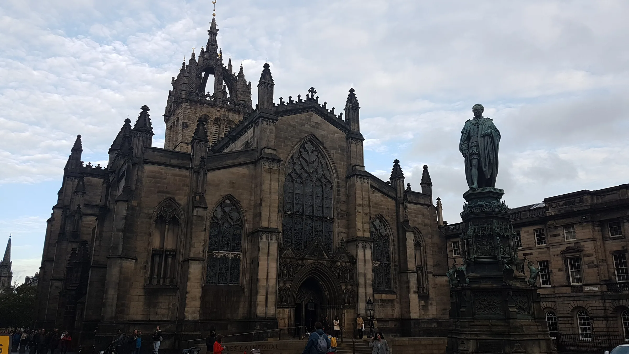
At St Giles, the Royal Mile becomes both street and civic room. The church’s crown spire is a long-distance marker, but the building is more revealing when you compare the busy paving outside with the compressed stone and coloured light within. Begin with the exterior rather than rushing to a list of famous events: note how Parliament Square wraps the south side and how pedestrians, monuments and doors compete for limited space.
Stinglehammer’s September 2018 exterior photograph establishes the crown spire and square. Michael D Beckwith’s March 2018 nave view changes scale to columns and vaults. Gregg M. Erickson’s 2009 panoramic photograph stretches the interior laterally, making clear that a spherical source flattened into a still is different from live navigation. These interior photographs document accessible viewpoints from their dates; they do not guarantee that every area, service or photography policy is the same now.
The cathedral’s official history dates its foundation to 1124 and explains how settlement from Holyrood grew up the ridge toward it, helping form what is now called the Royal Mile. The optional June 2023 Google sequence stays outdoors and follows three checked positions east of the church along High Street. A second nearby sequence appears later in Along-route exploration. Neither enters St Giles. It remains an active place of worship, so consult current visiting information and let services, quiet reflection and accessibility needs take priority over the camera.
Real-travel note
The Google view is exterior only. Check current visitor and worship arrangements, and follow staff guidance on quiet, photography and access inside St Giles.
Use the arrows to change viewpoint and date. These licensed photographs are not consecutive walking frames.
Chapter 4 · A different burgh on the same ridge
Notice where High Street becomes Canongate
East of the central High Street, Canongate deserves to be read as more than the final stretch before Holyrood. Its name and institutions belonged to a distinct burgh that grew from the abbey end of the ridge. The street still carries that layered identity in civic buildings, church frontage, housing, shops and passages. Rather than searching for a single boundary marker, watch for a shift in scale and rhythm as the road continues downhill.
Jim Barton’s August 2019 street view gives the descending frontage room to breathe. rboed*’s two April 2024 photographs isolate the Tolbooth and Canongate Kirk: one uses the clock and projecting stair as a civic landmark, while the other centres the kirk’s rounded gable and circular window. The images were not made as one sequence. Their value lies in changing the question from “what is the next attraction?” to “which institutions make this section feel like its own place?”
St Giles’ history connects the Canongate burgh to settlement built by the abbey up the ridge toward the older church. The optional Google experience follows three checked October 2025 positions on Canongate itself and returns to the start. It does not enter the Tolbooth, the kirk, a close or a residence. Traffic, construction and doors belong to that capture date only. Treat this as a short street observation, then check current opening, worship and access notices directly with the places you intend to enter.
Real-travel note
This remains a working street with homes, worship and traffic. Do not treat closes or doorways as public; the historical Google sequence is observation, not pedestrian guidance.
Use the arrows to change viewpoint and date. These licensed photographs are not consecutive walking frames.
Chapter 5 · Finish at a working royal precinct
End with palace, fountain and abbey
At the foot of the ridge, Holyrood changes the Royal Mile’s ending from a narrow street into a guarded precinct framed by palace, park and modern government buildings. The visual journey stops outside. That boundary matters because the Palace of Holyroodhouse is not only historic fabric; it is a working royal palace whose opening and security arrangements can change at short notice.
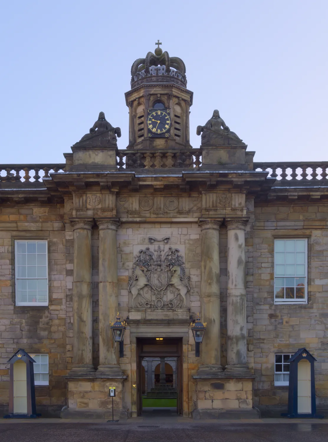
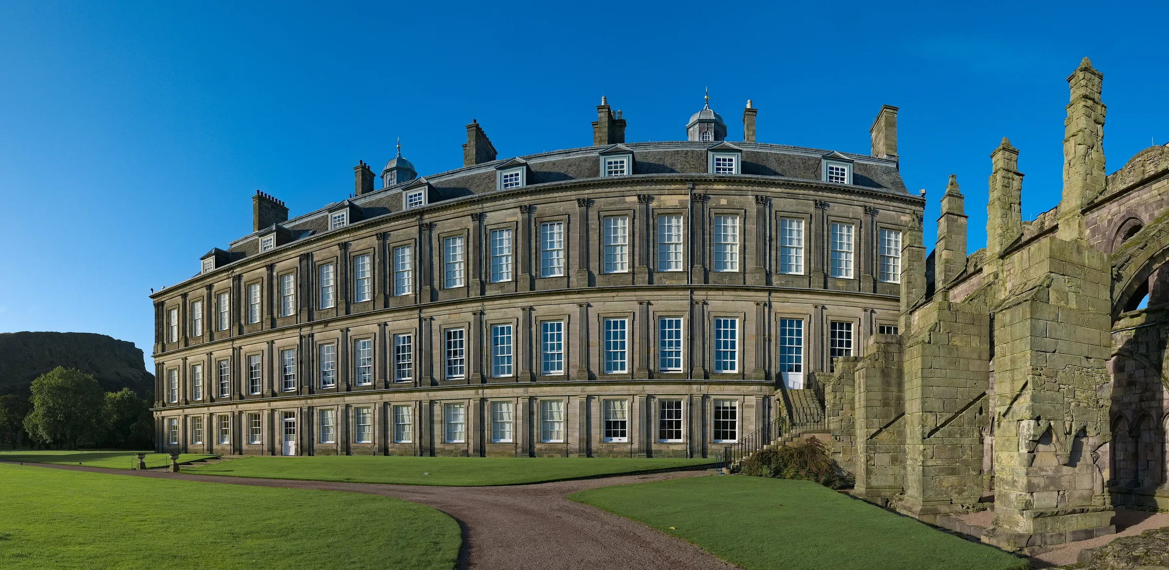
Daniel Kraft made all three photographs on 21 October 2021, but each asks a different question. The entrance view gives the façade a frontal hierarchy. The fountain draws attention to ornament and the space in front of the palace. The wide palace-and-abbey view places roofless ruins beside the inhabited complex, showing that “Holyrood” contains several historical layers rather than one façade. These stills share a date, not a continuous camera path, and their access does not establish what a visitor can enter now.
The optional October 2025 Google sequence follows three checked positions west on Horse Wynd and returns. It can help orient the palace gates and street edge, but it does not cross security, enter the forecourt or prove a route into Holyrood Park. Royal Collection Trust asks visitors to expect bag checks and a one-way internal route, and notes that indoor photography is restricted. Finish by separating what the page can show—scale, surroundings and historical views—from the live decisions only current official information can answer.
Real-travel note
The interactive view stays on Horse Wynd outside the palace. Recheck closures, tickets, security, photography and access; a working royal palace can change arrangements at short notice.
8 reviewed experiences
Explore along the route
Step into the places along this journey. Choose a view independently of the story chapters. Free previews do not count toward chapter progress. Return to the journey above to continue through its stops.
Let Castlehill establish the scale Short observation sequence
June 2023: three checked positions east along Castlehill, with a return. The camera remains below the esplanade and never enters the castle.
Reviewed 2026-10-13 · At the place
Explore at your own pace; these views do not count toward chapter completion. Check each point's coverage note before navigating provider imagery. Availability may change.
Sources
- The UNESCO World Heritage Site — Edinburgh World Heritage
- Edinburgh Castle: plan your visit — Historic Environment Scotland
- History of St Giles’ Cathedral — St Giles’ Cathedral
- St Giles’ Cathedral — St Giles’ Cathedral
- Practical information for visiting the Palace of Holyroodhouse — Royal Collection Trust
- Edinburgh Castle from Esplanade 20211019.jpg — Wikimedia Commons
- City of Edinburgh - Edinburgh Castle Esplanade - 20230412130104.jpg — Wikimedia Commons
- Edinburgh Castle dec.23 (2).jpg — Wikimedia Commons
- Edinburgh Townscape , The Lawnmarket, Royal Mile - geograph.org.uk - 2271346.jpg — Wikimedia Commons
- Lady Stair's House (the Writers Museum), Lawnmarket, Edinburgh.jpg — Wikimedia Commons
- Victoria Street in Edinburgh, Scotland, United Kingdom - 50436347402.jpg — Wikimedia Commons
- St Giles Cathedral Edinburgh - landscape.jpg — Wikimedia Commons
- St Giles Cathedral Nave.jpg — Wikimedia Commons
- St Giles Cathedral Interior, Edinburgh, 360° Panorama.jpg — Wikimedia Commons
- Canongate, Edinburgh - geograph.org.uk - 6242076.jpg — Wikimedia Commons
- Canongate Tolbooth, Edinburgh, Scotland.jpg — Wikimedia Commons
- Canongate Kirk, Edinburgh, Scotland.jpg — Wikimedia Commons
- Holyrood Palace main entrance 20211021.jpg — Wikimedia Commons
- Holyrood Palace fountain 20211021.jpg — Wikimedia Commons
- Holyrood Palace and Abbey 20211021.jpg — Wikimedia Commons


.jpg)

,_Lawnmarket,_Edinburgh.jpg)


Your journey, remembered.
Explored 0 of 5 stops. Explore every stop to unlock your keepsake.
5 stops to your keepsakeExplore every stop to share or download your keepsake.