
Athens Historic Centre: rock, neighbourhoods and public life
Read Athens’ ancient remains and modern life through five distinct urban spaces.
Begin the visual journeyPlan a real visit to Athens Historic CentreExplore 9 reviewed views along the routeGuided visual journey
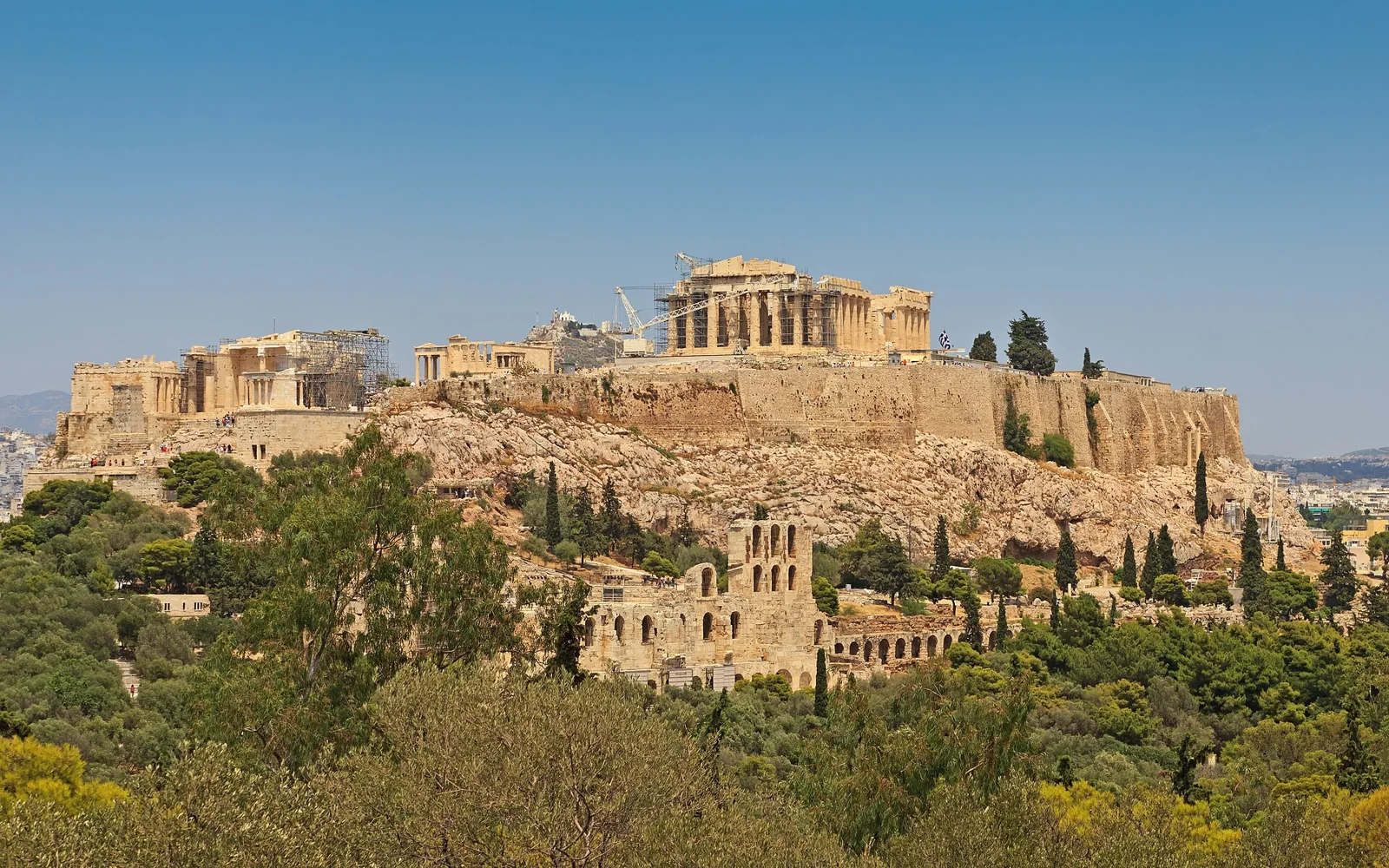
Acropolis hill above Athens viewed from Philopappos · A.Savin · CC BY-SA 3.0 · Resized and converted to WebP
Reading mode
Place stories to read at your own pace
Compare independently captured photographs and viewpoints, each with its own date.
Chapter 1
Acropolis: a monument above a living city
Begin with the relationship between the rock and the city. The Acropolis can seem detached from ordinary Athens when a photograph isolates its temples against the sky. Widen the frame and the hill becomes part of a larger inhabited landscape. Buildings, trees and paths establish the distance between a monumental summit and the streets below. This chapter asks you to read that relationship before concentrating on any single column. The independent interactive scene may be on surrounding footpaths; it does not take you through the ticketed summit complex.
UNESCO places the principal Classical monuments in the fifth century BC and recognises the Acropolis as a World Heritage property. That historical frame helps distinguish the ancient architecture from the many later lives of its setting. A surviving monument is not an untouched message delivered directly from antiquity. Look for changes of material and tone without trying to diagnose a restoration campaign from a small photograph. The visible surface is a starting point for questions, while a specialist source is needed to explain interventions.
Use the three photographs at different scales. In the broad view, trace the outline where rock gives way to construction. In the detail, consider how repeated vertical elements divide light and shadow. In the contextual frame, notice how much of the surrounding city enters the composition. The images need not share a viewpoint or capture date. Differences between them can therefore be useful evidence of how framing changes our understanding, rather than a sequence of steps that a visitor could reproduce.
End by returning to the ground outside the monument. Seeing the Acropolis from a public approach is a complete visual encounter in its own right, although it differs from entering the archaeological site. Admission, access arrangements and any ascent require separate planning. This journey supplies no verified continuous walking connection, summit access or step-free itinerary. Let the hill remain both a historical place and a reference point in a modern city, without confusing a compelling view with permission to cross every boundary.
Real-travel note
Local scenes are independent fragments; surrounding footpaths do not establish entry to ticketed sites or a continuous, step-free inter-site route.
Compare independently captured photographs and viewpoints, each with its own date.
Chapter 2
Plaka: the city at the foot of the rock
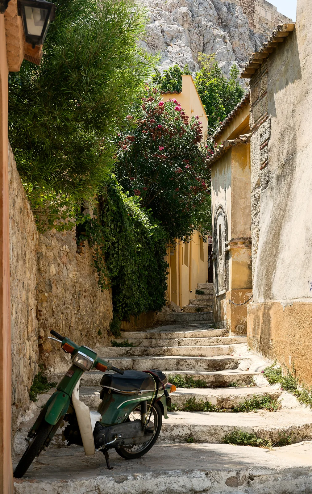
Plaka changes the scale of attention. After the distant outline of the Acropolis, the street asks you to look at thresholds, balconies and the spaces between buildings. An elevated landmark can still orient the scene, but it does not explain everything happening underneath it. Read the neighbourhood as a place with addresses and private boundaries. The official Athens neighbourhood guide locates Plaka beneath the Acropolis and presents it through its streets and historical layers. Our photographs offer selected encounters with that setting, rather than a complete survey.
Start with the width of the visible street. Ask how façades direct the eye and where the composition opens into a junction or closes against a wall. Colour can separate neighbouring buildings, while a repeated line of windows can briefly hold them together. Plants, awnings and shop displays introduce another scale of detail. These are things to observe in an image, not evidence that a particular business remains there today. A lively photograph is a record of a moment, and a quiet one does not establish the usual character of a whole neighbourhood.
Then compare the street with the optional Anafiotika discovery. Both belong to the wider setting below the rock, yet they should not be flattened into one picturesque style. The comparison is most useful when you keep differences in street width, building mass and enclosure visible. Notice whether the camera allows a long view or makes the next turn feel close. A narrow opening can suggest a route while revealing very little about its actual surface, gradient or destination. Looking and navigating are separate tasks.
Plaka is also a useful place to reconsider the idea of an old town. Historical surroundings continue to accommodate present lives; they are not simply a backdrop assembled for visitors. Keep doorways, residents and worship spaces distinct from public viewing positions. The local interactive fragment is independent of the other chapters and should not be read as a continuous descent from the Acropolis. Finish with one small detail, then return to the whole street and ask how that detail contributes to the rhythm of an inhabited place.
Real-travel note
Local scenes are independent fragments; surrounding footpaths do not establish entry to ticketed sites or a continuous, step-free inter-site route.
Compare independently captured photographs and viewpoints, each with its own date.
Chapter 3
Monastiraki: many histories in one urban frame
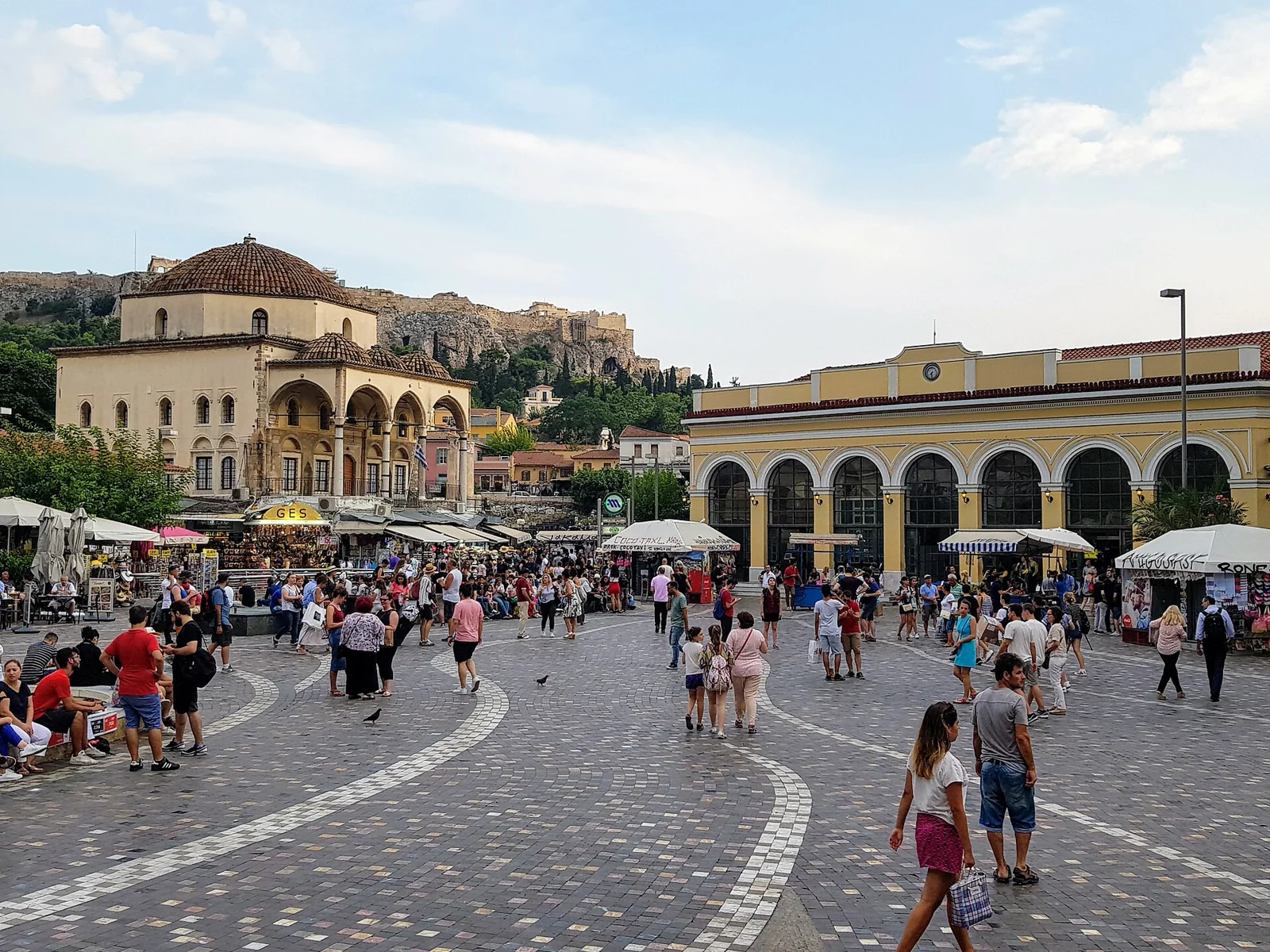
Monastiraki rewards a way of looking that accepts overlap. A square, surrounding buildings and the Acropolis skyline can occupy the same frame without belonging to one historical moment. Begin with the foreground rather than racing toward the famous silhouette. Ground surfaces, edges and the openings between buildings explain how the image is organised. The official Athens historic-centre guide places this area within the capital’s layered urban centre. This chapter uses that broad setting to explore the difference between a landmark and the everyday spaces around it.
Look across the square as if reading several horizontal bands. The nearest ground creates a field for movement, the façades make an enclosure, and the skyline sets a more distant reference. Depending on the chosen photograph, these bands can overlap or almost disappear behind one another. An architectural detail then changes the exercise: a wall, arch or roof asks for attention on its own terms. Resist the temptation to assign a date or function solely from appearance. Historical labels need a source, while visual relationships can be examined directly.
The optional Hadrian’s Library discovery introduces a specific Roman intervention near this setting. Keep it distinct from the Ancient Agora chapter, which concerns a different archaeological site. The word ancient does not make all ruins part of one complex. Nor does geographical proximity prove that two independent local scenes connect through a publicly usable passage. The journey’s order is editorial: it helps compare different forms of urban space, while leaving actual journeys between them for separate planning.
Return to the wider photograph and consider what it leaves unresolved. A camera can compress the distance between a square and a hill, suppress a busy edge, or make one façade dominate the story. Compare the other frames before forming an impression of the whole place. Shops and people, where present, belong to a recorded moment; no image establishes current commercial activity or crowd conditions. Monastiraki becomes more interesting when the parts retain their different scales and histories. Let the shared frame hold those differences together without turning them into a single timeless scene.
Real-travel note
Local scenes are independent fragments; surrounding footpaths do not establish entry to ticketed sites or a continuous, step-free inter-site route.
Compare independently captured photographs and viewpoints, each with its own date.
Chapter 4
Ancient Agora: public life and its surviving traces
The Ancient Agora invites a different reading from a single monumental façade. Its significance emerges through relationships between open ground, surviving structures and buildings made legible through reconstruction. The American School of Classical Studies describes the excavated public buildings within an archaeological park and identifies the restored Stoa of Attalos as the place housing finds and excavation records. This gives us a clear distinction to carry into the photographs: an ancient site can contain both surviving fabric and a modern reconstruction used to interpret it.
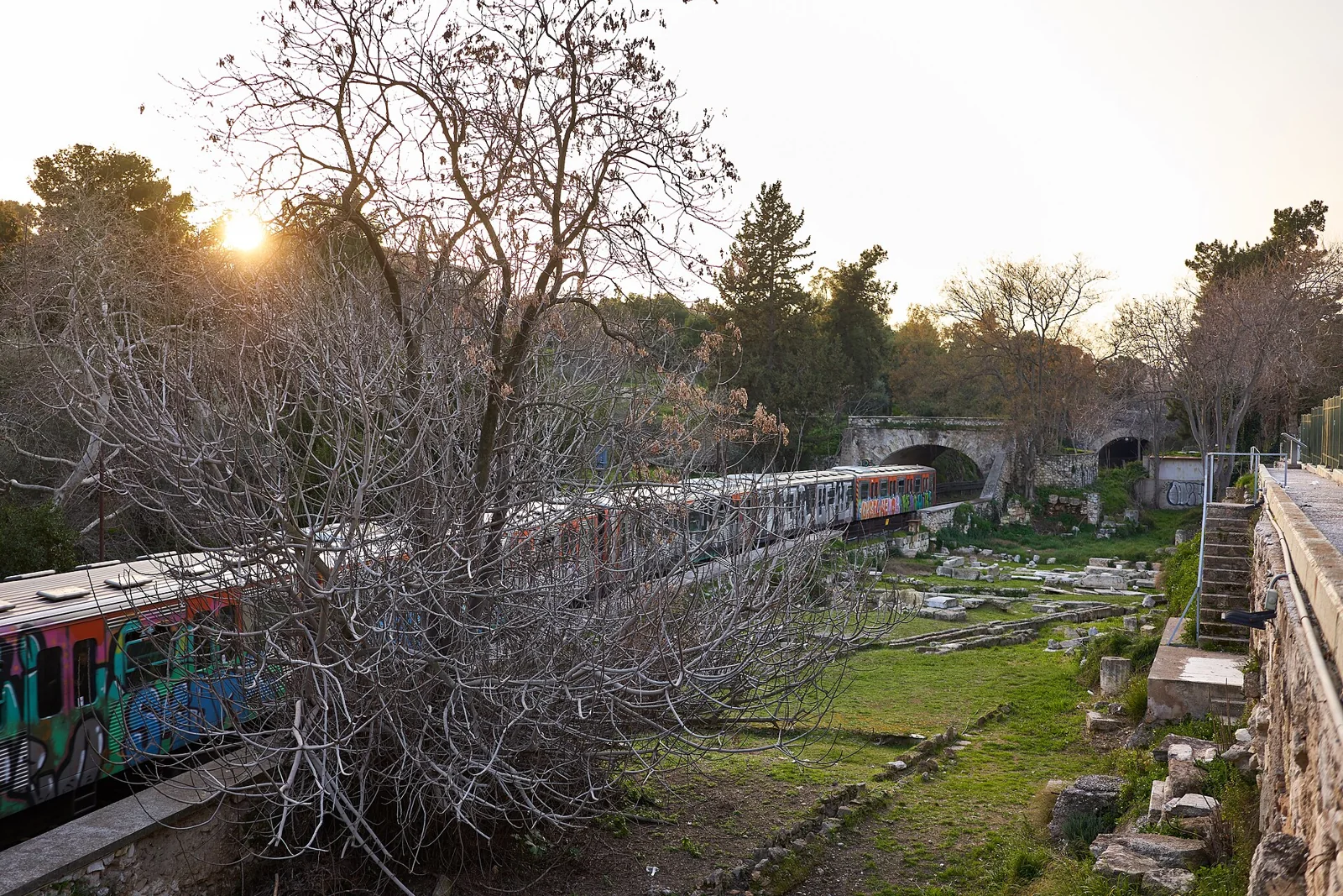
Begin by noticing the intervals. Empty-looking ground may be important to understanding a place once organised around public activity, but a photograph cannot reveal every buried phase or former building. Avoid filling gaps with an invented complete city. Instead, compare the density of architectural remains with the temple, church and excavated edges represented in these selected views. Their different forms can help the eye distinguish successive uses of the landscape without establishing that every surface in view has stood unchanged since antiquity. The difference matters because reconstruction is part of the site’s modern history.
Shift next to the edges of the frame. Trees, paths and the city beyond shape the experience of seeing archaeology today. They are not distractions from an otherwise pure ancient scene; they help locate the remains within a contemporary setting. A detail photograph may isolate stone and shadow, while a context photograph restores distance and surrounding ground. Neither replaces a site plan or a specialist account of a particular structure. Use each image for the question it can answer, and keep uncertainty visible where it cannot.
This chapter’s independent Google fragment may show an exterior edge rather than the interior archaeological circuit. The selected photographs can illustrate the site without proving that the interactive viewpoint reaches the same position. Any entry to the site or museum requires separate checks with the responsible operator. Finish by comparing this public landscape with Monastiraki’s urban frame: both prompt questions about shared space, but their historical functions and present boundaries differ. The editorial transition is an invitation to compare, not a verified walk between entrances.
Real-travel note
Local scenes are independent fragments; surrounding footpaths do not establish entry to ticketed sites or a continuous, step-free inter-site route.
Compare independently captured photographs and viewpoints, each with its own date.
Chapter 5
Syntagma: the modern capital in a public square
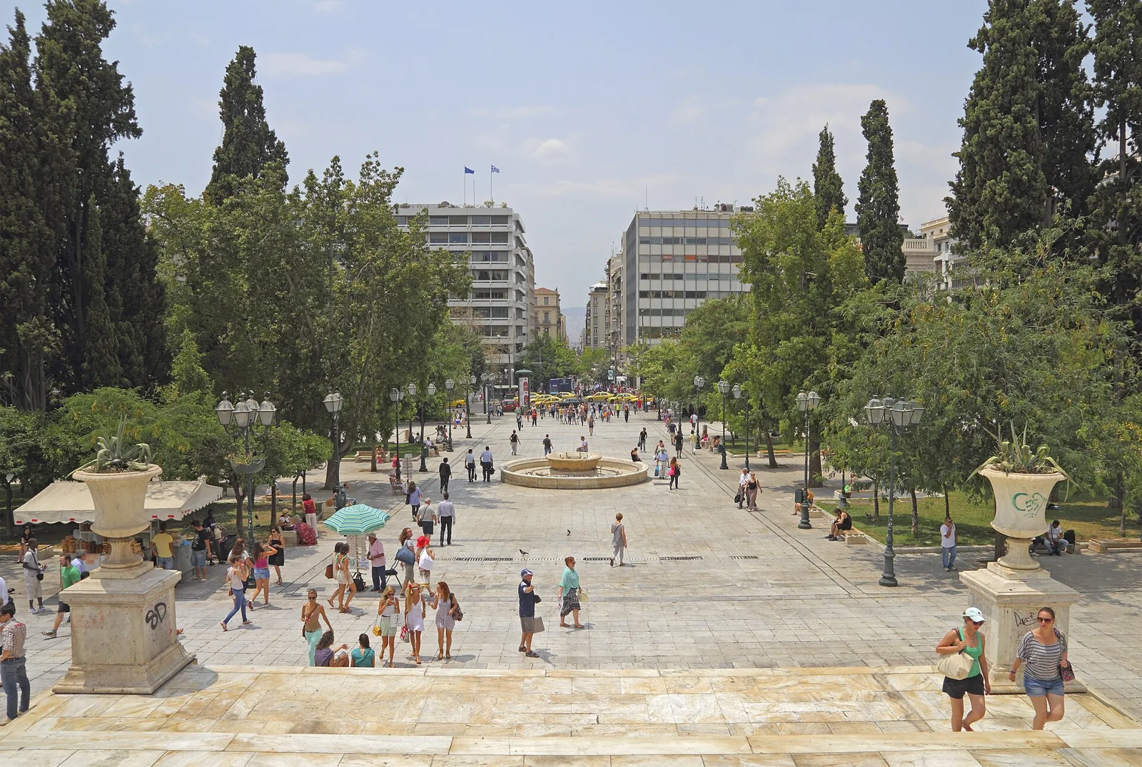
Syntagma brings the journey into the public language of the modern capital. A broad square and a formal institutional frontage arrange attention differently from a hillside street or an archaeological landscape. Start by comparing the horizontal expanse of the ground with the building above it. The photograph may encourage a frontal reading, but the edges matter too: they show where the composition meets surrounding city life. Treat the space as a setting for civic history rather than a decorative conclusion to a tour of antiquities.
The official Athens guide explains the name Syntagma through the constitution demanded in the uprising of 3 September 1843. It also identifies the Parliament directly across from the square. These sourced facts establish a modern political frame without requiring us to read every contemporary event into a single image. An open space can hold ceremony, passage, waiting and collective expression at different times. None of those possibilities means that a photograph proves what is happening there today. Keep the historical explanation separate from observations of a particular captured scene.
Use the detail image to change scale once more. Its west-facing view concerns the square’s terraces, trees and pedestrian space rather than a close-up of the Parliament façade. Ask how these elements organise the ground and how the image directs attention toward ordinary urban movement. The institutional history belongs to the wider setting; it is not evidence that this photograph depicts the building. Then compare the contextual image: a wider view can show how quickly a monumental setting becomes part of a larger city. The shift is useful after the Acropolis, where distance can also turn a complex place into a compact recognisable symbol.
The optional Zappeion discovery opens another discussion of formal public architecture and modern Greek history. Its place in this sequence is editorial, and no continuous walk through intervening streets or gardens is verified. Finish by recalling the different forms of public space encountered across the five chapters: elevated monument, inhabited neighbourhood, overlapping square, archaeological ground and modern civic setting. Their distinctions are the point of the journey. Independent exterior scenes and selected photographs offer ways to look, while actual access, transport and visits remain separate practical decisions.
Real-travel note
Local scenes are independent fragments; surrounding footpaths do not establish entry to ticketed sites or a continuous, step-free inter-site route.
9 reviewed experiences
Explore along the route
Step into the places along this journey. Choose a view independently of the story chapters. Free previews do not count toward chapter progress. Return to the journey above to continue through its stops.
Acropolis: a monument above a living city Short observation sequence
2014-08 · 5 connected local positions and return. Public exterior approach below the Acropolis; this does not show admission to the archaeological site. Capture-date archive; current access and arrangements may differ.
Reviewed 2026-11-06 · Nearby viewpoint
Explore at your own pace; these views do not count toward chapter completion. Check each point's coverage note before navigating provider imagery. Availability may change.
Sources
- Acropolis: a monument above a living city — UNESCO World Heritage Centre
- Plaka: the city at the foot of the rock — Official Athens Guide
- Monastiraki: many histories in one urban frame — Official Athens Guide
- Ancient Agora: public life and its surviving traces — American School of Classical Studies at Athens
- Syntagma: the modern capital in a public square — Official Athens Guide
- Areopagus — Official Athens Guide
- Anafiotika — Official Athens Guide
- Hadrian Library — Hellenic Heritage
- Zappeion — International Olympic Committee
- Acropolis hill above Athens viewed from Philopappos — A.Savin
- Acropolis illuminated after dark — Giles Laurent
- Acropolis panorama from Areopagus hill — Ggia
- Street scene in Plaka, Athens — Laurens R. Krol
- Historic facade on Aggelikis Chatzimichali Street in Plaka — FingerWiki
- Restaurants along Mnisikleous Street in Plaka — Jakub Hałun
- Monastiraki Square in Athens — Maksym Kozlenko
- Pantanassa church in Monastiraki Square — Jakub Hałun
- Evening scene in Monastiraki Square — Jakub Hałun
- Ancient Agora excavation beside Adrianou Street and the railway — George E. Koronaios
- Temple of Hephaestus seen from the Acropolis — Jebulon
- Holy Apostles church and the Ancient Agora seen from above — Jebulon
- Terraces, trees and pedestrians in Syntagma Square — A.Savin
- View across Syntagma Square — Intermedichbo
- Public space around Syntagma Square — Francisco Anzola
- Rocky Areopagus hill seen from the Acropolis — Jebulon
- Pastel houses and greenery in Anafiotika — Zde
- Ancient remains of Hadrian’s Library in Athens — Jakub Hałun
- Exterior facade of the Zappeion in Athens — Jebulon


Your journey, remembered.
Explored 0 of 5 stops. Explore every stop to unlock your keepsake.
5 stops to your keepsakeExplore every stop to share or download your keepsake.
Plan separate Athens visits
Explore five urban settings; arrange archaeological-site entry and inter-site travel separately.
Official sources checked:
Independent scenes and editorial transitions
Google local scenes are independent and may have different capture dates. Five chapters and four discoveries do not form a verified continuous walk or step-free route. Check actual surfaces, stairs, crossings and access conditions separately.
Exterior views and archaeological-site entry
The Acropolis interactive viewpoint may sit on surrounding footpaths and does not establish entry to the ticketed summit complex. Agora photographs can illustrate buildings within the site while the independent scene remains at an exterior edge. Images do not establish shared access rights, present opening or prices; check actual visits with the responsible operators.